Bryce Canyon National Park

Cuba
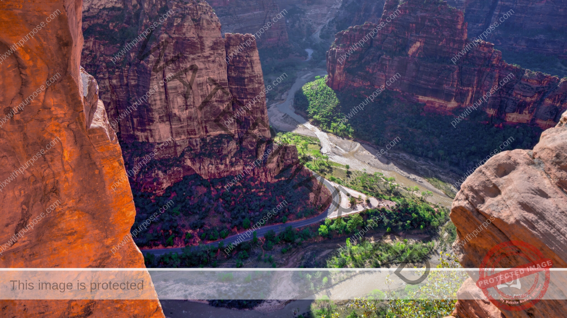
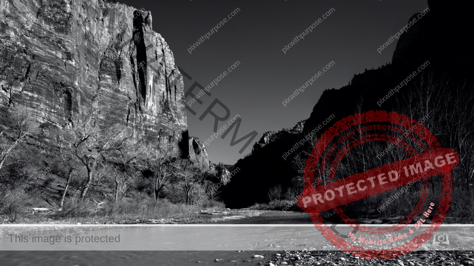
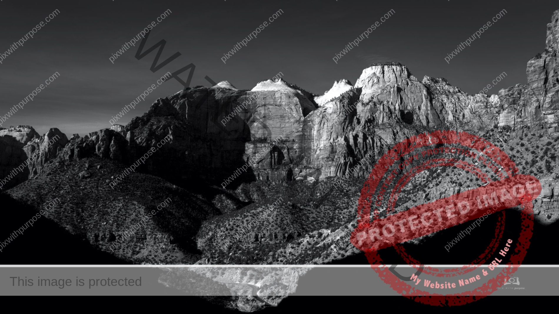
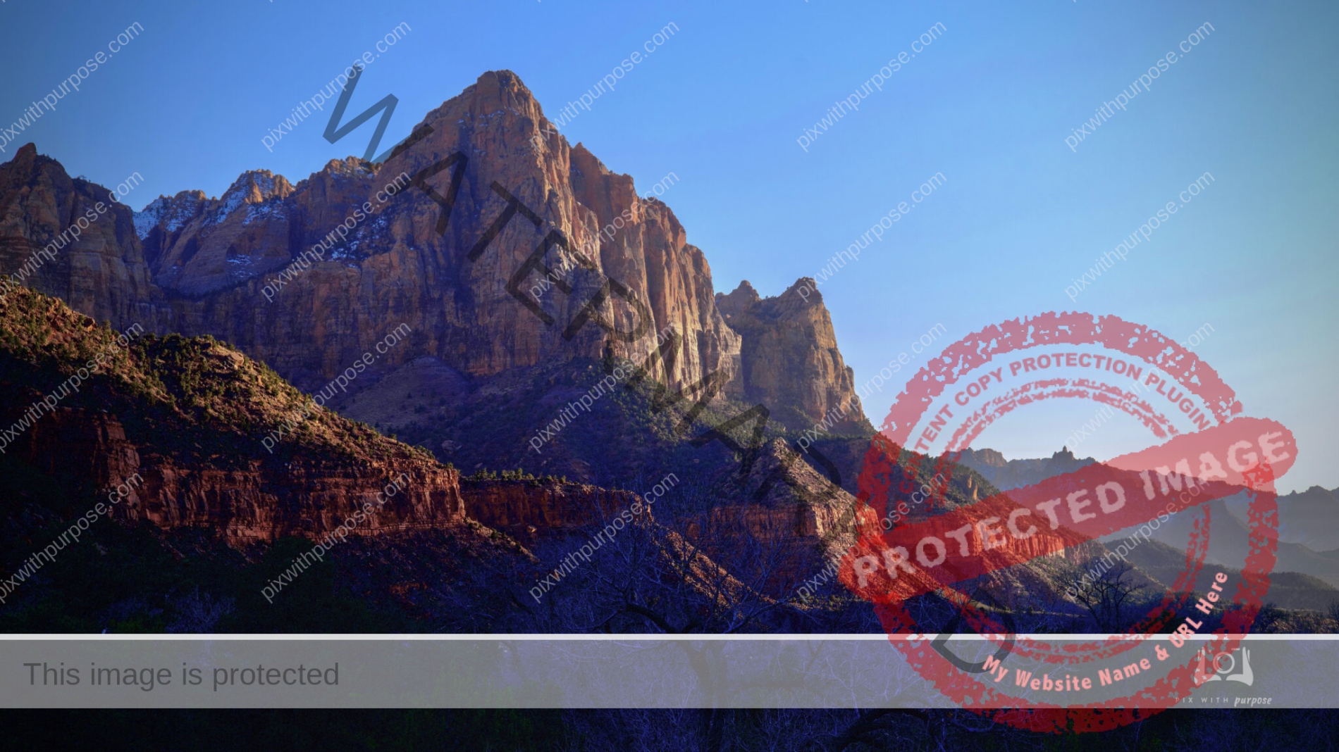
Zion National Park
Looking down on a bend in the Virgin River and park road.
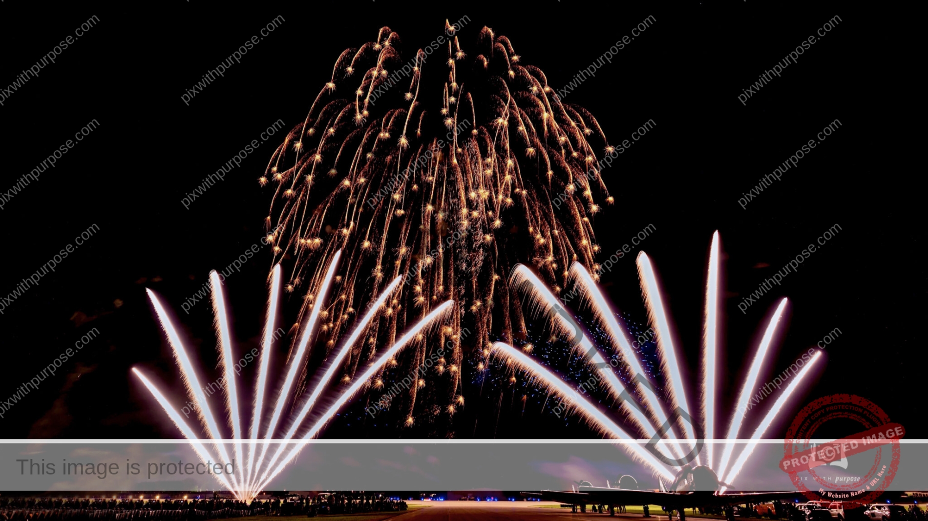
EAA Airshow Fireworks
The EAA (Experimental Aircraft Association) airshow in Oshkosh WI hosts over 600,000 attendees and 10,000 planes. Twice during the week they have a second airshow held after dark which is followed by spectacular fireworks.
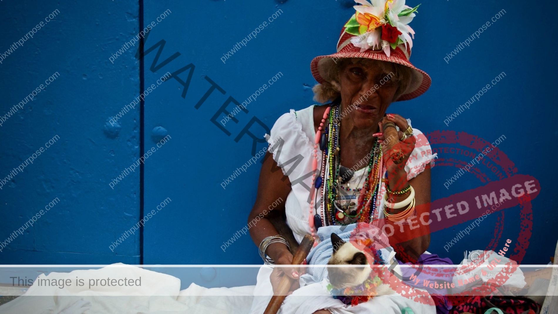
Dressed for tourists
Lady in Havana earning tips to take her photo.
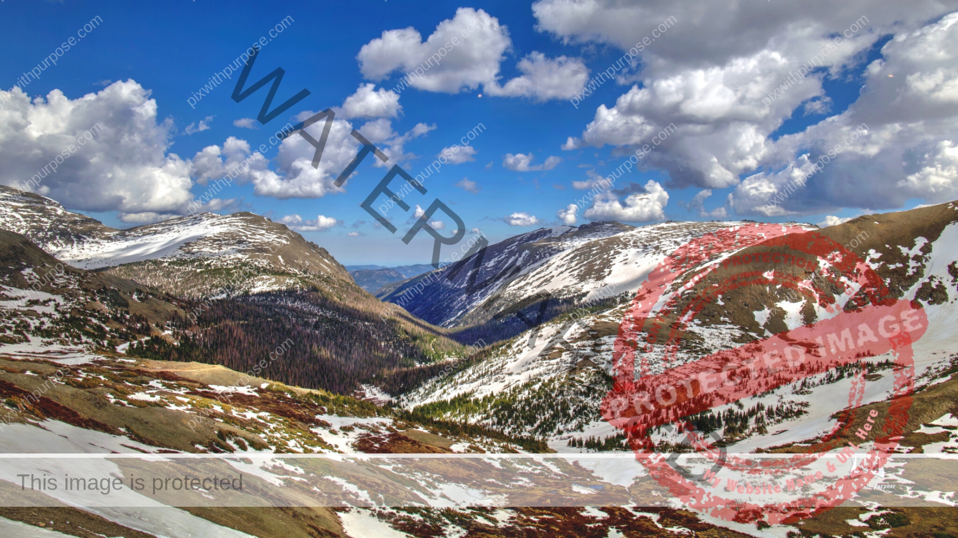
Rocky Mountain National Park
Rocky Mountain National Park encompasses 414 sq mi with an additional 395 sq mi of U.S. Forest Service wilderness adjoining the park boundaries. The Continental Divide runs north–south through the center of the park, with rivers and streams on the western side of the divide flowing toward the Pacific Ocean while those on the eastern side flow toward the Atlantic. Wikipedia
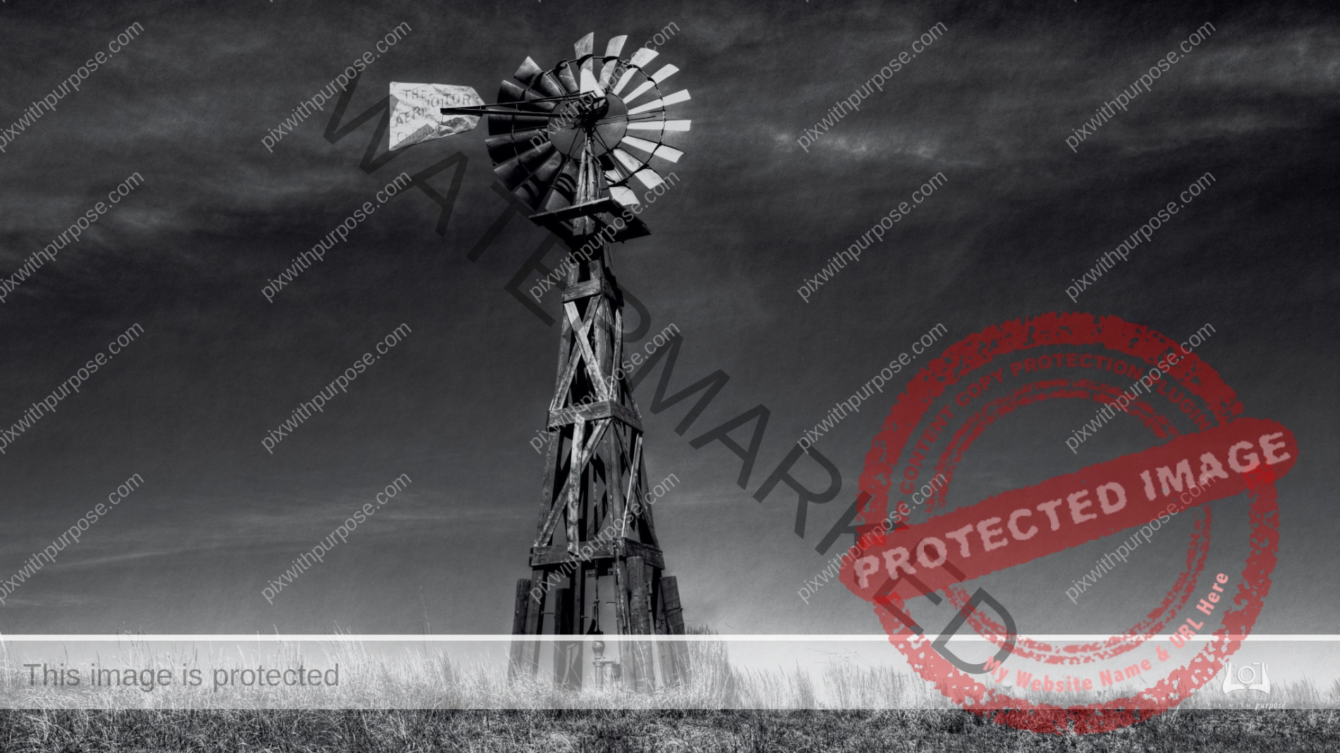
Aeromotor
Stumbled upon this abandoned small town with maybe 20 buildings and this wind powered water pump was still working.
I did a little research and found this: "The first Aermotor was sold in 1888, with 24 windmills in total being sold in the first year. Aermotor soon became a strong competitor among its contemporaries selling over 20,000 of its windmills by 1892". And this Chicago company is still in business today making high tech windmills.
Chicago B&W
Early morning sun begins to light up one side of the glass and steel canyon.
Nothing Compares
Great Basin National Park.
The Great Basin includes most of Nevada, half of Utah, and sections of Idaho, Wyoming, Oregon, and California. Great Basin National Park preserves a small representative piece of this entire region. NPS This "small" piece is the largest area of real estate I have ever seen. One stretch of the main highway was almost 90 miles long, had no intersections and we only saw 3 other vehicles the entire drive.
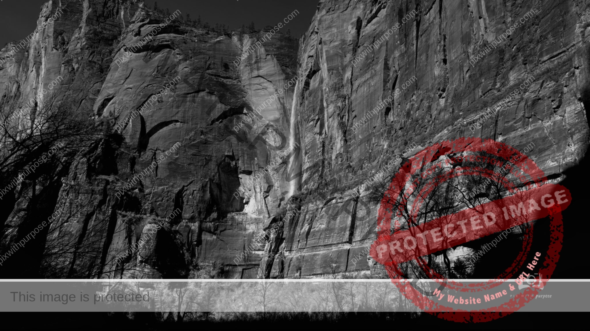
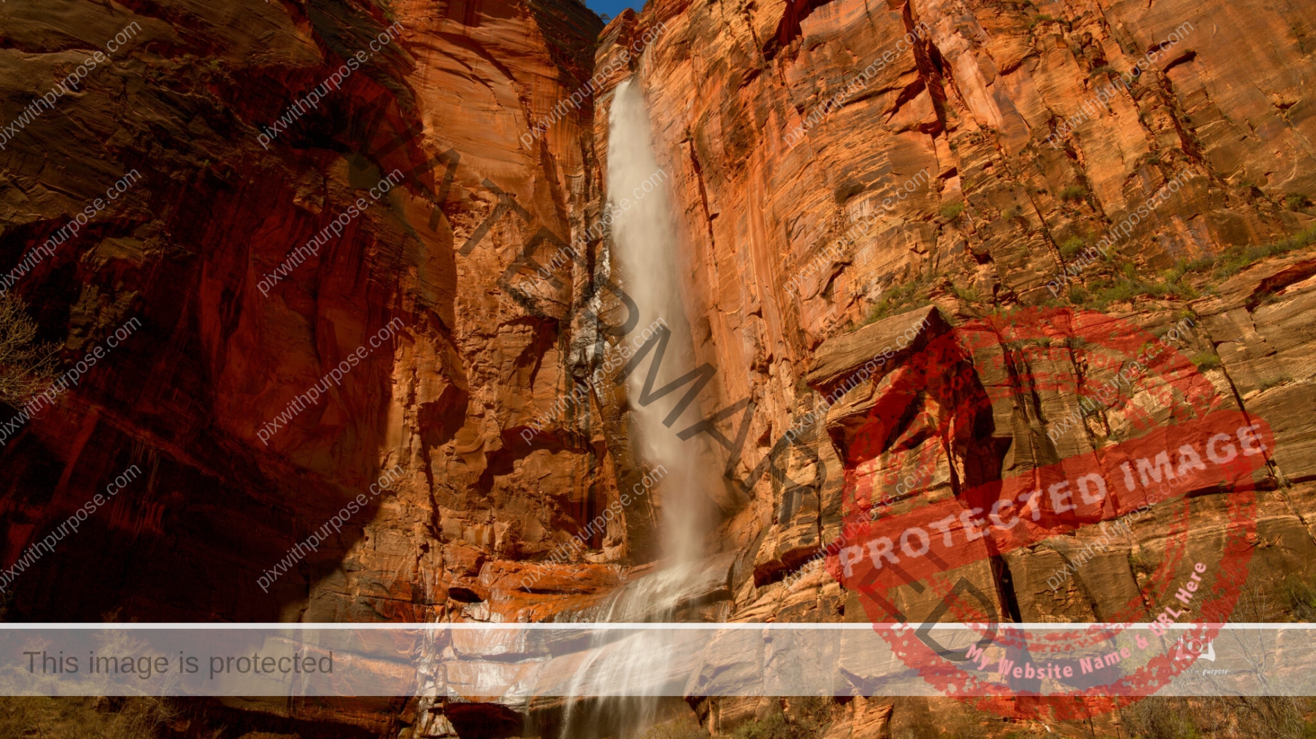
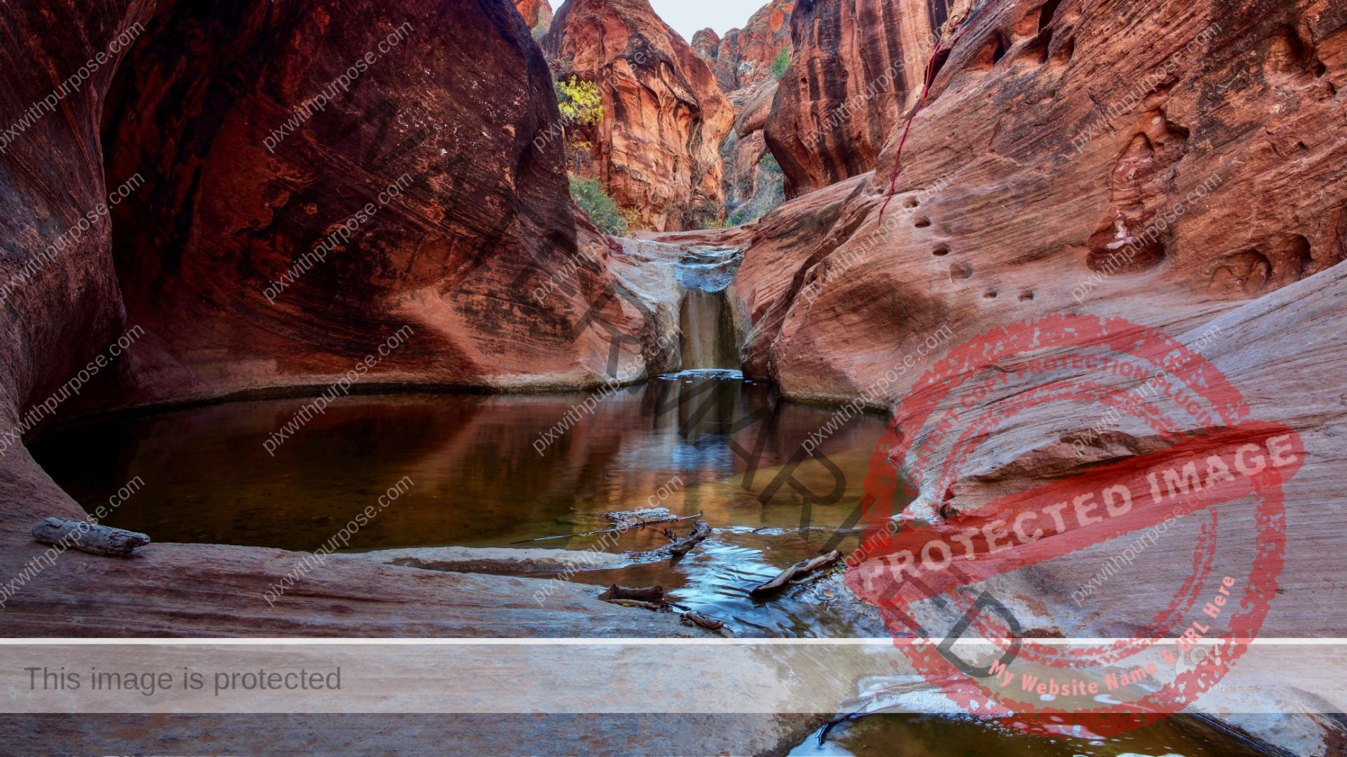
Zion Waterfall
The heavy rain and snow in the Zion National Park area feeds the Virgin River and gives us these rare waterfalls.
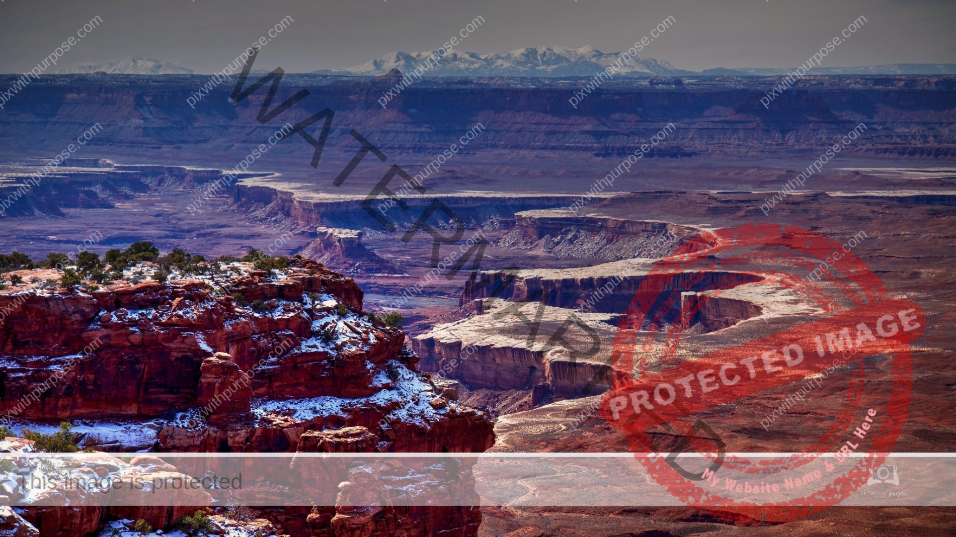
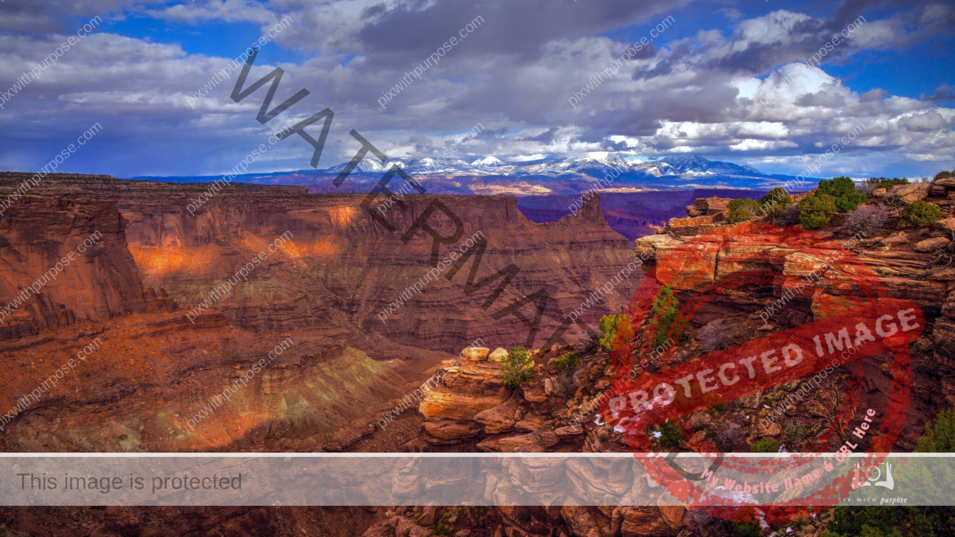
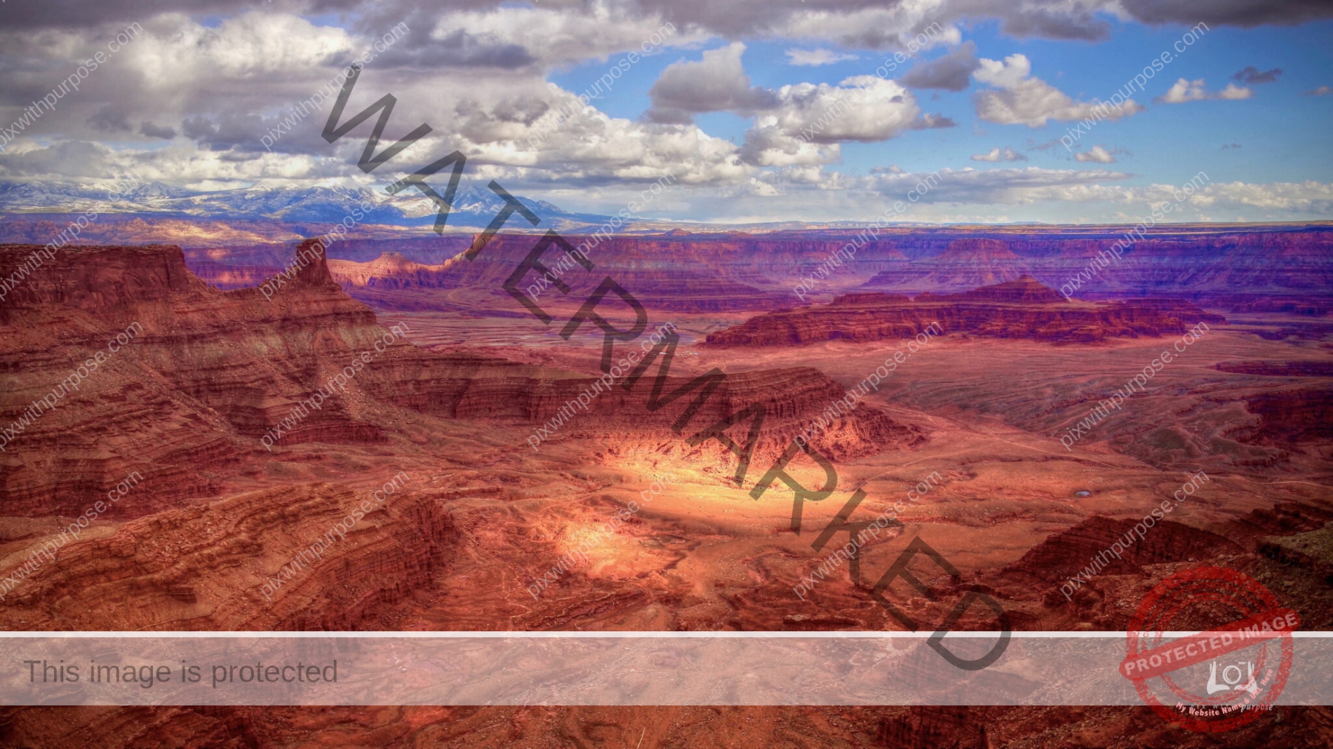
Canyonlands
The 527 square mile National park is divided into four districts: the Island in the Sky, the Needles, the Maze, and the combined rivers—the Green and Colorado—which carved two large canyons into the Colorado Plateau. While these areas share a primitive desert atmosphere, each retains its own character. Author Edward Abbey, a frequent visitor, described the Canyonlands as "the most weird, wonderful, magical place on earth—there is nothing else like it anywhere."
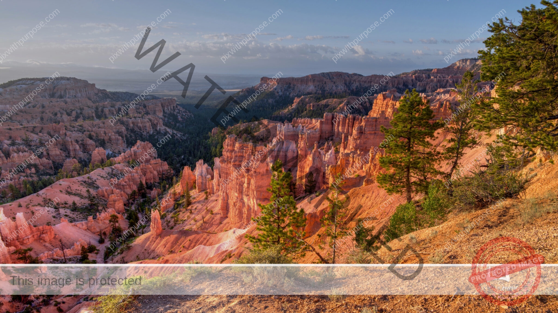
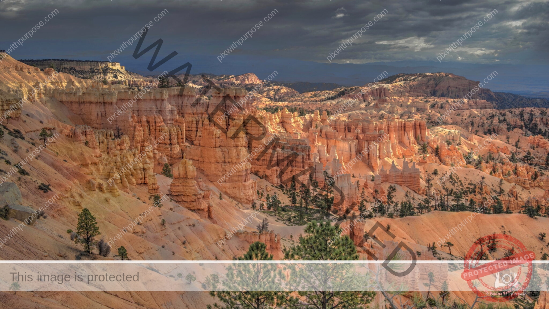
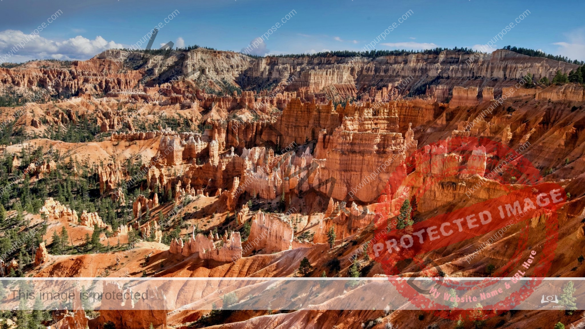
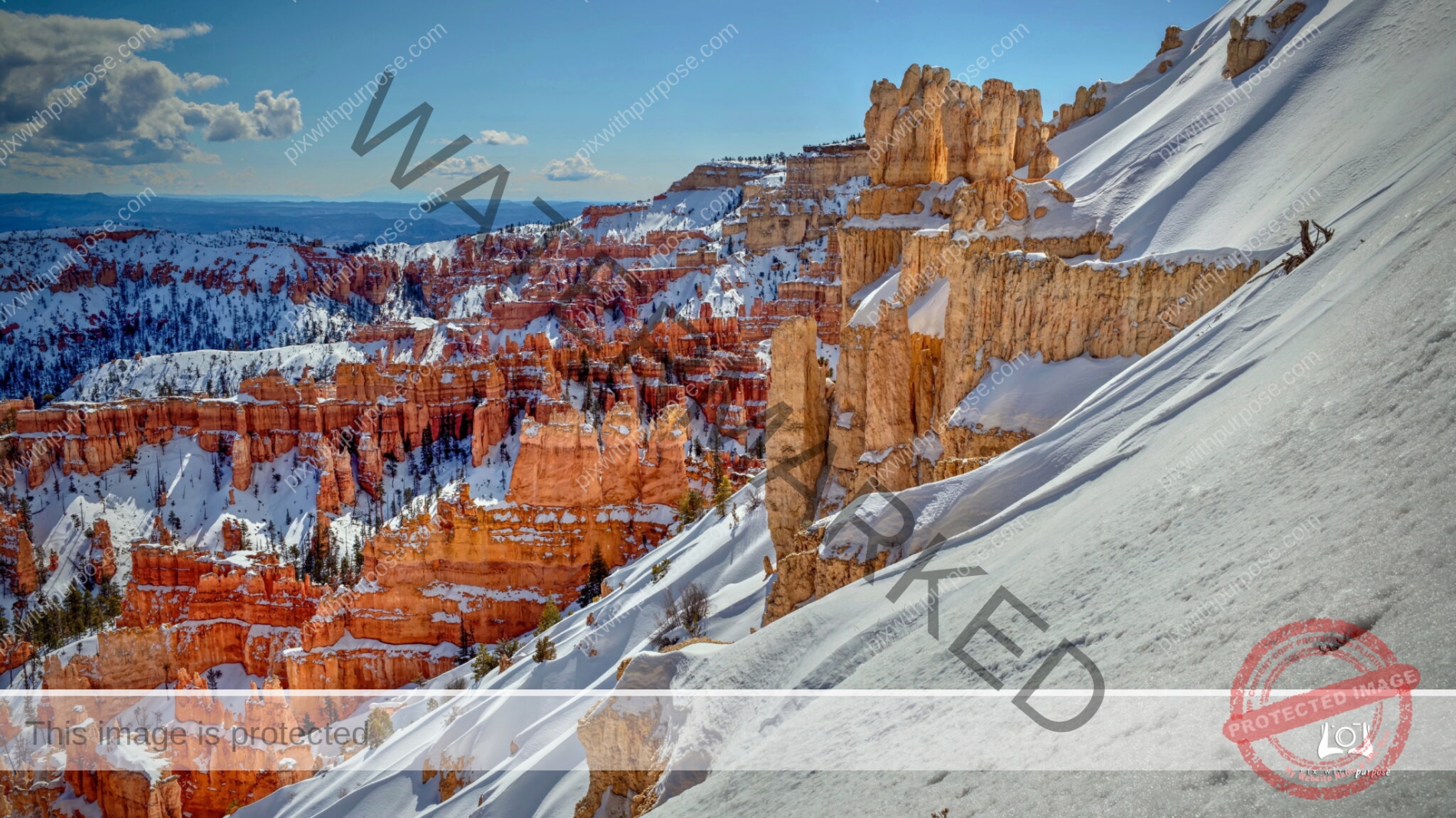
Bryce Canyon National Park
Bryce Canyon is made up of delicate and colorful pinnacles called hoodoos that are up to 200 feet high. A series of amphitheaters extends more than 20 miles north-to-south within the park. The largest is Bryce Amphitheater, which is 12 miles long, 3 miles wide and 800 feet deep. This photo was taken a few minutes after sunrise.
Ready for School
Cuba

Havana
Fort Zachary Taylor 1845
The Fort Zachary Taylor Historic State Park, also known simply as Fort Taylor, is a Florida State Park and National Historic Landmark centered on a Civil War-era fort located near the southern tip of Key West, Florida. Wikipedia
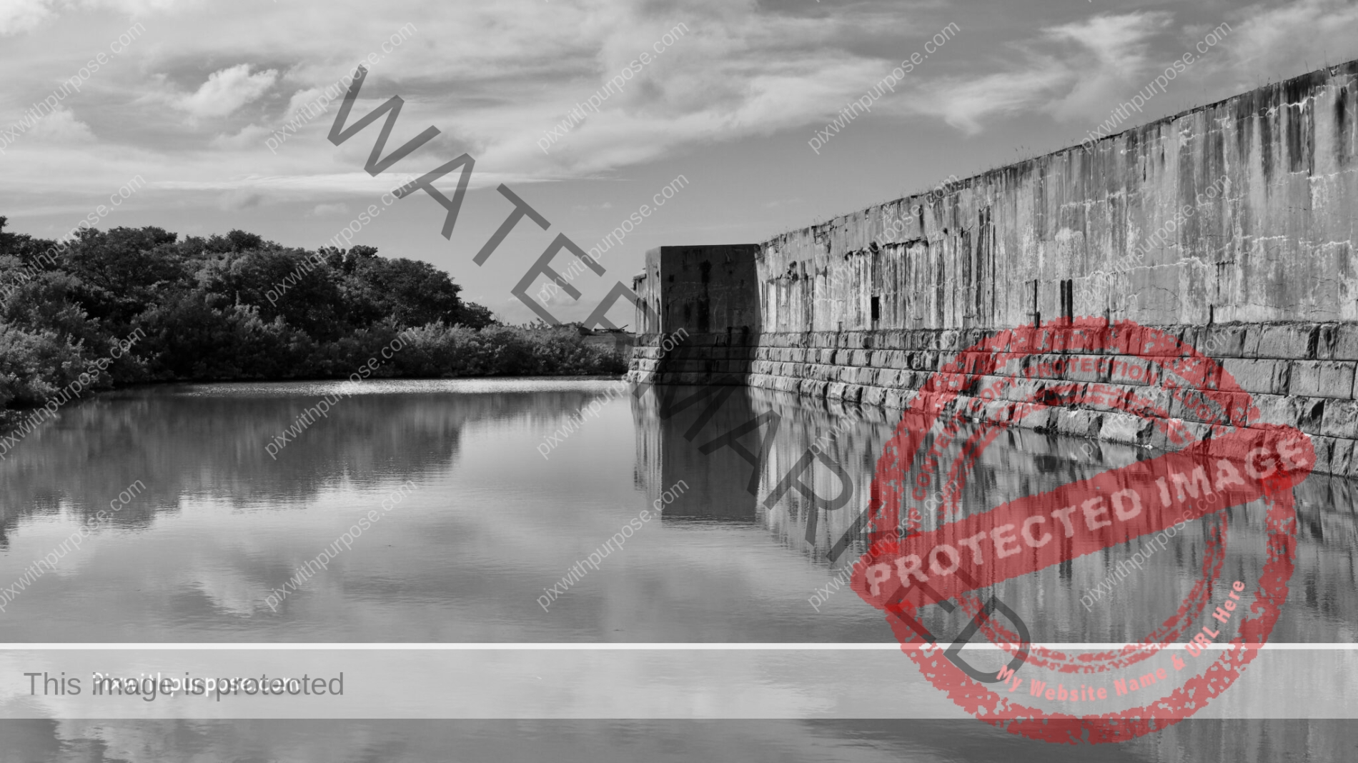
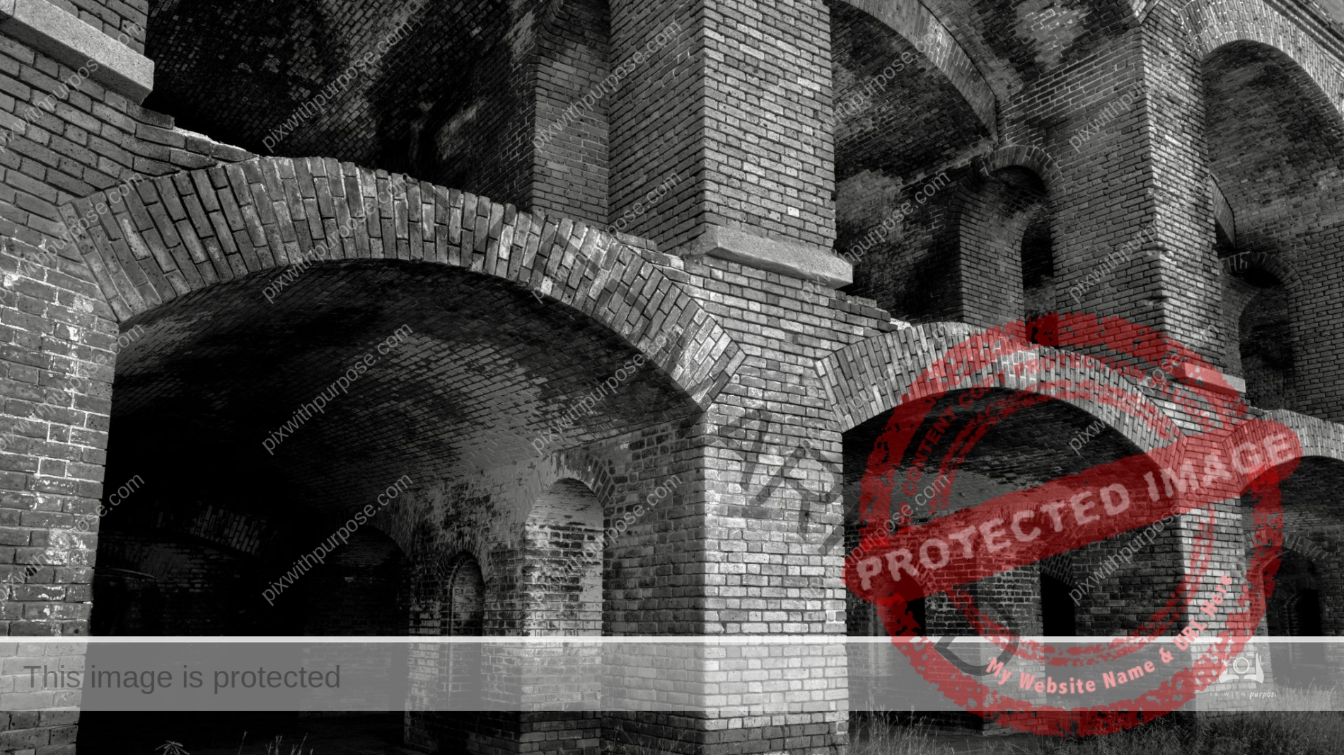
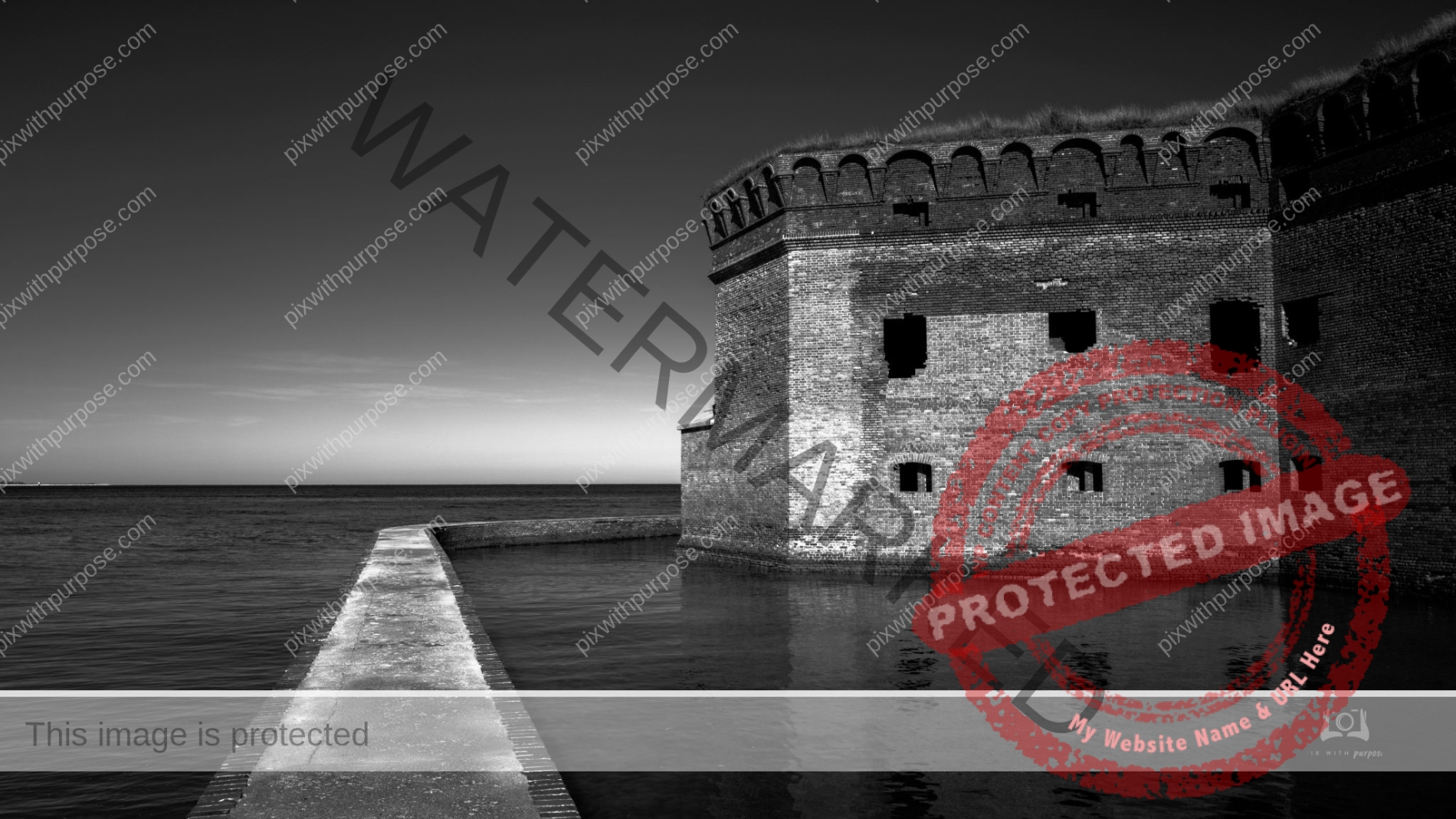
Fort Jefferson
Almost 70 miles west of Key West, Florida, lies a cluster of seven islands, composed of coral reefs and sand, called the Dry Tortugas.
With the surrounding shoals and water, they make up the Dry Tortugas National Park, an area noted for bird and marine life and shipwrecks. Fort Jefferson, its central feature, is one of the nation's largest 1800s masonry forts. Park Service
Early Morning Zion
Springtime in Zion National Park looking up the Virgin River canyon. Sun is just high enough to light the floor and one wall.

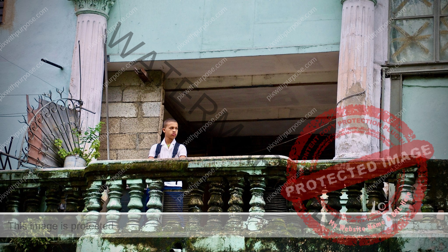
Watching the Street
Old Town Havana is very photogenic with its combination of crumbling structures and color.
Imperial Point
North Rim of the Grand Canyon
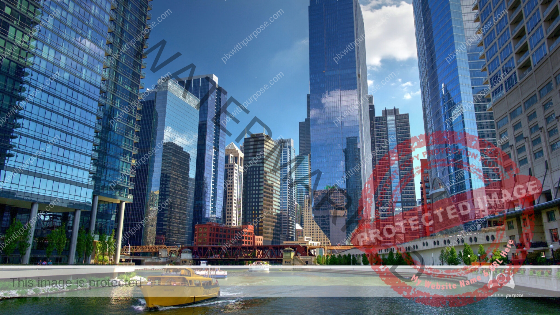
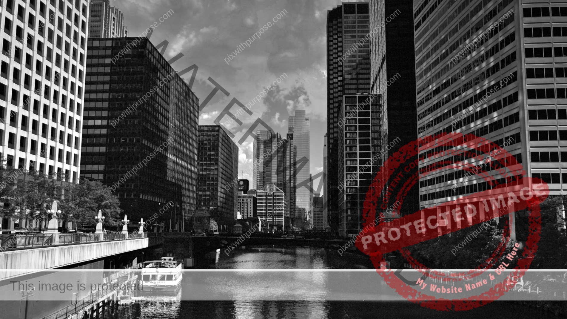
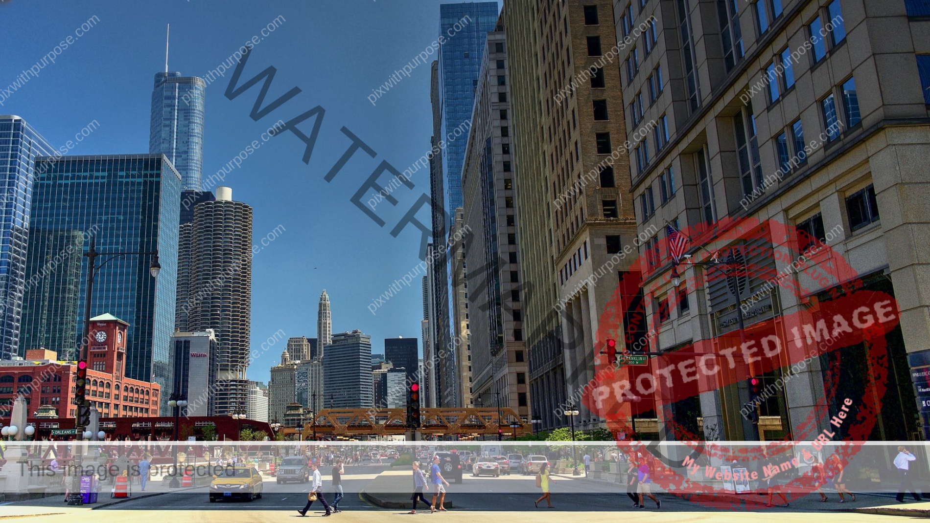
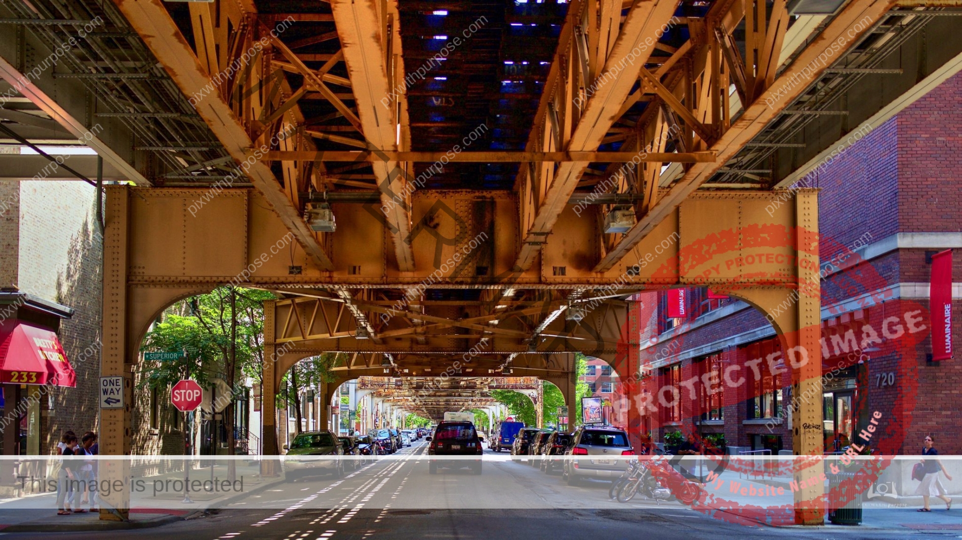
Chicago River
The Architectural Tour by riverboat offers some great history and photo opportunities of the great city.
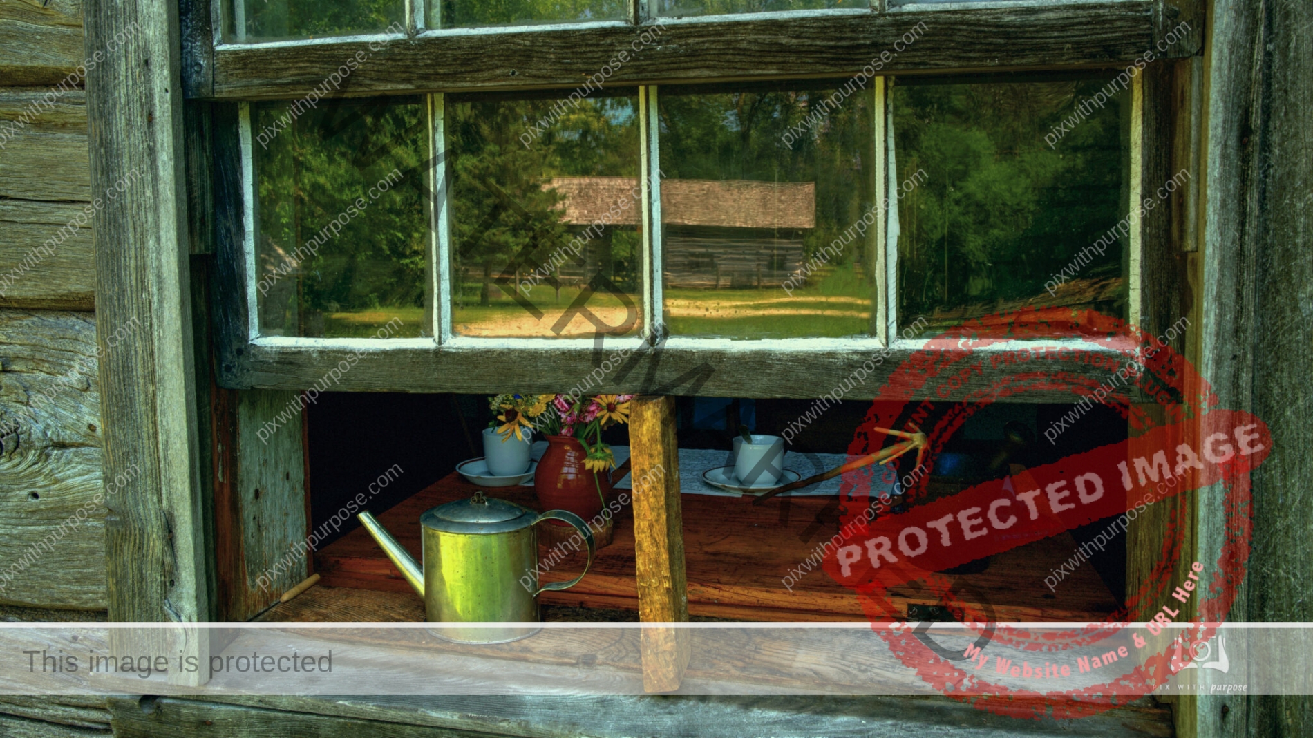
Old World Wisconsin
Original late 1800s homestead house. It was moved, furnished and repaired by the Wisconsin Historical Society.
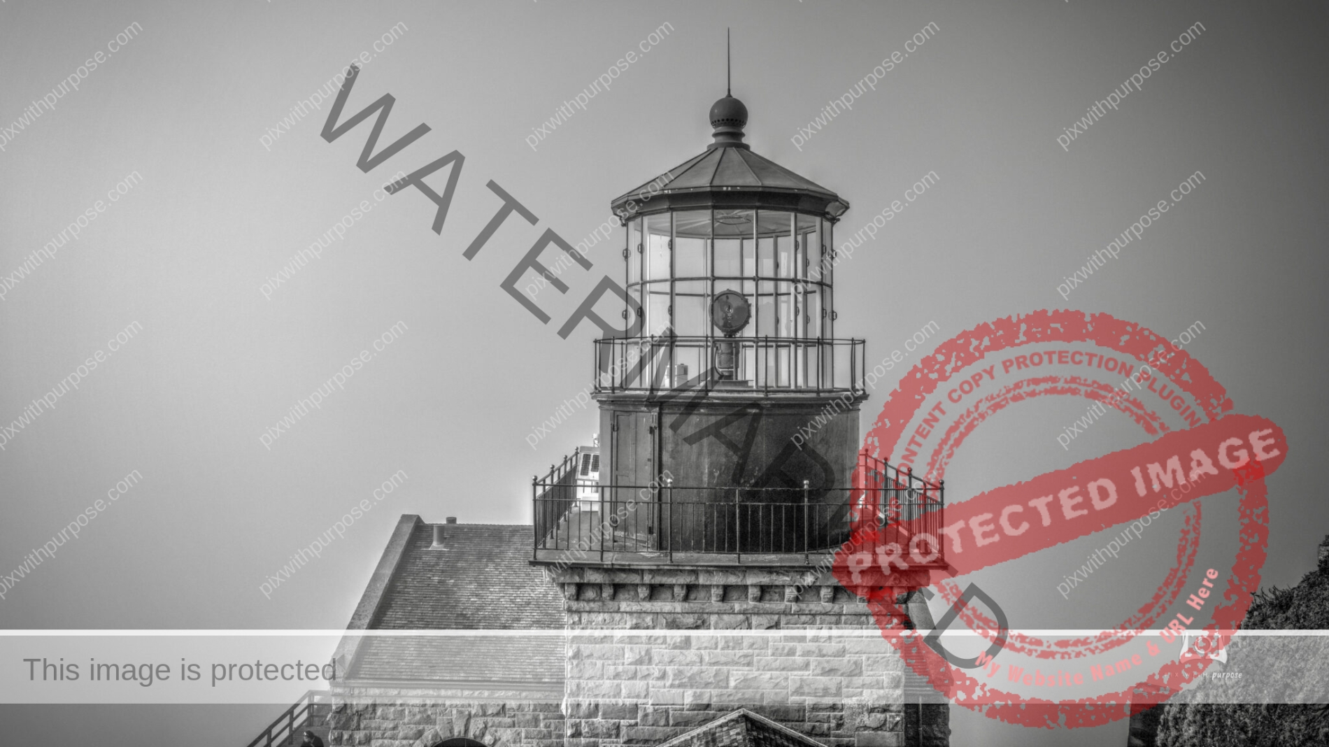
Point Sur Light Station
Point Sur Lighthouse is a lightstation at Point Sur 24.6 miles south of Monterey, California at the peak of the 361-foot rock at the head of the point. It was established in 1889 and is part of Point Sur State Historic Park. The light house is 40 feet tall and 270 feet above sea level. Wikipedia
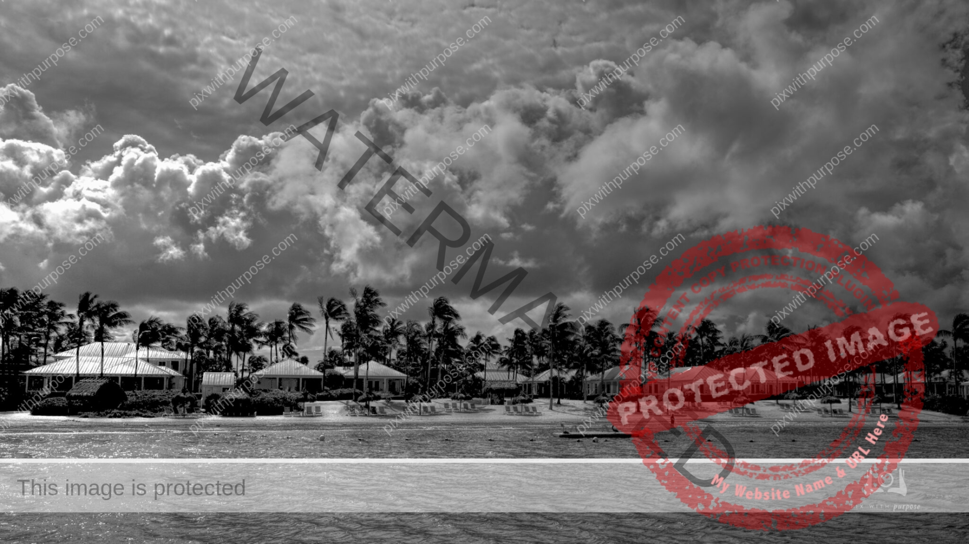
Sunset Key
An island that is accessed by a 10 minute ferry ride from Key West mainland. It is primarily a hotel but there are also about 50 private homes. I liked the layers of water, trees and clouds which would also look good in color but sometimes black and white is just more interesting.
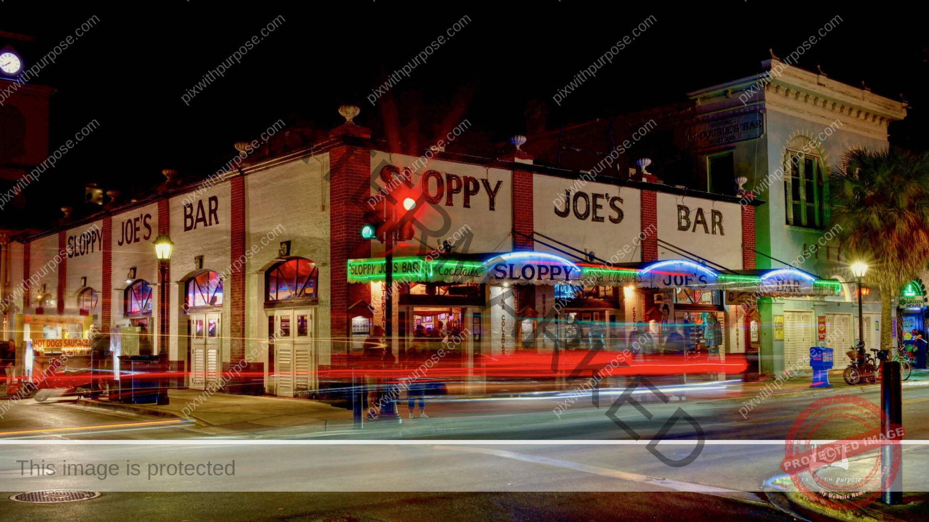
Night Photo Fun
Arguably the most photographed building in Key West located on Duval Street. The streaks are cars passing by which are captured by waiting for the light to turn green, pressing the shutter button while traffic moves past then closing the shutter.
Fort Ord
Fort Ord National Monument, located on the former Fort Ord military base, is currently run by the Bureau of Land Management (BLM). They protect and manage 44 species of rare plants and animals that call the property home. The 14,000 acre parcel has more than 86 miles of trails that can be explored on foot, bike or on horseback.
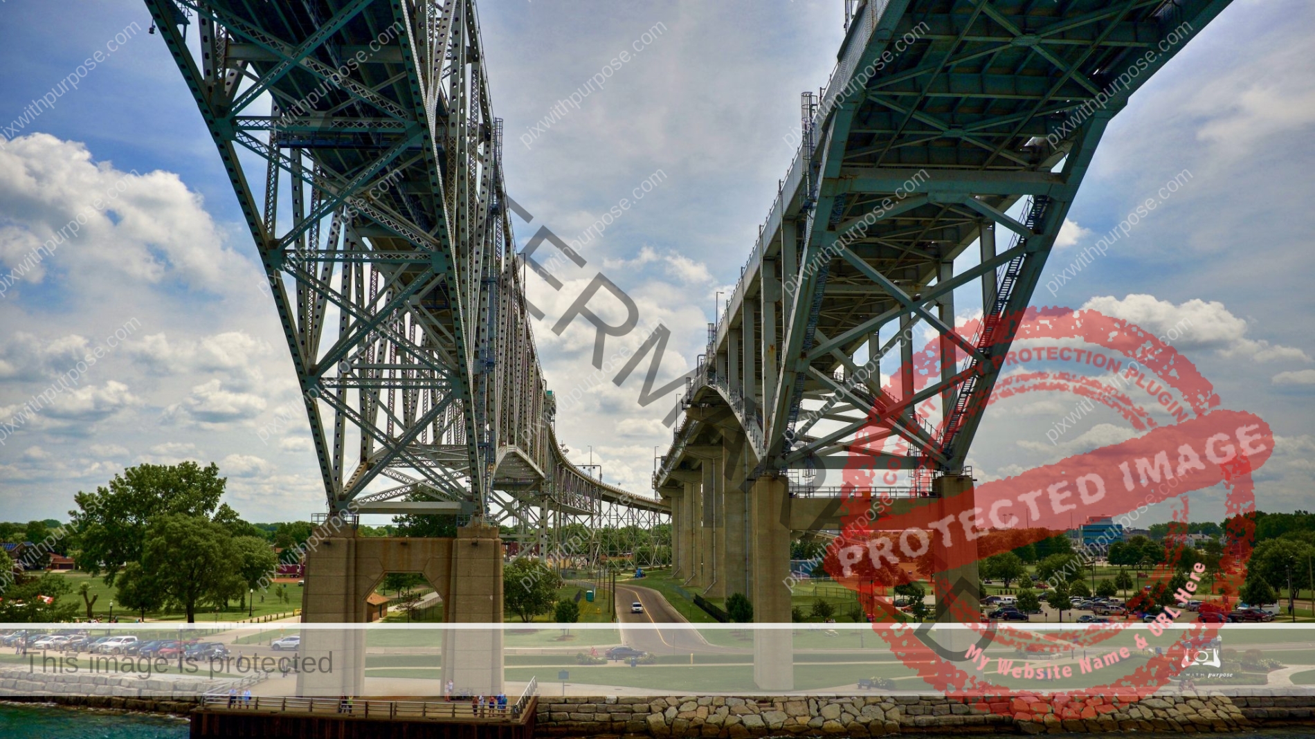
Point Edward Canada
This bridge extends behind me across the St Clair river to the USA.
Grand Canyon North Rim
Shot about 15 minutes before sunset.
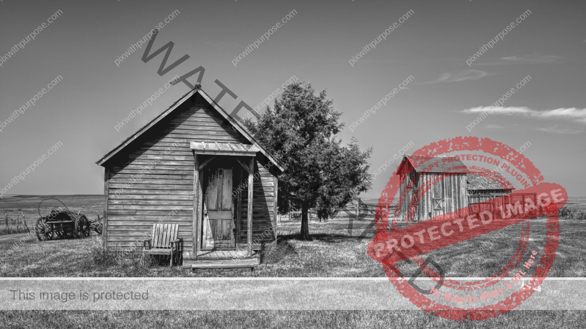
1880s South Dakota Homestead
An 1880s homestead complete with, corrals, barn, house and of course, outhouse. The nearby Dakota Hotel, built in 1910, it still carries the scars made by cowboys’ spurs on the staircase.
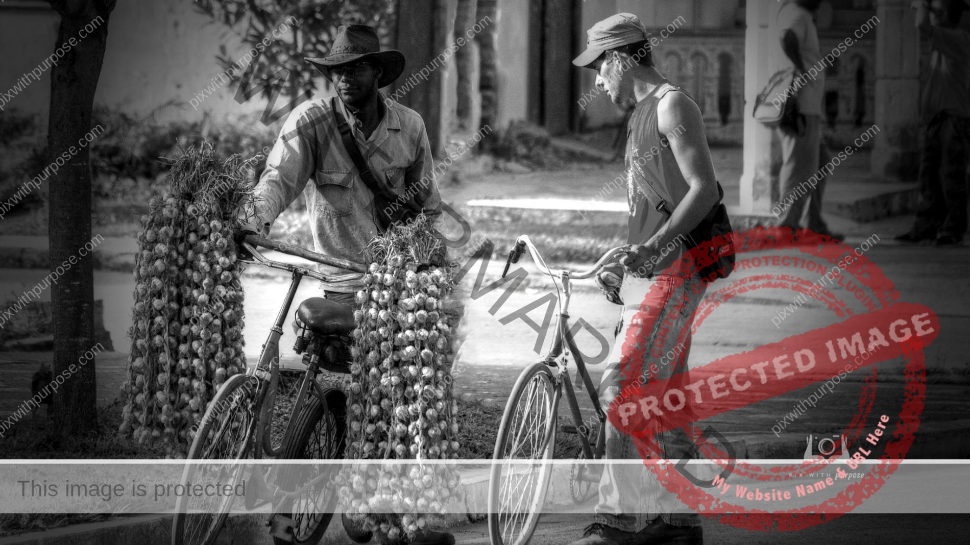
Salesman
A garlic vendor and friend
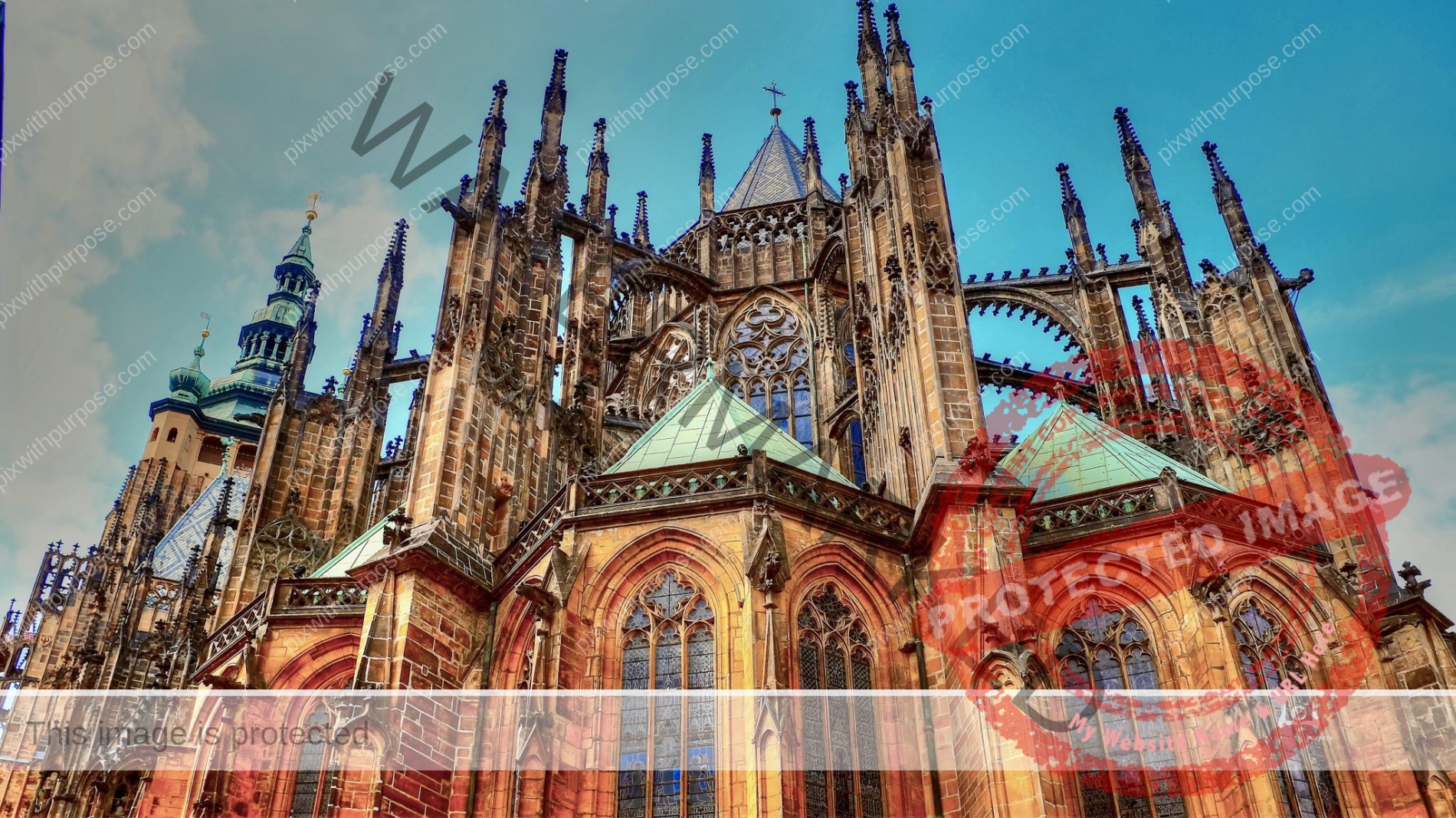
Prague
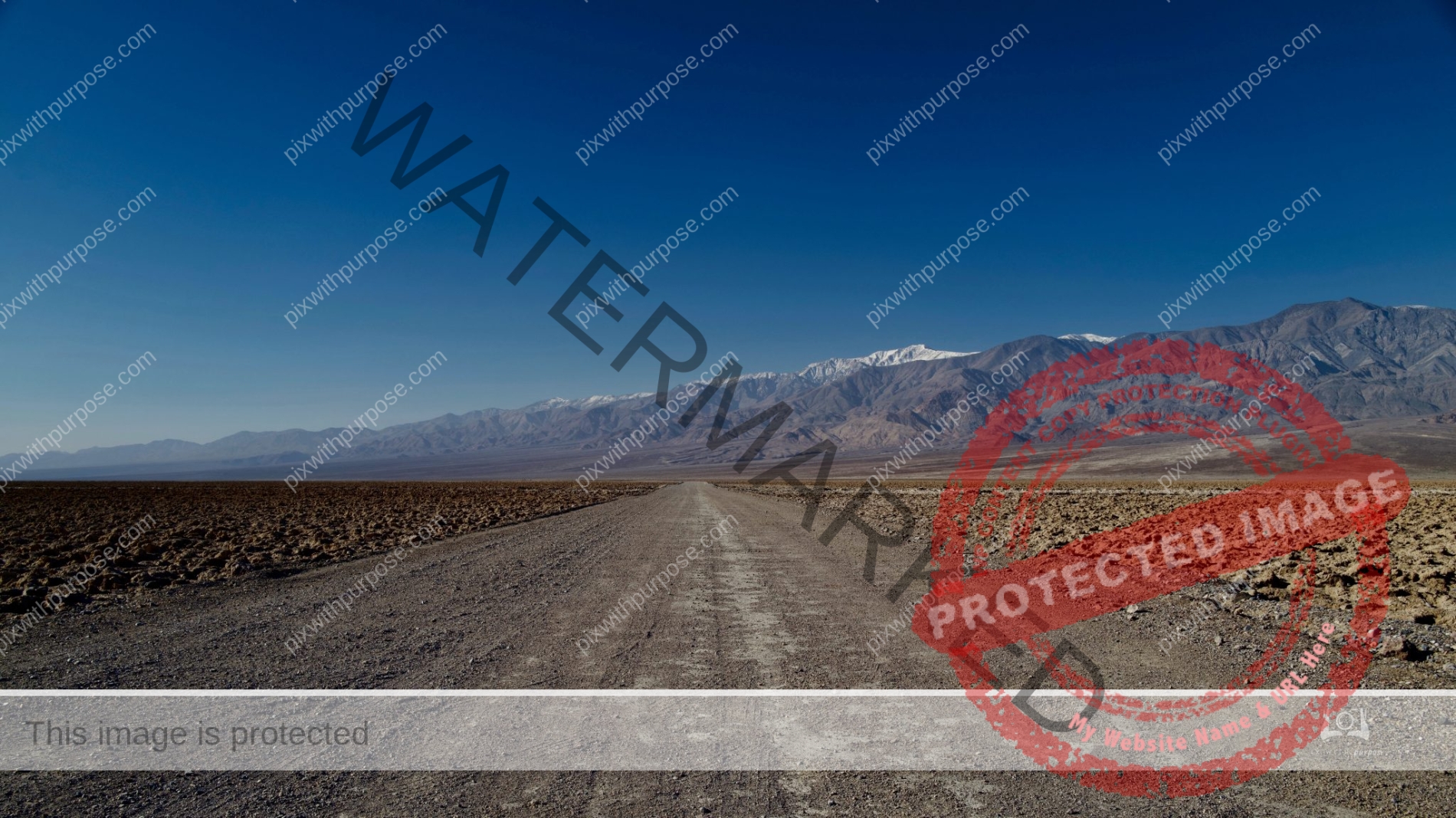
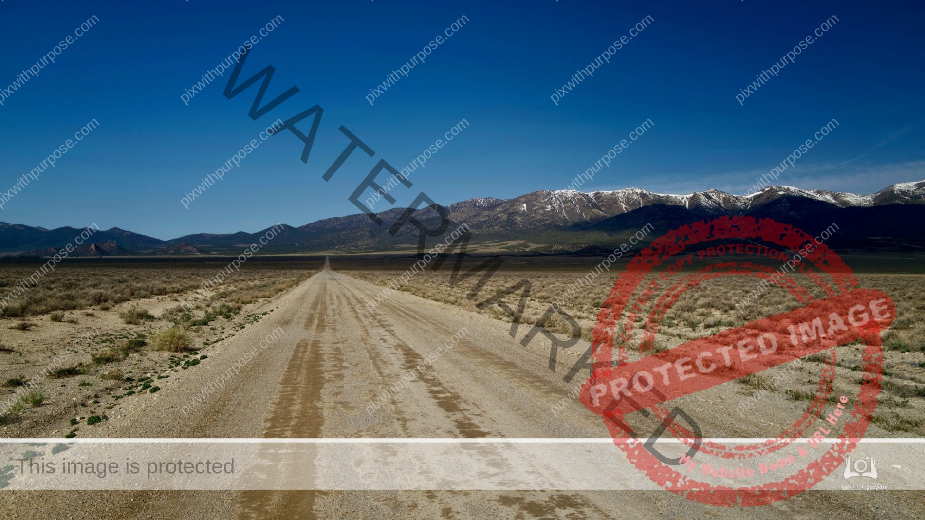
Full Gas Tank?
Death Valley is the largest U.S. National Park outside Alaska at 3,422,024 acres. Nearly 1,000 miles of paved and dirt roads provide access to locations both popular and remote. Even so, 93% of the park is protected as officially designated Wilderness. That wild country includes low valley floors crusted with barren salt flats, rugged mountains rising as much as 11,000 feet, deep and winding canyons, rolling sand dunes, and spring-fed oases.
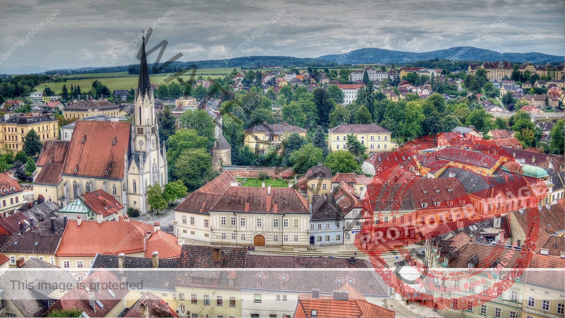
Germany
Unfortunately the town name escapes me. Back in 2015 when I took this photo I used a function of my old Nikon to give it an artsy look.
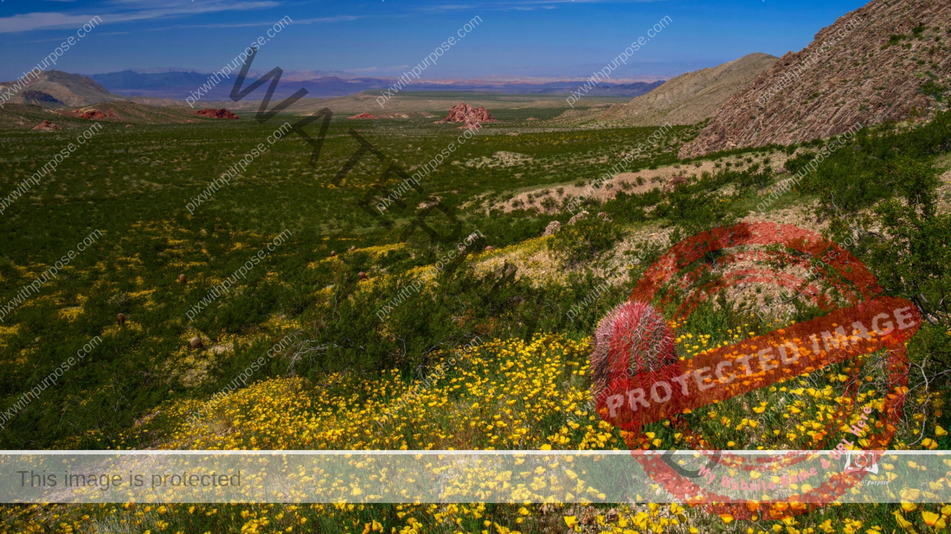
Poppy superbloom
Gold Butte National Monument in Nevada had square miles of blooming yellow poppies this past spring.

Toroweap
Toroweap is a viewpoint within the Grand Canyon National Park in Arizona. It is located in a remote area 148 miles west of the North Rim Headquarters by road. The overlook is the only viewpoint in the National Park from where the Colorado River can be seen vertically below. The overlook stands 3,000 feet above the river. wikipedia
Canyonlands National Park
Endless deep canyons, towering mesas, pinnacles, cliffs, and spires stretching across 527 square miles. This is Canyonlands National Park, formed by the currents and tributaries of Utah's Green and Colorado rivers. It is the largest park in Utah located near the town of Moab. Wikipedia
Fort Jefferson
Fort Jefferson was built to protect one of the most strategic deepwater anchorages in North America. By fortifying this spacious harbor, the United States maintained an important “advance post” for ships patrolling the Gulf of Mexico and the Straits of Florida. Nestled within the islands and shoals that make up the Dry Tortugas, the harbor offered ships the chance to resupply, refit, or seek refuge from storms. The location of the Tortugas along one the world’s busiest shipping lanes was its greatest military asset. Though passing ships could easily avoid the largest of Fort Jefferson’s guns, they could not avoid the warships that used its harbor.

Old World Wisconsin
Very old barn scene in Wisconsin's Kettle Moraine area which was shaped by the glaciers.
Zion National Park
If you look close you can see the road through the park at the very bottom.
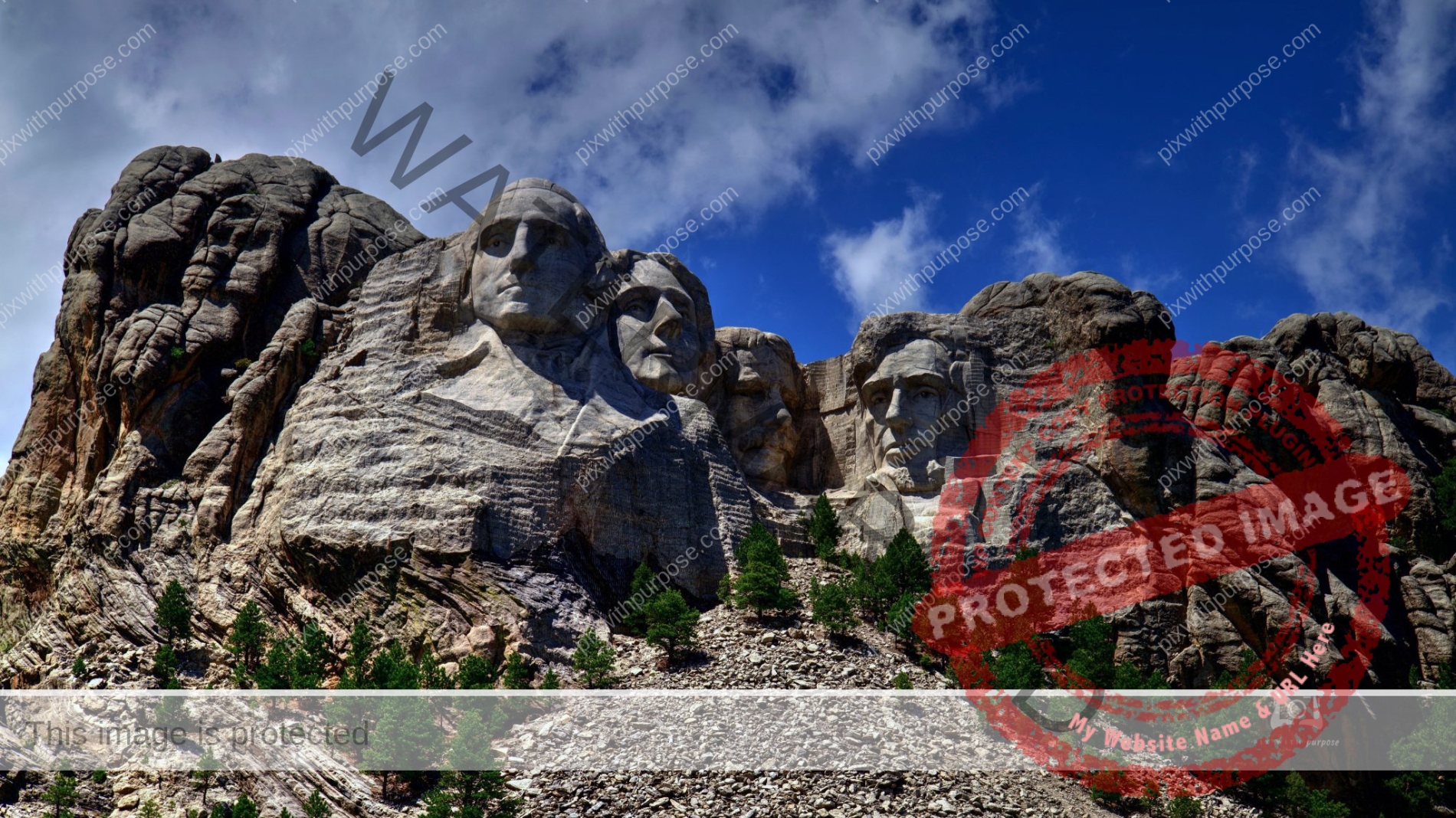
Mount Rushmore
Mount Rushmore National Memorial is a massive sculpture carved into Mount Rushmore in the Black Hills region of South Dakota. Completed in 1941 under the direction of Gutzon Borglum and his son Lincoln, the sculpture's roughly 60-ft.-high granite faces depict U.S. presidents George Washington, Thomas Jefferson, Theodore Roosevelt and Abraham Lincoln.
Bryce Canyon
Bryce Canyon National Park is a national park located in southwestern Utah. The major feature of the park is Bryce Canyon, which despite its name, is not a canyon, but a collection of giant natural amphitheaters along the eastern side of the Paunsaugunt Plateau. Bryce is distinctive due to geological structures called hoodoos, formed by frost weathering and stream erosion of the river and lake bed sedimentary rocks. The red, orange, and white colors of the rocks provide spectacular views for park visitors. Bryce Canyon National Park is much smaller than nearby Zion National Park. The rim at Bryce varies from 8,000 to 9,000 feet. Wikipedia

Havana Balcony
It's a very interesting and baffling country.
Canyonlands National Park
Canyonlands National Park is in southeastern Utah near the town of Moab. The park preserves a colorful landscape eroded into numerous canyons, mesas, and buttes by the Colorado River, the Green River, and their respective tributaries. Legislation creating the park was signed into law by President Lyndon B. Johnson on September 12, 1964.
The park is divided into four districts: the Island in the Sky, the Needles, the Maze, and the combined rivers—the Green and Colorado—which carved two large canyons into the Colorado Plateau. While these areas share a primitive desert atmosphere, each retains its own character. Author Edward Abbey, a frequent visitor, described the Canyonlands as "the most weird, wonderful, magical place on earth—there is nothing else like it anywhere." Wikipedia
Death Valley National Park
Perfect place to play with black & white photography.
Grafton UT
Original Morman homestead from the mid-1800s. Parks Utah is trying to maintain 1/2 dozen structures on the property within a few miles from Zion National Park
Glen Canyon Dam Lake View
This is the Lake Powell side of the dam and when water levels are higher this area I'm standing on would be completely submerged. As of 9/1/2021 the lake is down 151 feet leaving it only 30% full.

Rack em up
Walking down "The Boulevard" in St George UT I came upon this billiards, bowling and video arcade. The big brilliant red sign caught my eye but in B&W I look farther into the scene. The car, rather than blocking the view becomes another source of interest and light. This observation is all after the fact because when I was taking it I wished I had a color camera and didn't like the car. B&W photos are, to me, a very interesting medium.
Say Cheese
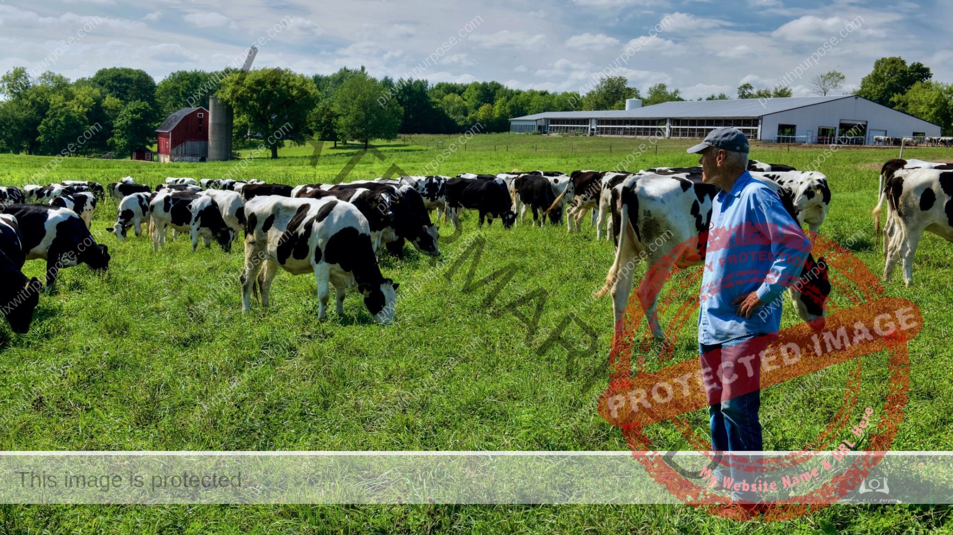
Organic dairy farm in Stonebank Wisconsin. This farmer has quite the story but I didn't ask his permission to tell it.
Bryce Canyon Utah
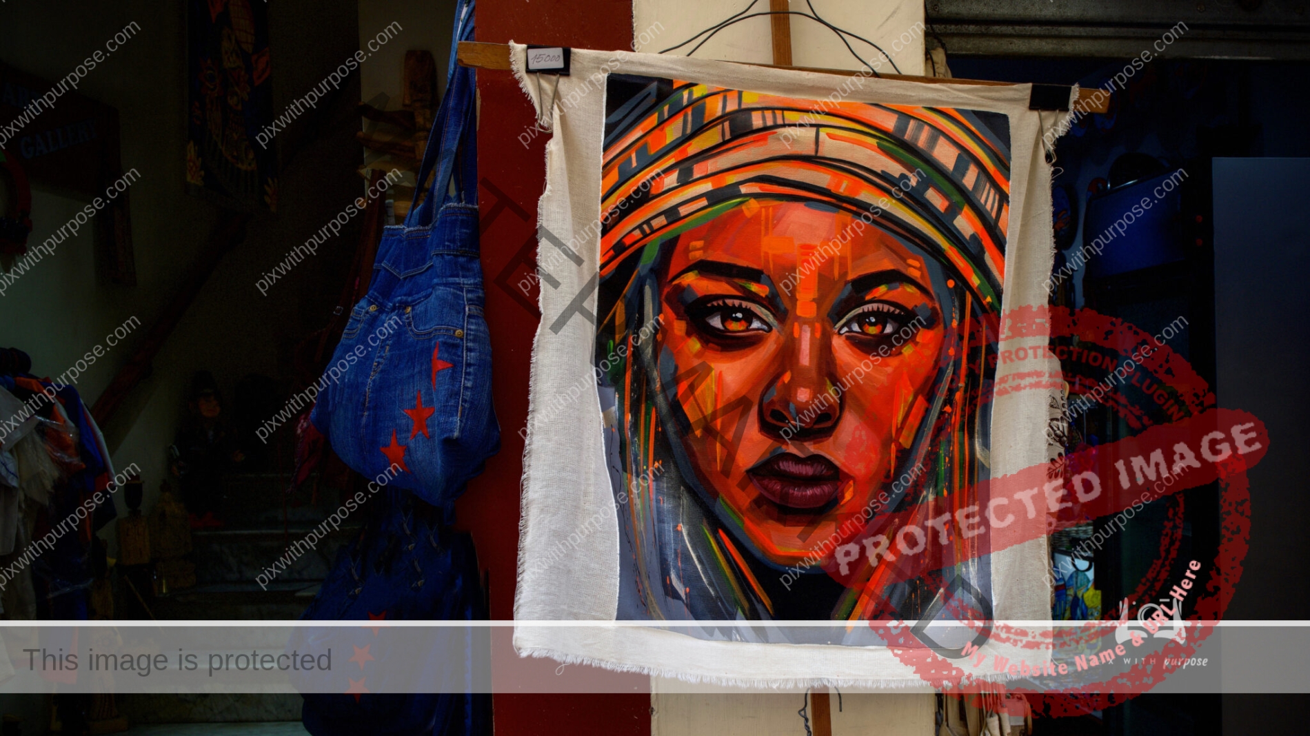
Cuban Art
Walking through the streets of Havana, bright bold colored art is for sale everywhere tourists might wander.
Zion at Dusk
We were leaving Zion National Park one winter evening while the sun was setting behind the mountains to the right. It was getting dark fast but we stopped on a bridge to shoot a couple more photos lit faintly by the fading light.
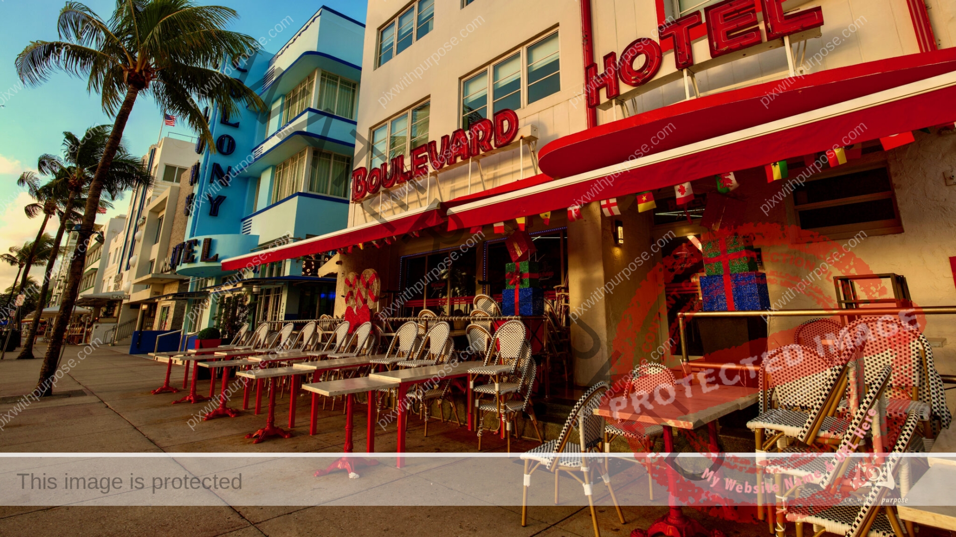
South Beach
South Beach, also nicknamed colloquially as SoBe, is a neighborhood in Miami Beach, Florida. It is located east of Miami between Biscayne Bay and the Atlantic Ocean. The area encompasses Miami Beach south of Dade Boulevard.
This area was the first section of Miami Beach to be developed, starting in the 1910. Day or night the colorful buildings are make for some beautiful photographs.
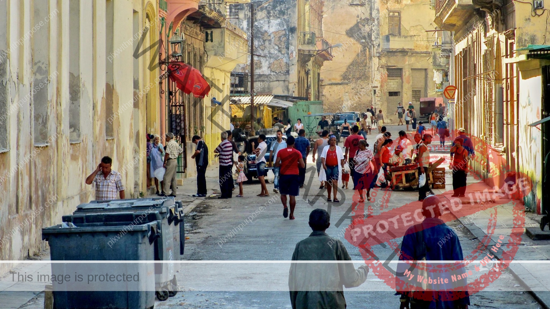
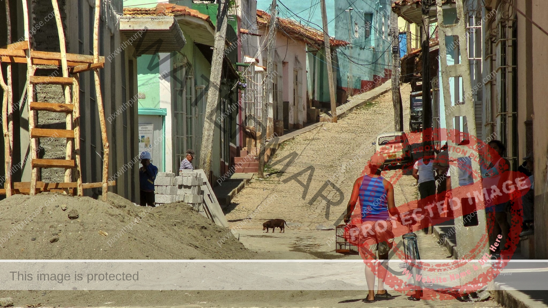
Typical downtown Havana
Every street in the capital you look down looks almost exactly like this one.

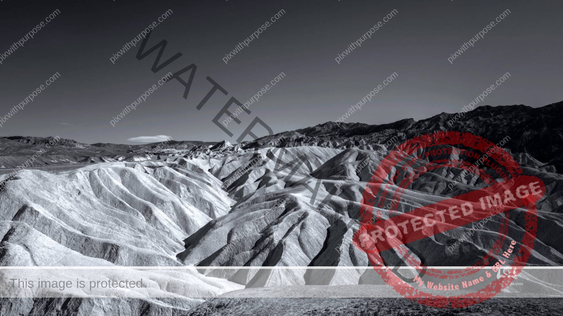
Death Valley
Death Valley National Park is one of my favorite places to use the black & white camera.

Porch Art
Key West porches are, to my eye, works of art.
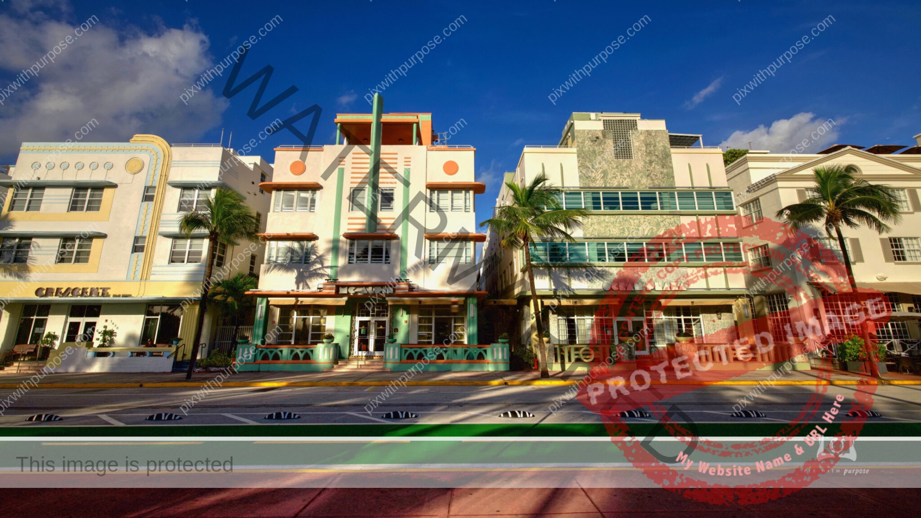
Art Deco
South Beach hotels in Miami are very photogenic daytime or especially after dark.

Common Street Scene
I have not been to another city that is more street photogenic than Havana.
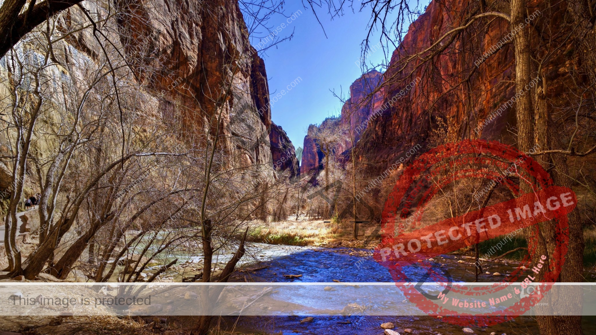
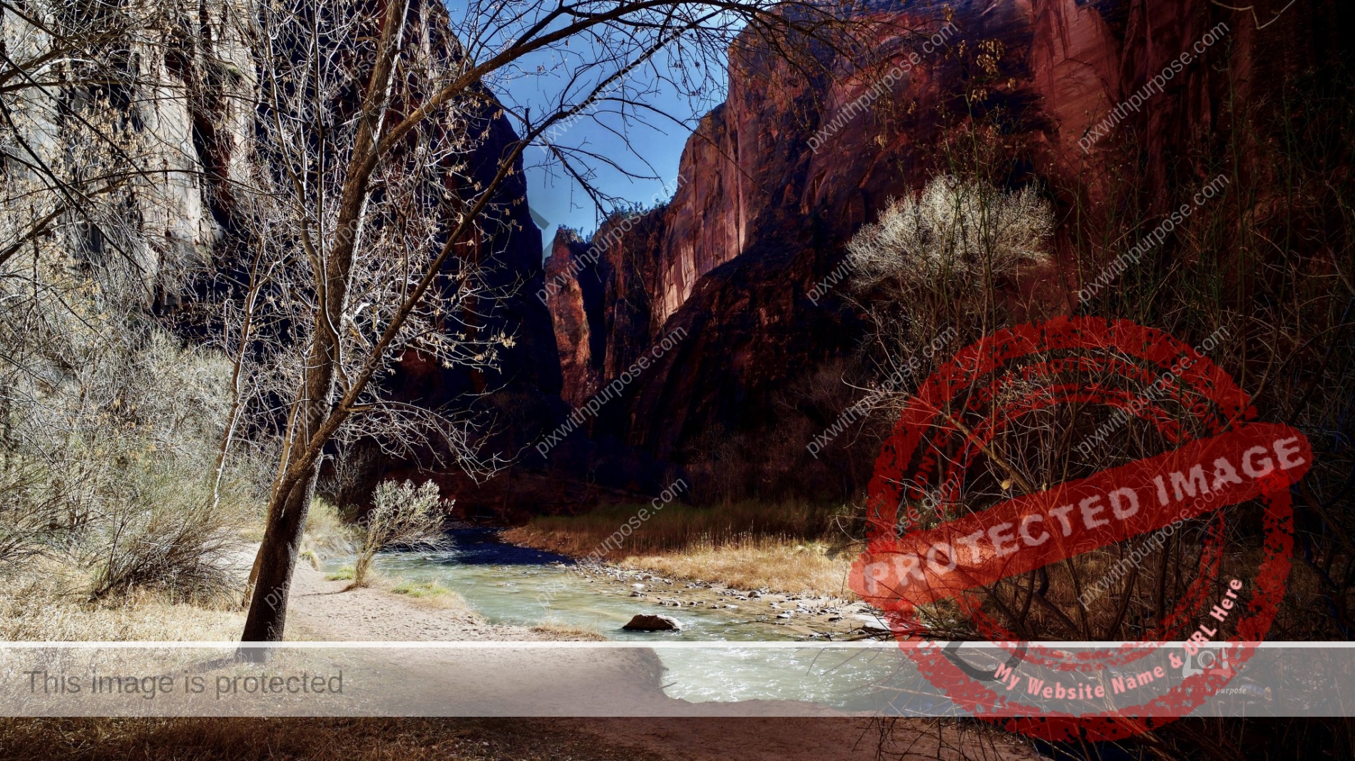
Virgin River
This river cut Zion National Park. I took this on the deep floor of the canyon in winter.
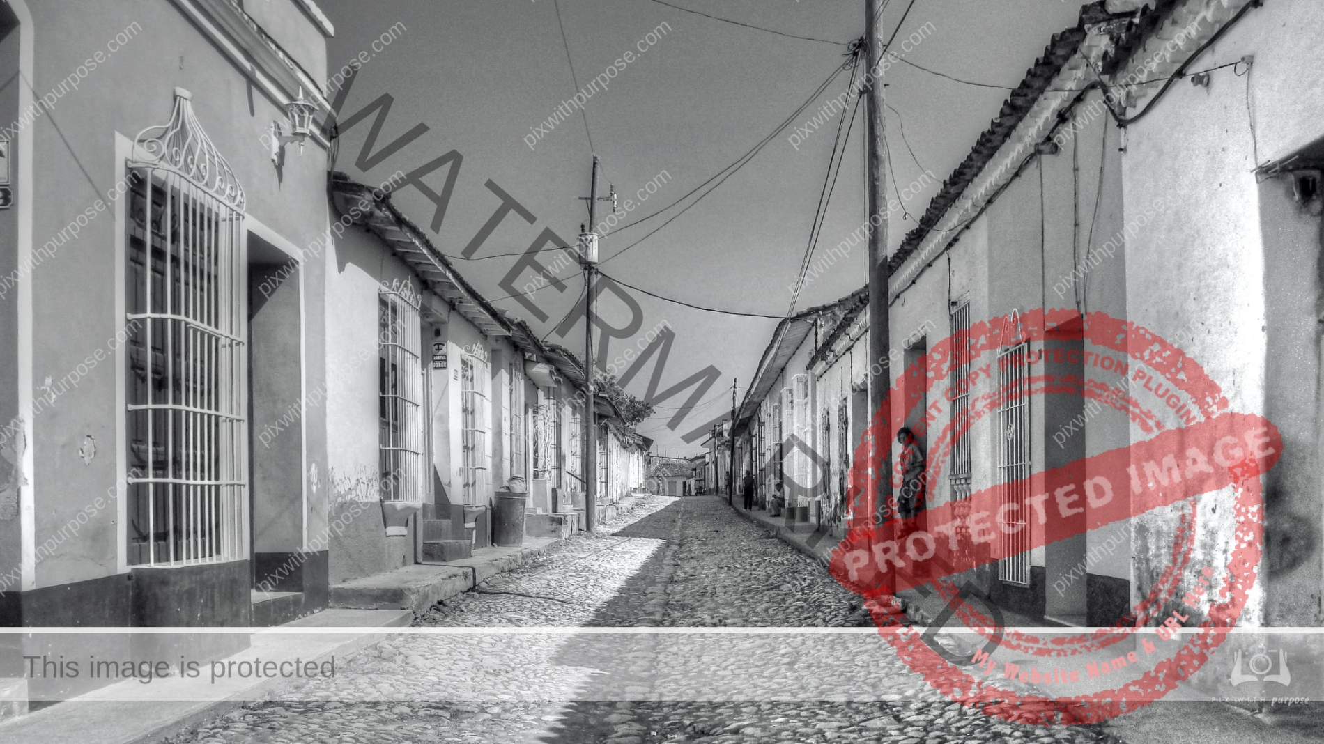
Cuban Neighborhood
These are very small homes lining the cobblestone street. Traffic is mostly mules and horse drawn carts.
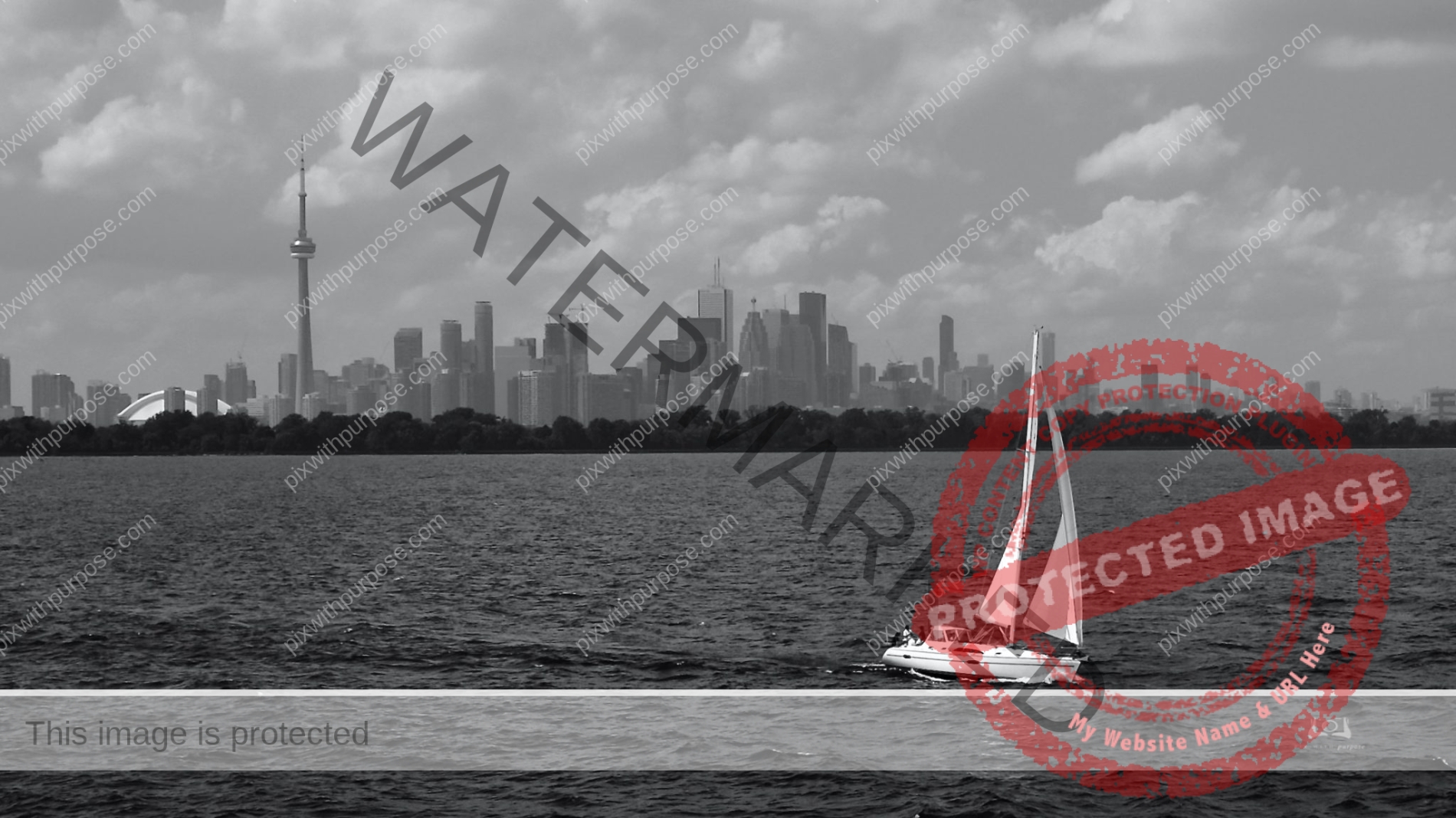
Toronto
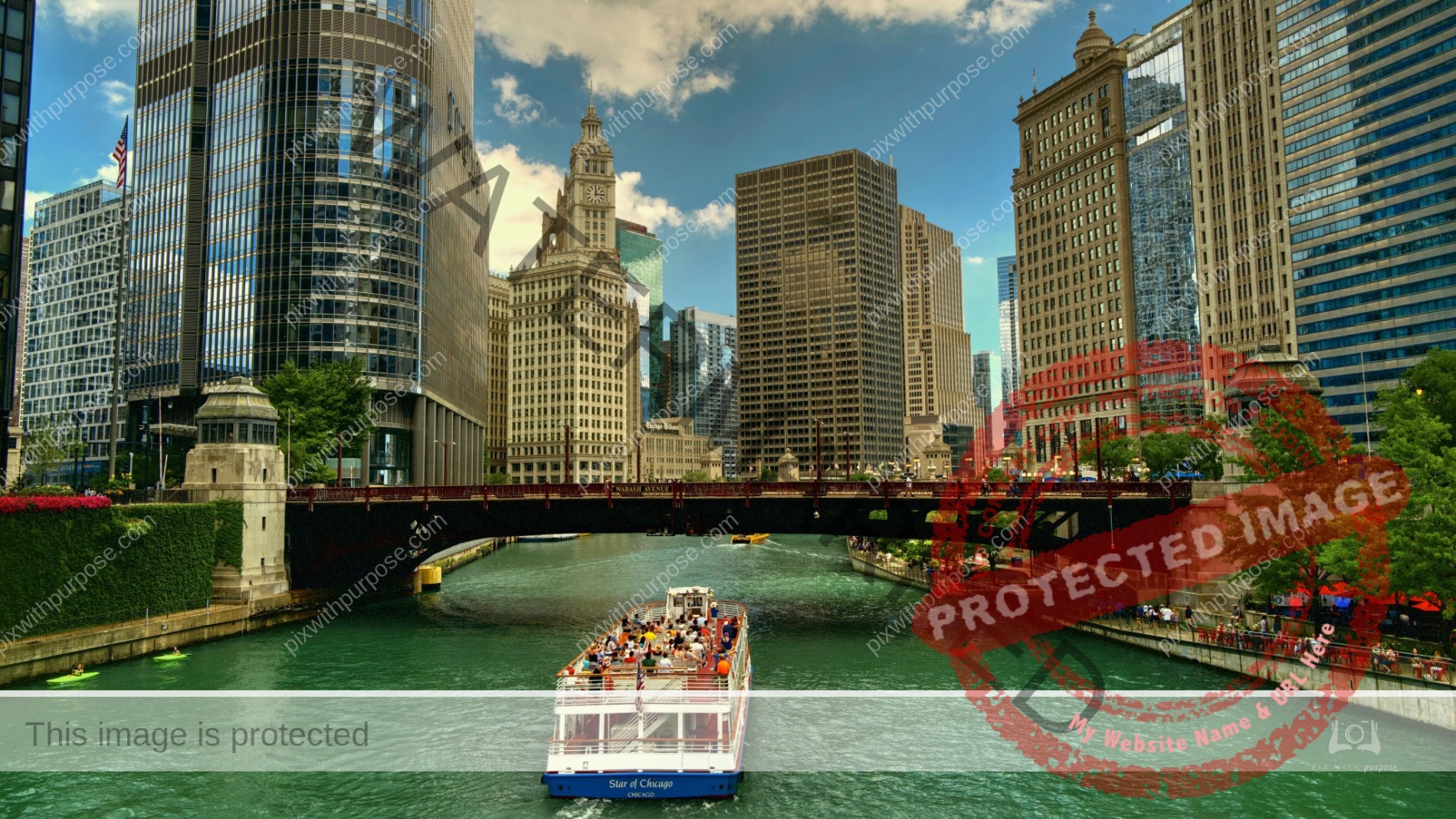
Chicago River
Downtown Chicago is a sparkling jewel of architecture, colors and people. Every summer I take the train to Union Station, spend the way walking till my feet hurt then the train back.
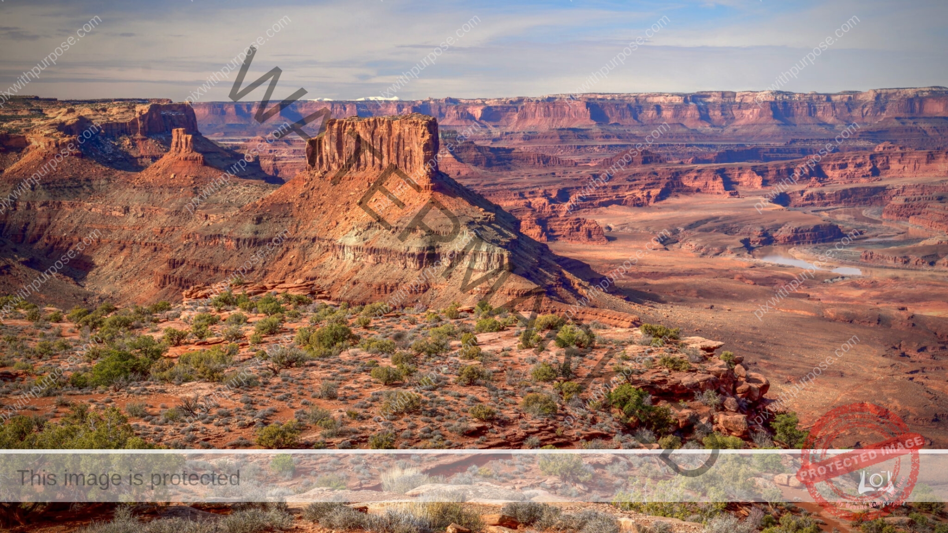
Canyonlands National Park Utah
The park is divided into four districts: the Island in the Sky, the Needles, the Maze, and the combined rivers—the Green and Colorado—which carved two large canyons into the Colorado Plateau. While these areas share a primitive desert atmosphere, each retains its own character. Author Edward Abbey, a frequent visitor, described the Canyonlands as "the most weird, wonderful, magical place on earth—there is nothing else like it anywhere. Wikipedia
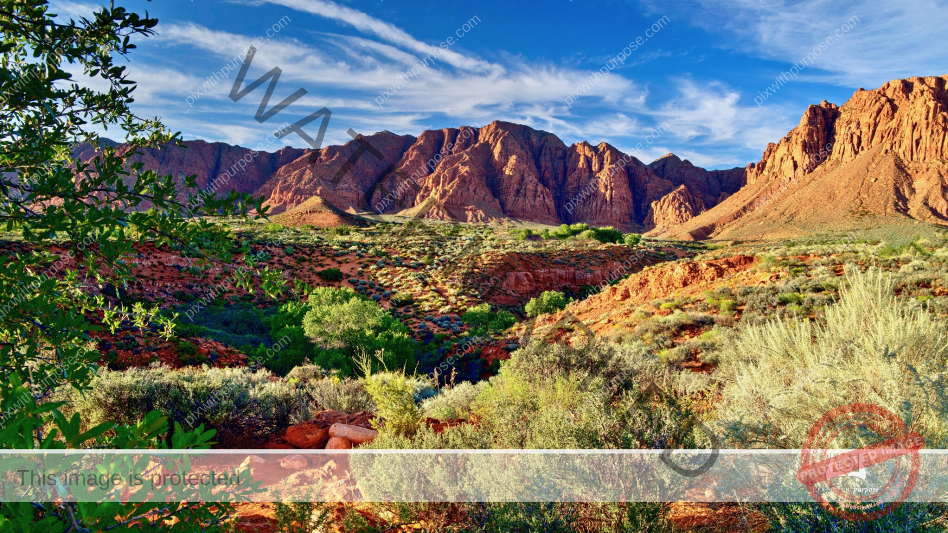
Ivins Utah
In Ivins Utah there is a development called Kayenta where color and height rules make the houses blend in with the surroundings. This red mountain is the areas backdrop while the deep wash cut the development in half.
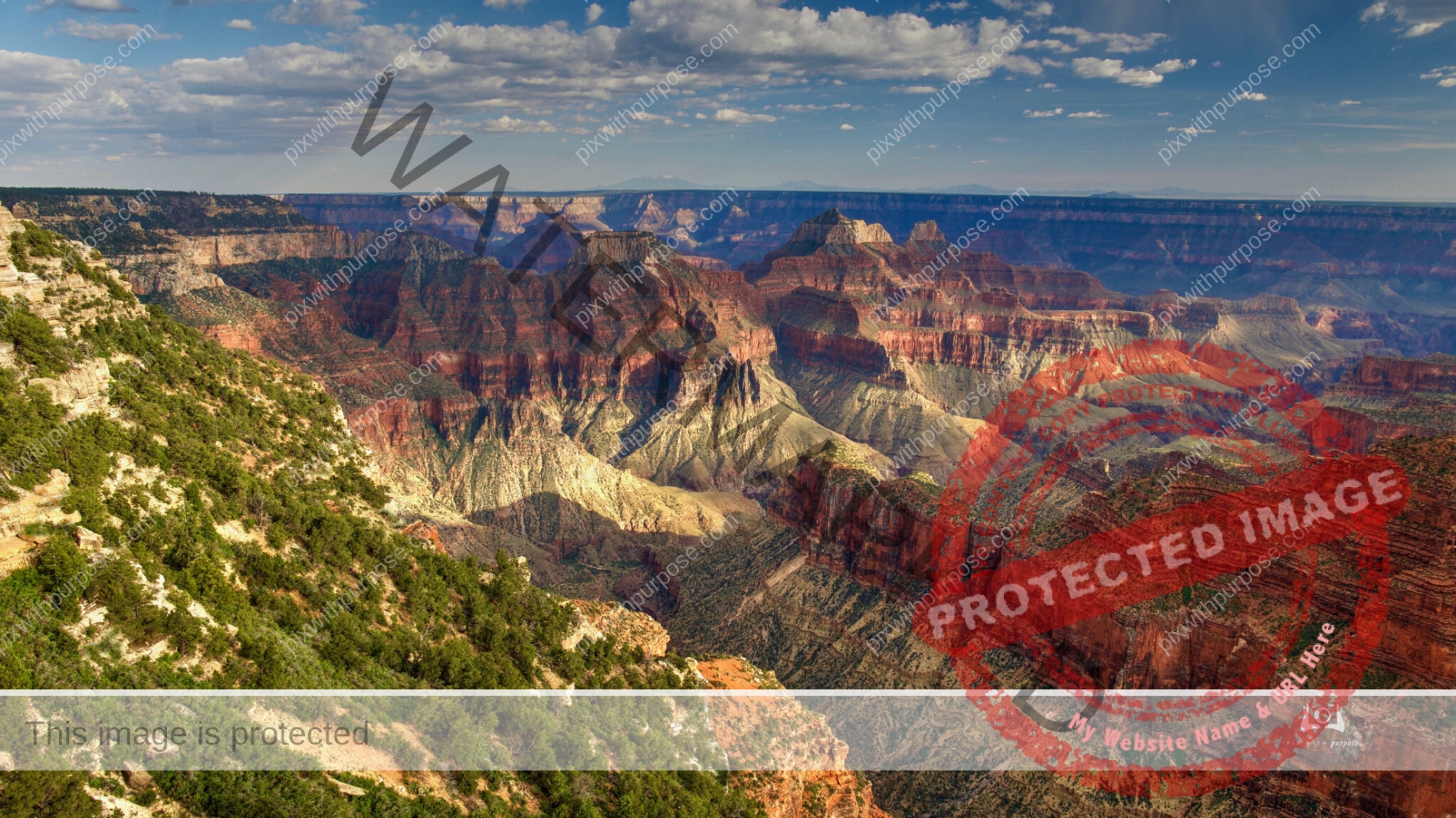
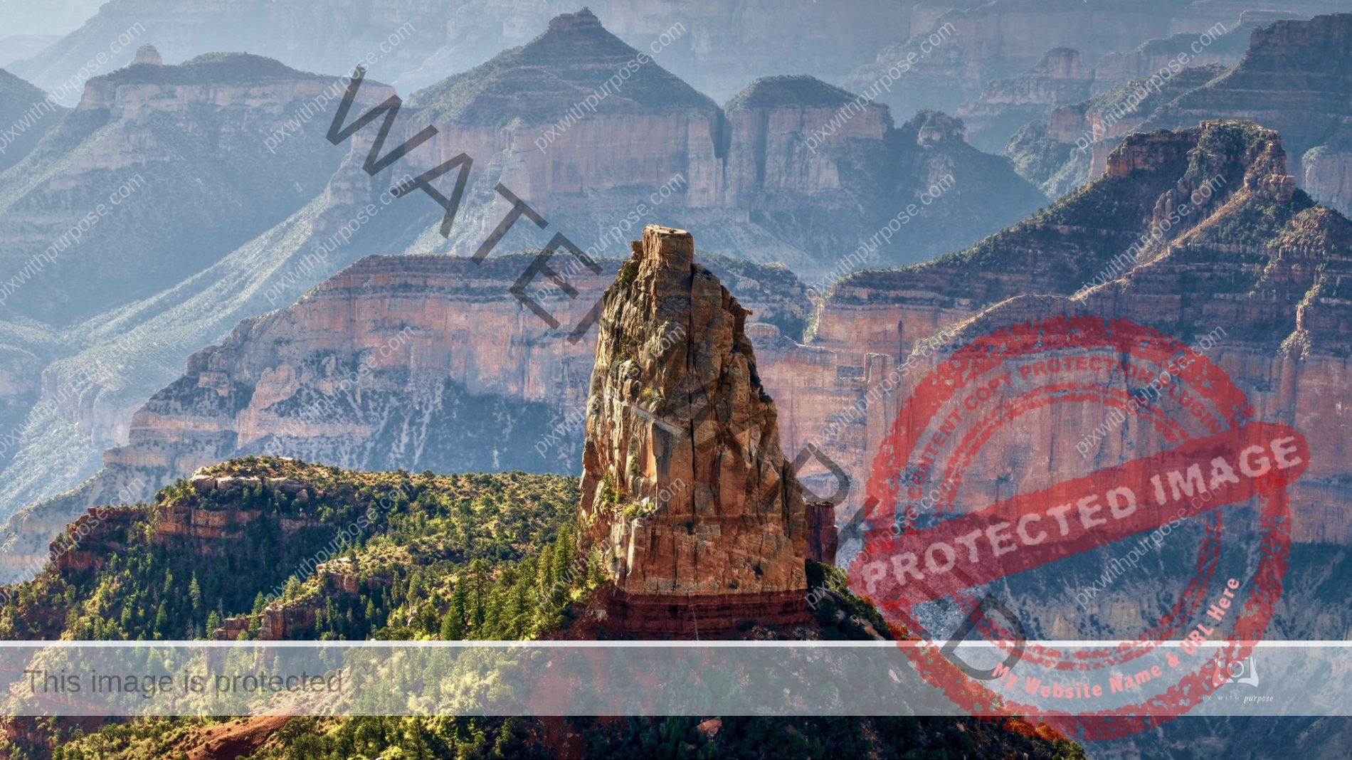
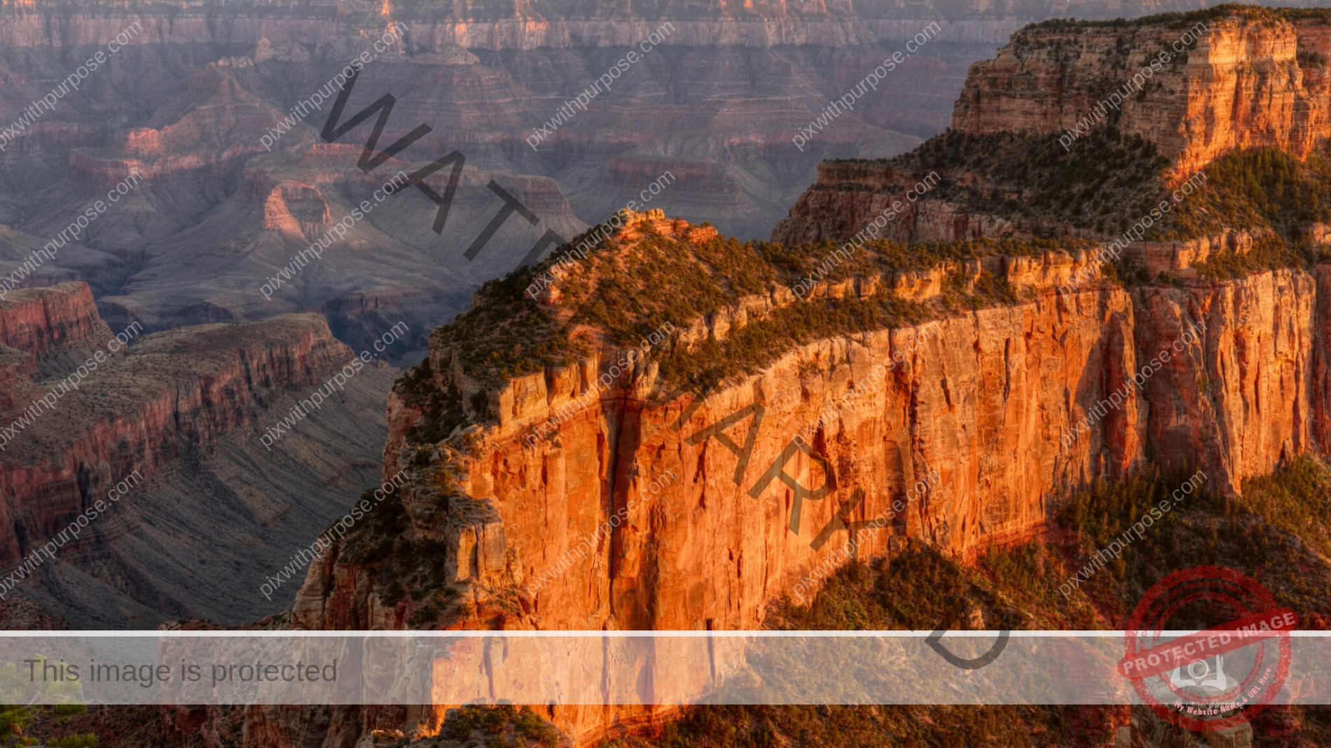
Point Imperial Grand Canyon National Park
Point Imperial Grand Canyon National Park
The highest point on the rim of Grand Canyon at 8,803 feet, Point Imperial is also the most northern boundary of the park.The views of the Painted Desert and the eastern end of Grand Canyon. It is from this area that the canyon transforms from the narrow walls of Marble Canyon, visible only as a winding gash, to a more open and dramatic "grand" canyon. Layers of red and black Precambrian rocks, not visible at Bright Angel Point, add contrast and color.
Santiago de Cuba
I would have a hard time finding a better place for street photography than Cuba
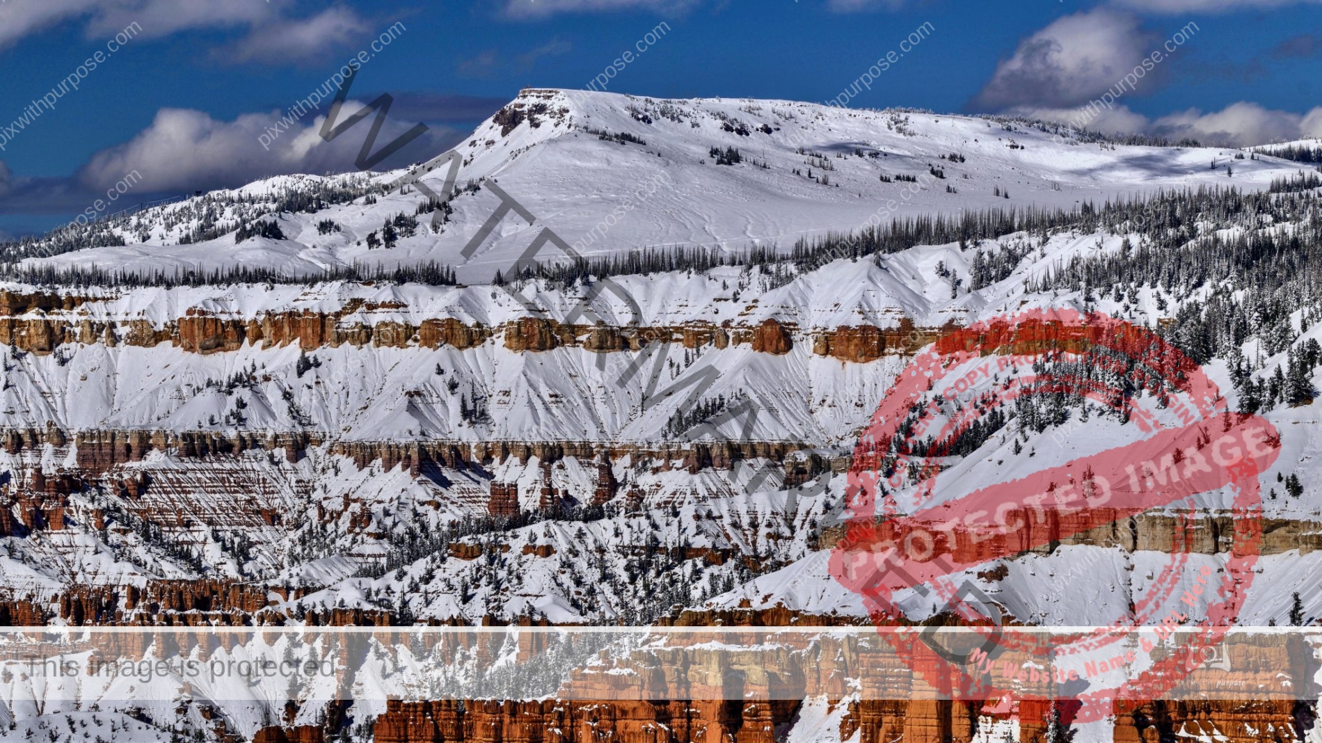
Cedar Breaks
The far peak is 11,300 feet. It's accessible by preferably 4WD vehicle a few months a year.
Zion National Park in Winter
Deep in the valley the sunlight barely made it to the bottom this time of year.

Cuban Street

State Fair
Lady in red
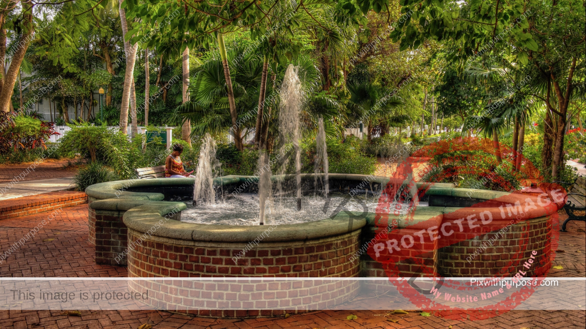
Beautiful pocket park in Key West.
Chicago IL

Bookseller in Havana
Both Che Guevara and Fidel Castro are revered in Cuba.
Zion National Park
Snowmelt in SW Utah has caused rivers to run fast and wide and in Zion, waterfalls.
Fort Jefferson
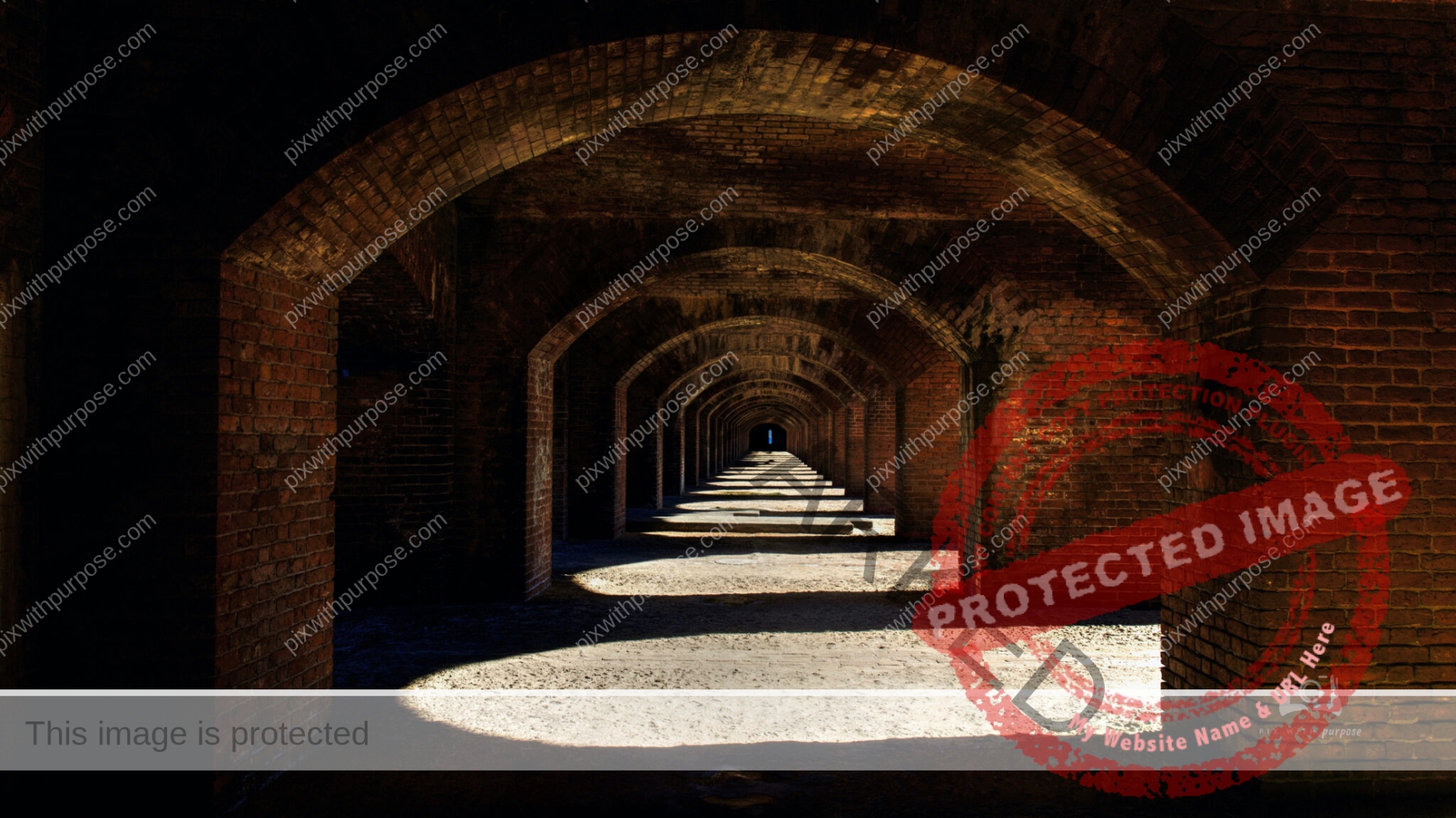
Fort Jefferson is a massive coastal fortress. It is the largest brick masonry structure in the Americas and is composed of over 16 million bricks. The building covers 16 acres. Among United States forts, only Fort Monroe in Virginia and Fort Adams in Rhode Island are larger. The fort is located on Garden Key in the lower Florida Keys within the Dry Tortugas National Park, 68 miles west of the island of Key West.
Red Rock Recreation Area
Utah park with multiple waterfalls and numerous dinosaur prints. You can maybe make out the chiseled foot holds and rope for climbing.

A Beautiful Walk
Boca Chica Naval Air Station (Key West) is just over the far mangroves. I love to walk the coast here as the water depth varies from a few inches to a few feet depending on tides. There are birds, sea creatures, plants, coral and F18 Super Hornets to keep my interest as I walk.

Joshua Tree in Gold Butte National Monument
Joshua trees are fast growers for a desert species; new seedlings may grow at an average rate of 3 inches per year in their first 10 years, then only about 1.5 per year. The trunk consists of thousands of small fibers and lacks annual growth rings, making determining the tree's age difficult. This tree has a top-heavy branch system, but also what has been described as a "deep and extensive" root system, with roots reaching down to 36 ft. If it survives the rigors of the desert, it can live for hundreds of years; some specimens survive a thousand years. The tallest trees reach about 49 ft. New plants can grow from seed, but in some populations, new stems grow from underground rhizomes that spread out around the parent tree.
The first time I "bumped" into one I thought I'd been stabbed thereafter keeping my distance.
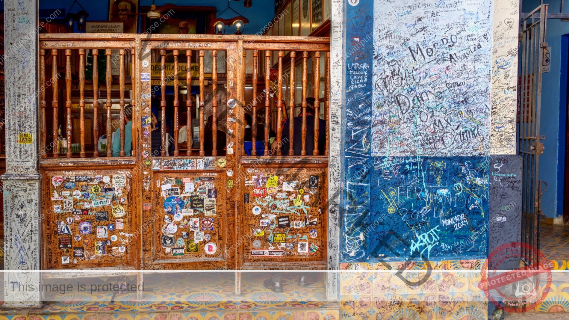
Tavern in Cuba
Like everything else in Havana, very old and rundown but lots of character.

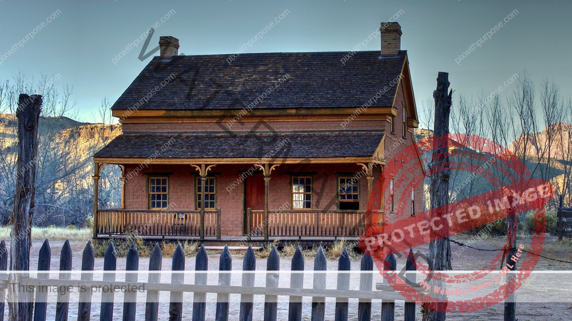
Grafton Settlement
Historic Mormon settlement on the south side of the Virgin River, adjoining orchards and farmland; last occupied in the 1940s. The town contains five original, partly restored buildings plus pieces of iron equipment and other relics. Zion National can be seen in the background.
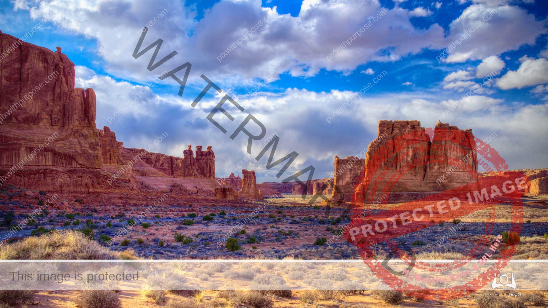
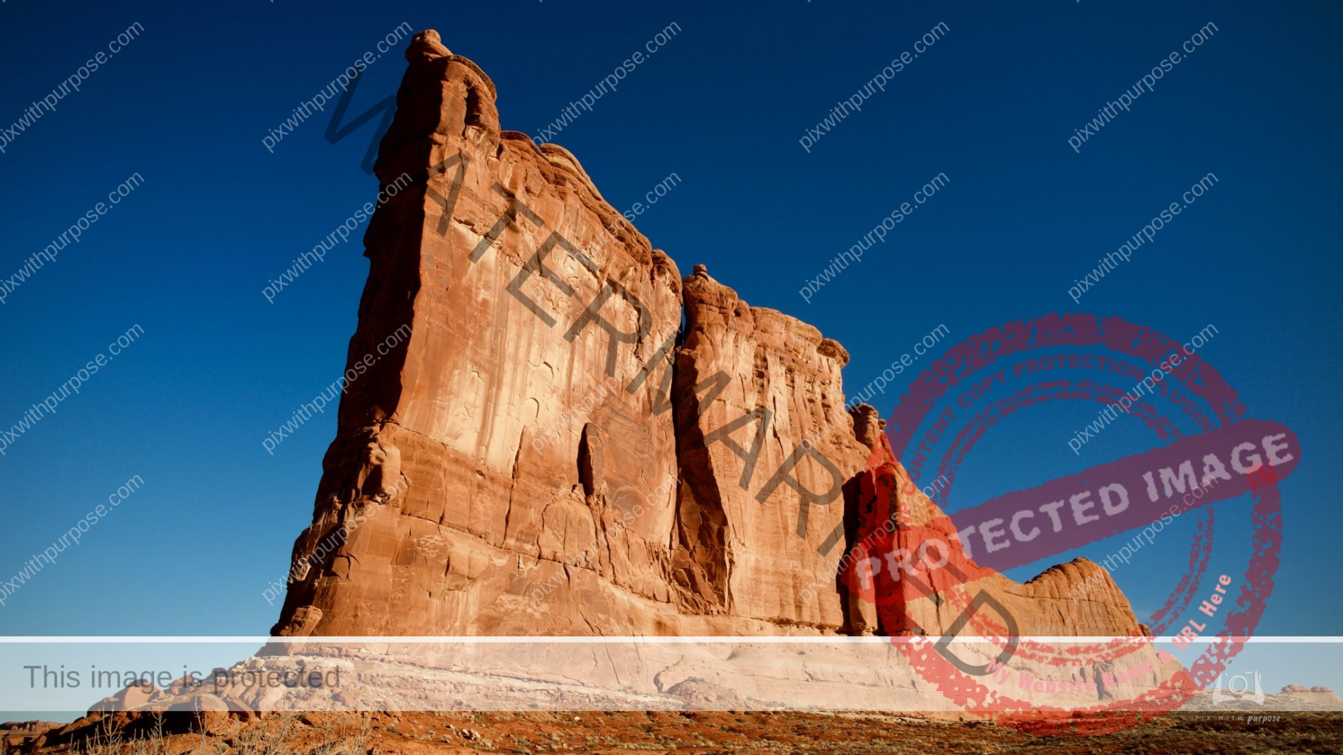
Arches National Park
Arches National Park is in eastern Utah adjacent to the Colorado River, north of Moab, Utah. It contains more than 2,000 natural sandstone arches, including the well-known Delicate Arch, which constitute the highest density of natural arches in the world. The national park lies above an underground evaporite layer or salt bed, which is the main cause of the formation of the arches, spires, balanced rocks, sandstone fins, and eroded monoliths in the area. The park consists 119.81 sq miles. Wikipeda
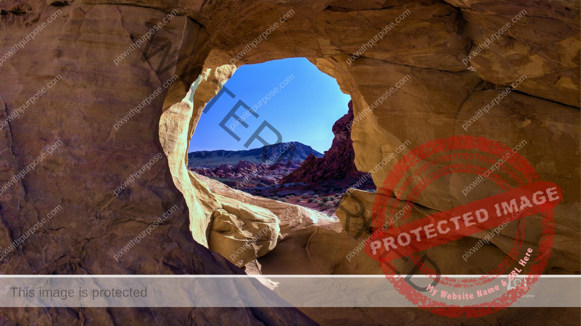
5 foot hole
In Valley Of Fire State Park in Nevada.

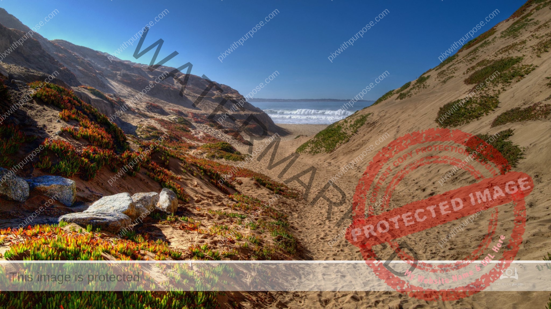
Pacific Coast
South of Carmel CA
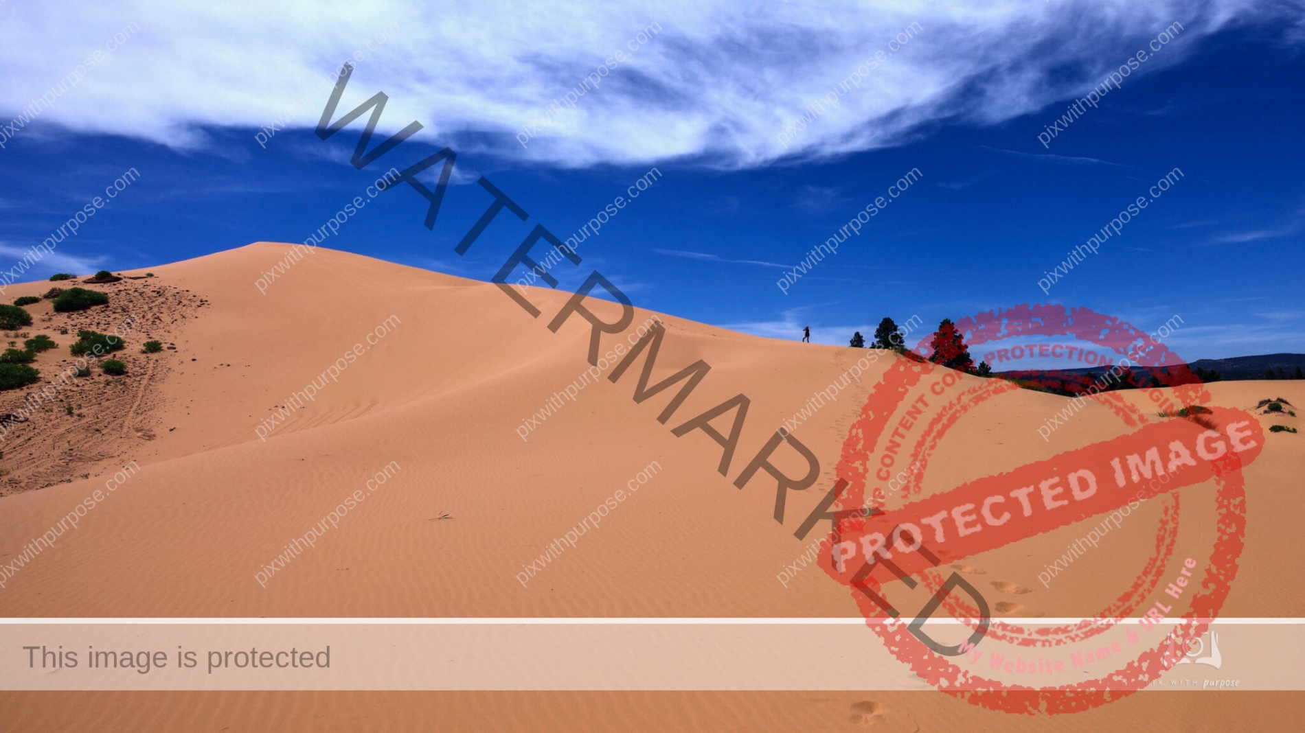
Pink Coral Sand Dunes State Park
This is a wonderful park near Zion National Park in Utah. Follow the footprints to my friend, about 1/2 way to the top to give this some scale.
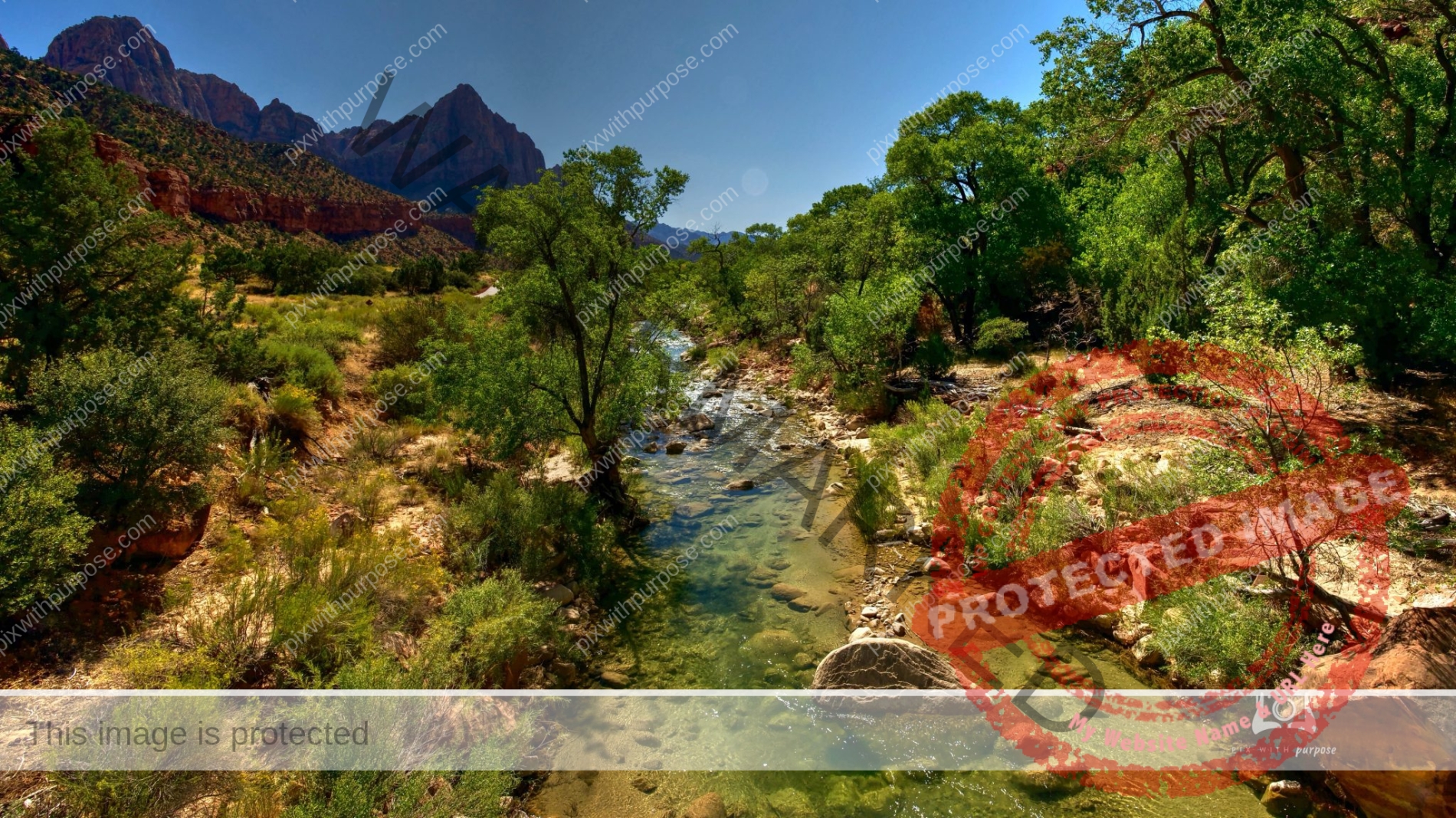
Virgin River
Standing on a bridge in Zion National Park I was able to take this photo of the Virgin River which carved the canyons through the park.
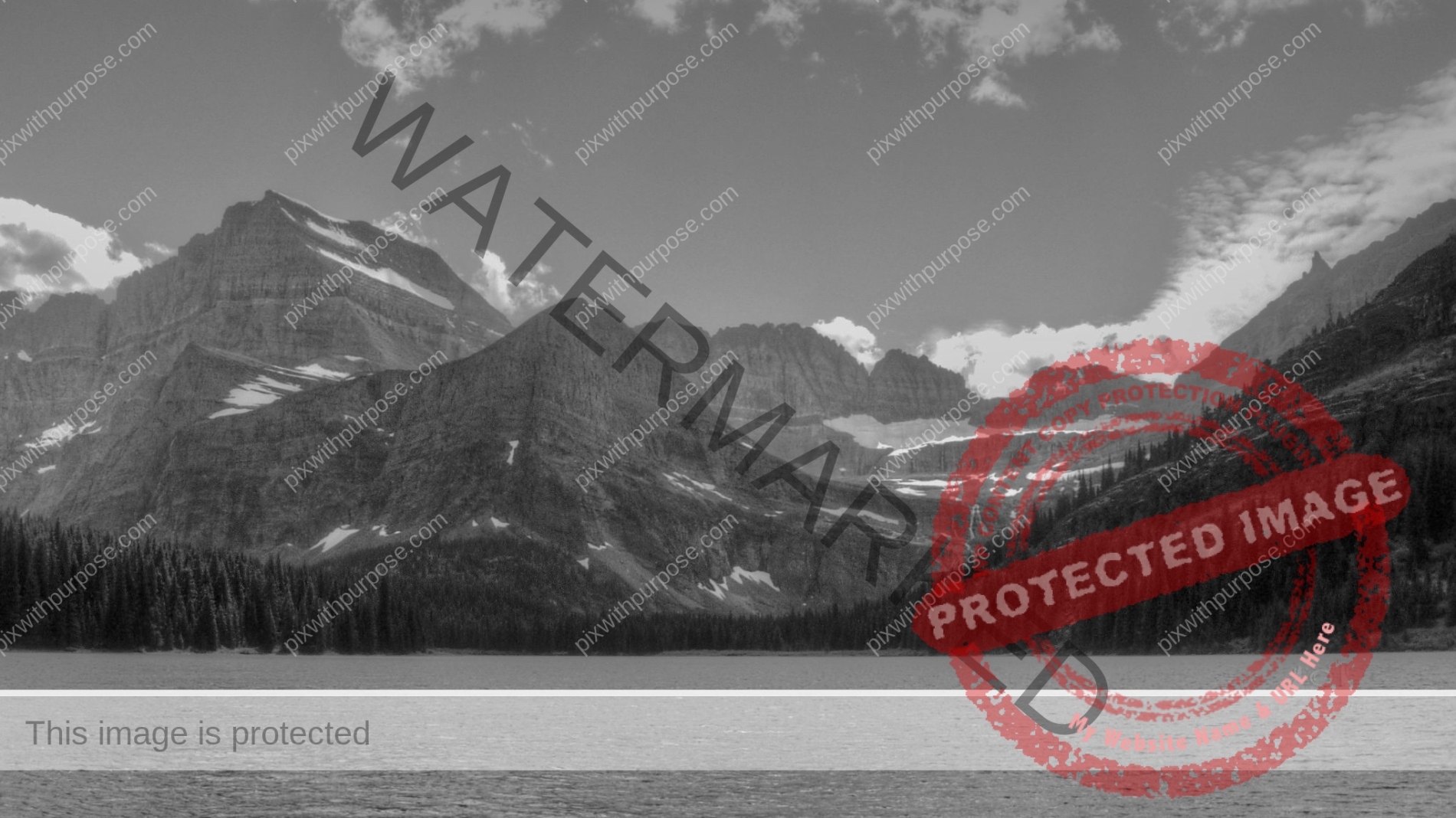
Glacier National Park
If you haven't visited this park.... bucket list it.

Virgin River
Zion National Park
Coral Pink
While the dunes are estimated to be 10,000 to 15,000 years old, this state park was first opened to the public in 1963. A phenomenon known as the Venturi Effect created the dunes, which is when wind passes through a notch between the Moquith and Moccasin Mountains. It increases velocity through the notch, which erodes the sandstone and carries the grains to the dunes.
Coral Pink Sand Dunes State Park is 3,730 acres of sand.
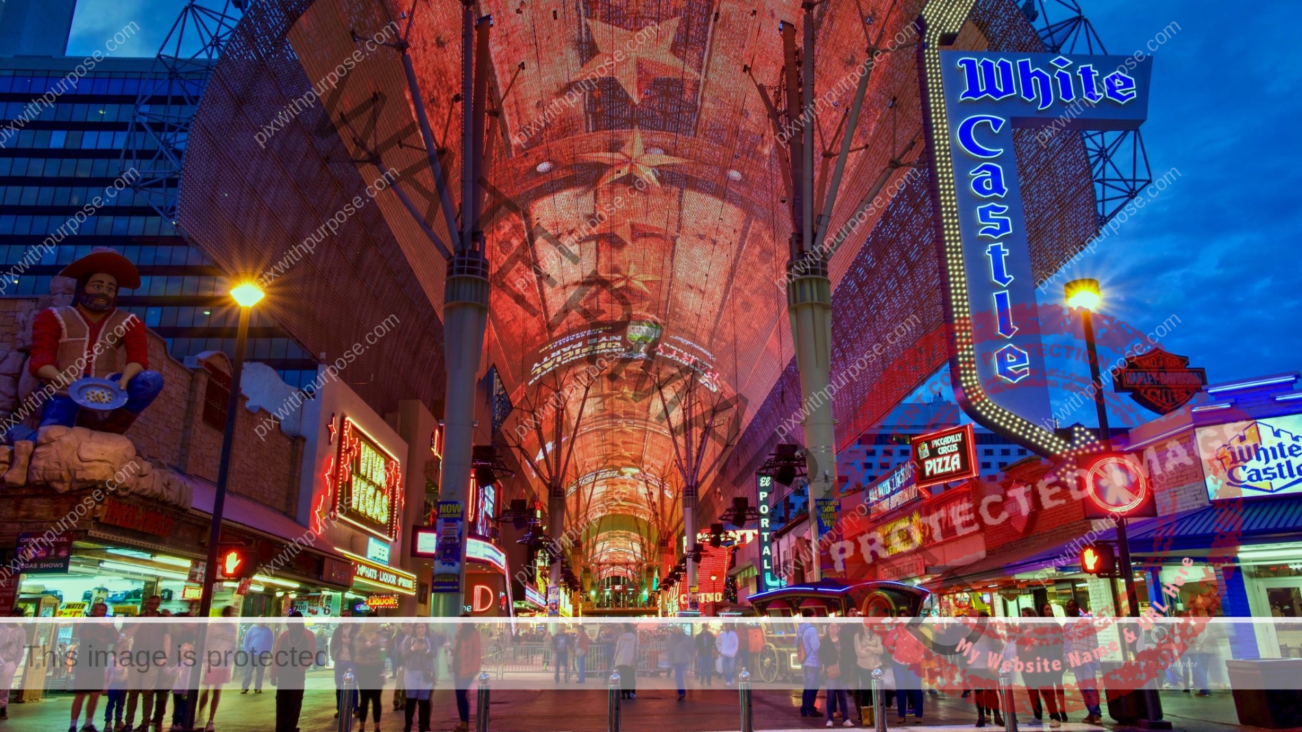
Downtown Las Vegas
a.k.a. The Fremont Street Experience
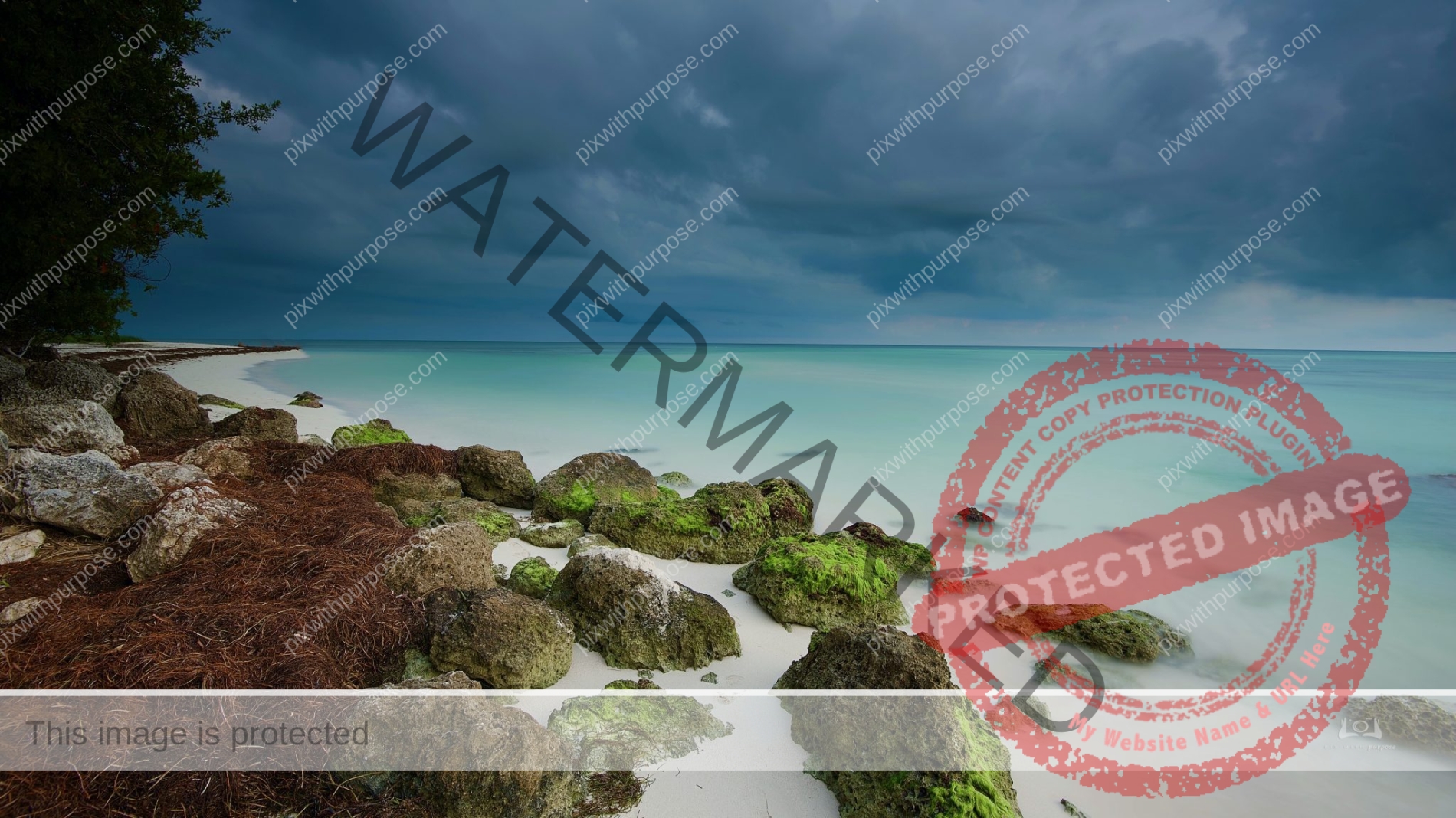
Bahia Honda State Park
The stormy skies made for strong color contrast between water, grass and sand.
Arches NP
Arches National Park is in eastern Utah adjacent to the Colorado River, 4 miles north of Moab. More than 2,000 sandstone arches are located in the park which is the highest density in the world.
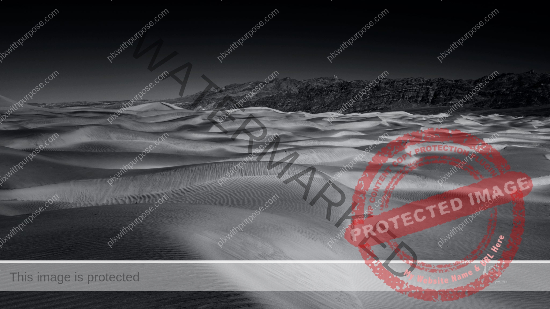
Mesquite Dunes
While sand exists throughout Death Valley, there are very few locations where large dune fields are created. In order to create sand dunes, there must be a source of sand (in this case, the eroding mountains to the north), wind to move that sand, and a barrier to prevent the sand from being blown farther (the mountains to the south). The conditions at Mesquite Flat Sand Dunes are perfect for the creation of dunes, and while individual grains move, and ripples form, the dune field remains.
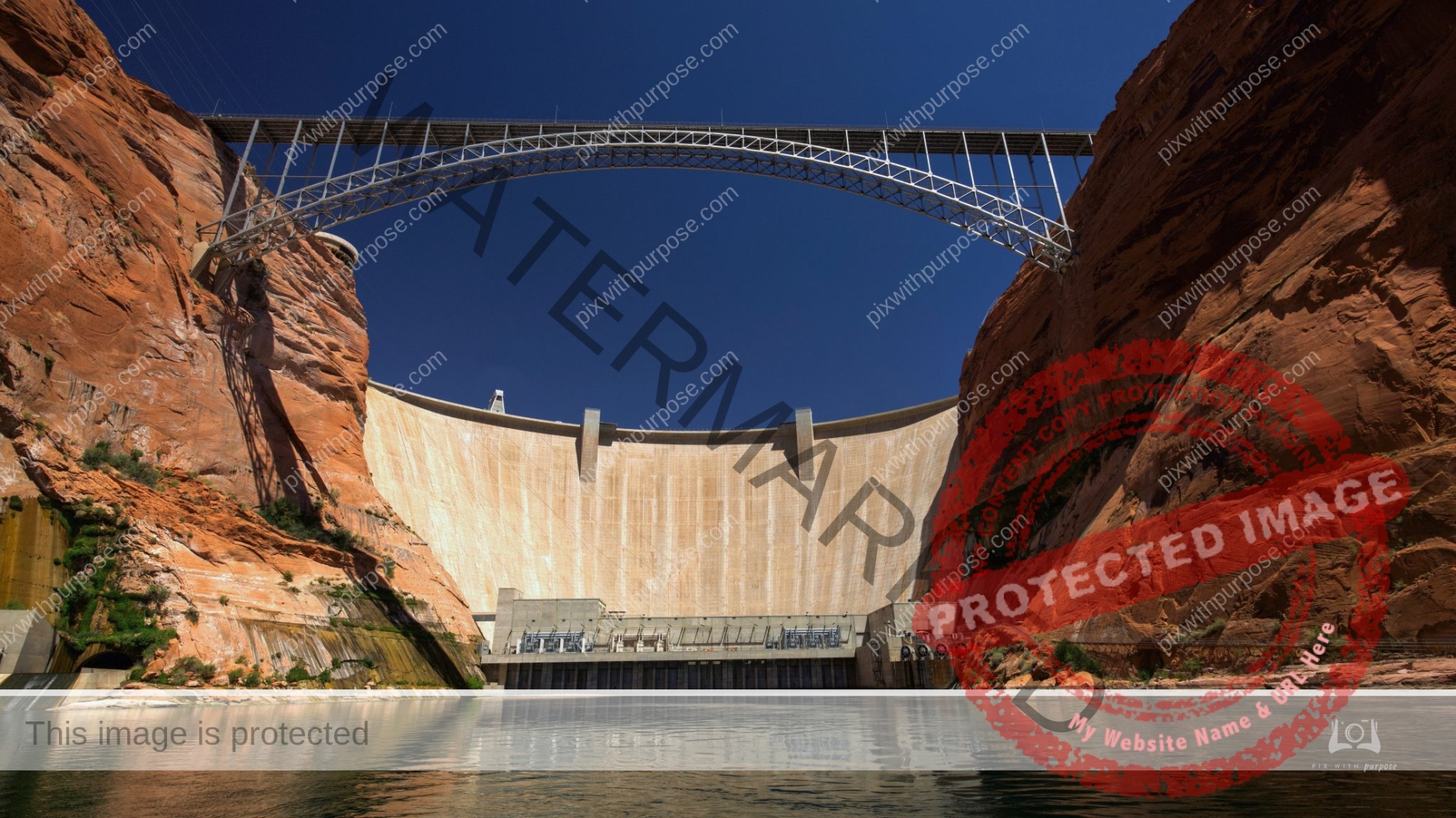
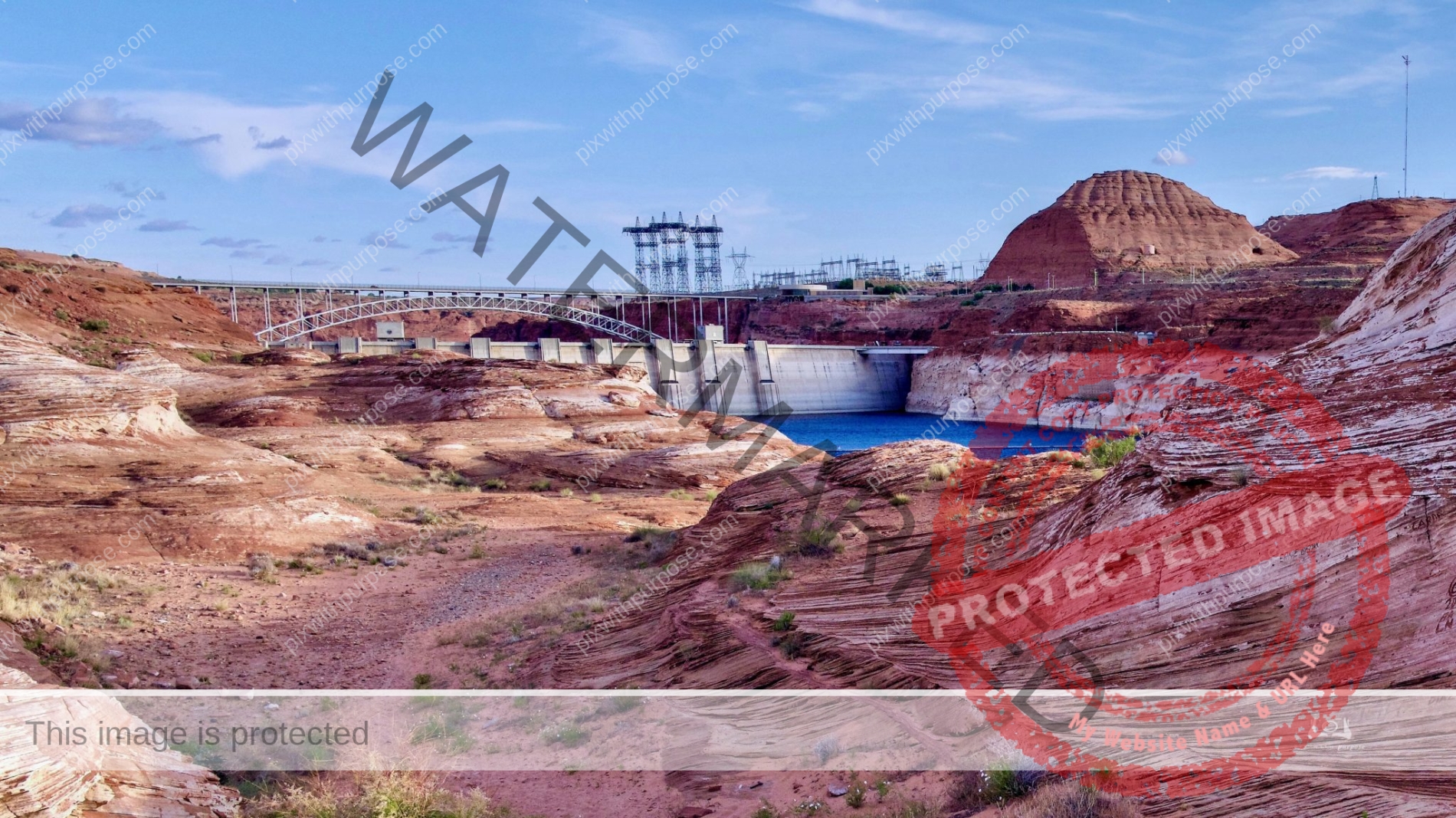
Glen Canyon Dam
Glen Canyon Dam, rising 710 feet above bedrock within the steep, rust-colored sand-stone walls of Glen Canyon, was constructed in 1956 to harness the power of the Colorado River in order to provide for the water and power needs of millions of people in the West. BLM
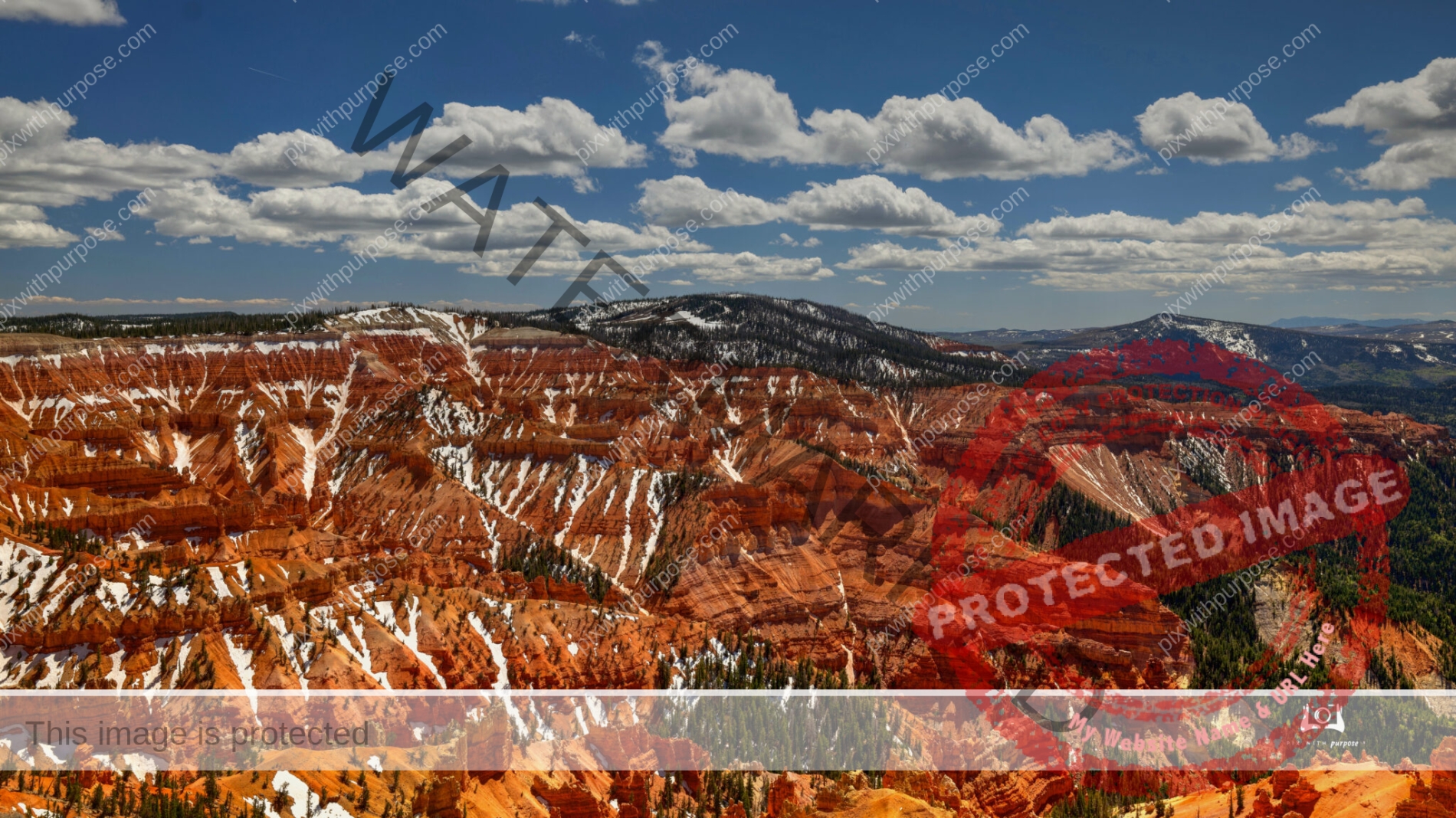
Cedar Breaks
Cedar Breaks National Monument in Utah. Elevation here is about 10,500 feet.

Race time
Road America at Elkhart Lake WI
Think Blues Brothers
Chicago
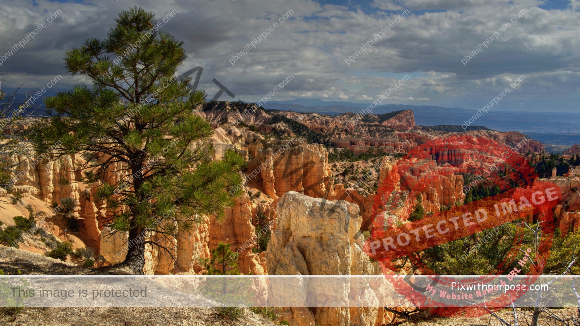
Bryce Canyon Utah
One of the "Big Five" as they are called, National Parks in Utah.
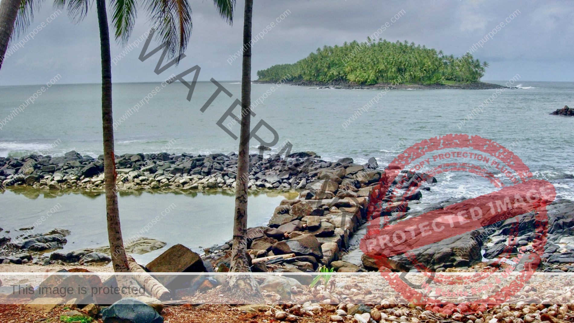
Devils Island
In the distance is Devil's Island (Île du Diable), a French penal colony that operated for more than 100 years, from 1852 to 1953, in the Salvation Islands of French Guiana.
Opened in 1852, the Devil's Island system received convicts from the Prison of St-Laurent-du-Maroni, who had been deported from all parts of the Second French Empire. It was notorious both for the staff's harsh treatment of detainees and the tropical climate and diseases that contributed to high mortality. The prison system had a death rate of 75% at the worst, and was finally closed down in 1953.
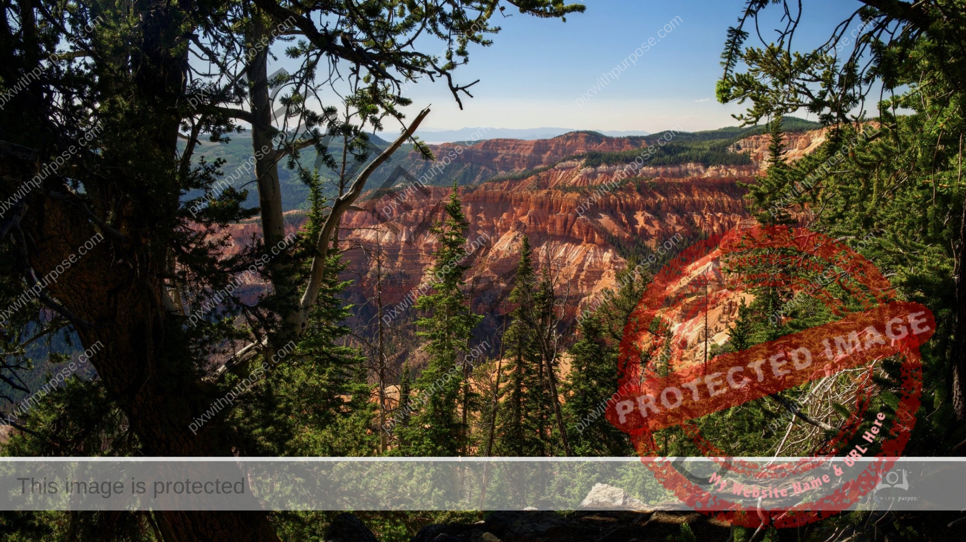
Cedar Breaks
Cedar Breaks is a natural amphitheater, stretching across 3 miles, with a depth of over 2,000 feet. The elevation of the rim of the amphitheater is over 10,000 feet above sea level. Iron oxides provide the reds, oranges and yellows, while manganese oxides provide shades of purple.
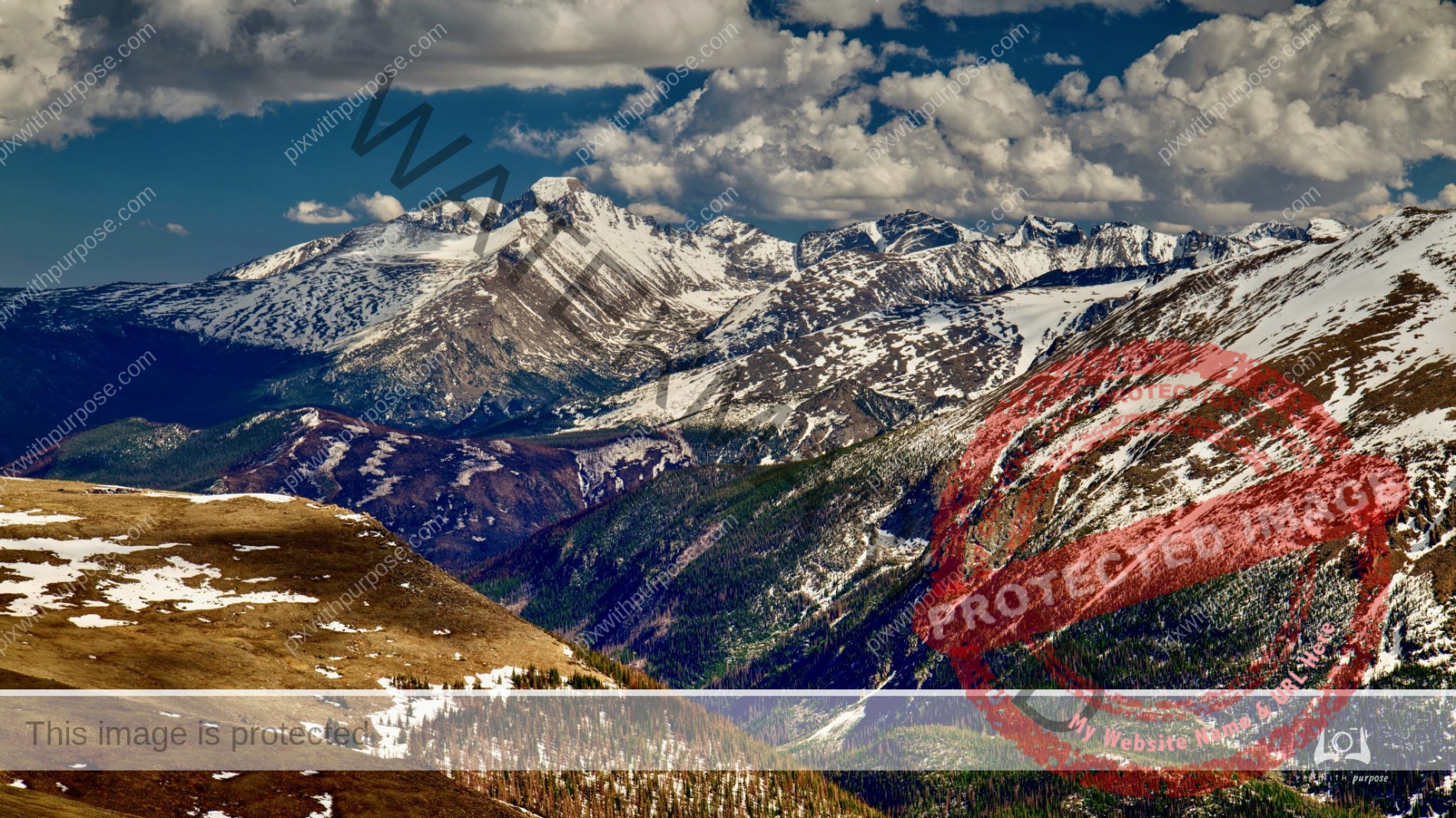
Continental Divide
Rocky Mountain National Park at 10,759 feet.

Glen Canyon Dam
Supplying Colorado River water and hydroelectric power to 5 states located in Page Arizona

Dante’s View
Perched atop the Black Mountains at 5,475 feet, Dante’s view is tall and wide. Both of Death Valley’s elevation extremes, 282 feet below sea level and 11,049 feet above, can be seen in a single glance. Dante’s View in Death Valley National Park offers premier panoramic views of Badwater Basin, the lowest point in North America. Across the valley rises Telescope Peak, the highest in the park.