Bryce Canyon National Park Utah
From Wikipedia: The air in the park is so clear that on most days the Kaibab Plateau can be seen 90 miles away in Arizona. On extremely clear days, the Black Mesas of eastern Arizona and western New Mexico can be seen some 160 miles away. The park also has a 7.4 magnitude night sky, making it one of the darkest in North America. Stargazers can, therefore, see 7,500 stars with the naked eye, while in most places fewer than 2,000 can be seen due to light pollution, and in many large cities only a few dozen can be seen.
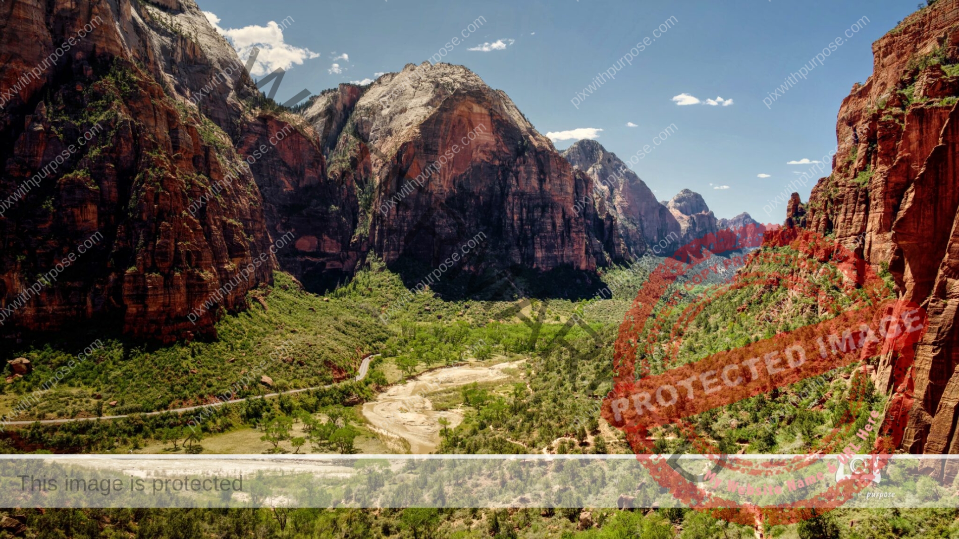
Sunny Zion
Zion National Park at about 1pm. To give an idea of scale you might be able to see the shuttle bus left of center or people on the trail in the lower right.
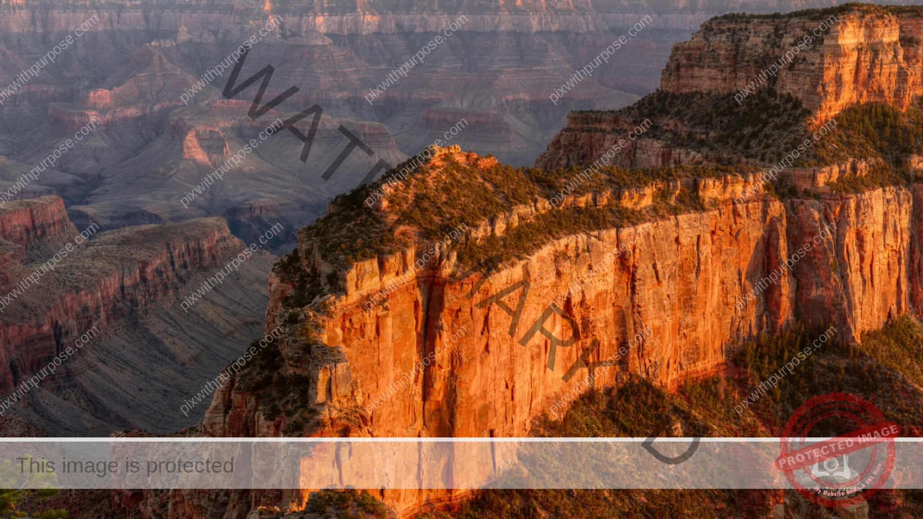
Grand Canyon North Rim
Shot about 15 minutes before sunset.
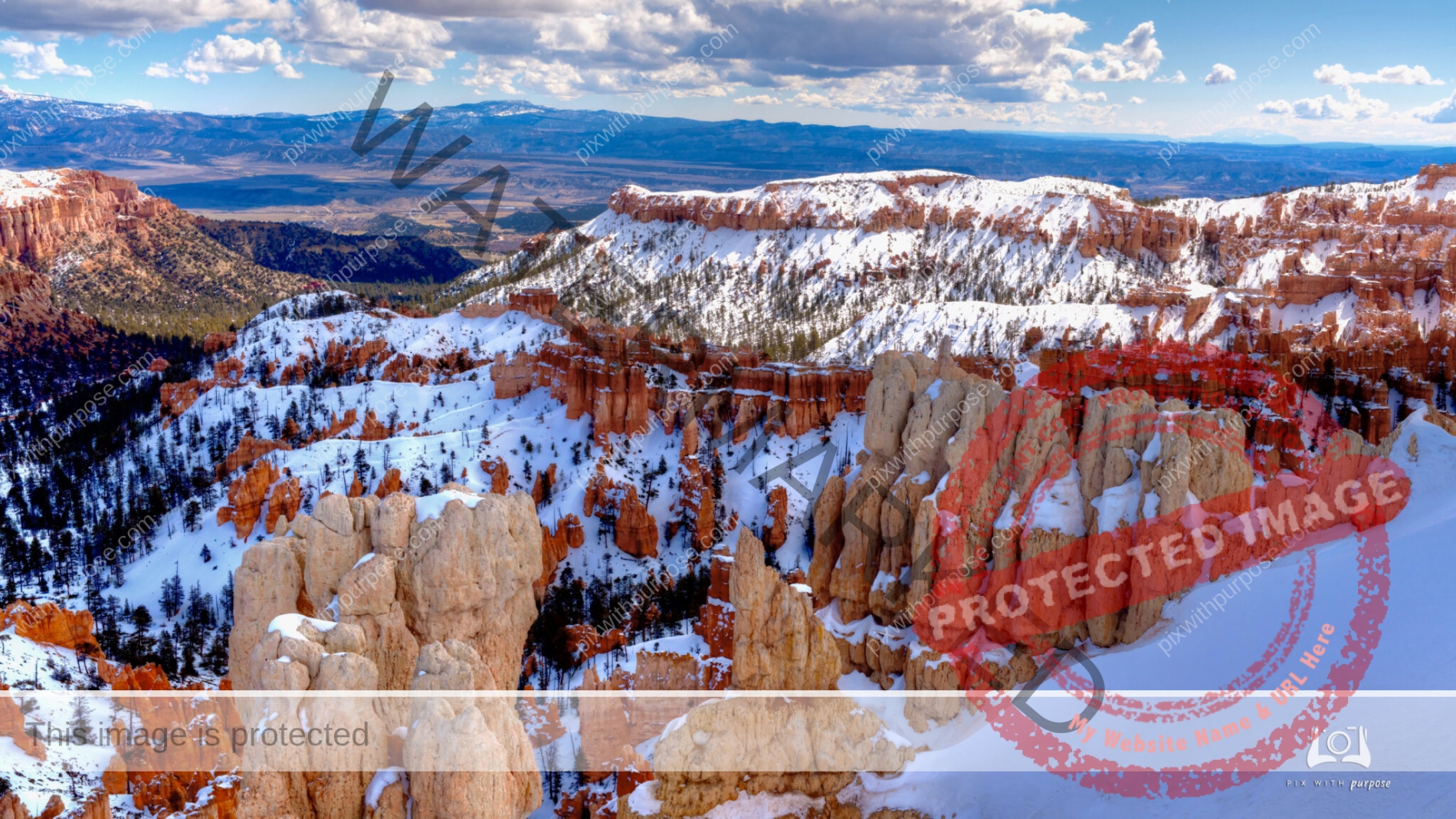
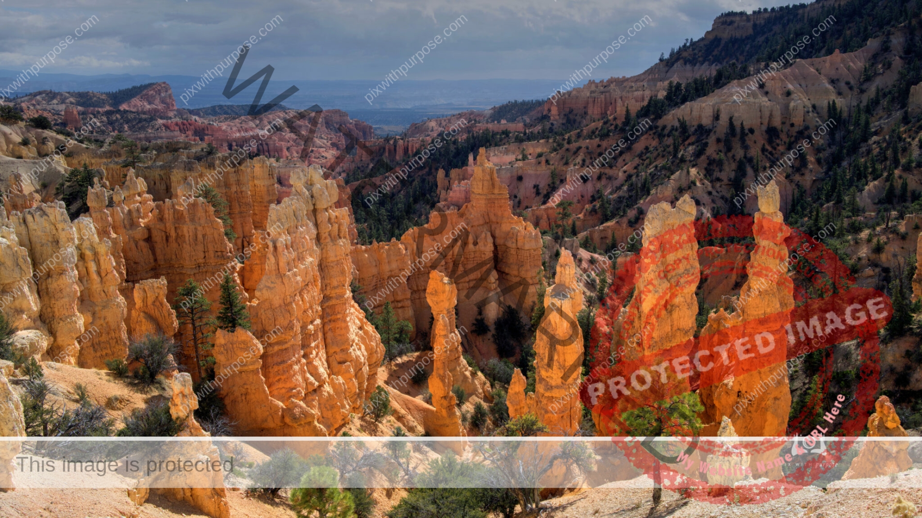
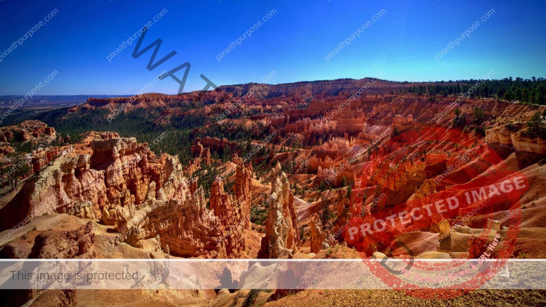
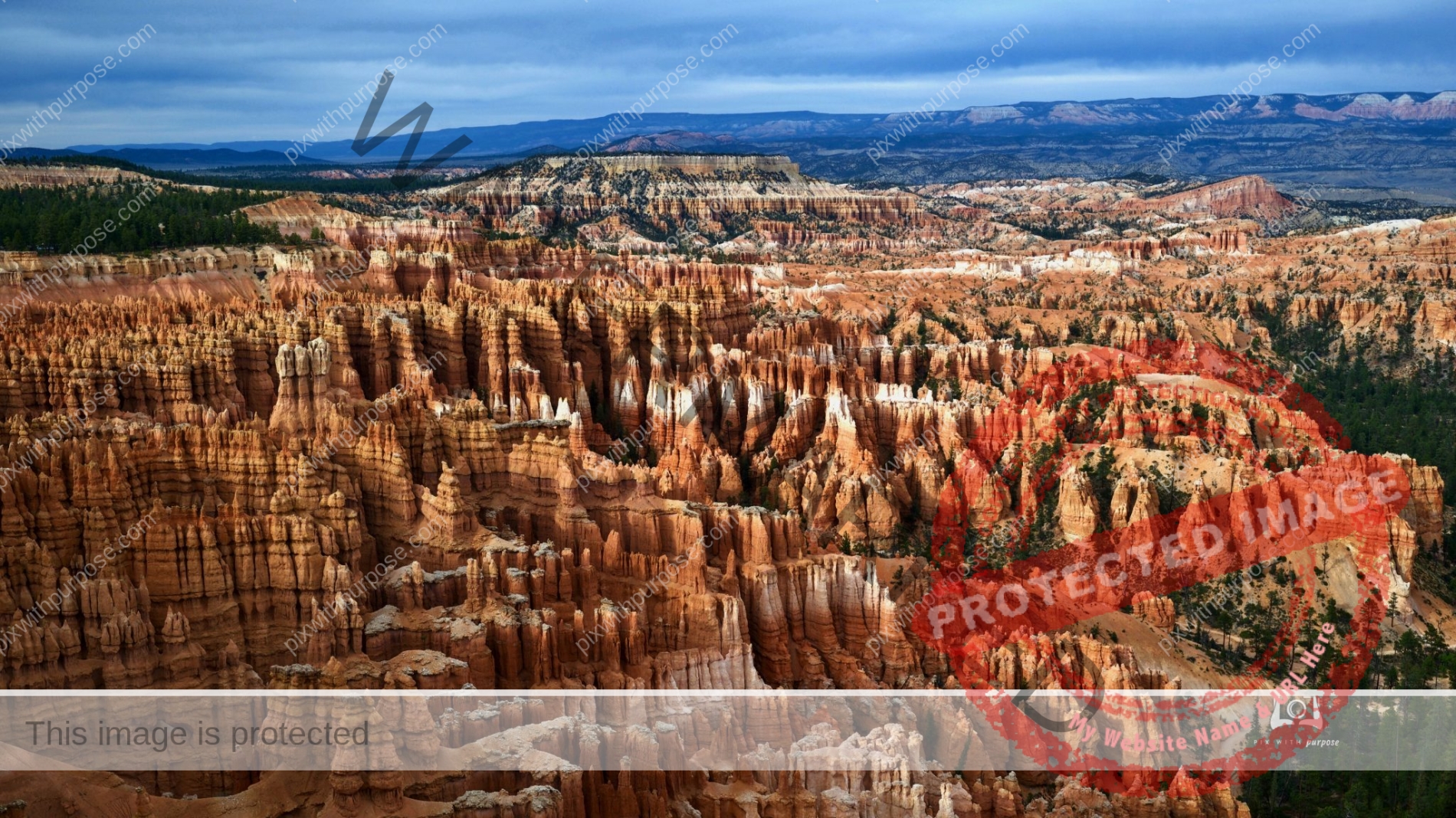
Bryce Canyon
Bryce Canyon National Park
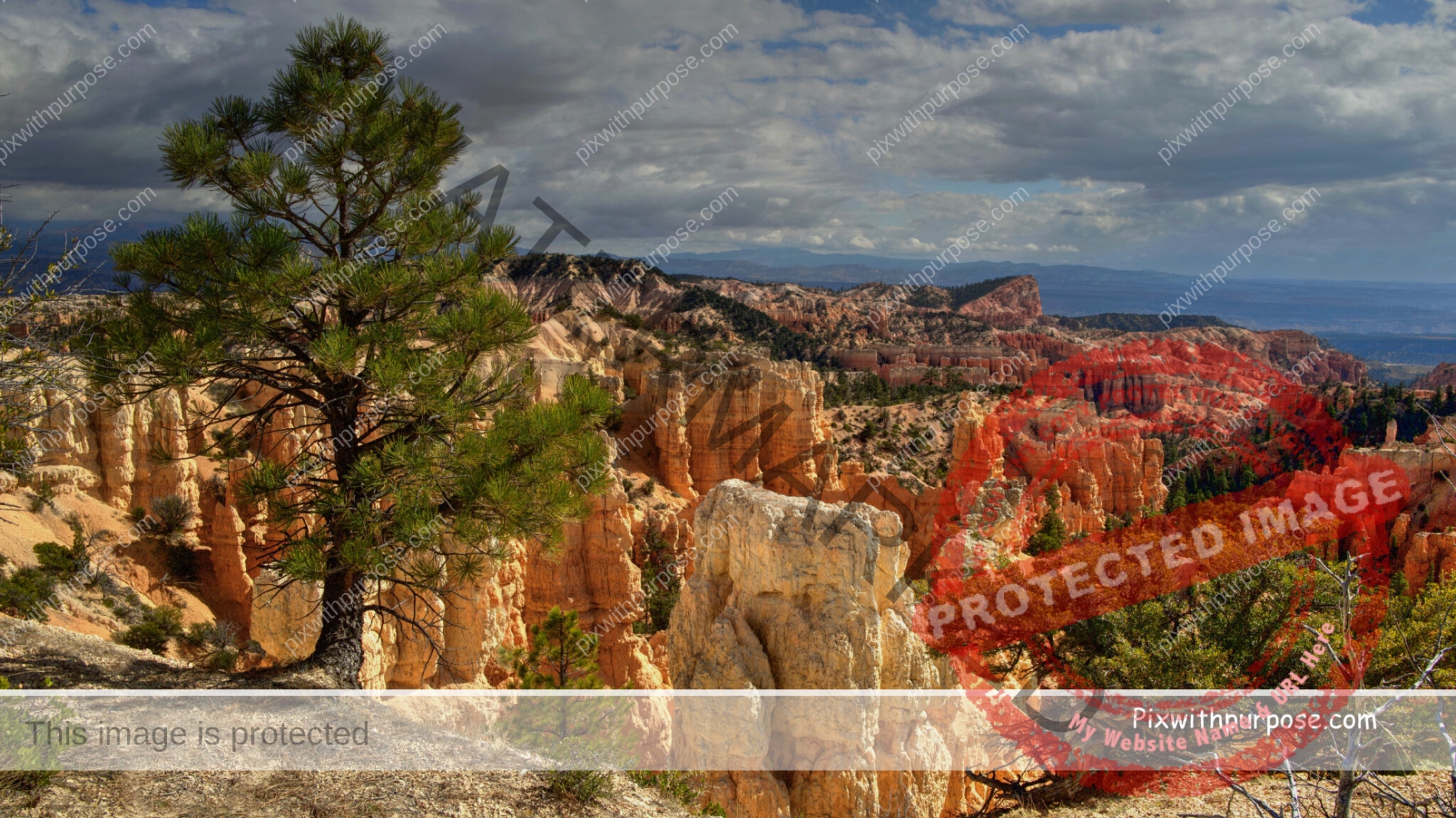
Bryce Canyon Utah
One of the "Big Five" as they are called, National Parks in Utah.
Red & White
Snow covered Navajo Sandstone at 10,700 feet in Cedar Breaks National Monument
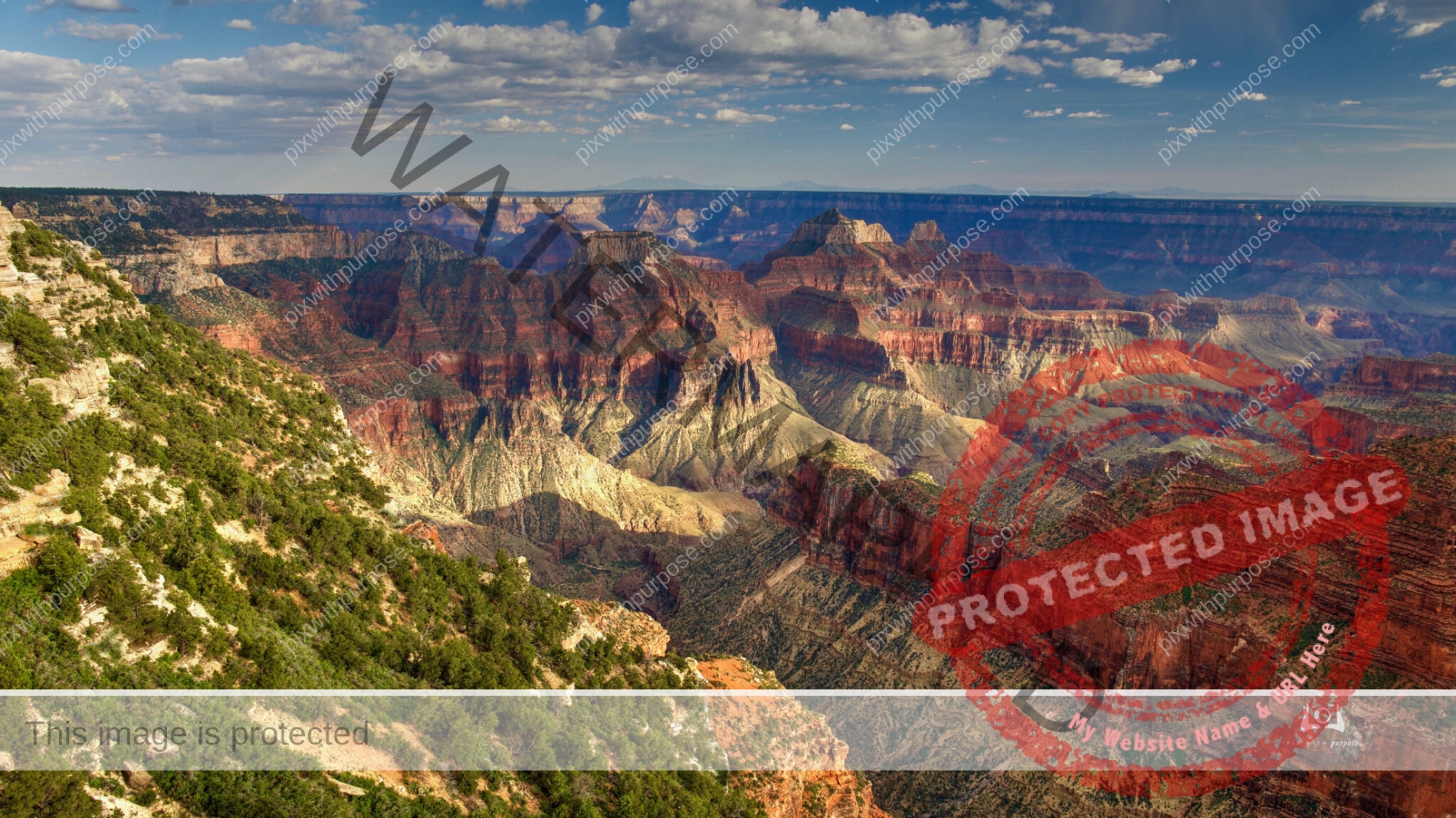
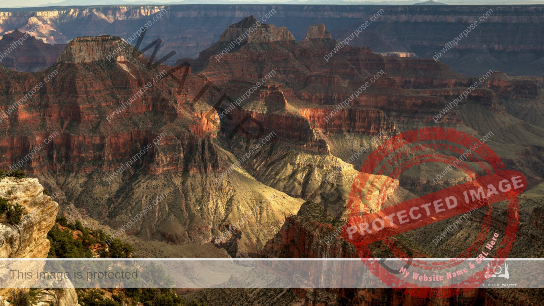
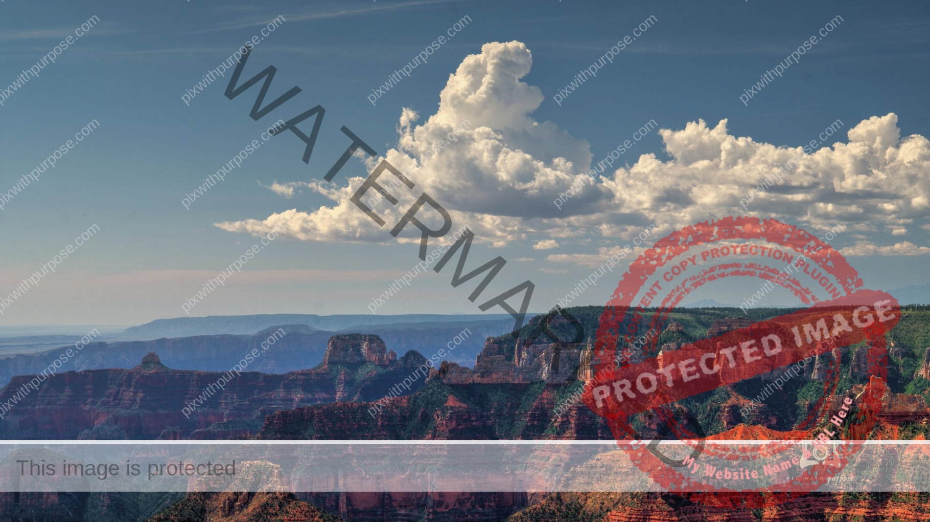
Point Imperial Grand Canyon National Park
Point Imperial Grand Canyon National Park
The highest point on the rim of Grand Canyon at 8,803 feet, Point Imperial is also the most northern boundary of the park.The views of the Painted Desert and the eastern end of Grand Canyon. It is from this area that the canyon transforms from the narrow walls of Marble Canyon, visible only as a winding gash, to a more open and dramatic "grand" canyon. Layers of red and black Precambrian rocks, not visible at Bright Angel Point, add contrast and color.
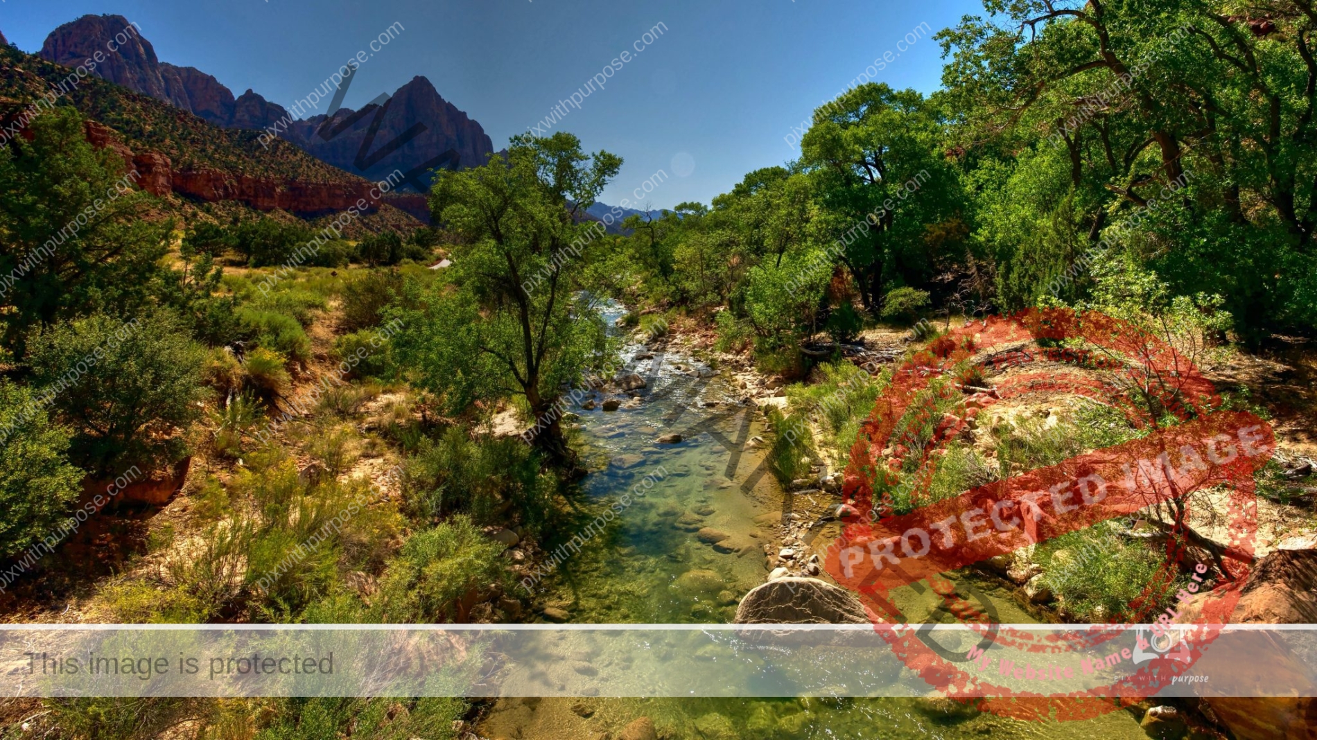
Early Morning Zion
Springtime in Zion National Park looking up the Virgin River canyon. Sun is just high enough to light the floor and one wall.
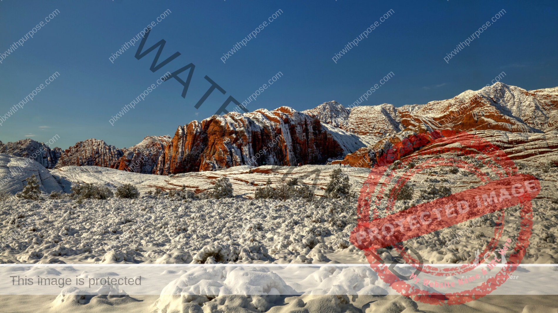
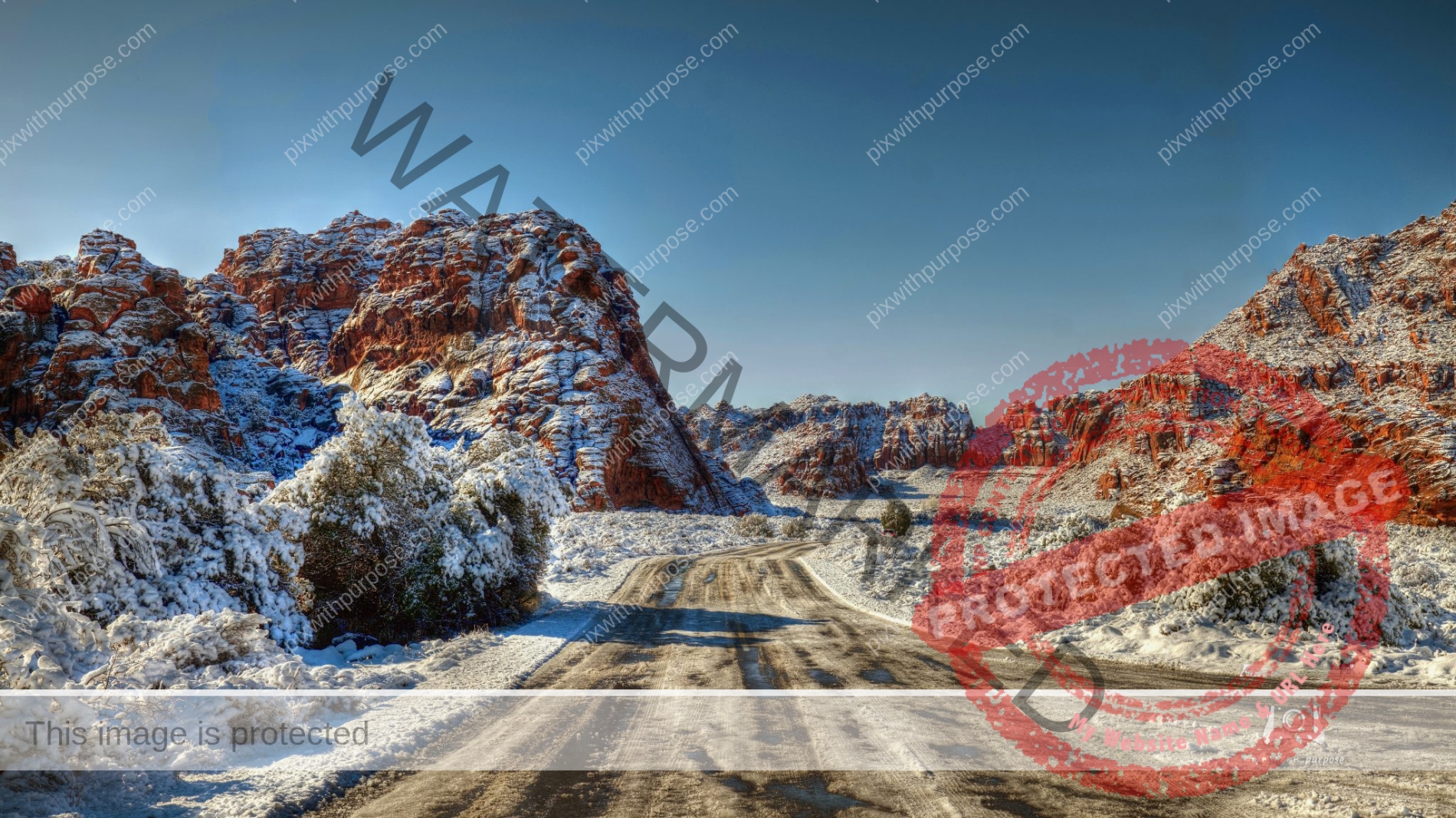
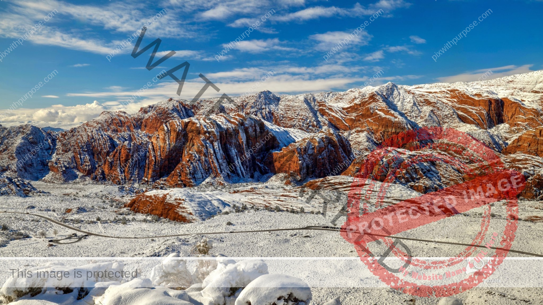
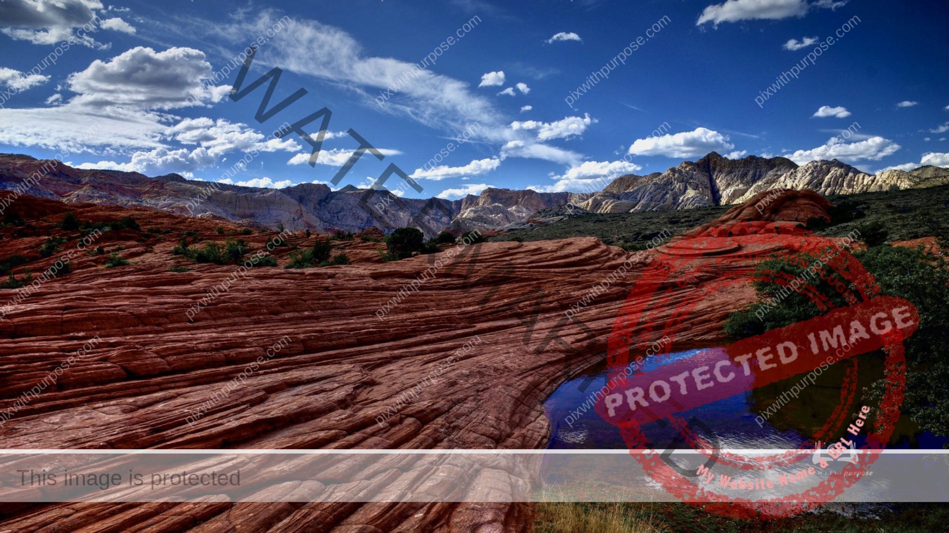
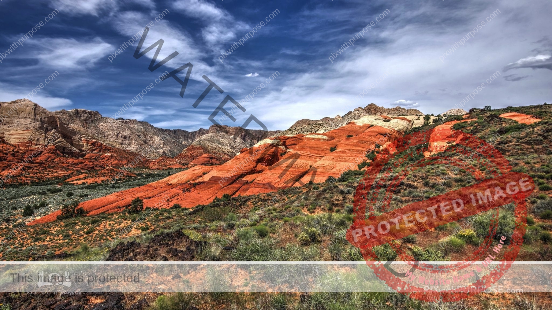
Snow Canyon State Park
Snow Canyon State Park is a state park in Utah, located in the Red Cliffs Desert Reserve. The park features a canyon carved from the red and white Navajo sandstone of the Red Mountains, as well as the extinct Santa Clara Volcano, lava tubes, lava flows, and sand dunes. Snow Canyon is located near the cities of Ivins and St. George in Washington County. Wikipedia
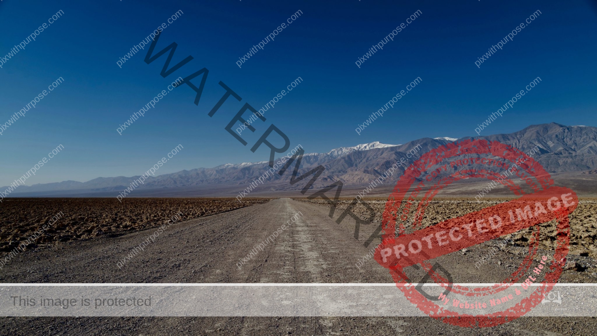
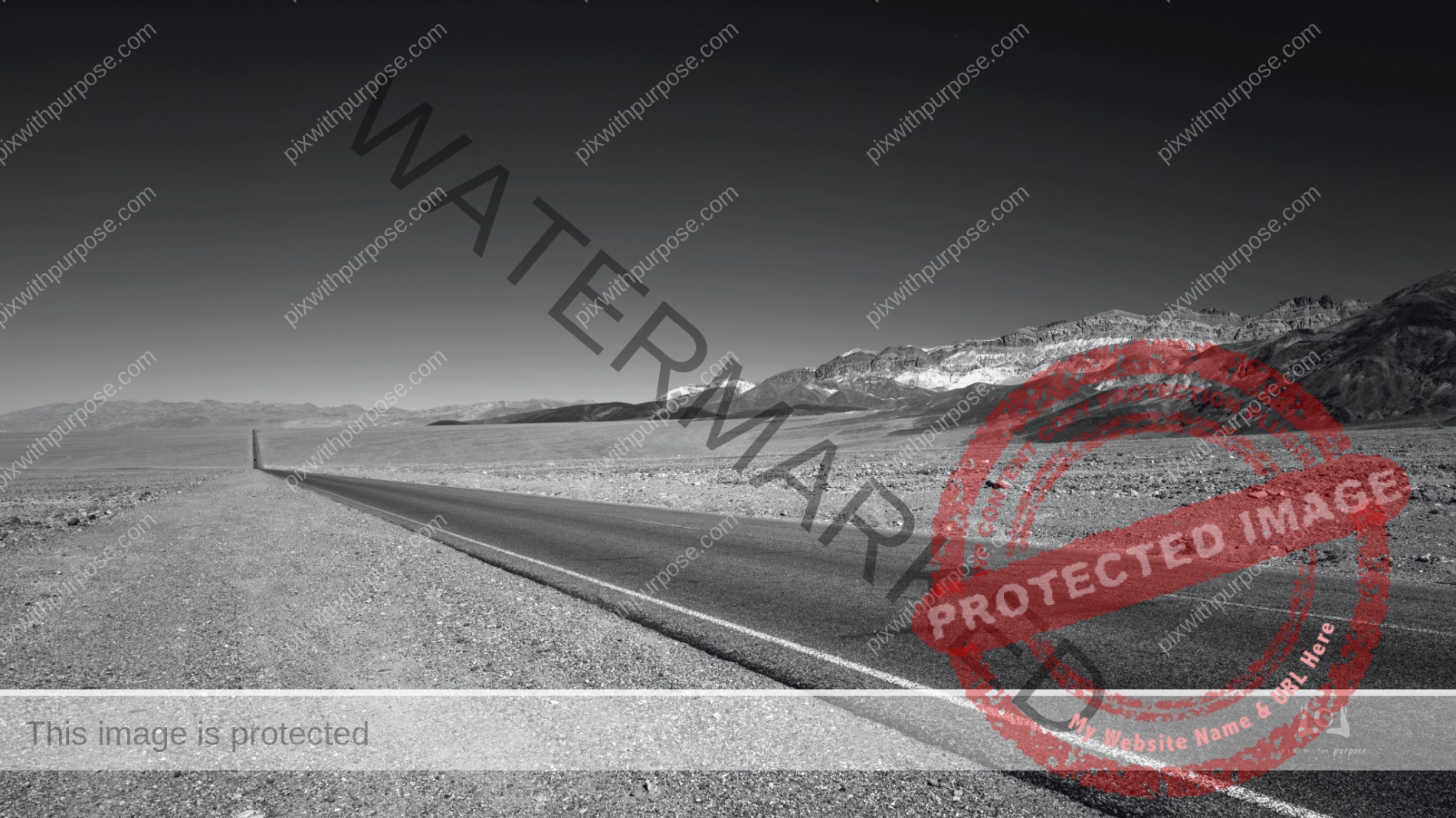
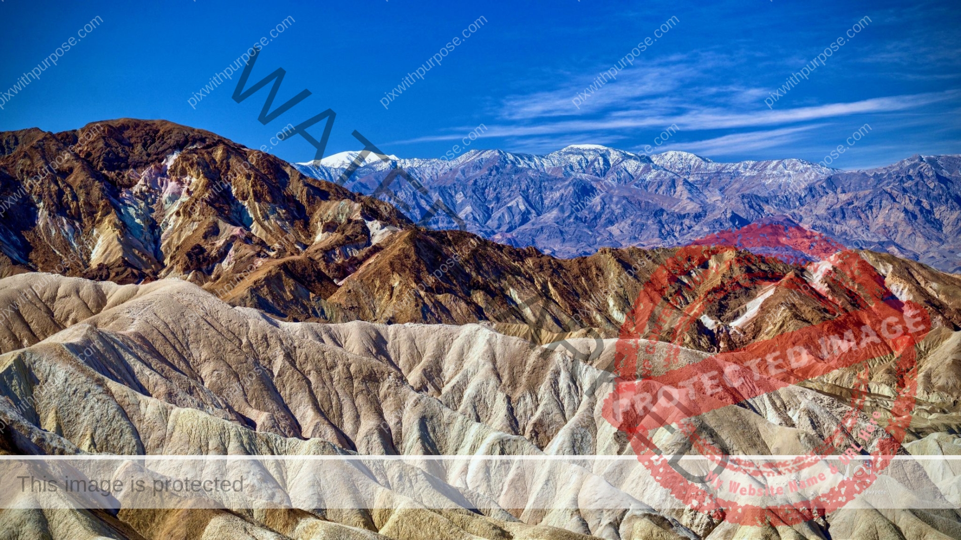
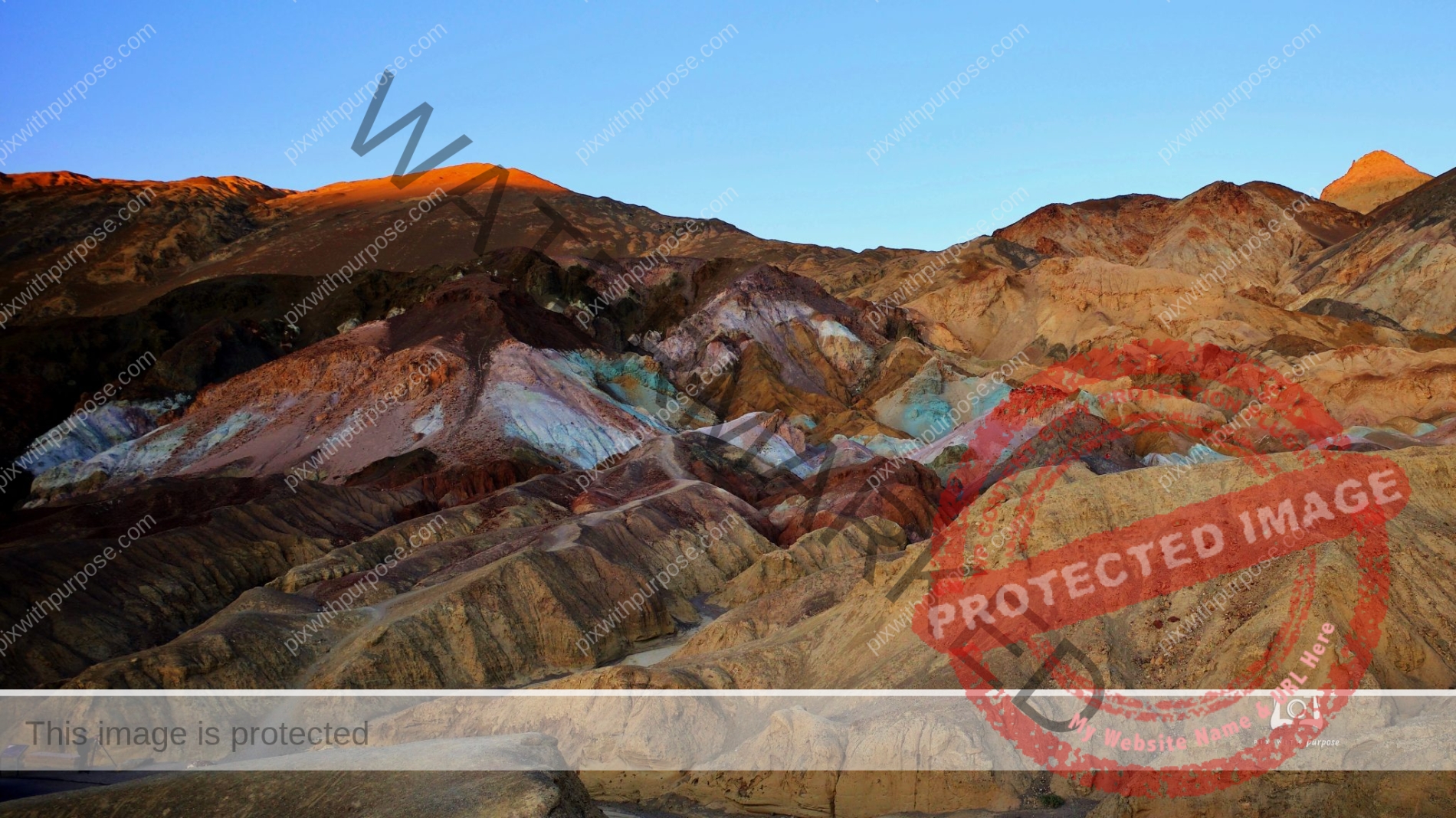
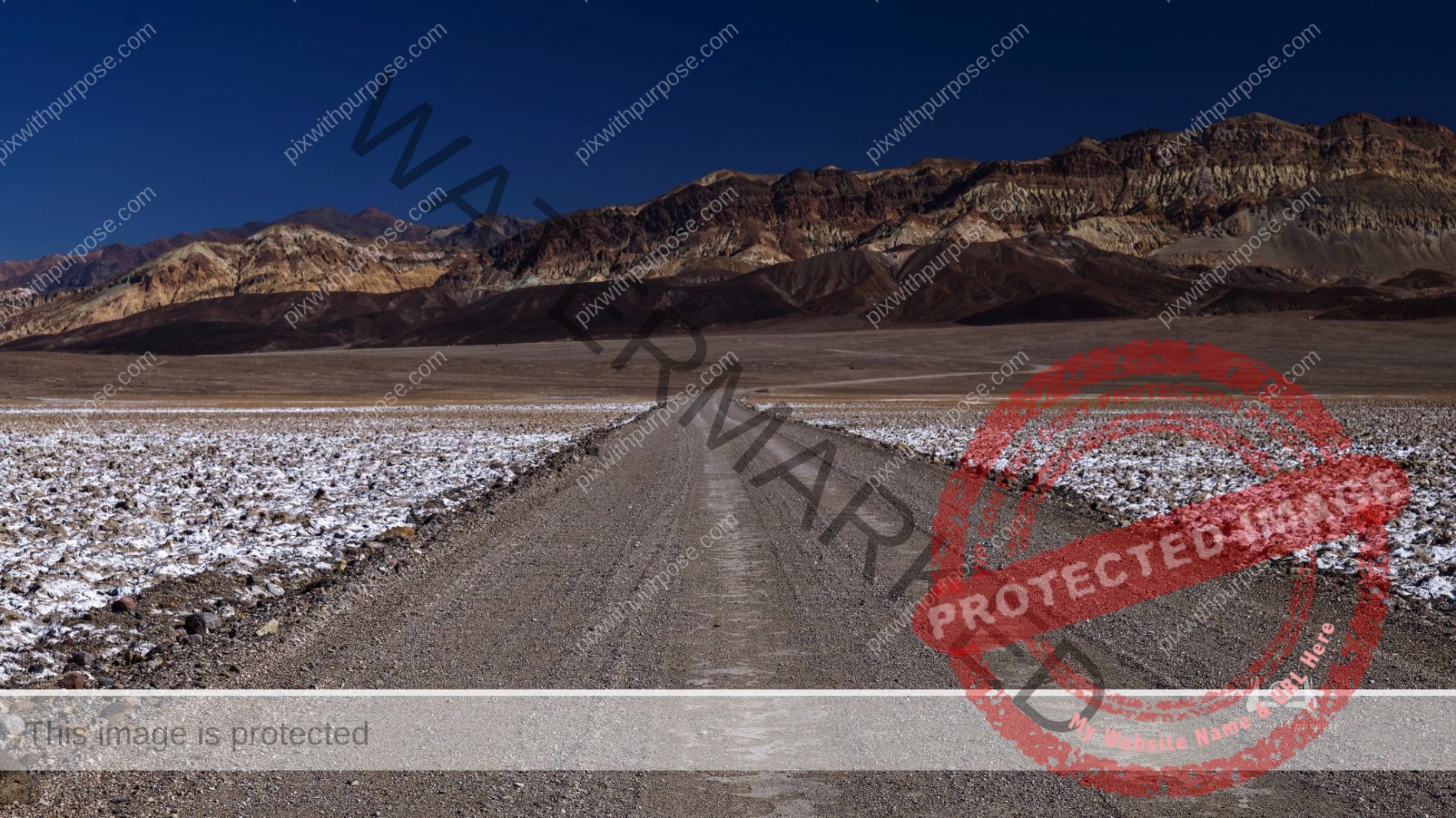
Death Valley NP
Hottest, Driest and Lowest National Park
In this below-sea-level basin, steady drought and record summer heat make Death Valley a land of extremes. Yet, each extreme has a striking contrast. Towering peaks are frosted with winter snow. Rare rainstorms bring vast fields of wildflowers. Lush oases harbor tiny fish and refuge for wildlife and humans. Despite its morbid name, a great diversity of life thrives in Death Valley.NPS
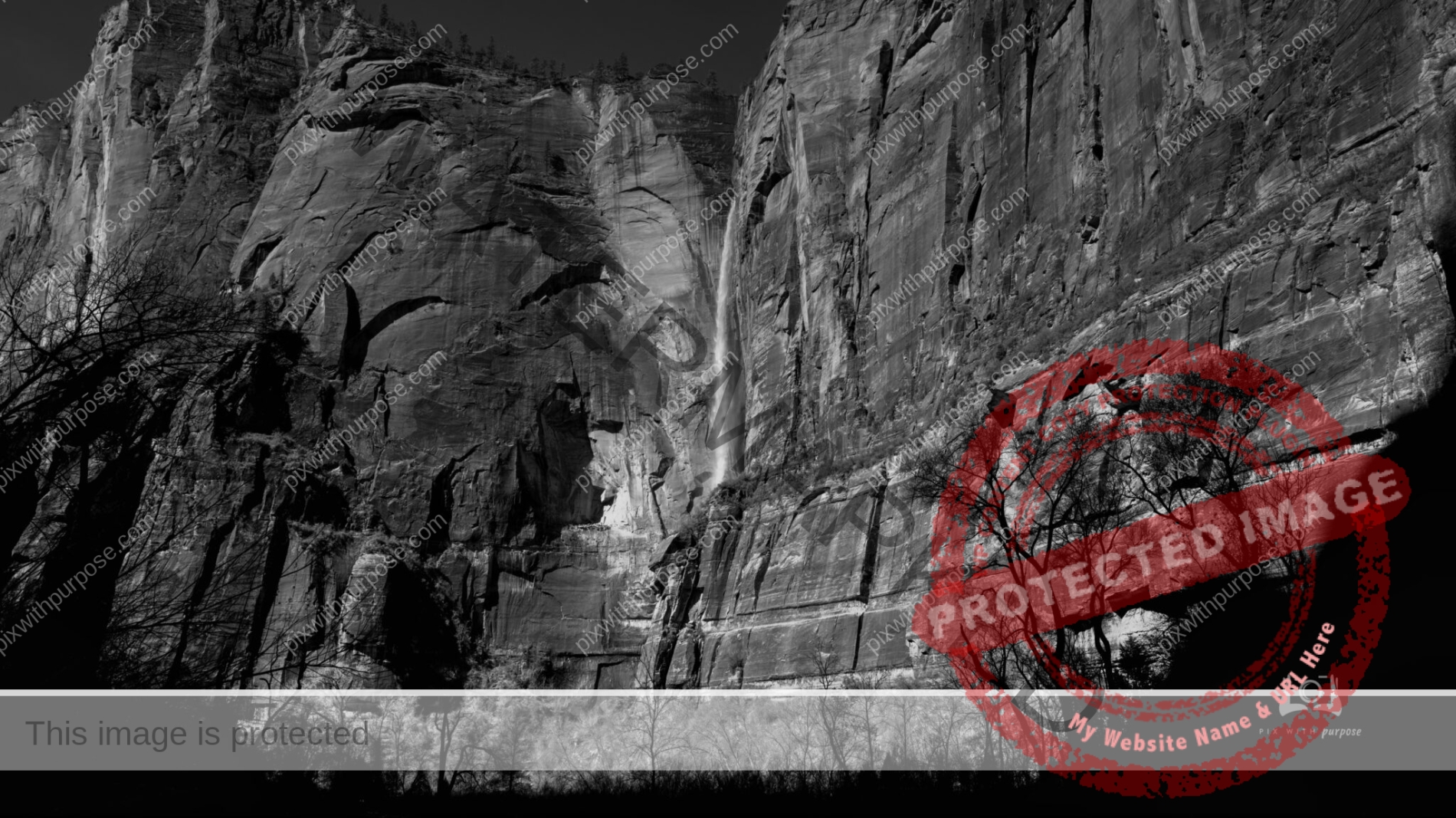
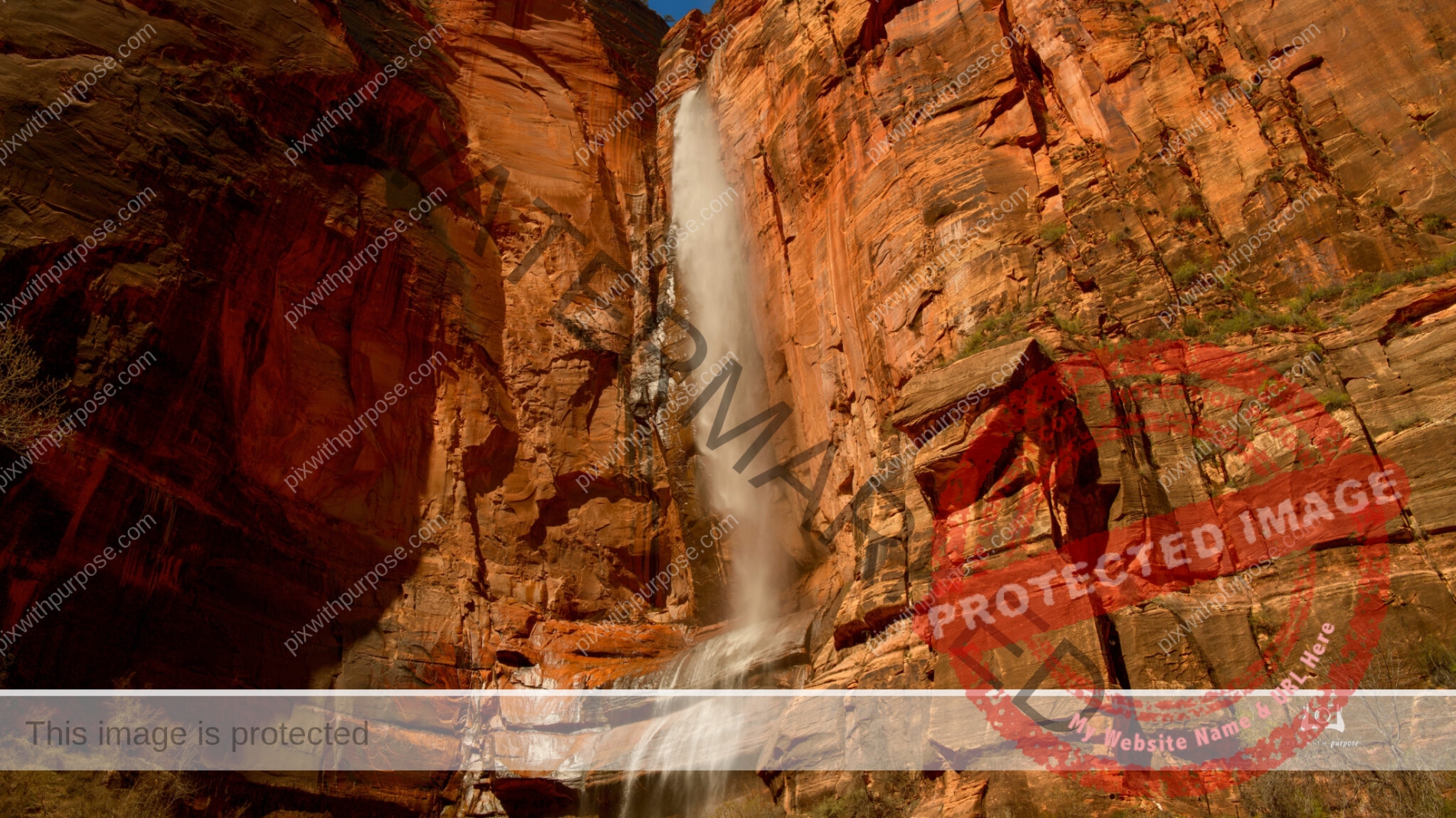
Zion Waterfall
The heavy rain and snow in the Zion National Park area feeds the Virgin River and gives us these rare waterfalls.
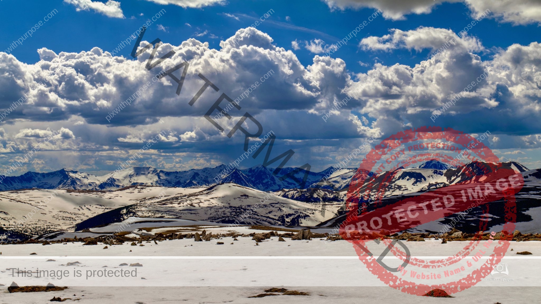
Trail Ridge Road
In Rocky Mountain National Park, the 48 mile Trail RidgeRoad more than lives up to its advanced billing. Eleven miles of this high highway travel above treeline, the elevation near 11,500 feet where the park's evergreen forests come to a halt. It winds across the tundra's vastness to this high point of 12,183 feet elevation.
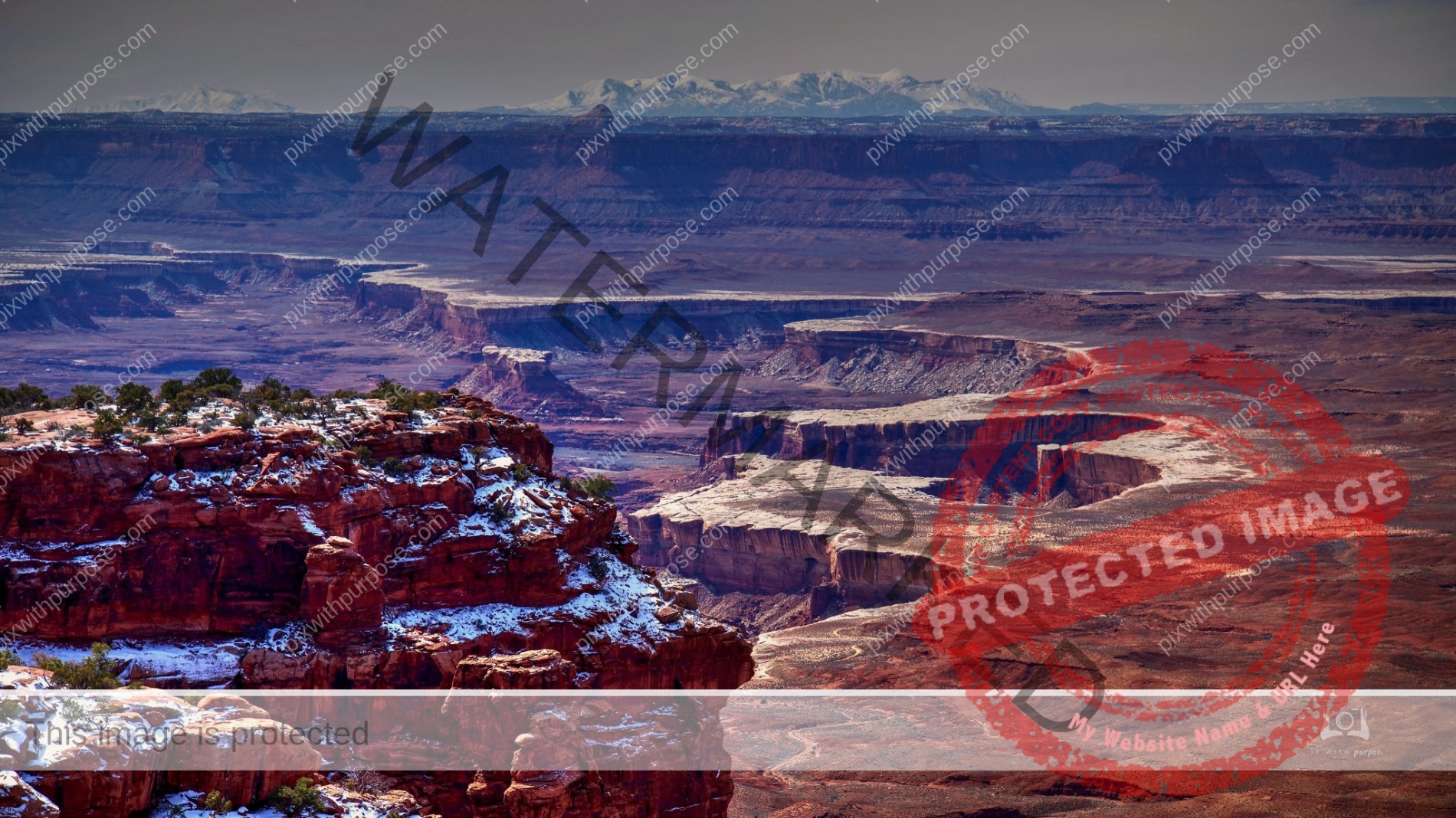
Canyonlands
The 527 square mile National park is divided into four districts: the Island in the Sky, the Needles, the Maze, and the combined rivers—the Green and Colorado—which carved two large canyons into the Colorado Plateau. While these areas share a primitive desert atmosphere, each retains its own character. Author Edward Abbey, a frequent visitor, described the Canyonlands as "the most weird, wonderful, magical place on earth—there is nothing else like it anywhere."
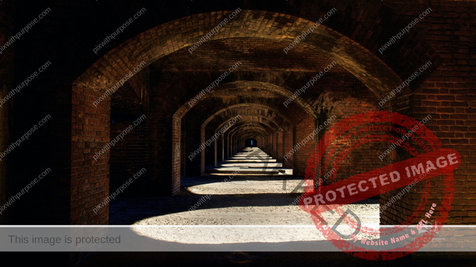
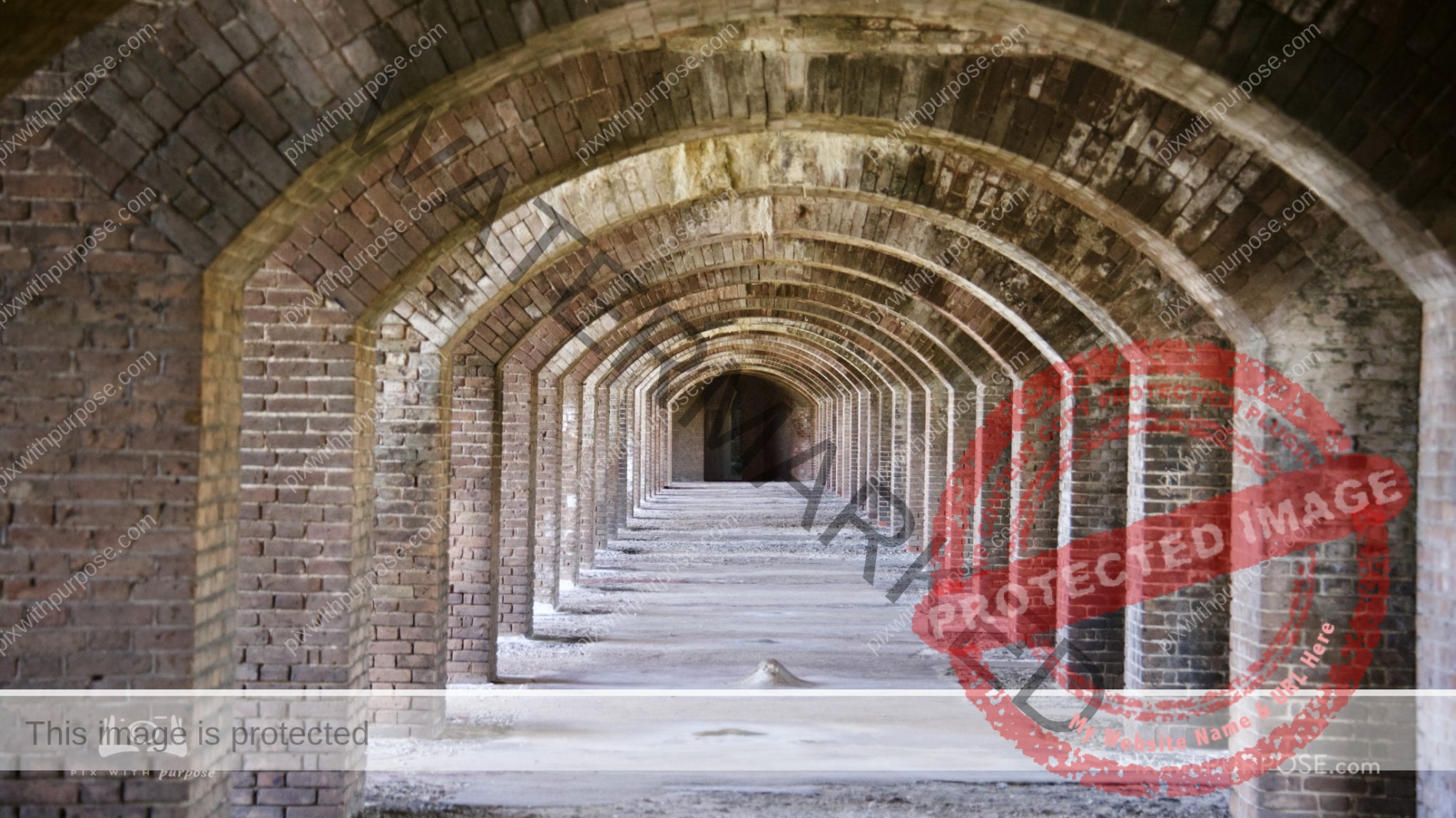
Fort Jefferson
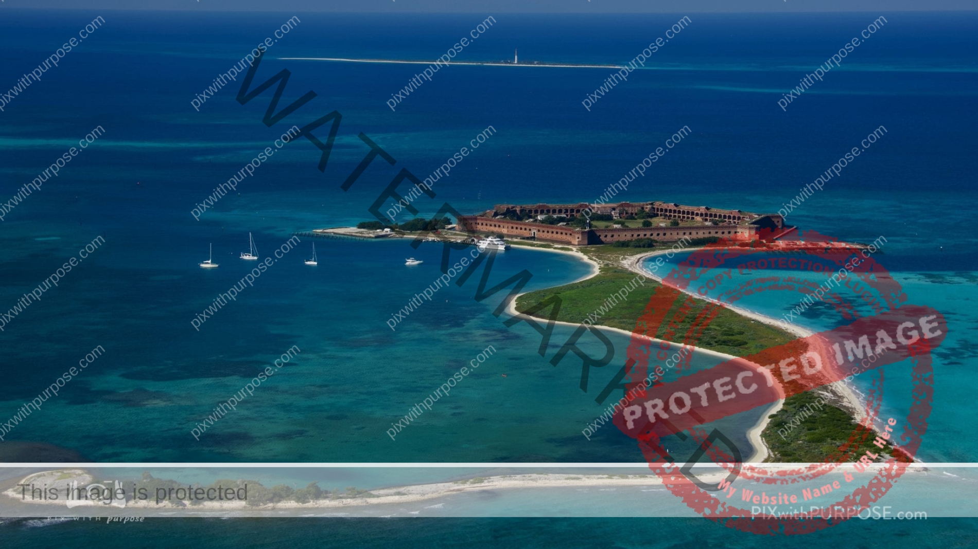
Almost 70 miles west of Key West, Florida, lies a cluster of seven islands, composed of coral reefs and sand, called the Dry Tortugas.
With the surrounding shoals and water, they make up the Dry Tortugas National Park, an area noted for bird and marine life and shipwrecks. Fort Jefferson, its central feature, is one of the nation's largest 1800s masonry forts. Park Service
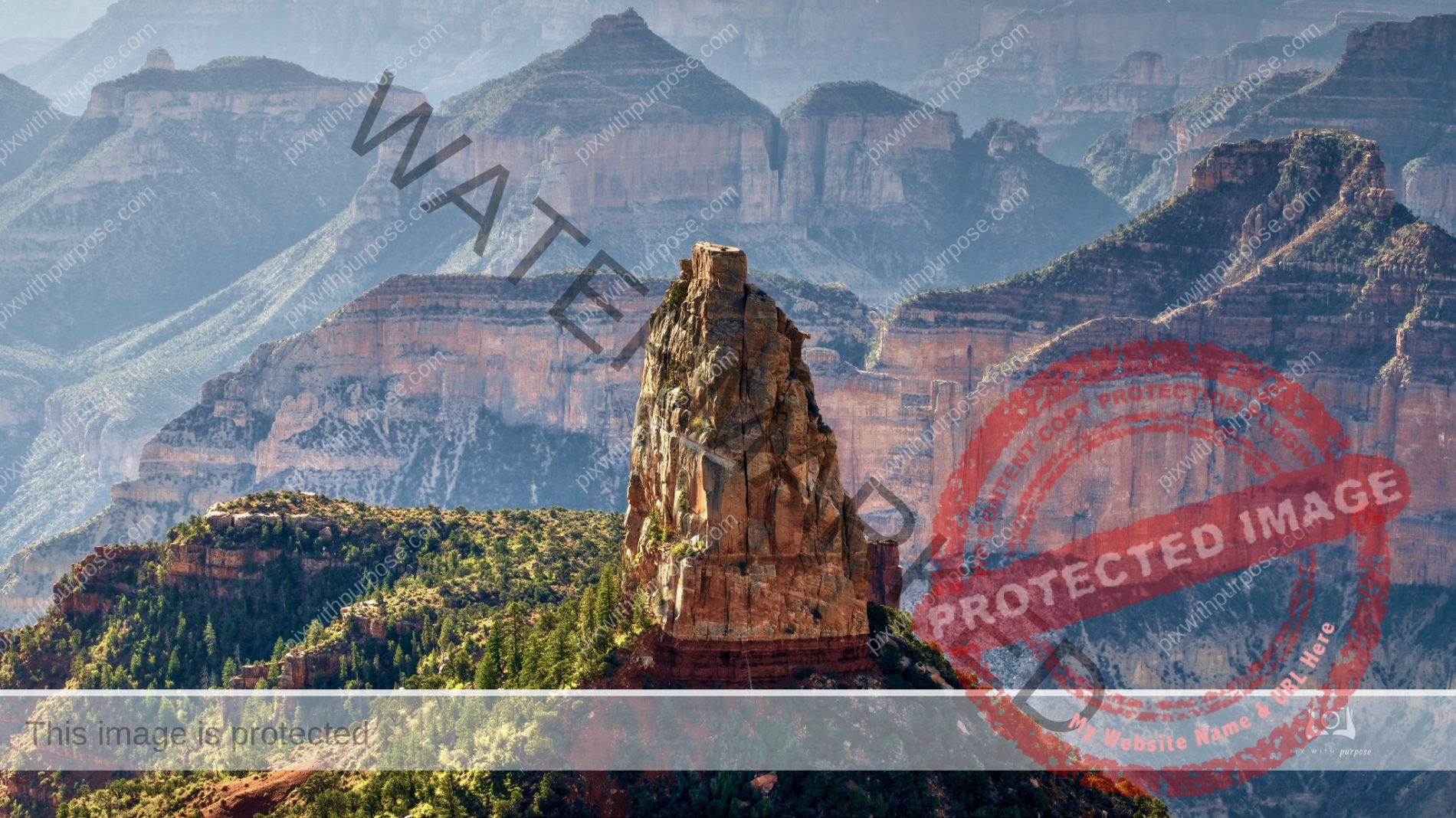
Imperial Point
North Rim of the Grand Canyon
Fort Ord
Fort Ord National Monument, located on the former Fort Ord military base, is currently run by the Bureau of Land Management (BLM). They protect and manage 44 species of rare plants and animals that call the property home. The 14,000 acre parcel has more than 86 miles of trails that can be explored on foot, bike or on horseback.
Full Gas Tank?
Death Valley is the largest U.S. National Park outside Alaska at 3,422,024 acres. Nearly 1,000 miles of paved and dirt roads provide access to locations both popular and remote. Even so, 93% of the park is protected as officially designated Wilderness. That wild country includes low valley floors crusted with barren salt flats, rugged mountains rising as much as 11,000 feet, deep and winding canyons, rolling sand dunes, and spring-fed oases.
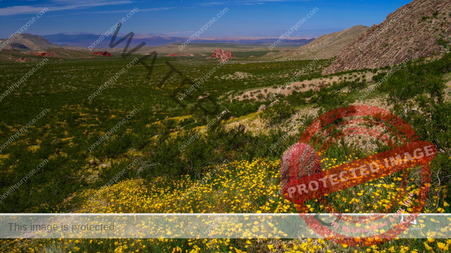
Poppy superbloom
Gold Butte National Monument in Nevada had square miles of blooming yellow poppies this past spring.
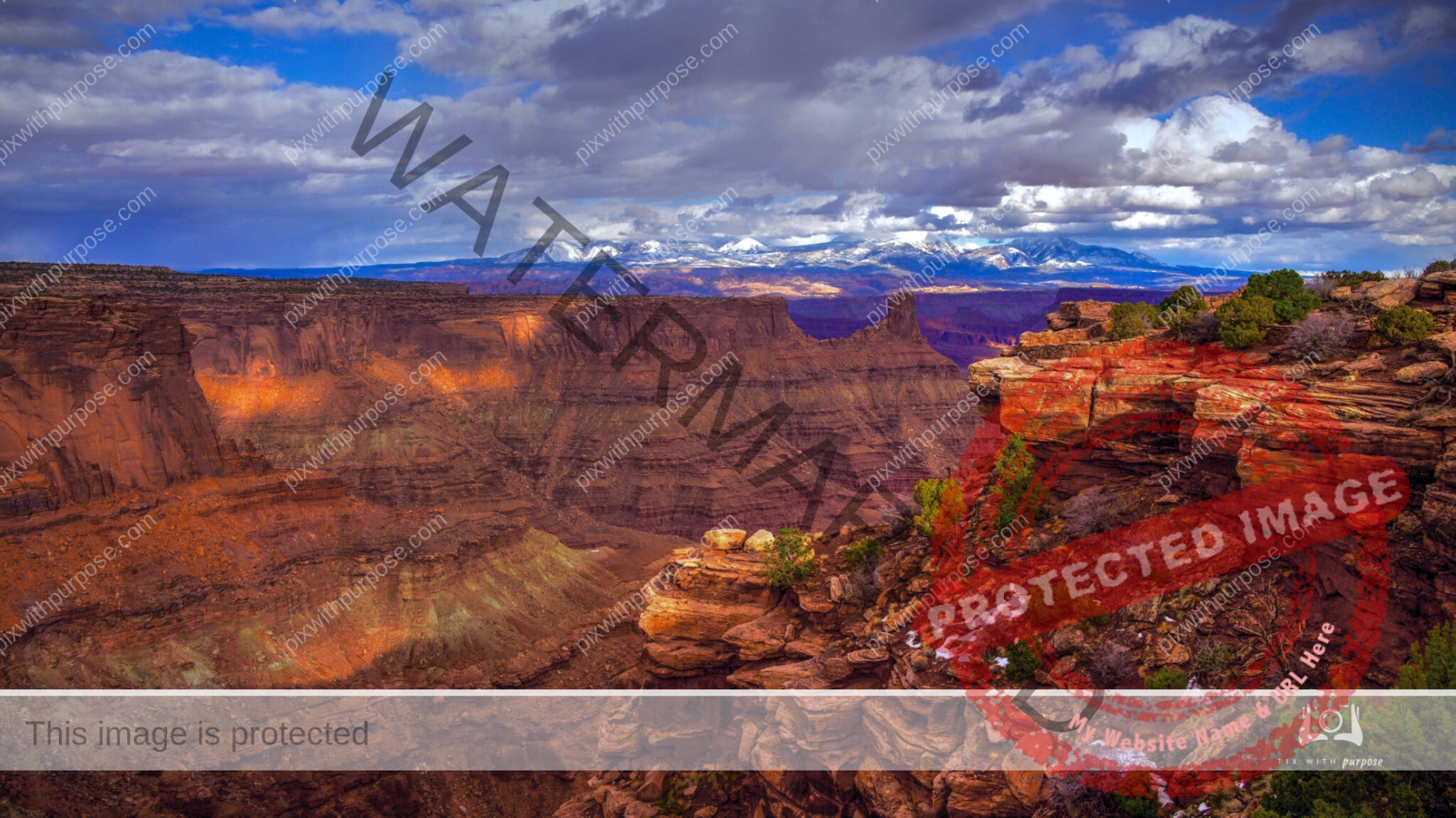
Canyonlands National Park
Endless deep canyons, towering mesas, pinnacles, cliffs, and spires stretching across 527 square miles. This is Canyonlands National Park, formed by the currents and tributaries of Utah's Green and Colorado rivers. It is the largest park in Utah located near the town of Moab. Wikipedia
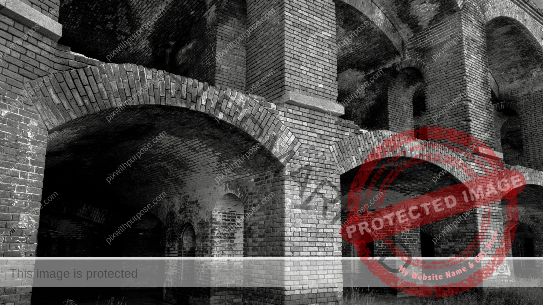
Fort Jefferson
Fort Jefferson was built to protect one of the most strategic deepwater anchorages in North America. By fortifying this spacious harbor, the United States maintained an important “advance post” for ships patrolling the Gulf of Mexico and the Straits of Florida. Nestled within the islands and shoals that make up the Dry Tortugas, the harbor offered ships the chance to resupply, refit, or seek refuge from storms. The location of the Tortugas along one the world’s busiest shipping lanes was its greatest military asset. Though passing ships could easily avoid the largest of Fort Jefferson’s guns, they could not avoid the warships that used its harbor.
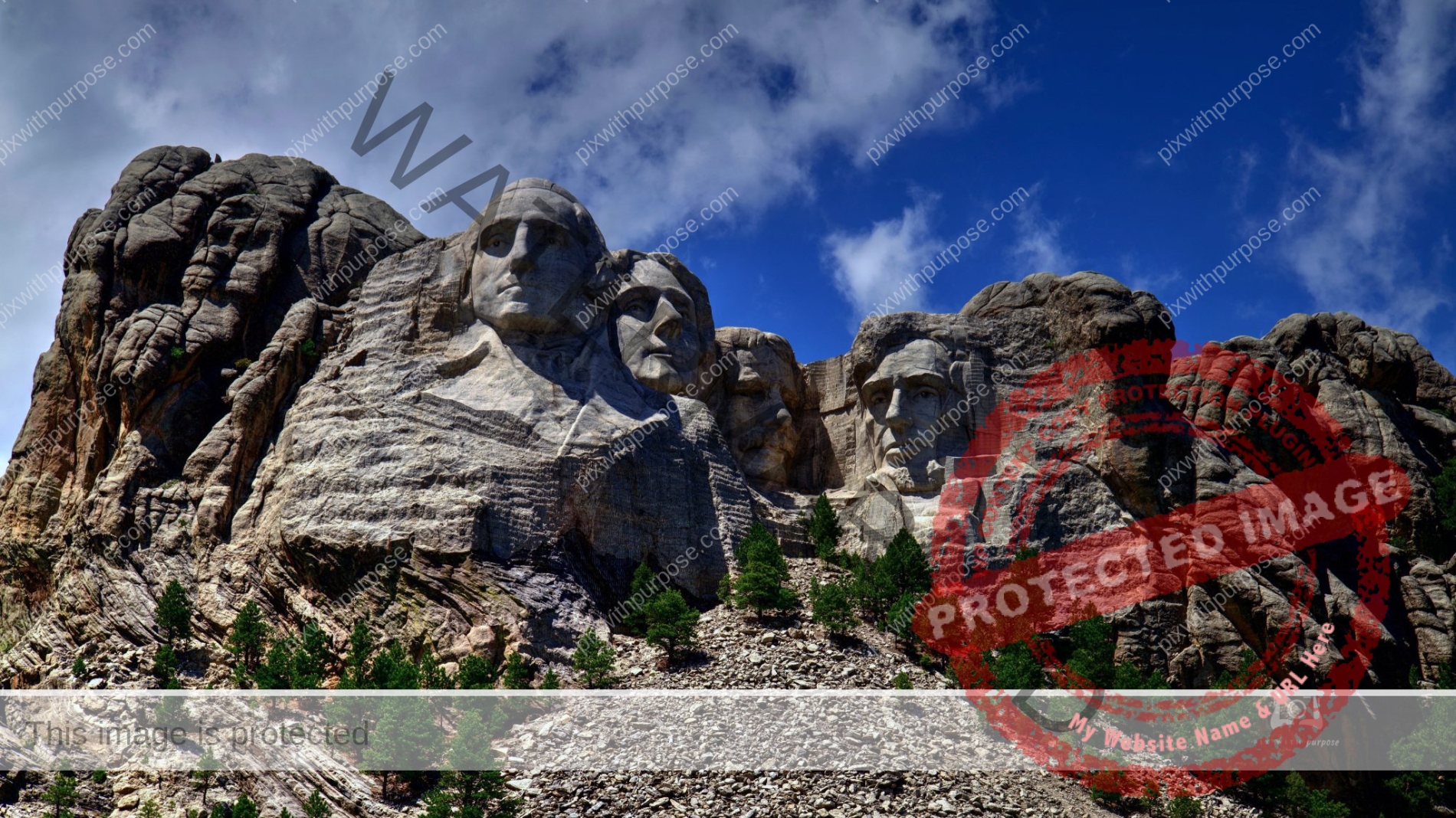
Mount Rushmore
Mount Rushmore National Memorial is a massive sculpture carved into Mount Rushmore in the Black Hills region of South Dakota. Completed in 1941 under the direction of Gutzon Borglum and his son Lincoln, the sculpture's roughly 60-ft.-high granite faces depict U.S. presidents George Washington, Thomas Jefferson, Theodore Roosevelt and Abraham Lincoln.
Zion National Park
If you look close you can see the road through the park at the very bottom.
Bryce Canyon
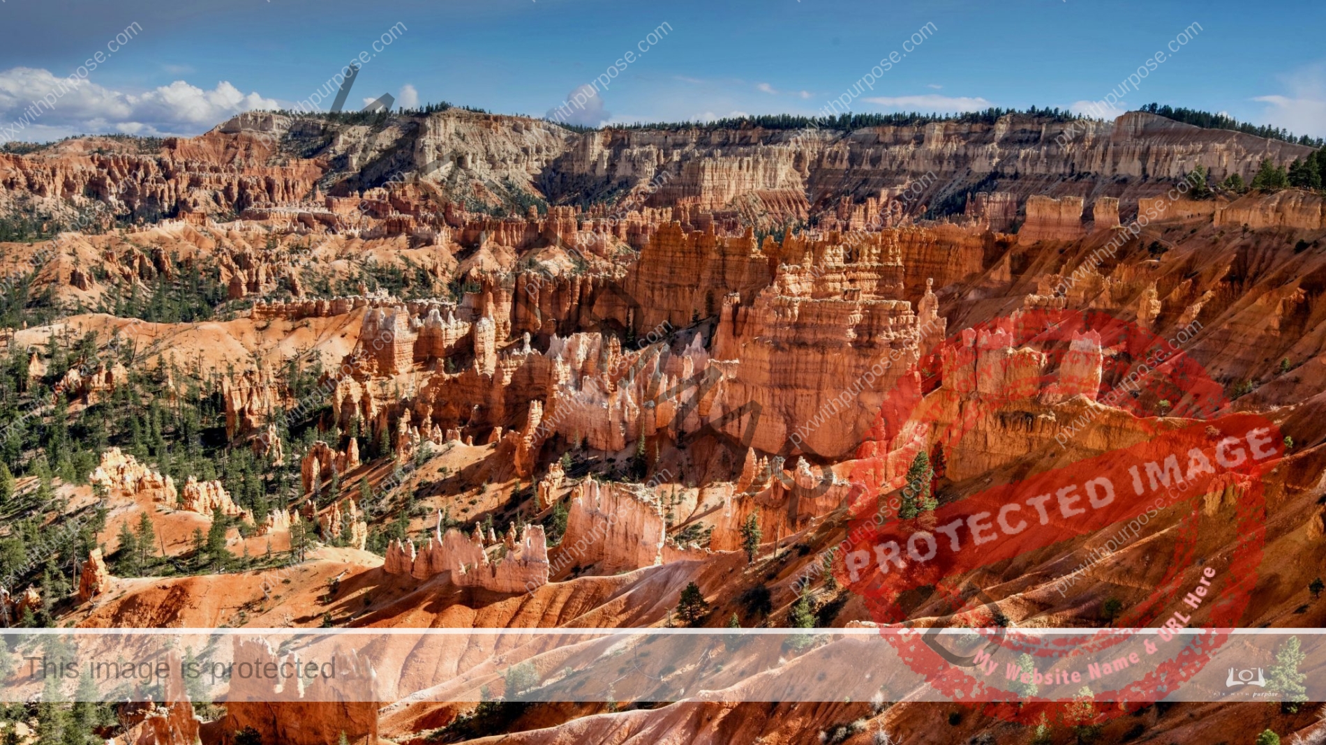
Bryce Canyon National Park is a national park located in southwestern Utah. The major feature of the park is Bryce Canyon, which despite its name, is not a canyon, but a collection of giant natural amphitheaters along the eastern side of the Paunsaugunt Plateau. Bryce is distinctive due to geological structures called hoodoos, formed by frost weathering and stream erosion of the river and lake bed sedimentary rocks. The red, orange, and white colors of the rocks provide spectacular views for park visitors. Bryce Canyon National Park is much smaller than nearby Zion National Park. The rim at Bryce varies from 8,000 to 9,000 feet. Wikipedia
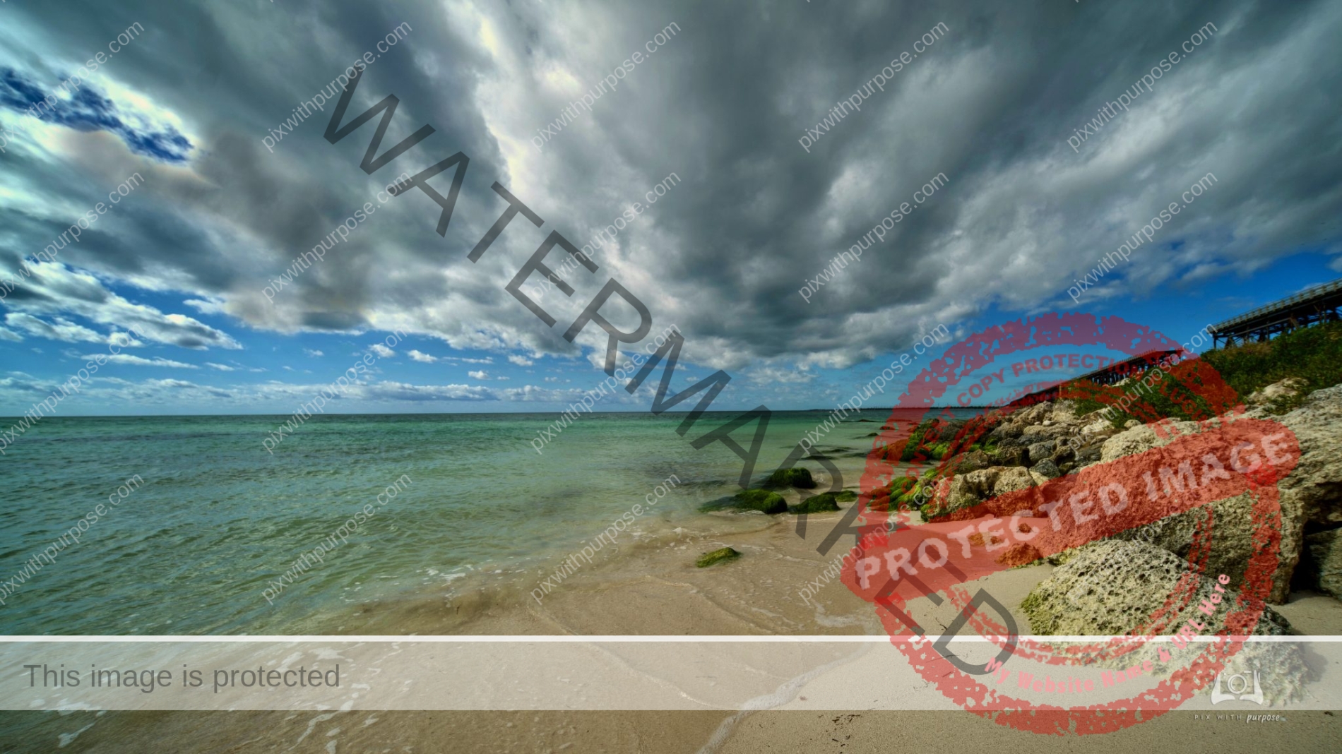
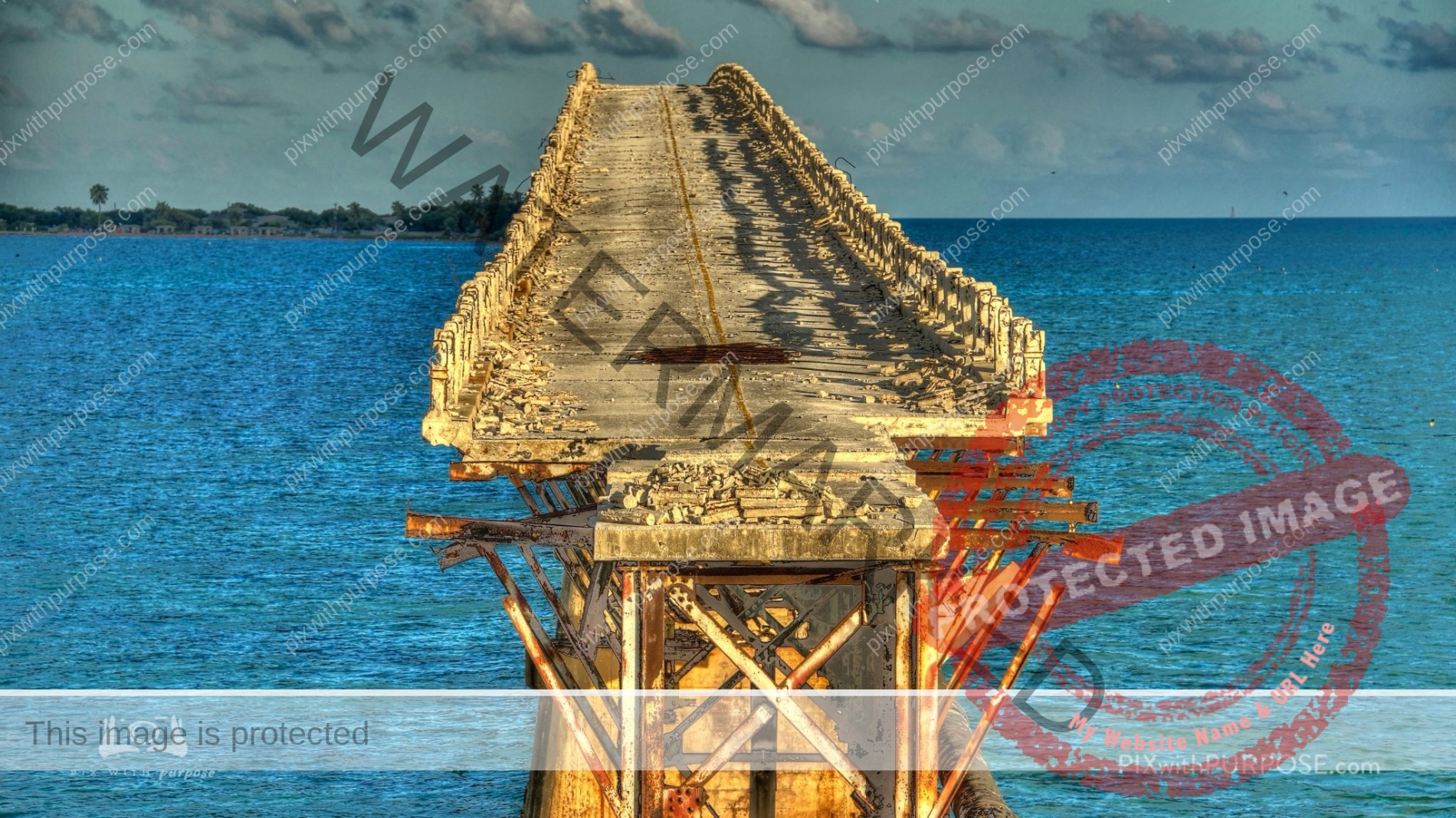
Bahia Honda State Park
Located about 40 miles North of Key West it's geography was changed during Hurricane Irma. Prior to that it always made the top 10 list for the best beach in the USA. When I visited in December 2021 the access road to the beach was still closed because of the hurricane. The South end of the Key has been restored and is actually better because many buildings and shorelines had to be replaced.
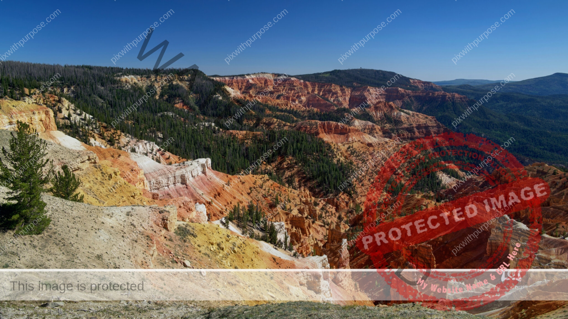
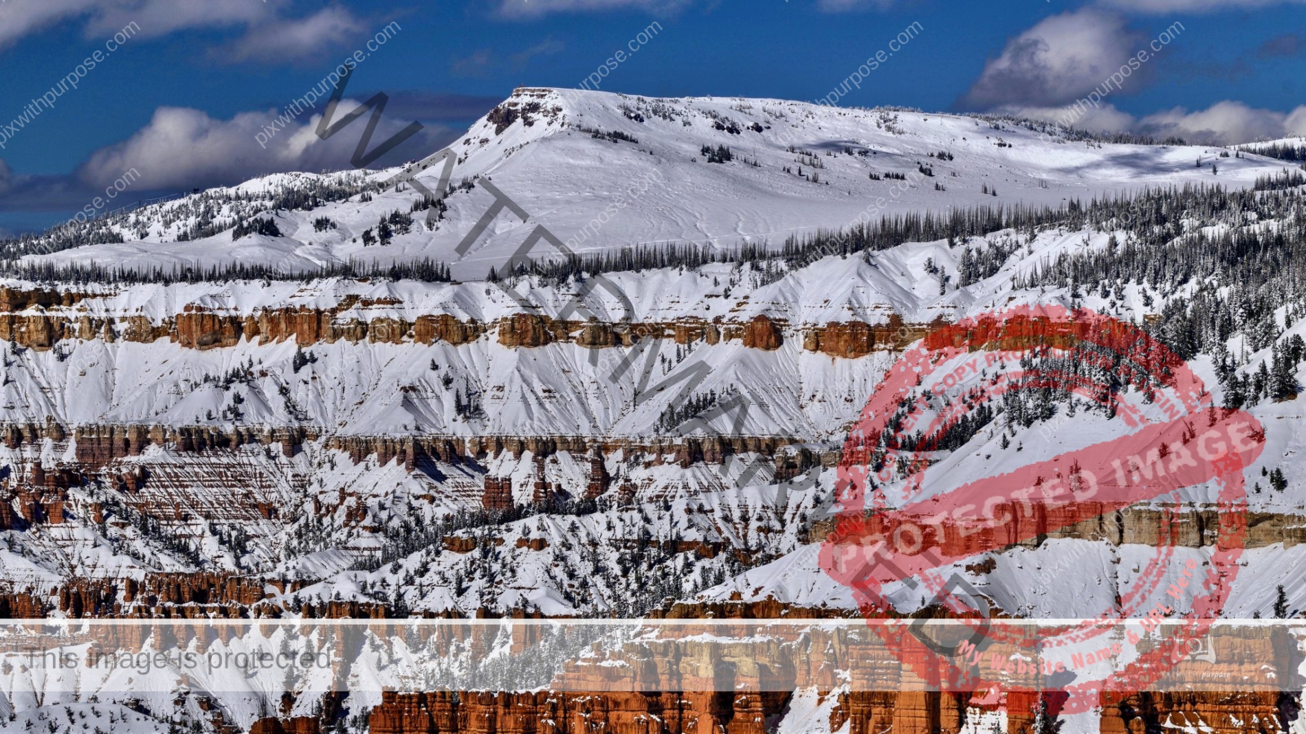
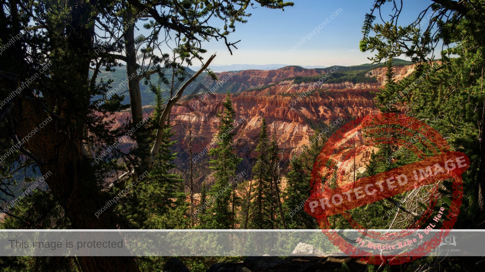
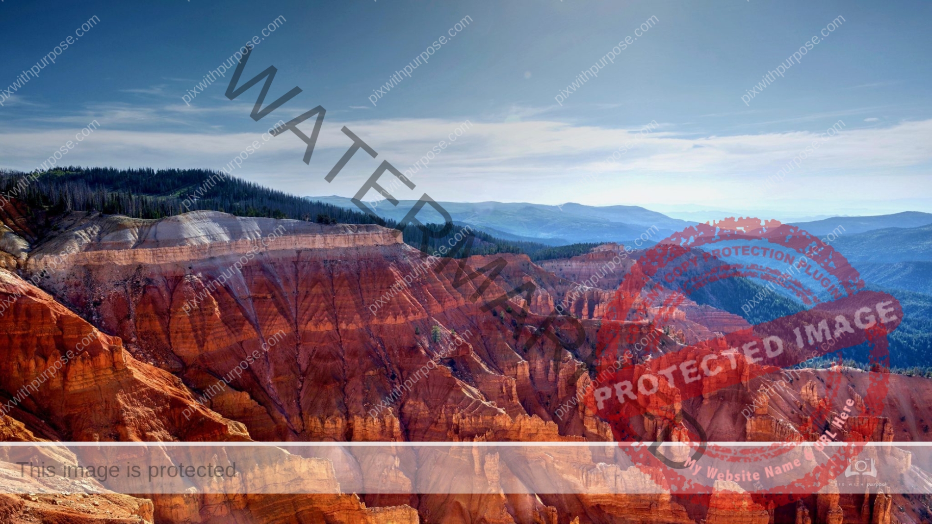
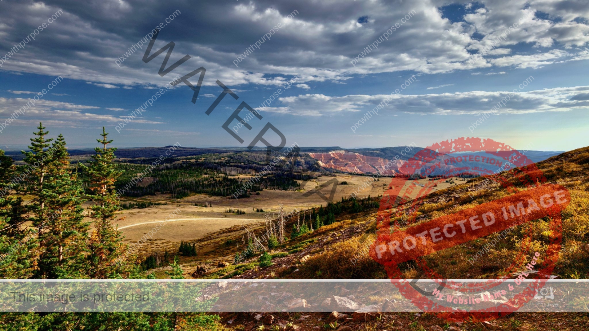
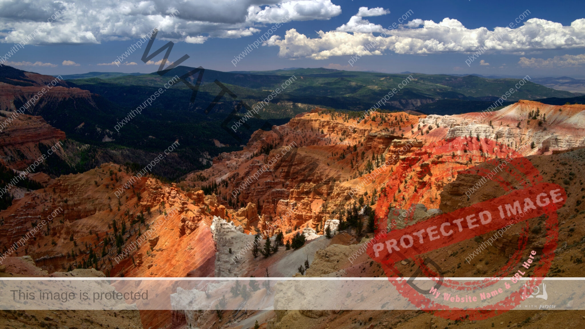
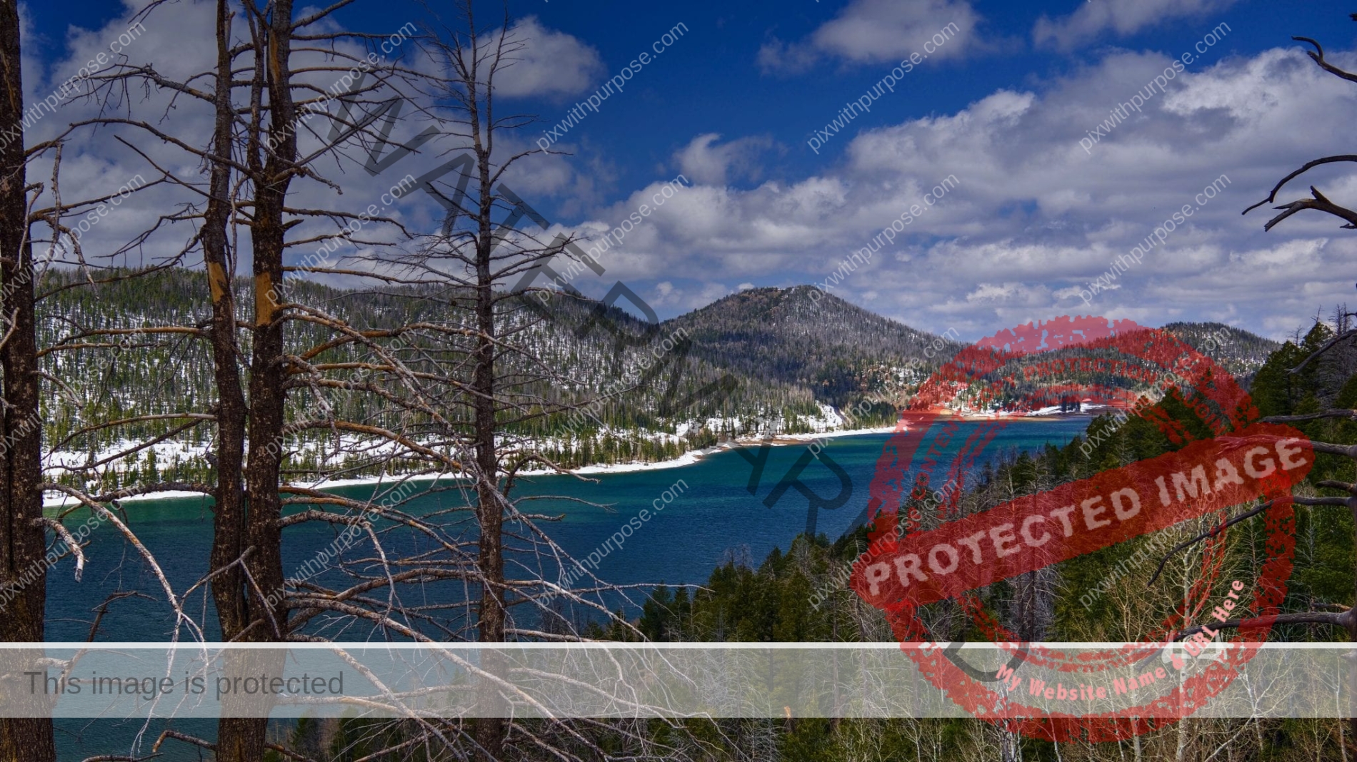
Cedar Breaks National Monument
Cedar Breaks National Monument is in the U.S. state of Utah near Cedar City. Cedar Breaks is a natural amphitheater, stretching across 3 miles, with a depth of over 2,000 feet. The elevation of the rim of the amphitheater is over 10,000 feet above sea level. Rising above the rim is the prominent Brian Head, the peak of which lies a short distance outside of the National Monument boundary. Wikipedia
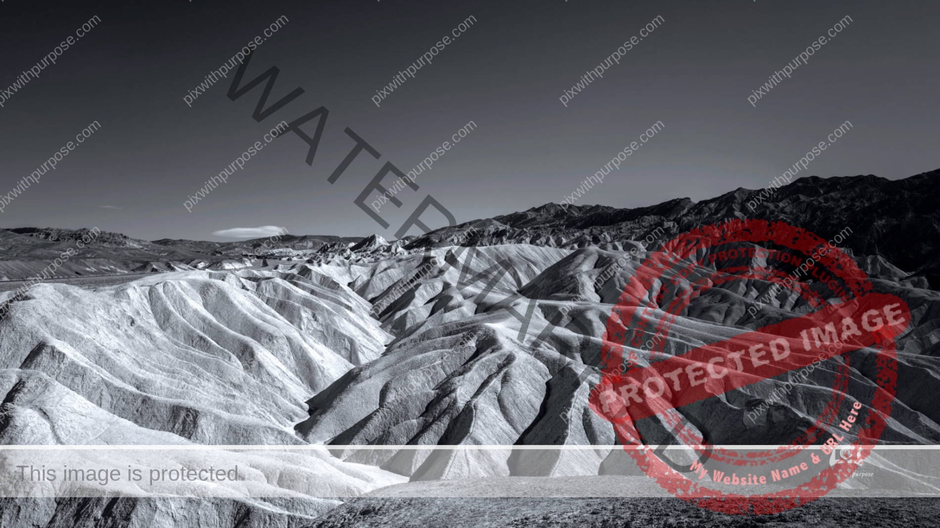
Death Valley National Park
Perfect place to play with black & white photography.
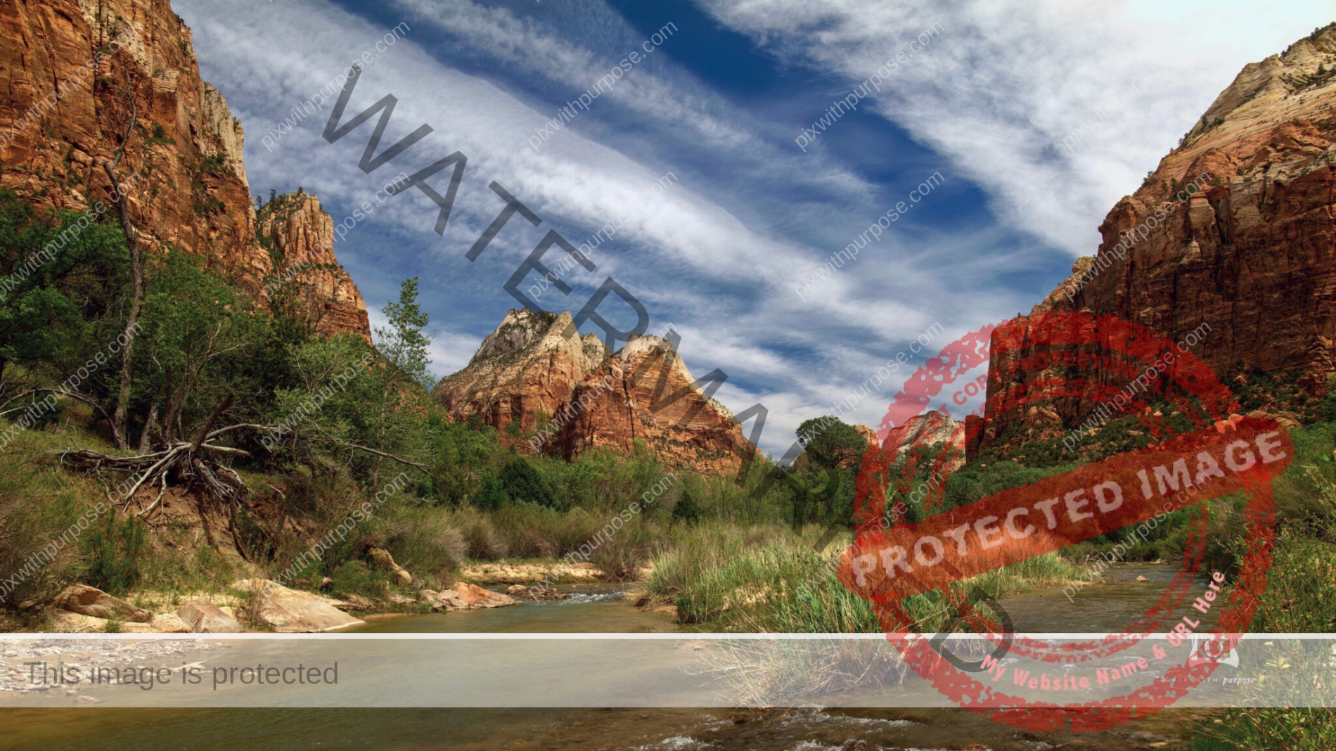
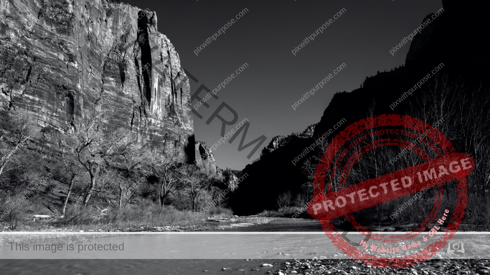
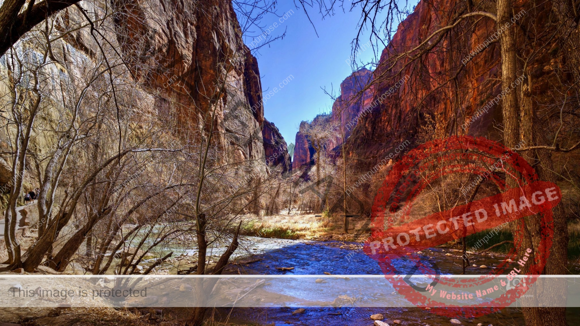
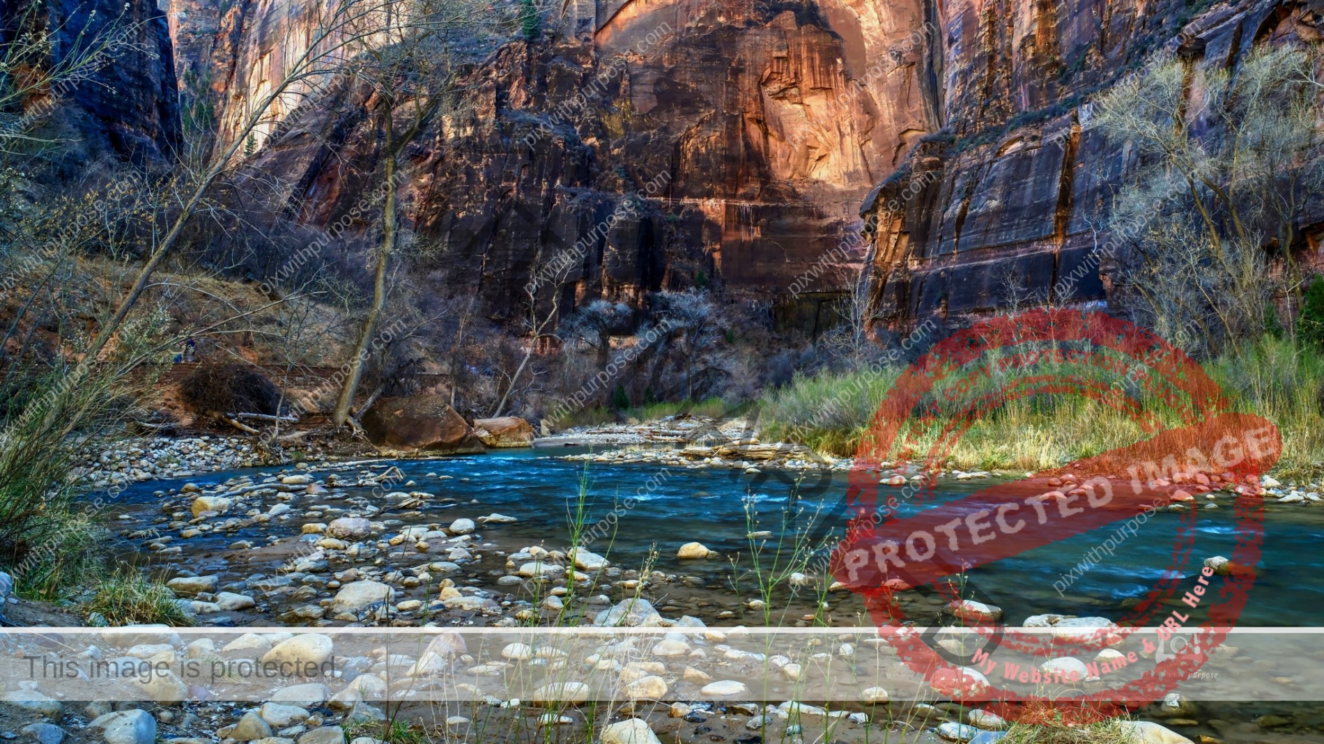
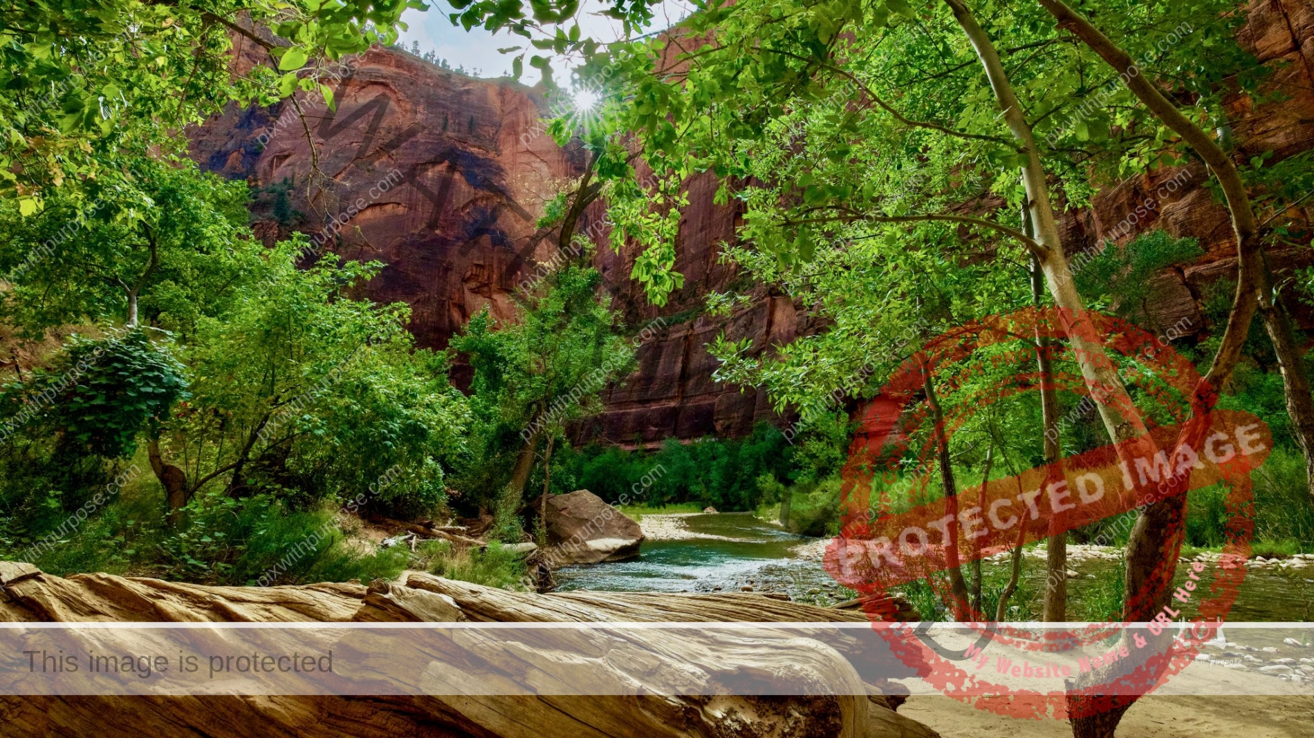
Zion National Park Virgin River
The Virgin River has carved a spectacular gorge in the upper reaches of Zion Canyon: 16 miles long, up to 1,000 feet deep, and at times only 30 feet wide. Walking in the shadow of soaring walls, sandstone grottos, natural springs, and hanging gardens can be an unforgettable wilderness experience. It is not, however, a trip to be underestimated. When hiking through the Virgin River Narrows, at least 80% of the route is spent wading, walking, and swimming sections of the river. There is no maintained trail; the river is the route. The river current is swift, the water is cold, and the rocks underfoot are slippery. Flash flooding and hypothermia are constant dangers. Per NPS
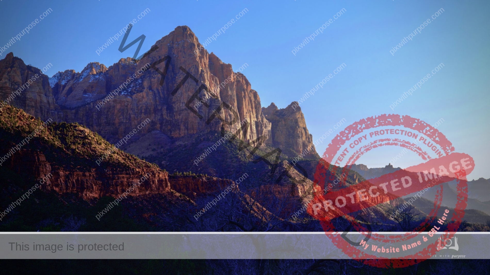
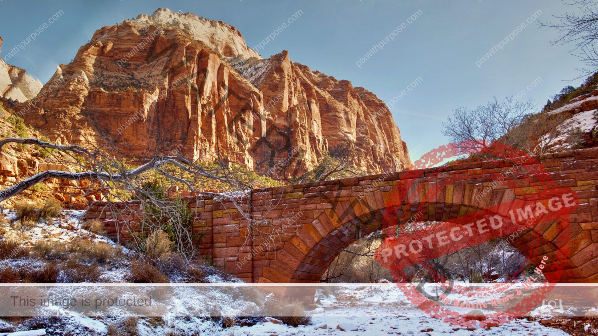
Zion at Dusk
We were leaving Zion National Park one winter evening while the sun was setting behind the mountains to the right. It was getting dark fast but we stopped on a bridge to shoot a couple more photos lit faintly by the fading light.
Cedar Breaks National Monument
Located in Southwest Utah at over 10,000' the monument is a multi-colored sandstone amphitheater. Due to snow it is inaccessible for most of the year. We were lucky to be there after the roads were plowed and before all the snow had melted.

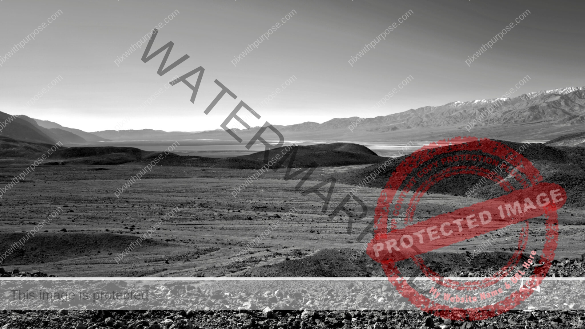
Death Valley
Death Valley National Park is one of my favorite places to use the black & white camera.
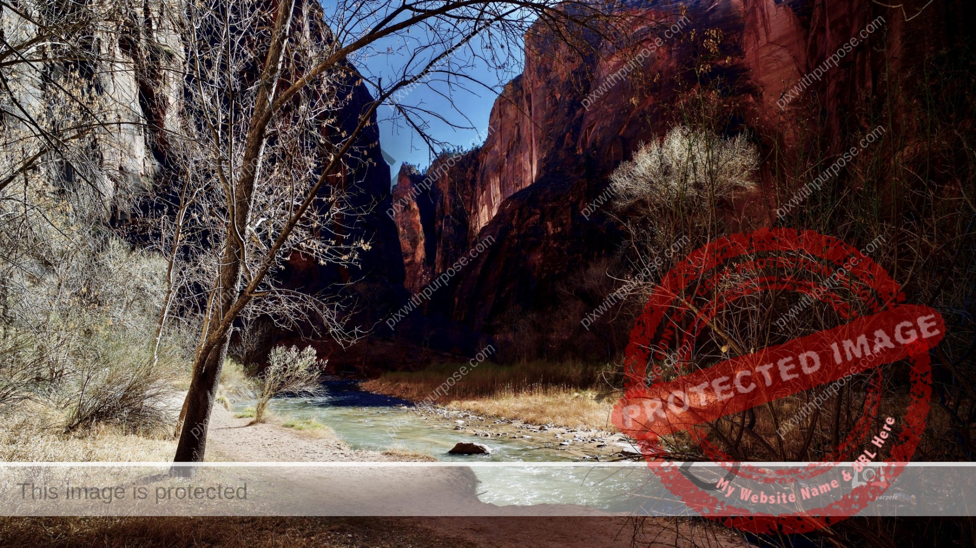
Virgin River
This river cut Zion National Park. I took this on the deep floor of the canyon in winter.
Zion National Park in Winter
Deep in the valley the sunlight barely made it to the bottom this time of year.
Cedar Breaks
The far peak is 11,300 feet. It's accessible by preferably 4WD vehicle a few months a year.
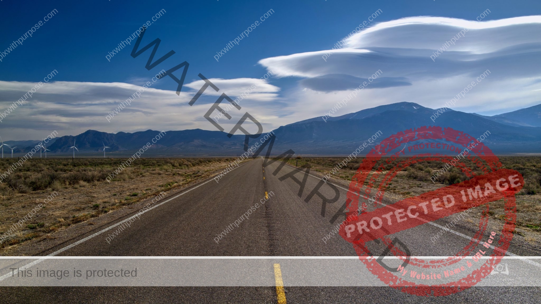
Long Way Home
This is an 80 mile long road out of Great Basin National Park. We saw only 3 other cars during the drive.
Canyon Floor Colors
Early Spring in Zion National Park.
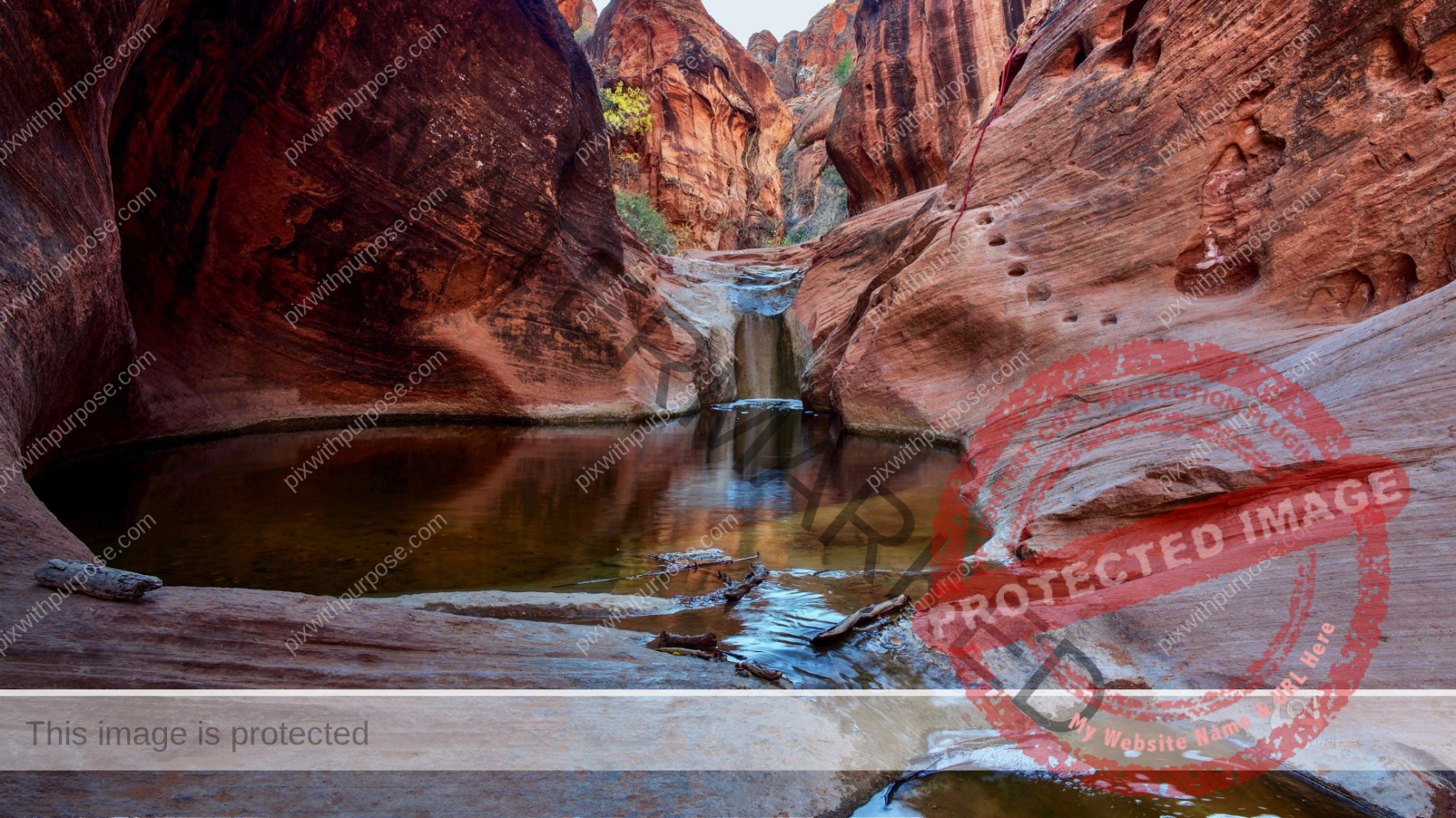
Red Rock Recreation Area
Utah park with multiple waterfalls and numerous dinosaur prints. You can maybe make out the chiseled foot holds and rope for climbing.
Zion National Park
Snowmelt in SW Utah has caused rivers to run fast and wide and in Zion, waterfalls.
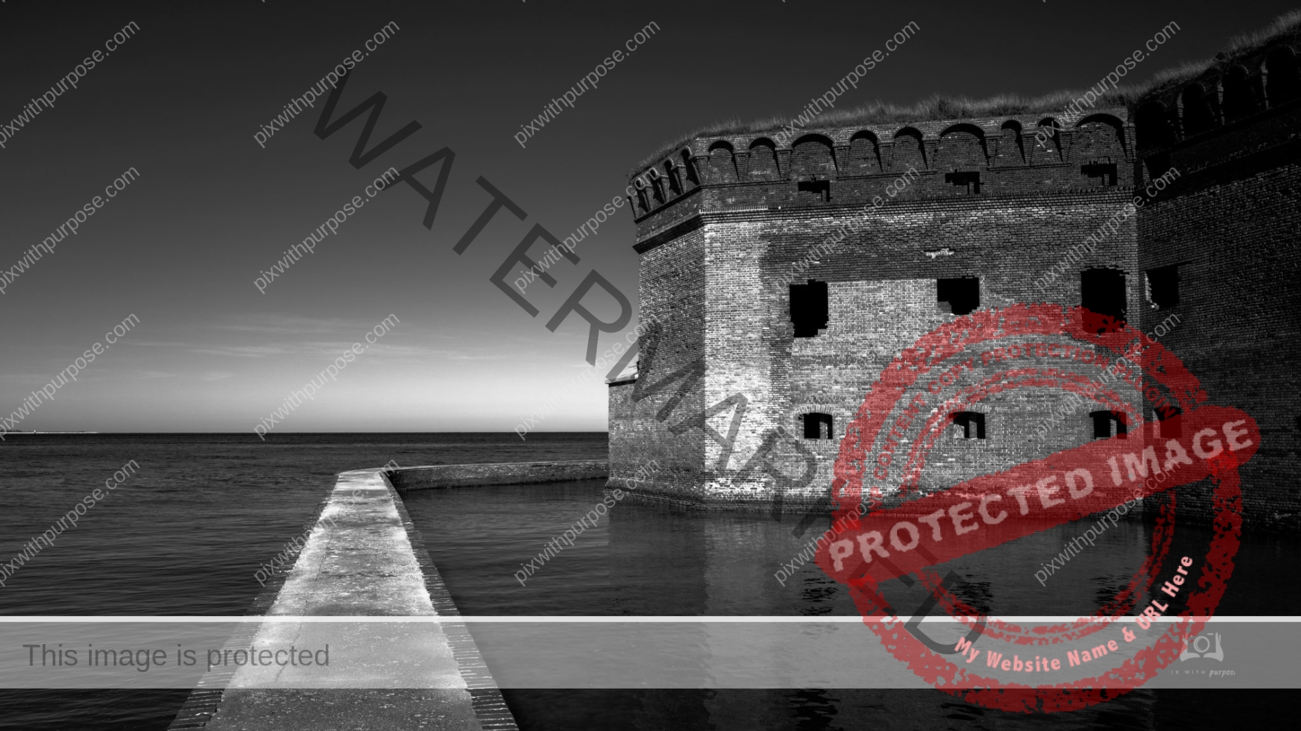
Fort Jefferson
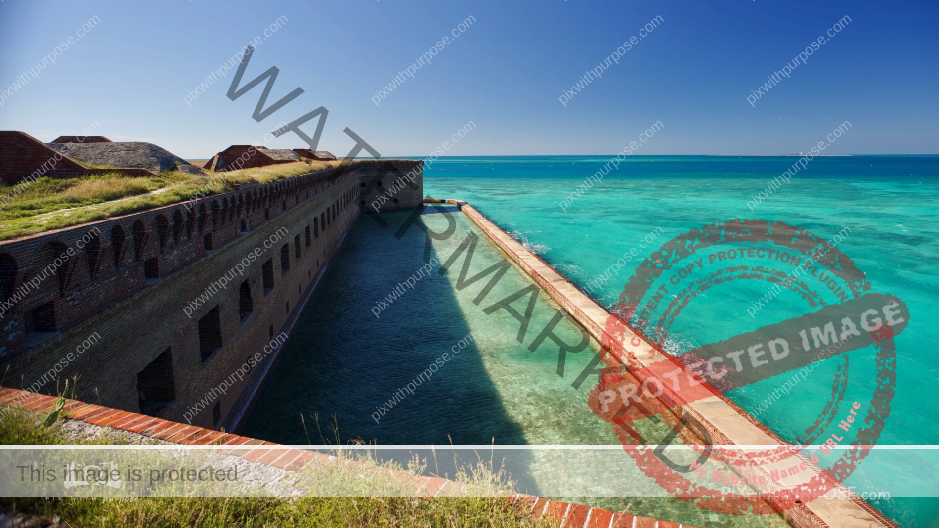
Fort Jefferson is a massive coastal fortress. It is the largest brick masonry structure in the Americas and is composed of over 16 million bricks. The building covers 16 acres. Among United States forts, only Fort Monroe in Virginia and Fort Adams in Rhode Island are larger. The fort is located on Garden Key in the lower Florida Keys within the Dry Tortugas National Park, 68 miles west of the island of Key West.

Joshua Tree in Gold Butte National Monument
Joshua trees are fast growers for a desert species; new seedlings may grow at an average rate of 3 inches per year in their first 10 years, then only about 1.5 per year. The trunk consists of thousands of small fibers and lacks annual growth rings, making determining the tree's age difficult. This tree has a top-heavy branch system, but also what has been described as a "deep and extensive" root system, with roots reaching down to 36 ft. If it survives the rigors of the desert, it can live for hundreds of years; some specimens survive a thousand years. The tallest trees reach about 49 ft. New plants can grow from seed, but in some populations, new stems grow from underground rhizomes that spread out around the parent tree.
The first time I "bumped" into one I thought I'd been stabbed thereafter keeping my distance.
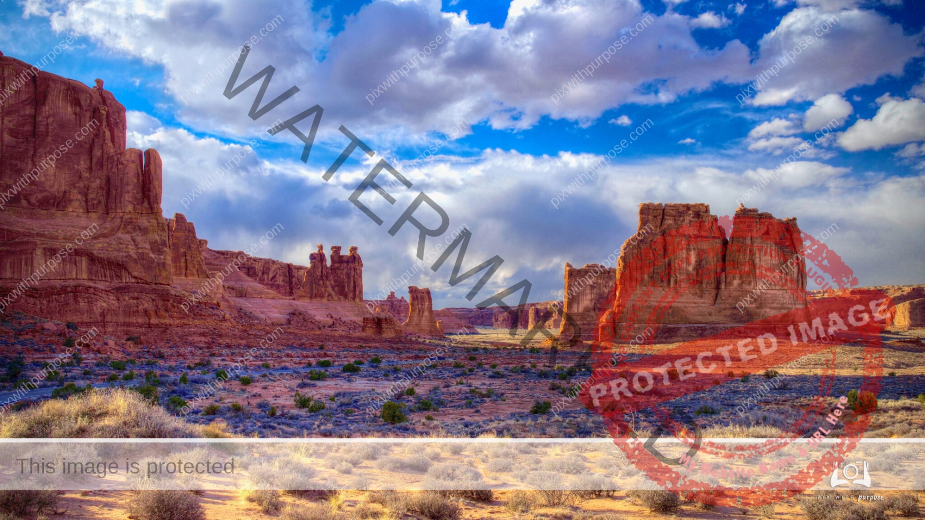
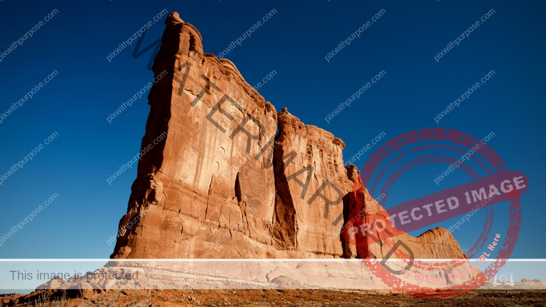
Arches National Park
Arches National Park is in eastern Utah adjacent to the Colorado River, north of Moab, Utah. It contains more than 2,000 natural sandstone arches, including the well-known Delicate Arch, which constitute the highest density of natural arches in the world. The national park lies above an underground evaporite layer or salt bed, which is the main cause of the formation of the arches, spires, balanced rocks, sandstone fins, and eroded monoliths in the area. The park consists 119.81 sq miles. Wikipeda

Grafton Settlement
Historic Mormon settlement on the south side of the Virgin River, adjoining orchards and farmland; last occupied in the 1940s. The town contains five original, partly restored buildings plus pieces of iron equipment and other relics. Zion National can be seen in the background.
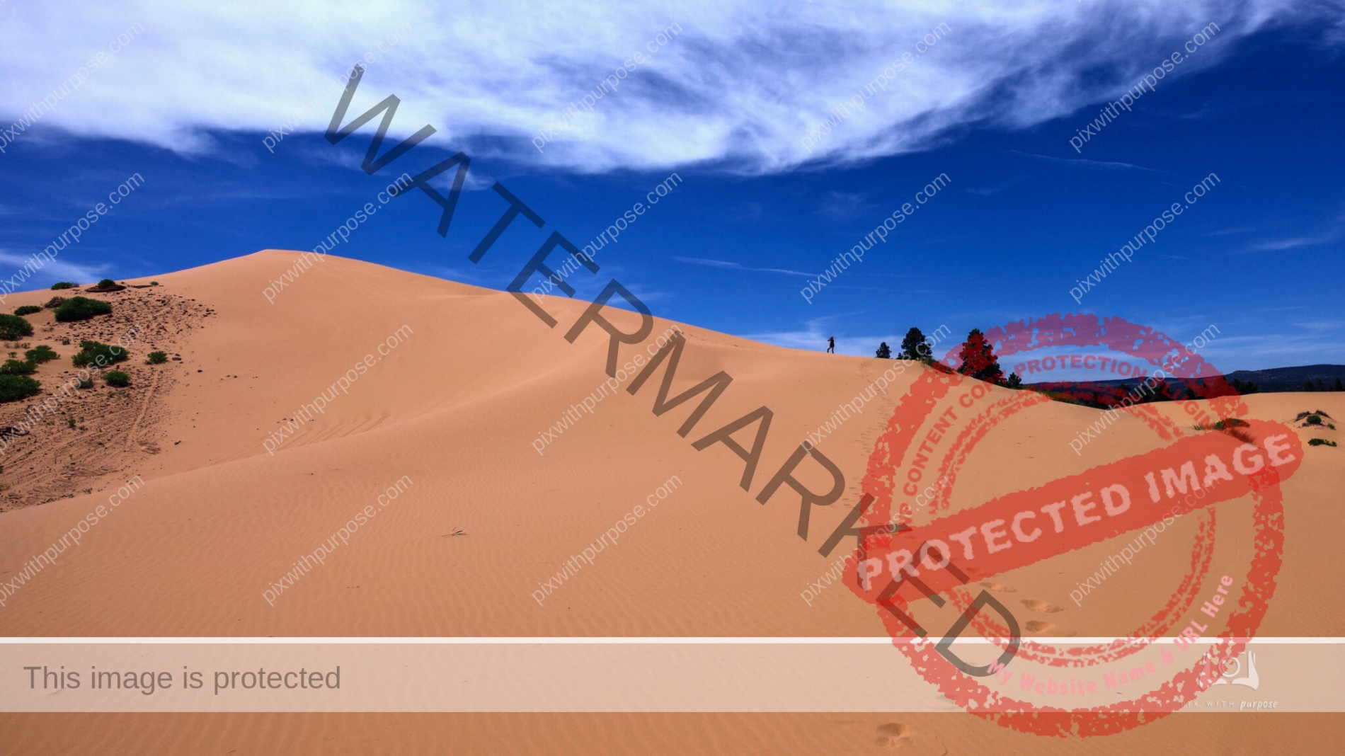
Pink Coral Sand Dunes State Park
This is a wonderful park near Zion National Park in Utah. Follow the footprints to my friend, about 1/2 way to the top to give this some scale.
5 foot hole
In Valley Of Fire State Park in Nevada.
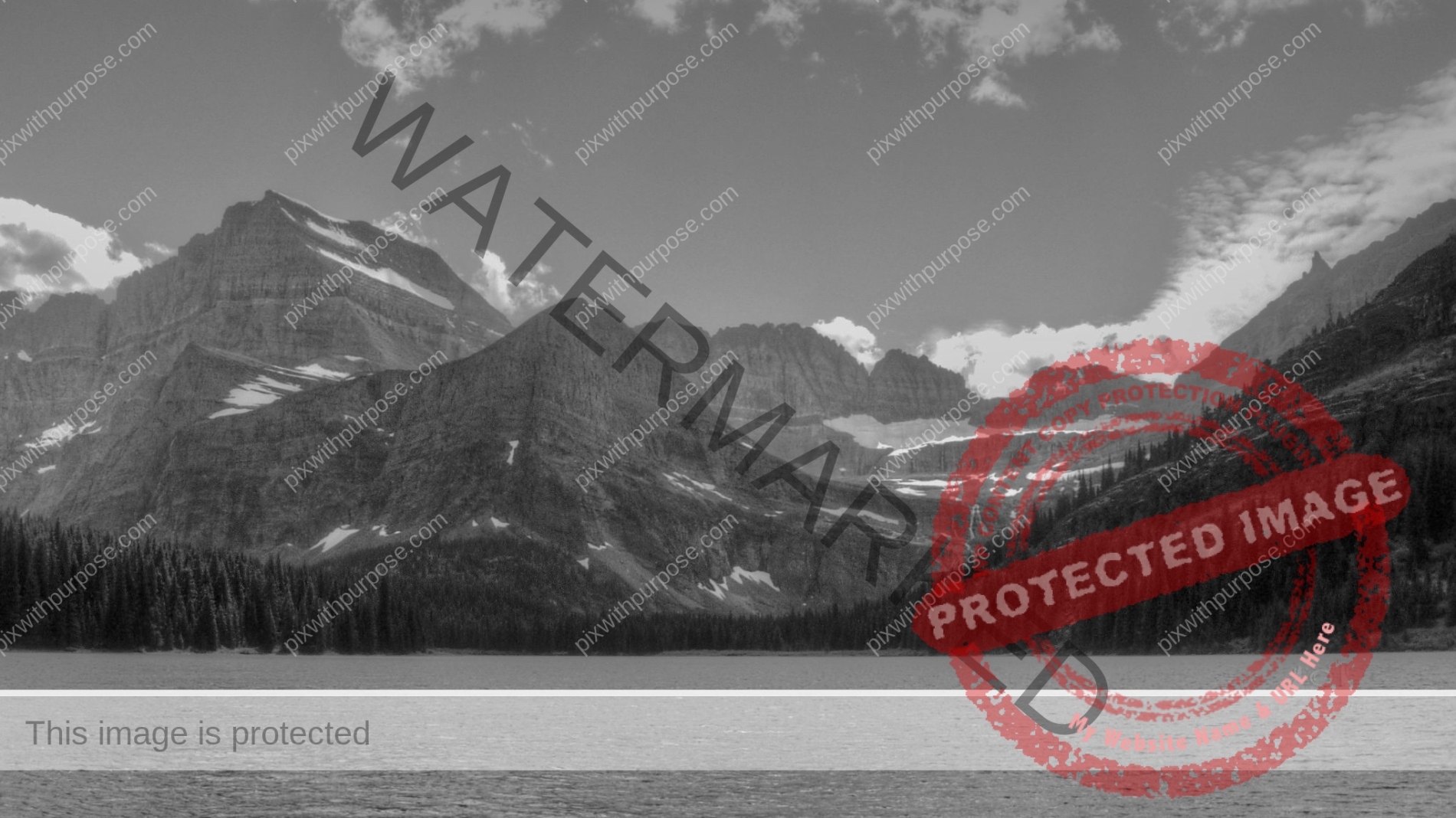
Glacier National Park
If you haven't visited this park.... bucket list it.

Virgin River
Zion National Park
Coral Pink
While the dunes are estimated to be 10,000 to 15,000 years old, this state park was first opened to the public in 1963. A phenomenon known as the Venturi Effect created the dunes, which is when wind passes through a notch between the Moquith and Moccasin Mountains. It increases velocity through the notch, which erodes the sandstone and carries the grains to the dunes.
Coral Pink Sand Dunes State Park is 3,730 acres of sand.
Virgin River
Standing on a bridge in Zion National Park I was able to take this photo of the Virgin River which carved the canyons through the park.
Arches NP
Arches National Park is in eastern Utah adjacent to the Colorado River, 4 miles north of Moab. More than 2,000 sandstone arches are located in the park which is the highest density in the world.
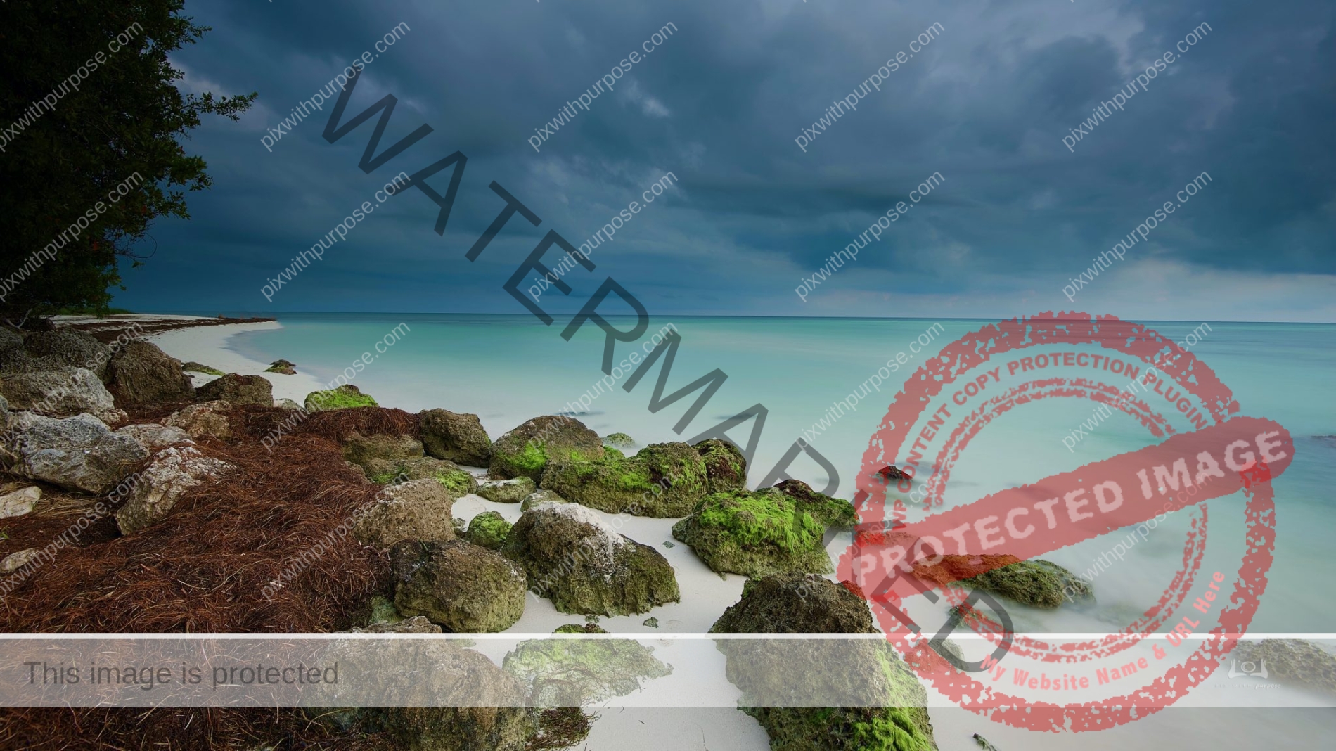
Bahia Honda State Park
The stormy skies made for strong color contrast between water, grass and sand.
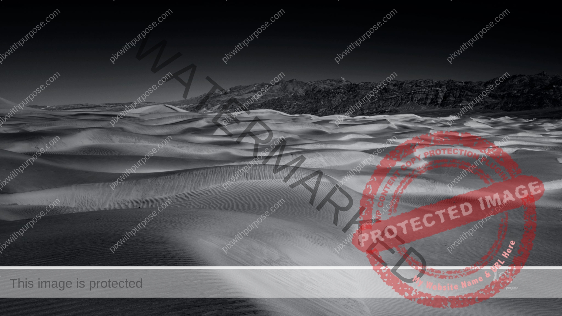
Mesquite Dunes
While sand exists throughout Death Valley, there are very few locations where large dune fields are created. In order to create sand dunes, there must be a source of sand (in this case, the eroding mountains to the north), wind to move that sand, and a barrier to prevent the sand from being blown farther (the mountains to the south). The conditions at Mesquite Flat Sand Dunes are perfect for the creation of dunes, and while individual grains move, and ripples form, the dune field remains.
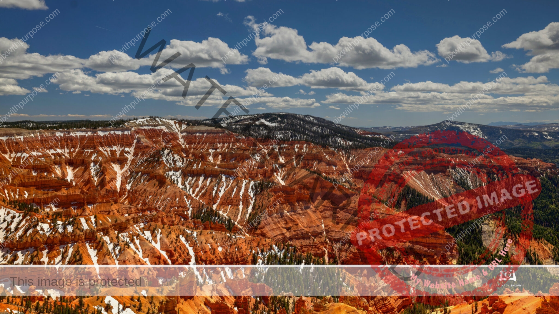
Cedar Breaks
Cedar Breaks National Monument in Utah. Elevation here is about 10,500 feet.
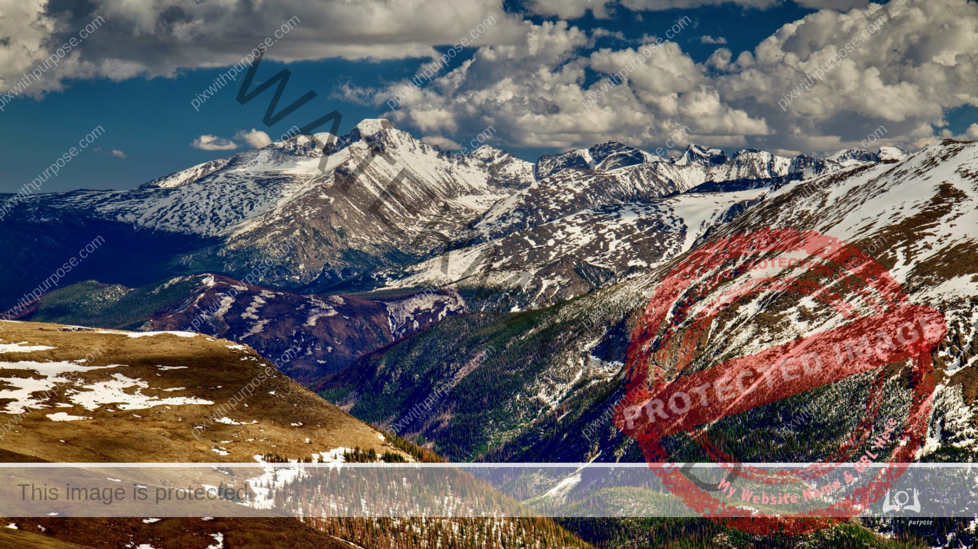
Continental Divide
Rocky Mountain National Park at 10,759 feet.
Cedar Breaks
Cedar Breaks is a natural amphitheater, stretching across 3 miles, with a depth of over 2,000 feet. The elevation of the rim of the amphitheater is over 10,000 feet above sea level. Iron oxides provide the reds, oranges and yellows, while manganese oxides provide shades of purple.

Dante’s View
Perched atop the Black Mountains at 5,475 feet, Dante’s view is tall and wide. Both of Death Valley’s elevation extremes, 282 feet below sea level and 11,049 feet above, can be seen in a single glance. Dante’s View in Death Valley National Park offers premier panoramic views of Badwater Basin, the lowest point in North America. Across the valley rises Telescope Peak, the highest in the park.
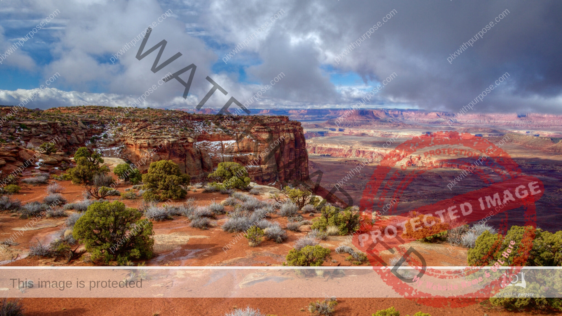
Canyonlands
Canyonlands National Park is located in southeastern Utah near the town of Moab. The parks 530 square miles preserves a colorful landscape eroded into numerous canyons, mesas, and buttes by the Colorado River, the Green River, and their respective tributaries. Legislation creating the park was signed into law by President Lyndon Johnson on September 12, 1964.
Wikipedia
Frosty Zion
Utah's Zion National Park is beautiful year round but winter is special with the dusting of snow and very few people.
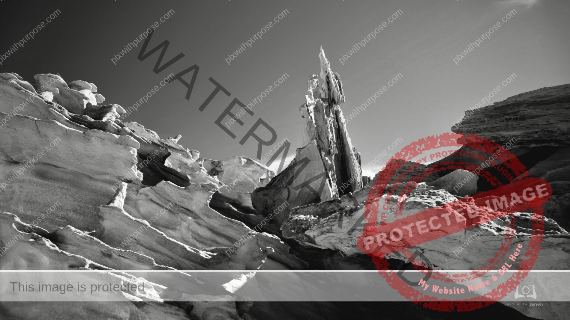
Paria Canyon
The Paria Movie Set: This set was located at the bottom of this towering, multi-colored sandstone canyon only a few miles up the Paria River from Paria Sage Casitas. The movie set was used to film western movies such as Sergeants 3 in 1961 and The Outlaw Josey Wales in 1976 as well as TV shows from 1963-1991. As a location, it was used for several episodes of Gunsmoke and Sergeants Three. Those willing to take the bumpy trip will be rewarded with interpretive displays and remarkable canyon views. While the movie set withstood gunfights and saloon brawls, it couldn’t withstand the ravages of nature. Flooding left a 20 foot gully running through the middle of the three-building town. Through a cooperative effort between local volunteers and the BLM, the buildings were dismantled and rebuilt on stable ground.
Death Valley
One of my favorite National Parks.
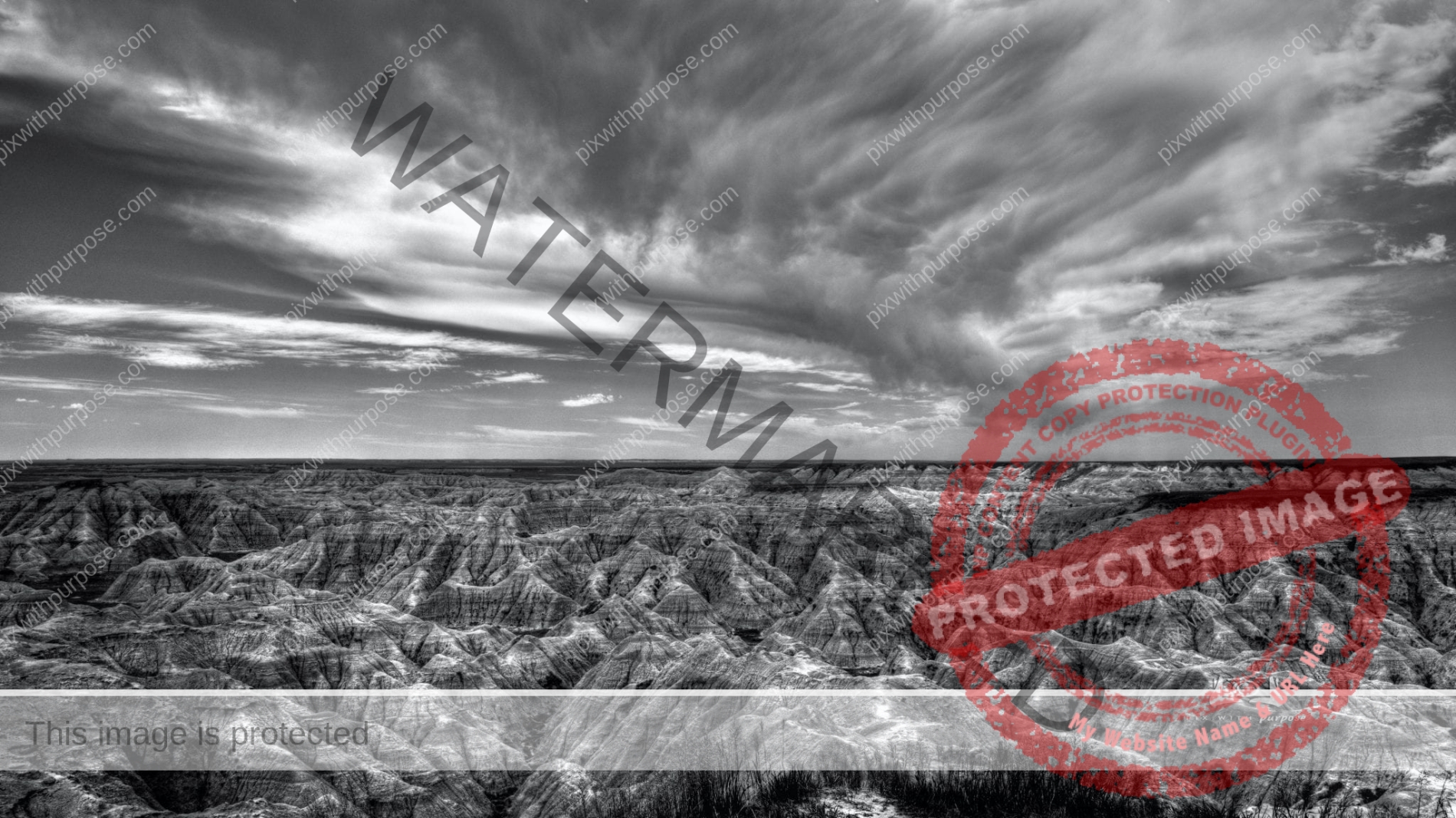
Badlands National Park
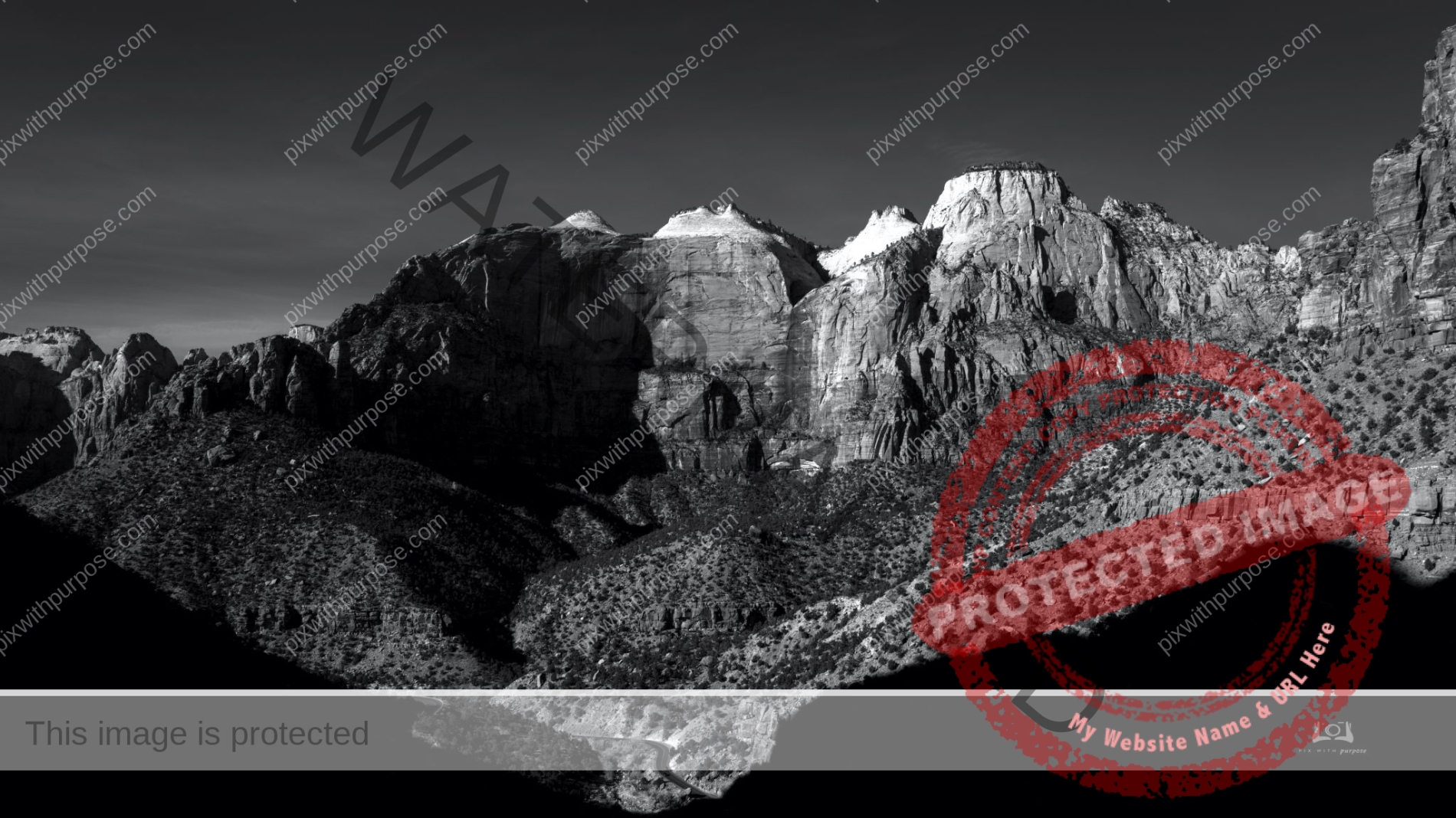
Neither the sky nor the landscape had much color that day so I shot it in black & white.
Bryce Canyon National Park
I drove through here last week on the way home from somewhere else. The skies were dark with very thick grey almost black low clouds. But every once in a while the sun would peek through and light up a small area of dream sickle colored sandstone allowing me a couple photos.
Finland
An area called Little Finland in Gold Butte National Monument is filled with interesting sandstone shapes. For scale, the centerpiece is 10-15' tall.
Cedar Breaks
A National Monument in Utah with an elevation of about 10,500 feet.
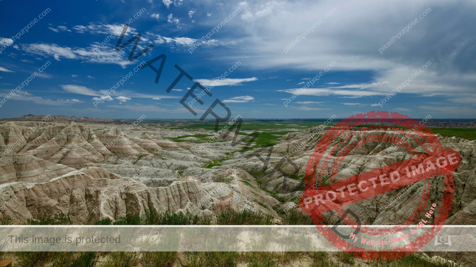
Badlands National Park
The rugged beauty of the Badlands in South Dakota draws visitors from around the world. These striking geologic deposits contain one of the world’s richest fossil beds. Ancient horses and rhinos once roamed here. The park’s 244,000 acres protect an expanse of mixed-grass prairie where bison, bighorn sheep, prairie dogs, and black-footed ferrets live today. per NPS
Sunset Gunlock
Gunlock State park near Ivins Utah
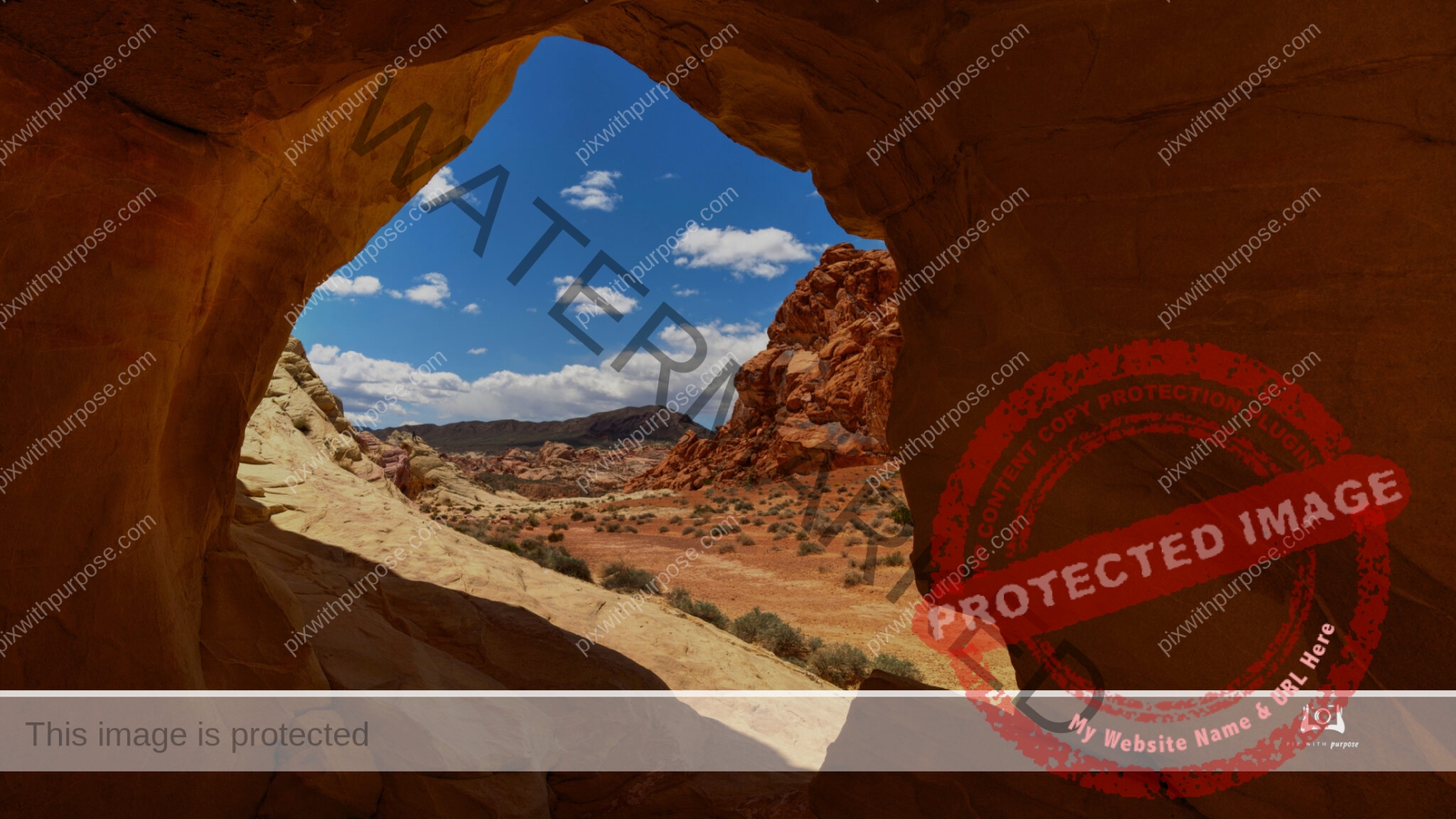
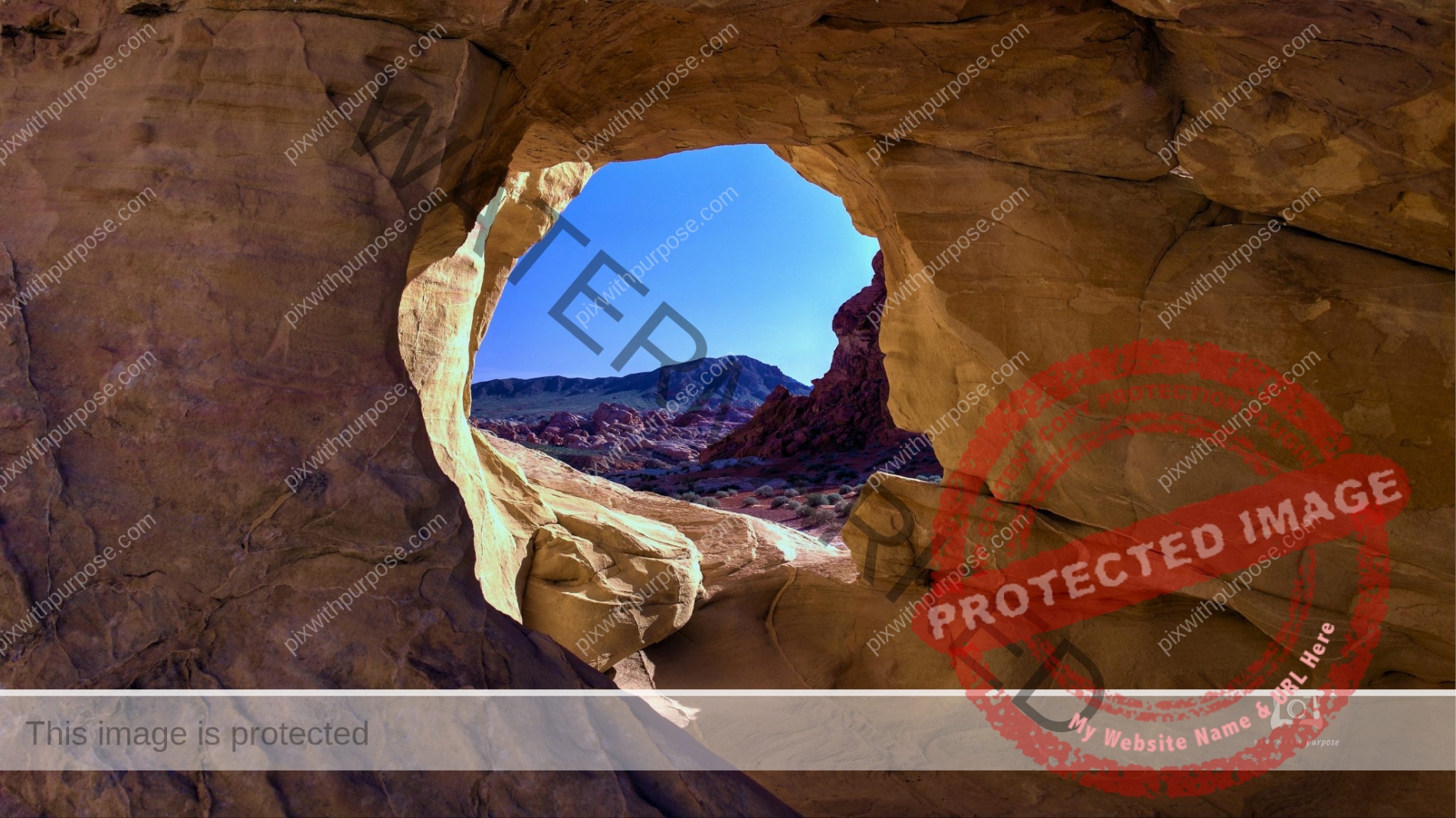
Valley of Fire
Valley of Fire State Park is a public recreation and nature preservation area covering nearly 46,000 acres located 16 miles south of Overton, Nevada. The state park derives its name from red sandstone formations, the Aztec Sandstone, which formed from shifting sand dunes 150 million years ago.Wikipedia
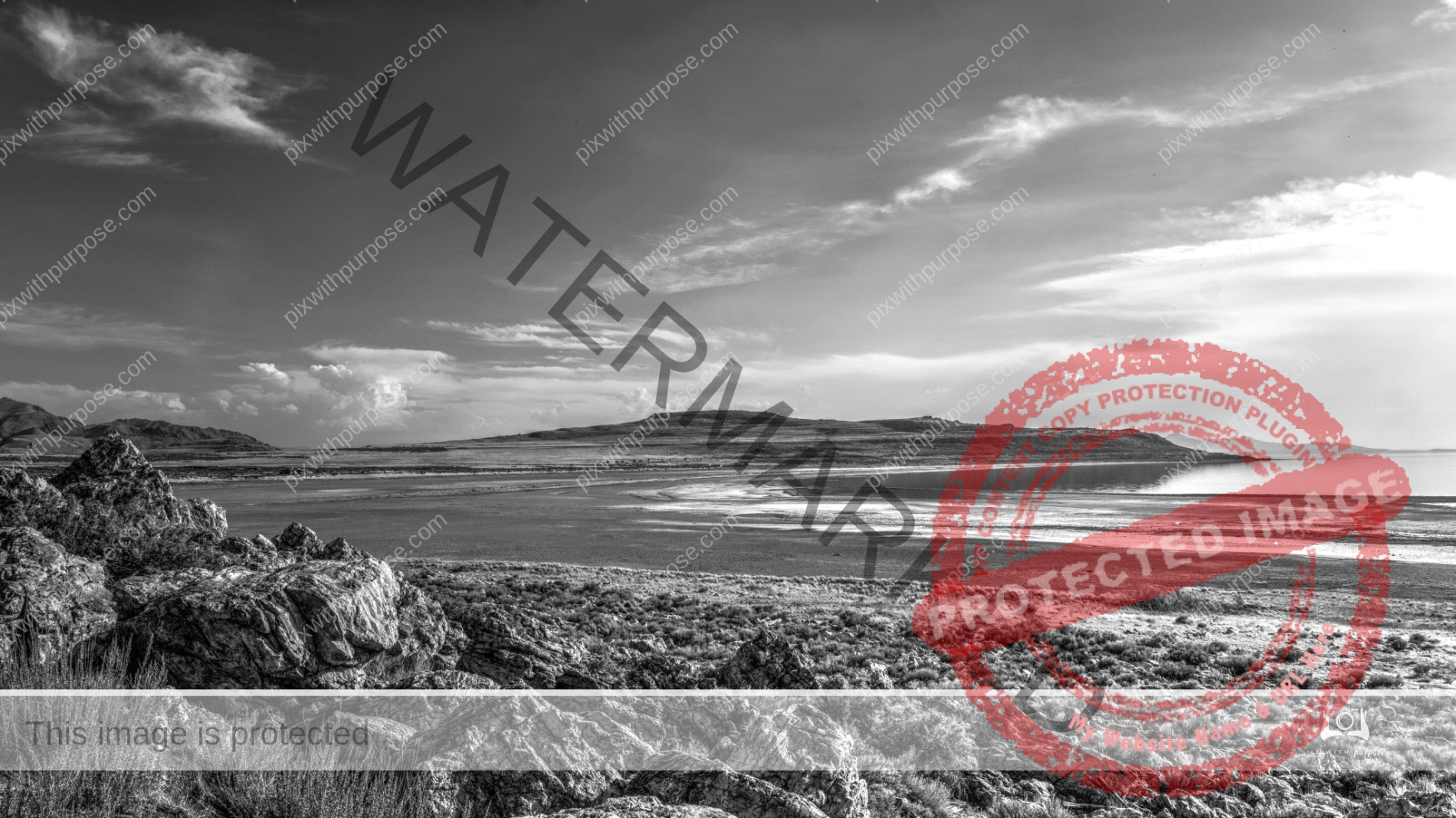
Salt Lake Utah
The Great Salt Lake is the largest saline lake in the Western Hemisphere and the eighth largest in the world. The 15,000 square miles of various water environments, remote islands and shorelines, with 400,000 acres of wetlands, provide habitat for plants, brine shrimp, reptiles, amphibians, mammals, shorebirds and waterfowl. Birds rely on the lake, a critical link in the Pacific Flyway between North and South America. Every year 10 million birds from 338 different species come to rest, eat and breed during migrations of a thousand miles or more. With the decline of other lakes, GSL is increasingly important to these species.
Brian Head
Brian Head, at 11,312 feet, looking down at Cedar Breaks National Monument.
Cedar Breaks National Monument

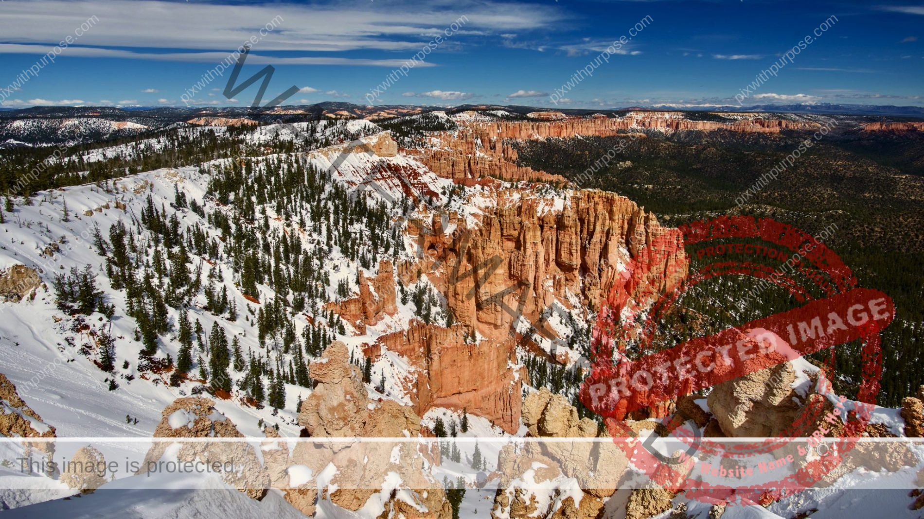
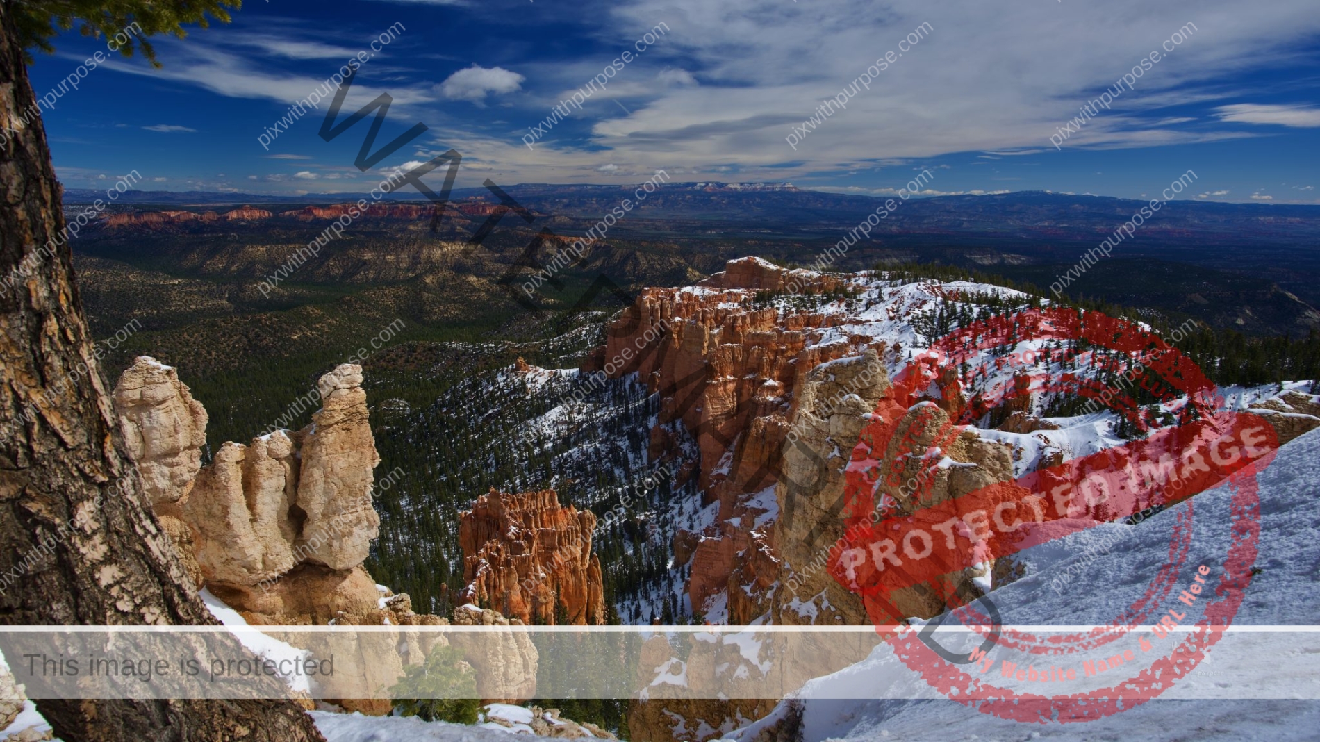
Winter Bryce
The snow really adds nice color to the sandstone.
Death Valley In Color
Death Valley's cultural history is well-known. At least from 1849 on. That was when a group of emigrants en route to California's gold fields encountered the worst of the valley that they attached the "death" name to.
They had set out from Salt Lake City, determined to cross the Great Basin and reach California before winter's snows made the Sierra Nevada impassable. Leaving Salt Lake in October of 1849, they decided to skirt the Sierra Nevada to the south and avoid the snows. Unfortunately, this route took them through today's Death Valley.
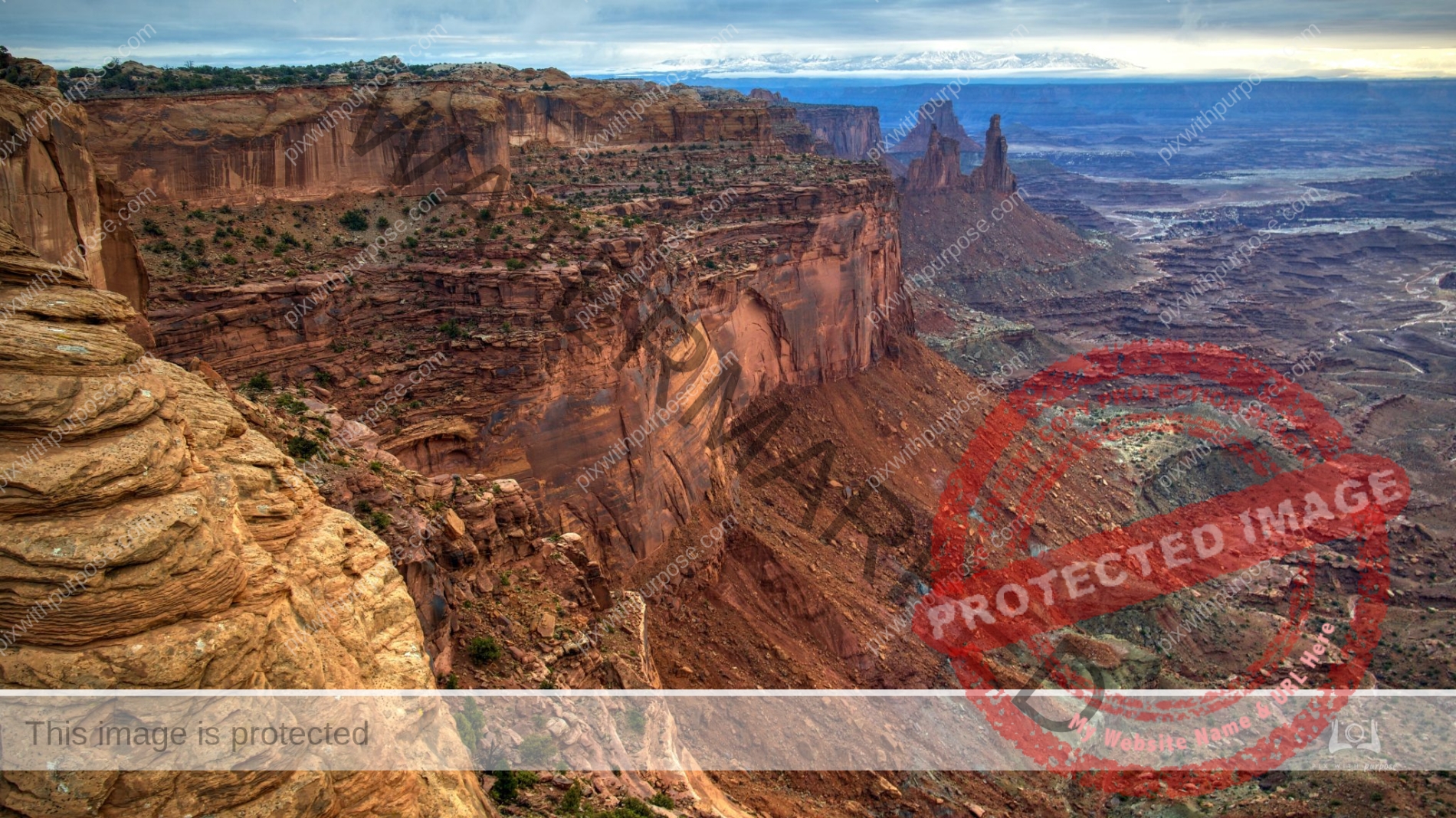
Canyonlands
Canyonlands National Park is a park located in southeastern Utah near the town of Moab. The park preserves a colorful landscape eroded into numerous canyons, mesas, and buttes by the Colorado River, the Green River, and their respective tributaries. Legislation creating the park was signed into law by President Lyndon Johnson on September 12, 1964. Wikipedia
Bryce National Park
Winter is the best time to visit as it's less crowded and it's prettier with snow.
North Rim
Grand Canyon National Park North Rim in Arizona is about 8,000 feet deep. We drove up early to arrive around sunrise to photograph the canyon before the sun could light up the haze.
One of my favorite Bryce Canyon formations.
Bryce Canyon National Park - Utah
Red White & Blue
Woke early and things looked unusually bright. Walking outside I realized it had snowed, a very rare event where we live. Grabbed the camera and began taking photos knowing it would melt fast. There was 6-10" on the ground but by 11am it had completely disappeared. The white/red/blue was a wonderful combination while it lasted. Here's the park's description per Utah.com:
SNOW CANYON STATE PARK - This place would be a national park in any other state.
Located in the red-rock country near St George, in southwestern Utah, this park enjoys mild winter weather and seldom receives snow. The park was named after early Utah leaders Lorenzo and Erastus Snow. It offers some 16 miles of hiking trails, technical rock climbing, biking and horseback riding. It features a very nice campground open year-round. People also enjoy nature studies, wildlife viewing and photographic opportunities galore. All of this is set against a stunning backdrop of towering sandstone cliffs colored red and white. A jumbled of black lava rock caps some ridges and tumbles down hillsides.
Virgin River Valley
Zion National Park Utah
Snow Canyon Utah
Snow Canyon State Park is a state park in Utah, located in the Red Cliffs Desert Reserve. The park features a canyon carved from the red and white Navajo sandstone of the Red Mountains, as well as the extinct Santa Clara Volcano, lava tubes, lava flows, and sand dunes. Snow Canyon is located near the cities of Ivins and St. George in Washington County.Wikipedia
I took this photo after a very rare snowfall. This part of Utah may never see snow all winter but this morning saw a 10" depth in the park which was completely gone by noon that day.
North Rim
Grand Canyon National Park Utah
Death Valley National Park
Death Valley National Park is an American national park that straddles the California–Nevada border. It has a diverse environment of salt-flats, sand dunes, badlands, valleys, canyons and mountains. Death Valley is the largest national park in the contiguous United States, as well as the hottest, driest and lowest of all the national parks in the United States. It contains Badwater Basin, the second-lowest point in the Western Hemisphere at 282 feet below sea level.
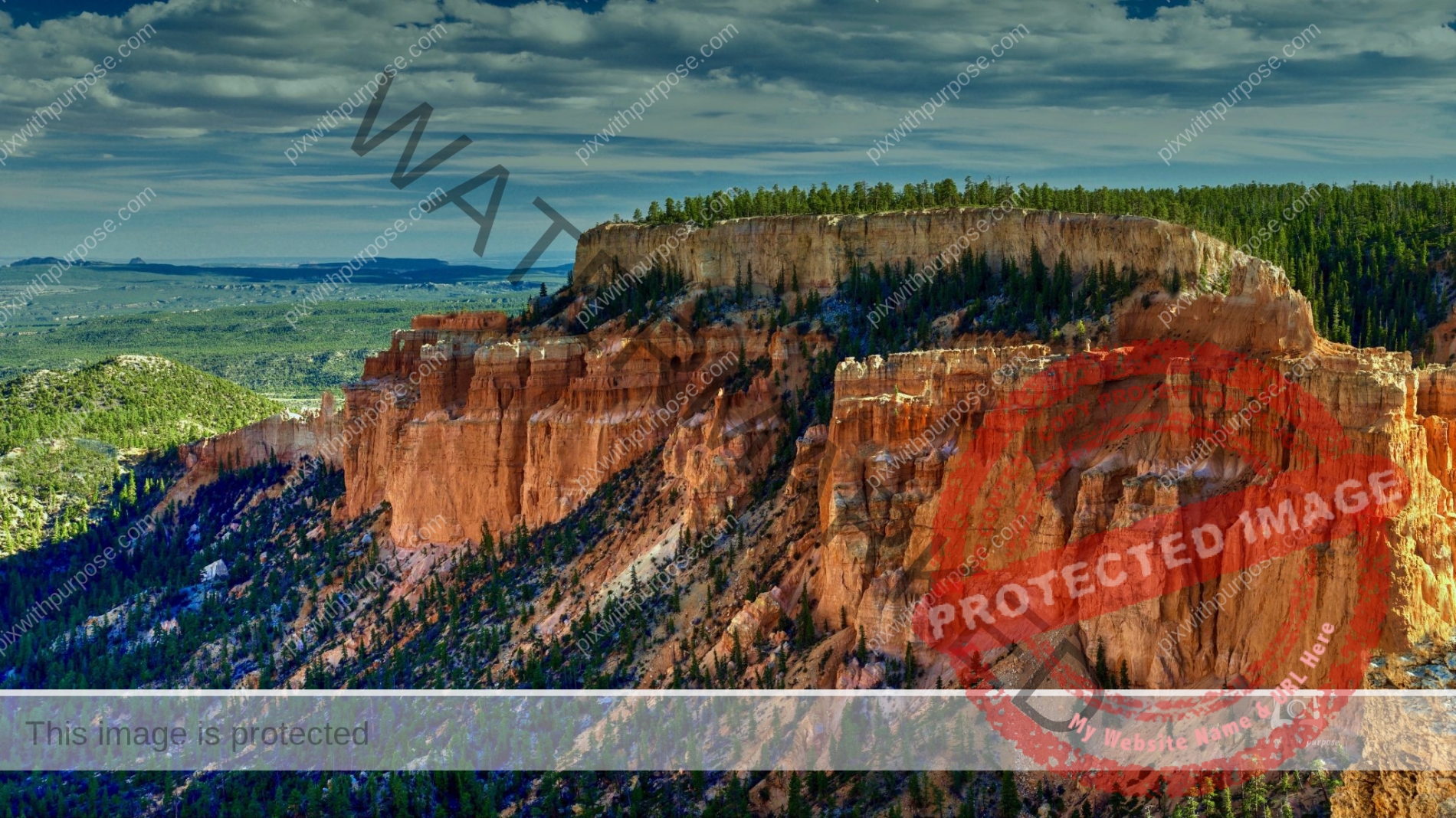
Bryce Canyon Panorama
Using an extremely wide lens (11mm) I still can't get it all in a photo.
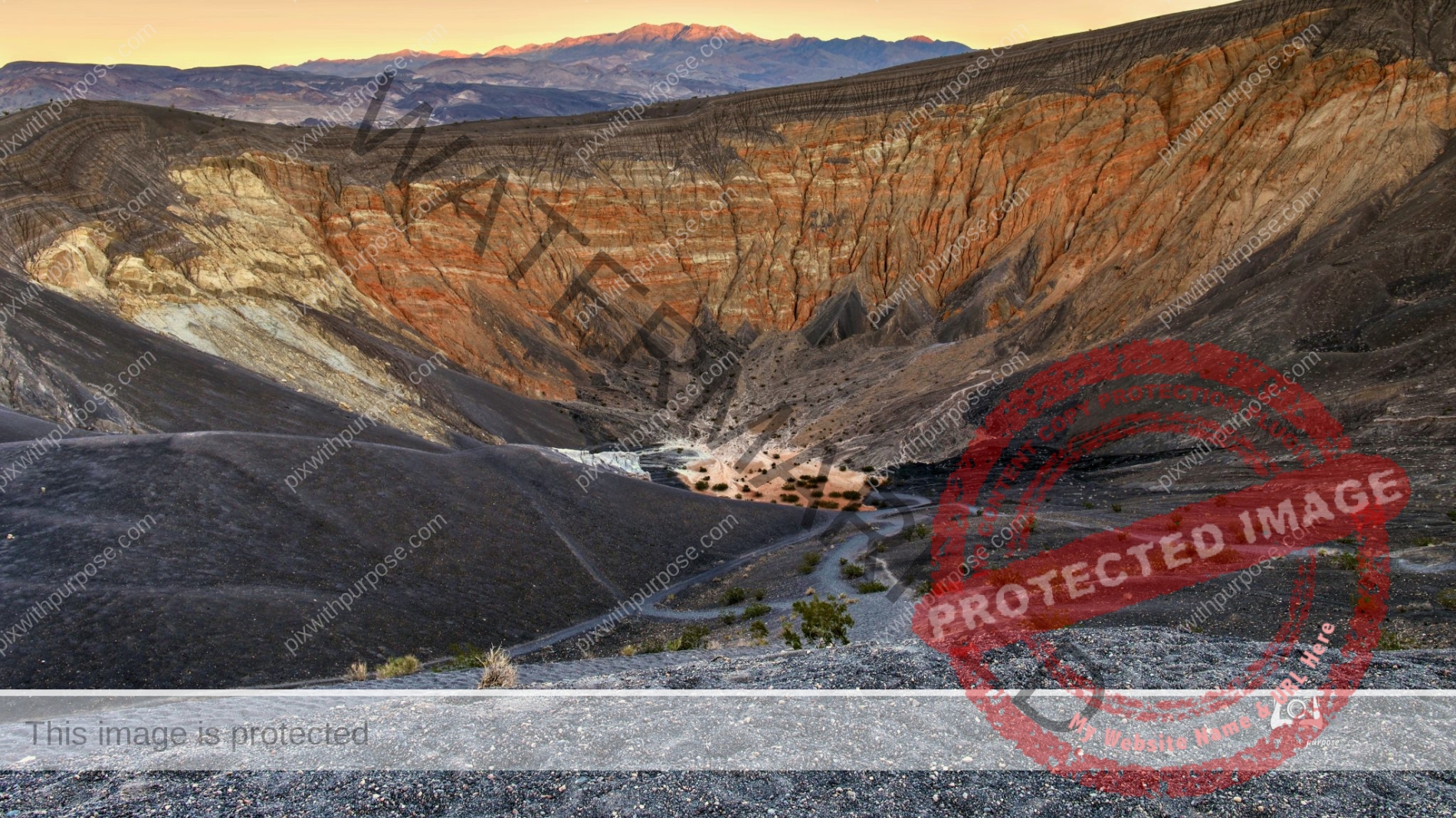
Death Valley National Park Crater
Ubehebe Crater is a large volcanic crater 600 feet deep and half a mile across.
Death Valley California
Nations largest National Park. Well worth the visit except in mid summer.
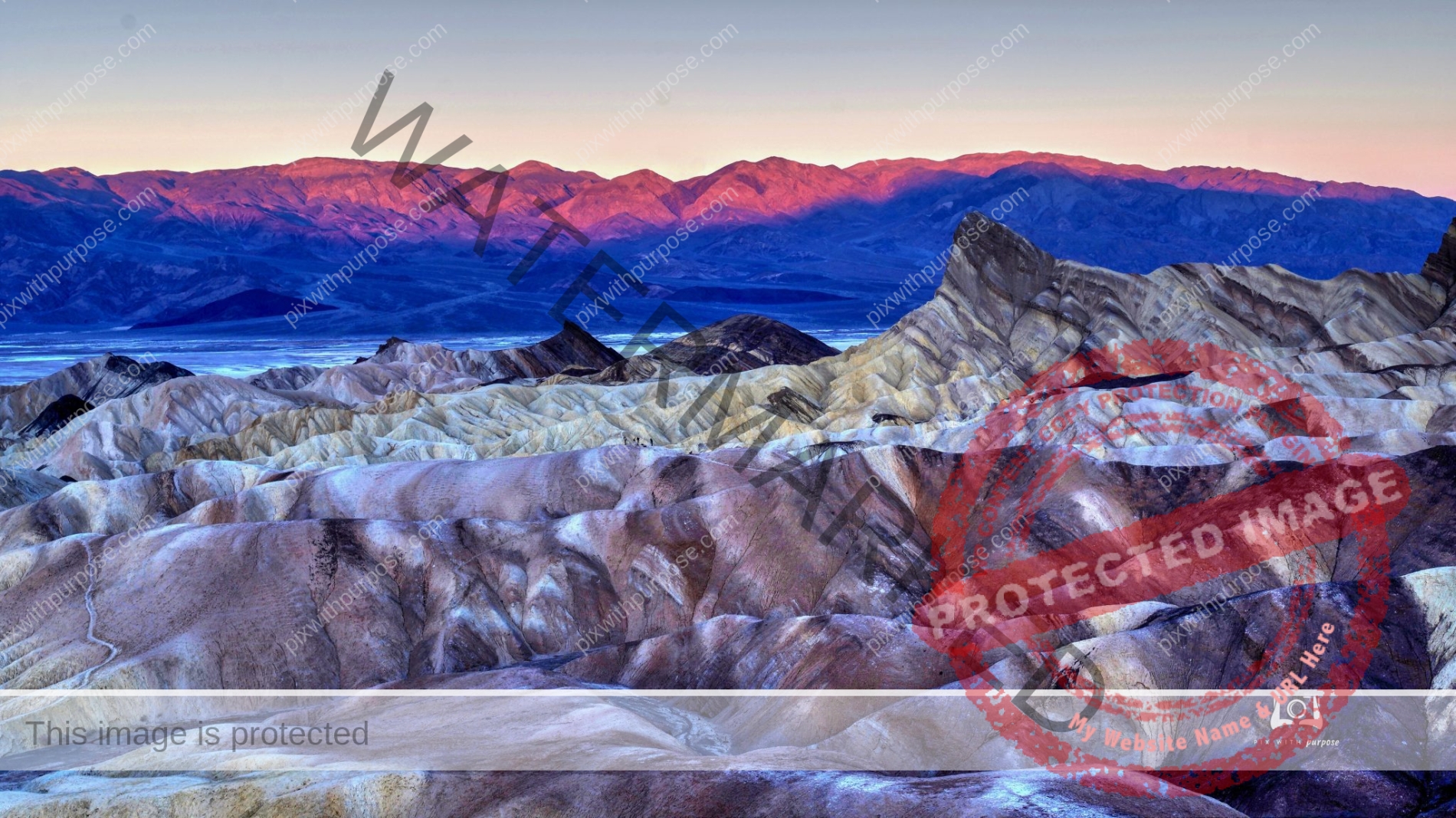
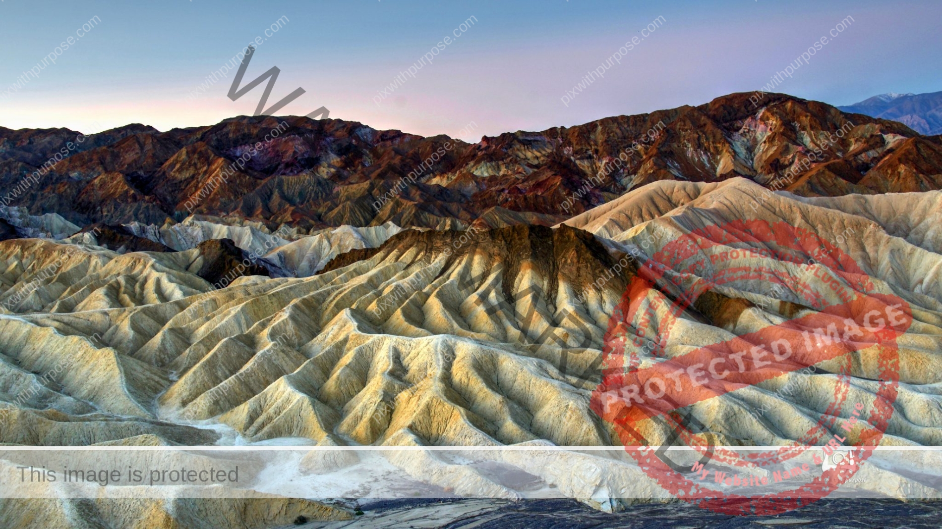
Zabriskie Point
Zabriskie Point is an elevated overlook of a colorful, undulating landscape of gullies and mud hills at the edge of the Black Mountains, just a few miles east of Death Valley - from the viewpoint, the flat salt plains on the valley floor are visible in the distance.
Sunrise White Pocket
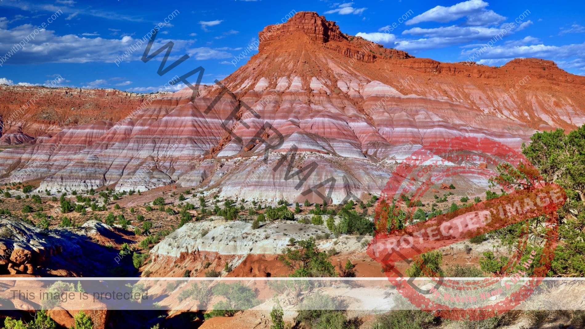
National monument in Utah
It’s difficult to visually comprehend
when you first peer over the rim of Bryce National Park
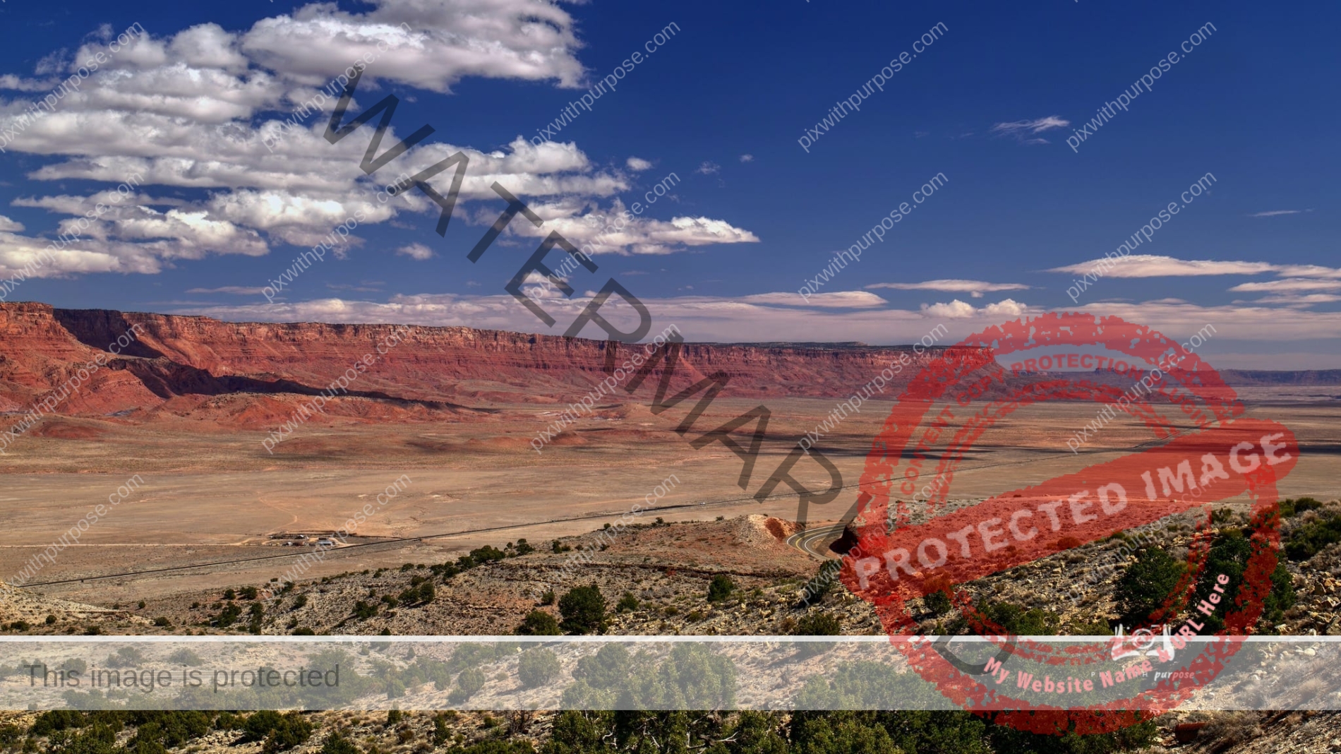
Vermillion Cliffs
This is looking at the Vermillion Cliffs which is home to condors. If you followed the road into the distance it will take you to Lee's Ferry before reaching Page AZ. Continuing the journey about 40 miles behind me is the entrance road to the Grand Canyon North Rim.
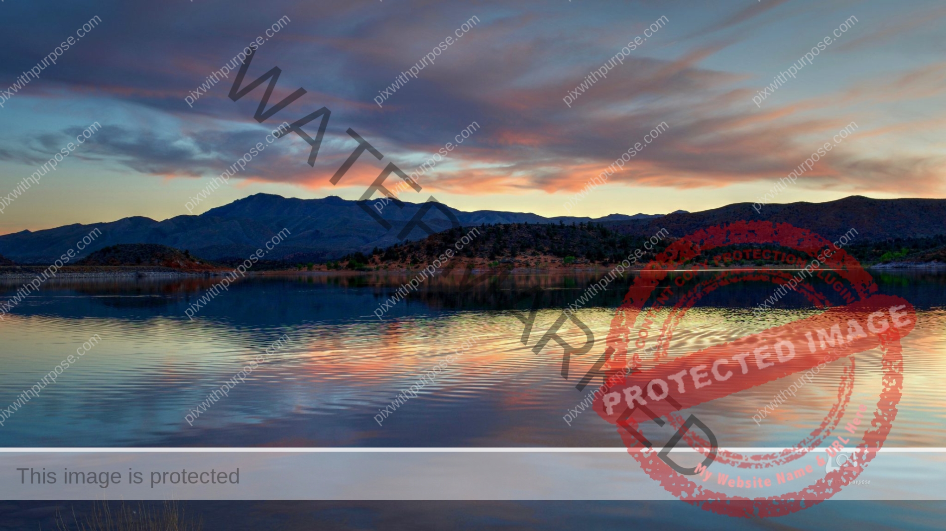
Navajo Lake Utah
High altitude lake near Cedar Breaks National Monument

Niagara Falls
Maiden Of The Mist
Death Valley CA
This National Park is diverse, massive and beautiful.
Snow Canyon State Park
Located in Ivins Utah
Horicon Marsh Wisconsin
It is the site of both a national and a state wildlife refuge. The silted-up glacial lake is the largest freshwater cattail marsh in the United States
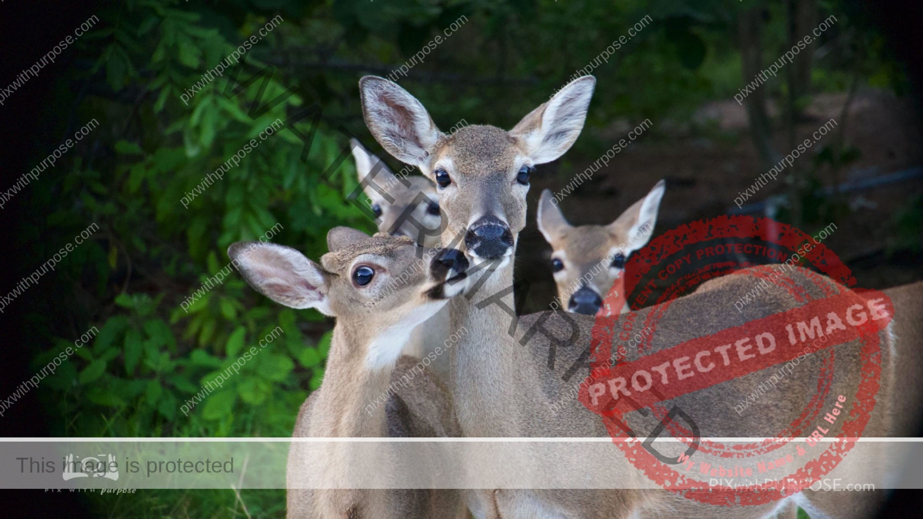
Key Deer National Wildlife Sanctuary
An endangered species on Big Pine Key FL, this deer can be recognized by its characteristic size, smaller than all other white-tailed deer. Adult males stand about 30 in tall at the shoulder. Adult females (does) have an average height of 26 in at the shoulders.
Fort Jefferson National Park
Dry Tortugas FL
Fort Jefferson National Park
Bahia Honda Florida
Snow Canyon State Park Utah
Navajo sandstone formation in a more recent stream of lava

Cedar Breaks National Monument – Utah
Fort Zachary Taylor
Key West
Bahia Honda FL

Bahia Honda FL State Park
Considered to be one of the finest beaches in the world until hurricane Irma came to town. The amount of surf driven sand buried the roads and campgrounds so when repairs are complete it could be even better.