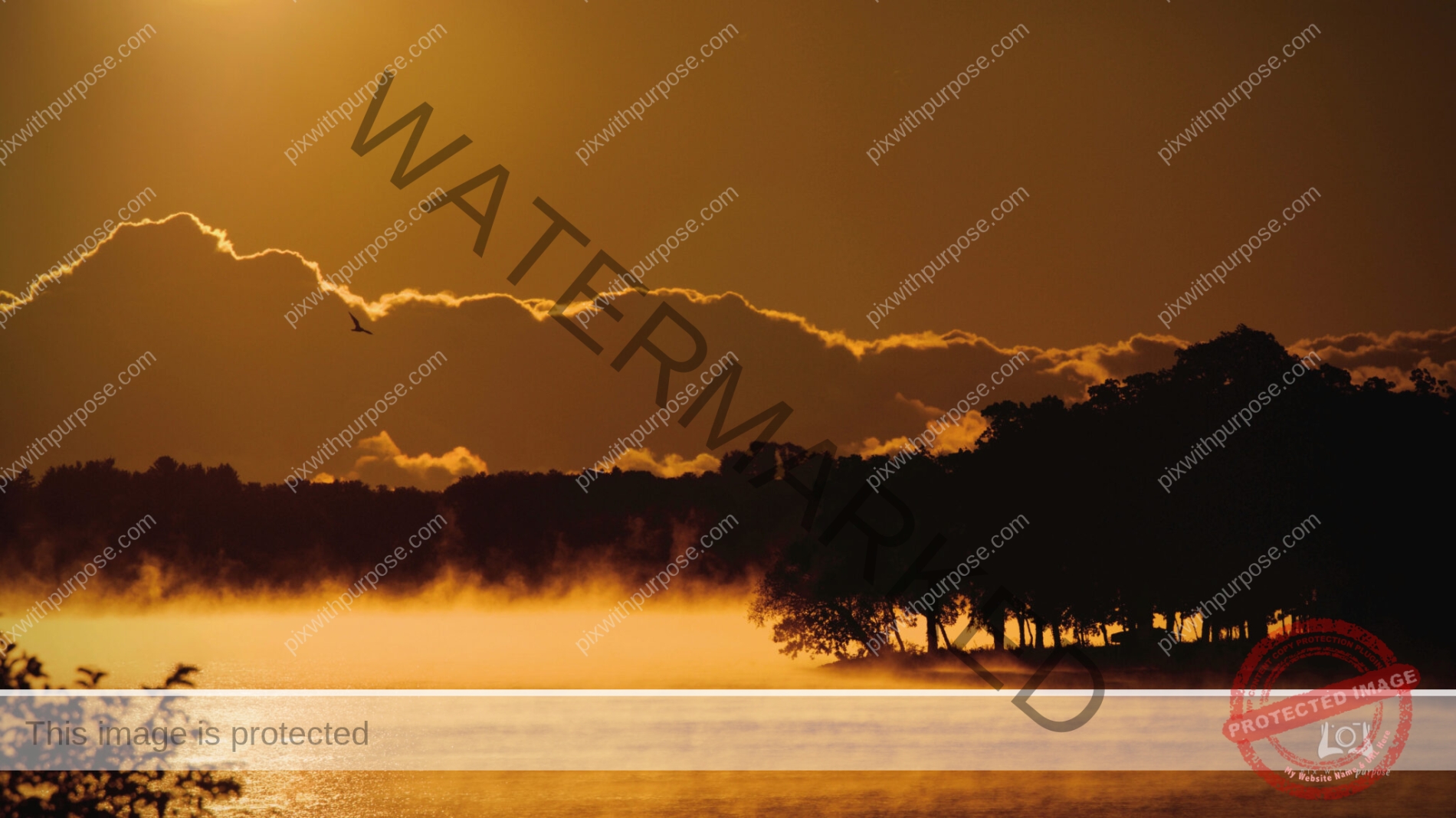
A chill is in the air
Took this shortly after sunrise yesterday here in Wisconsin. I used a long lens so this image looks about 1-2 miles out. Air temps were in the low 40s so it is easy to see the heat leaving the much warmer lake water.
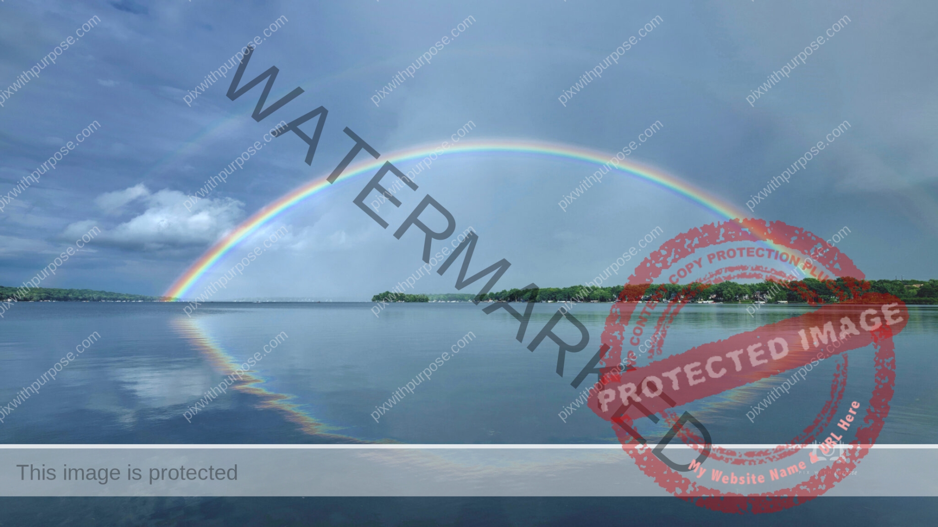
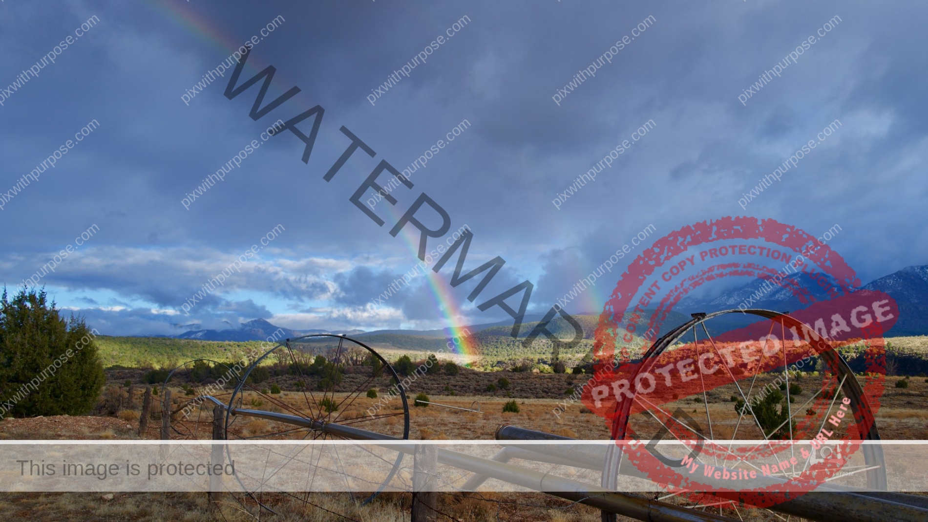
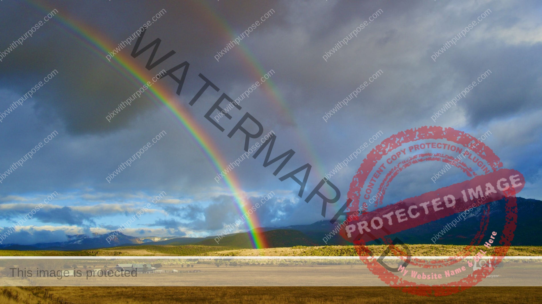
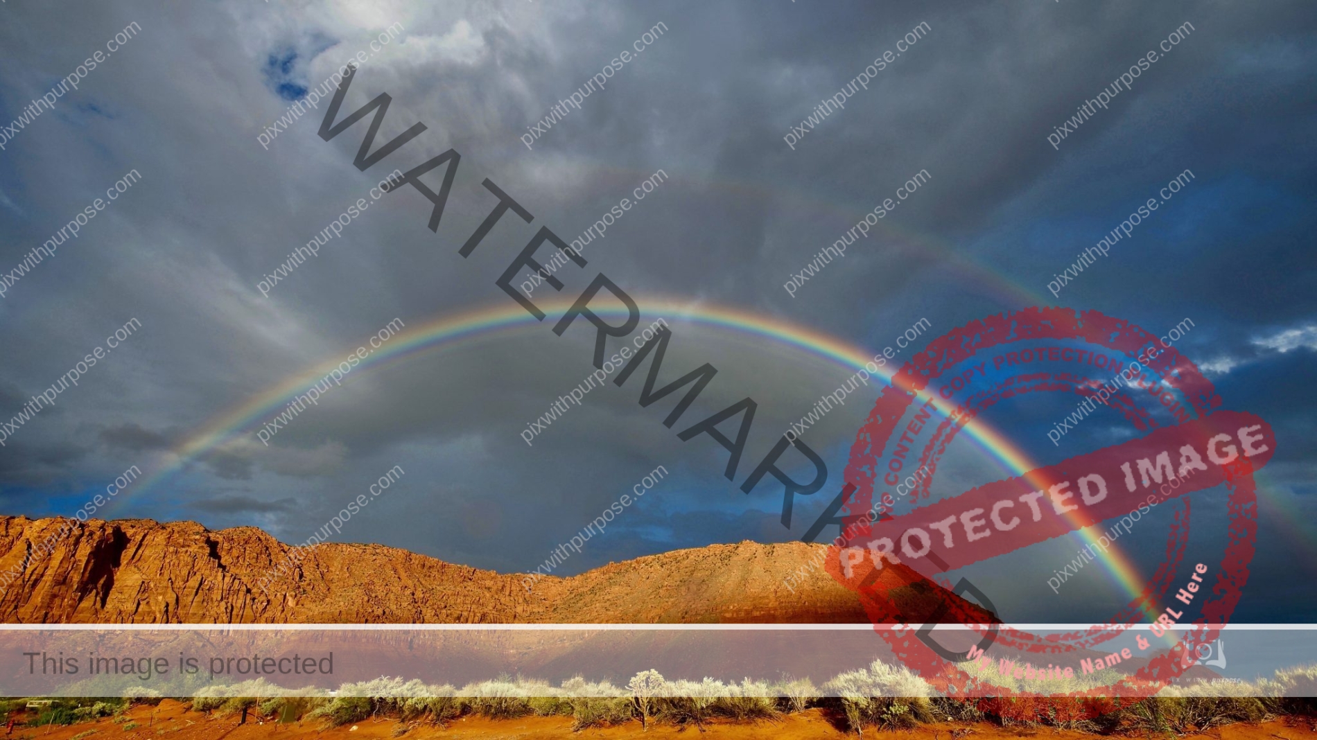
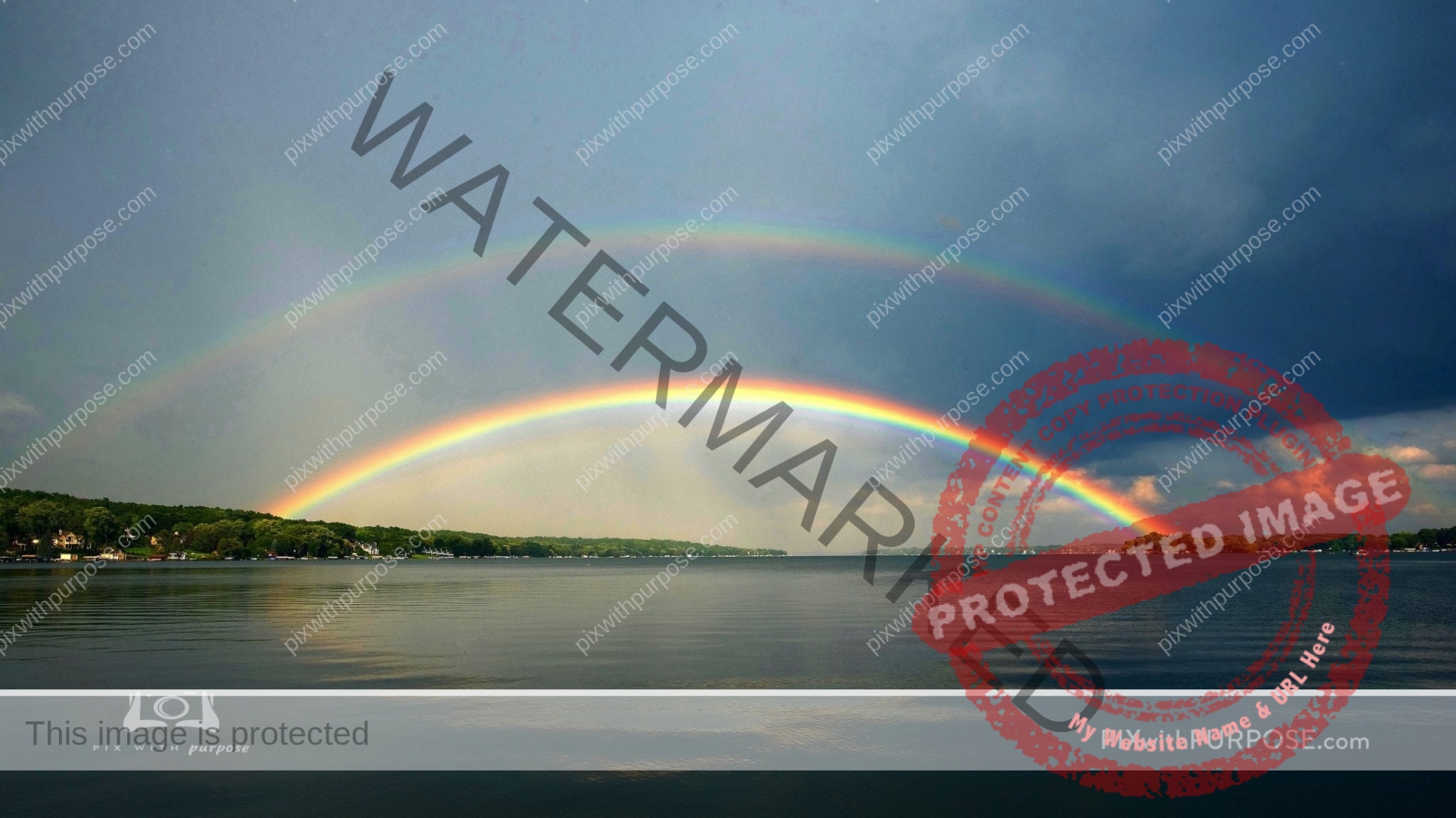
Double Rainbow
Wisconsin this past summer.
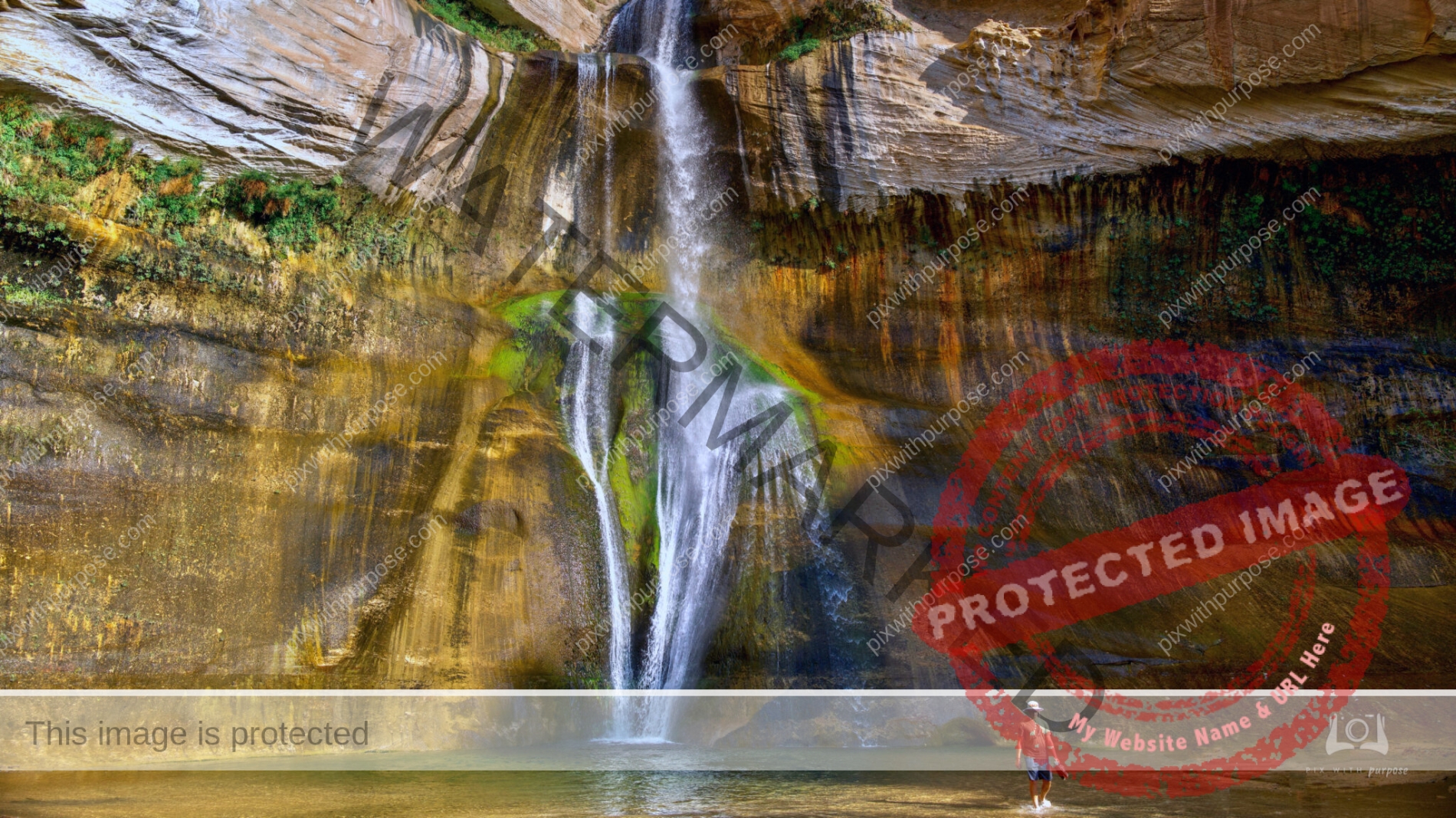
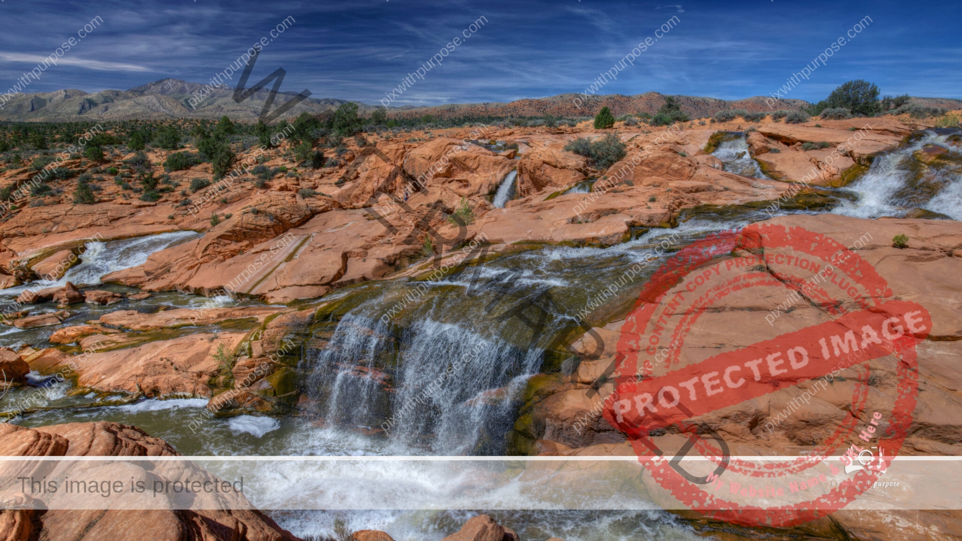
Calf Creek Falls
Calf Creek is a perennial clear stream that descends 126 feet into a pool. It’s located in Utahs Grand Staircase-Escalante National Monument. During the 6 mile hike you’ll pass two granaries, beaver dams, and a mighty pictograph on the wall opposite the canyon, to name but a few sites along the way.
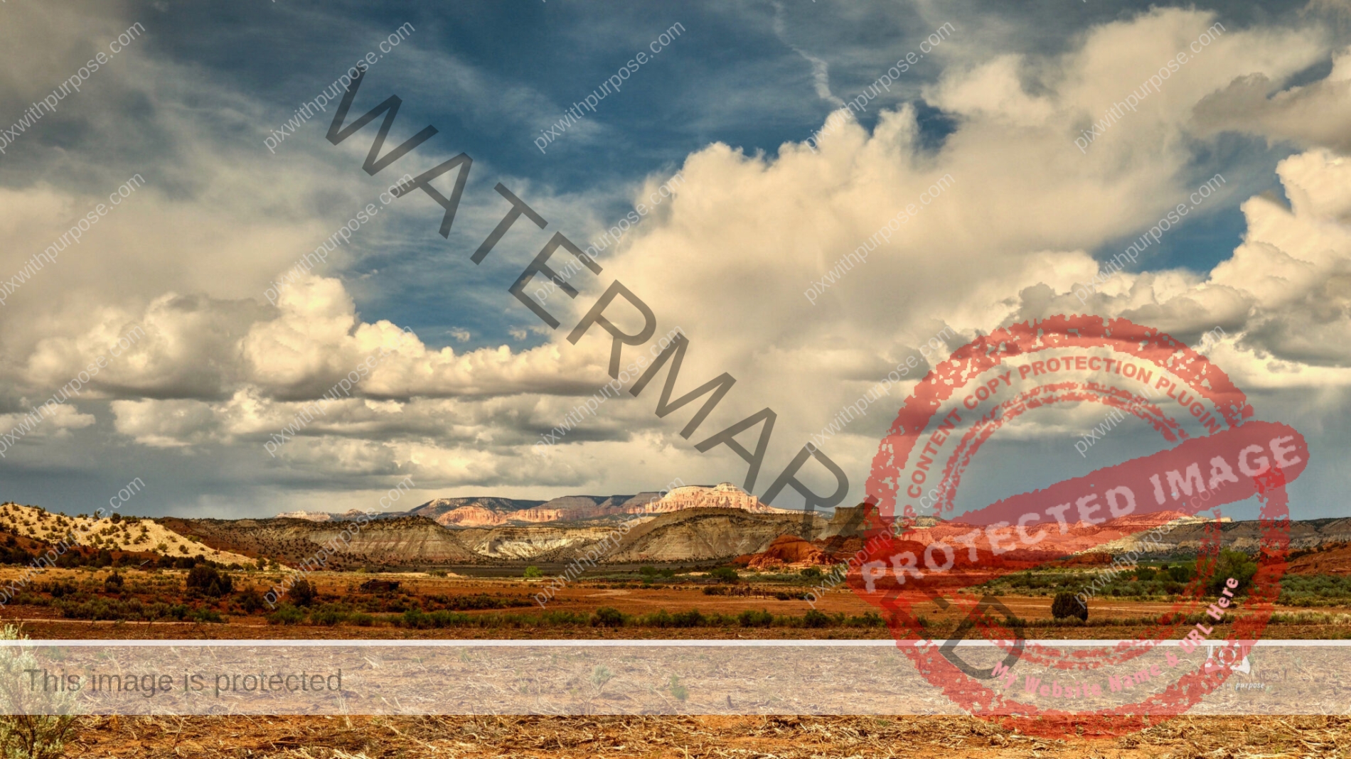
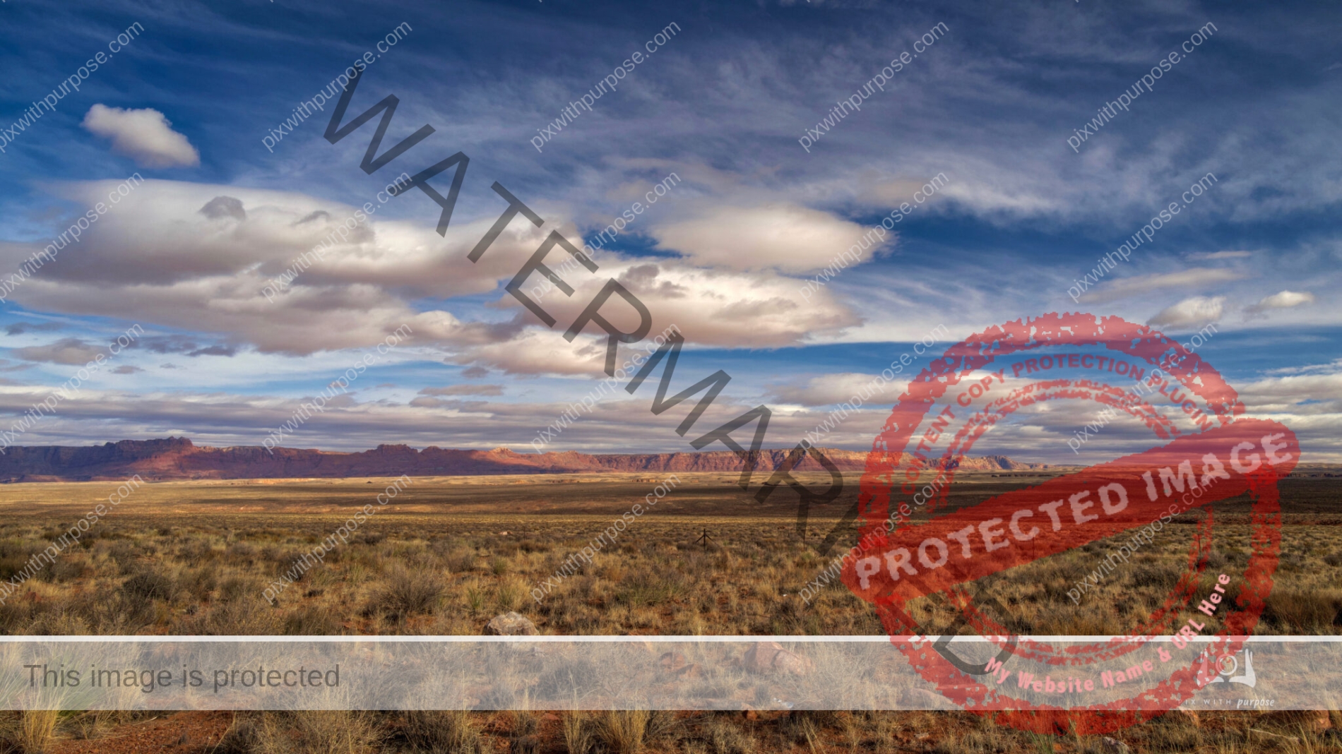
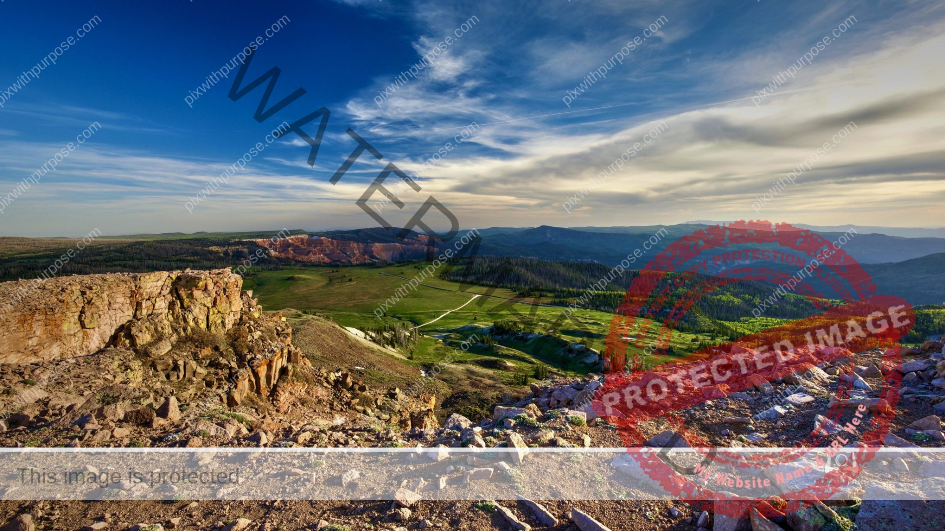
Big sky Utah
I took this in the general area of Bryce Canyon National Park. The 120 mile route from Bryce to Capital Reef National Park is a beautiful trip with ever-changing scenery.
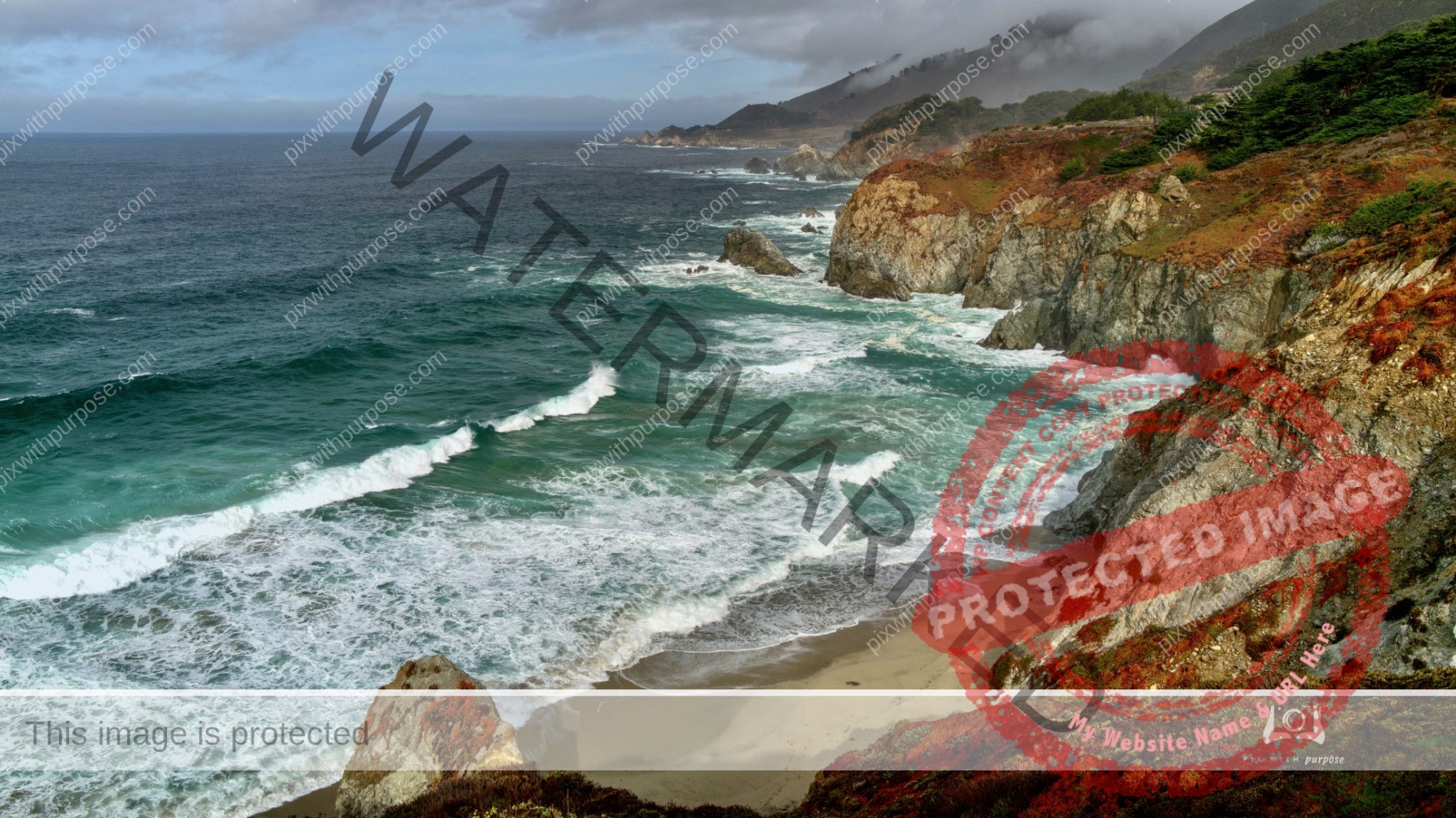
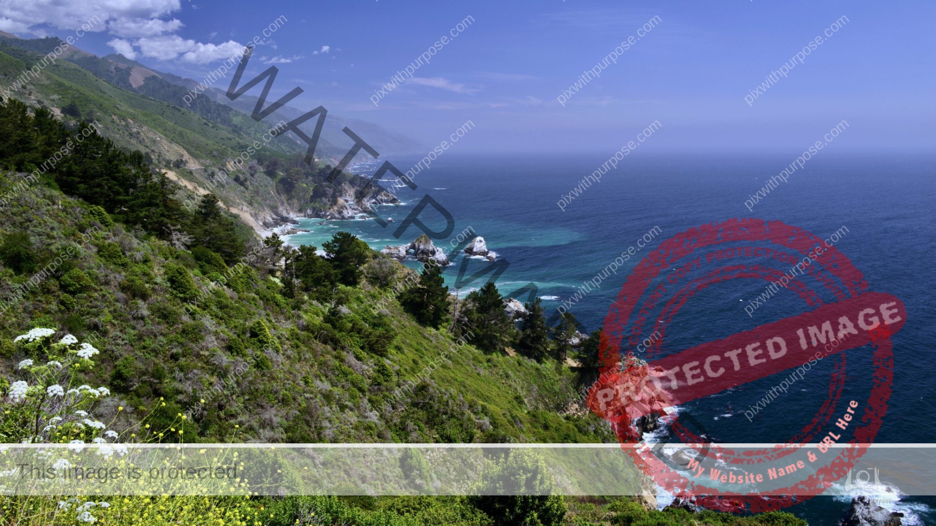
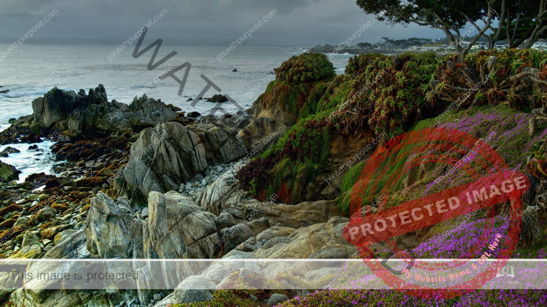
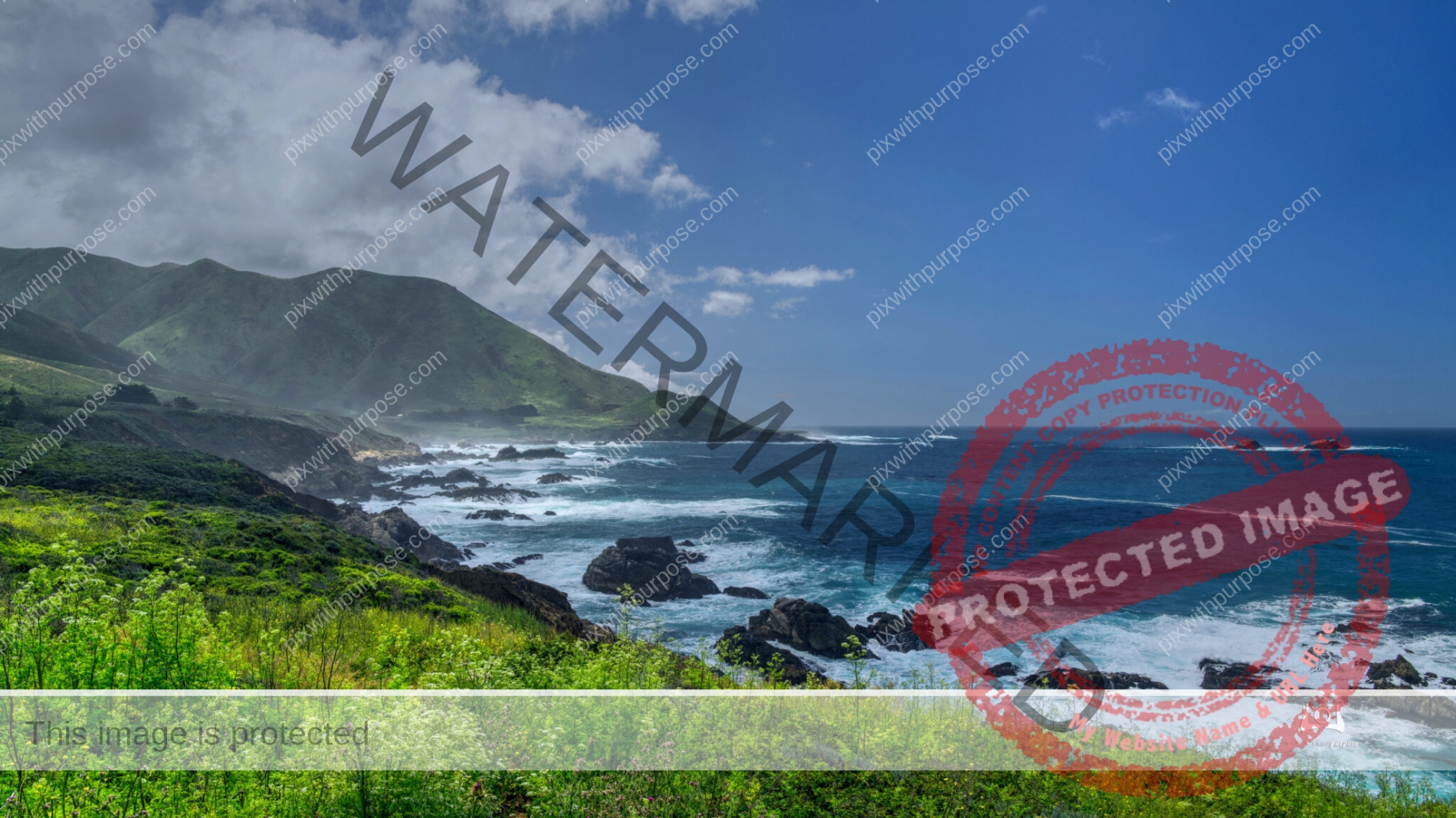
Pacific Coast CA
PacState Route 1 is a scenic highway that runs along most of the Pacific coastline of the U.S. At 656 miles (1,056 km), it is the longest state route in California. Wikipedia
Northern Utah
On a road trip to Park City
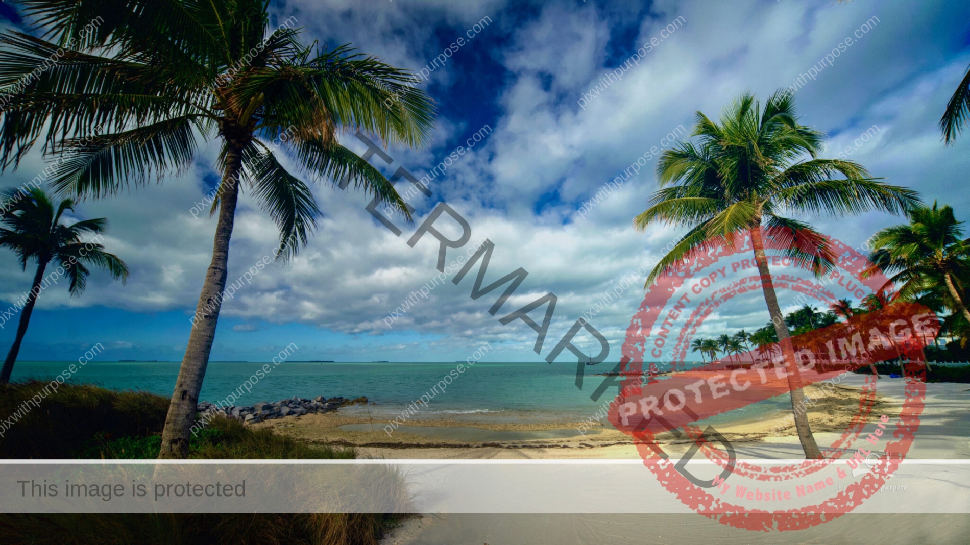
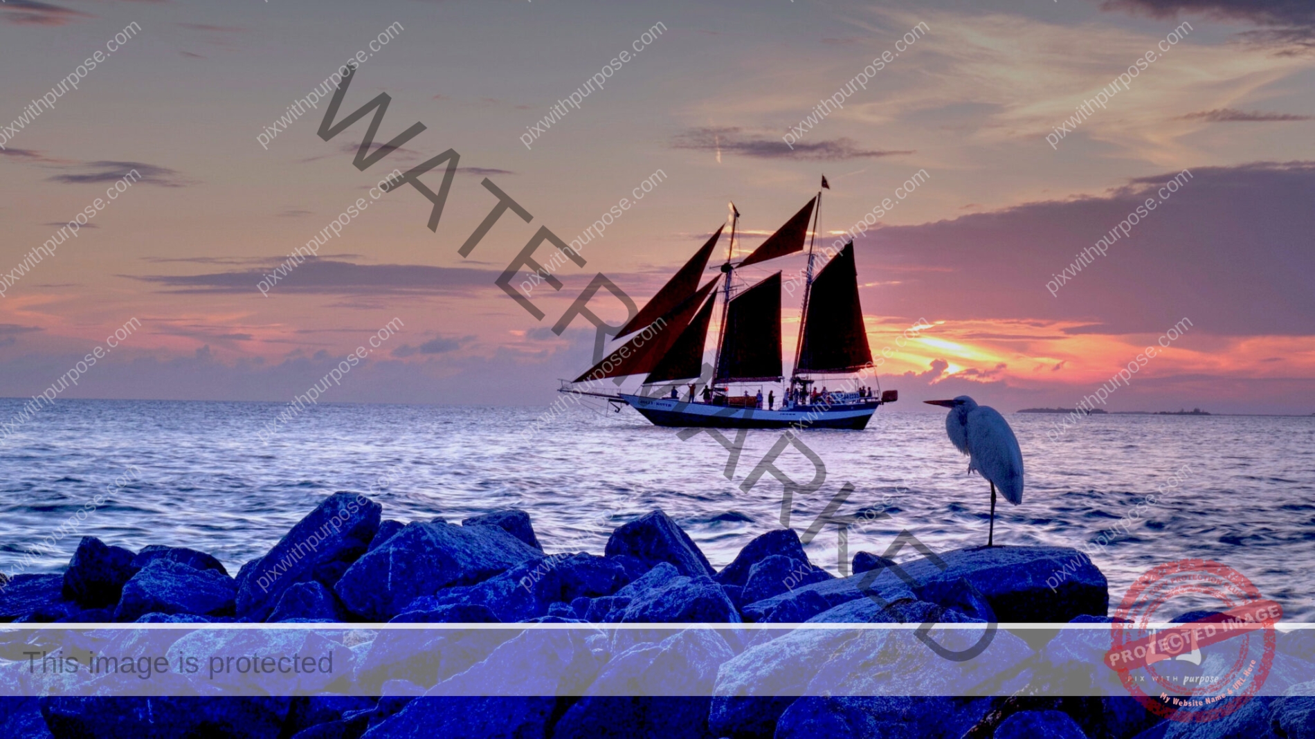
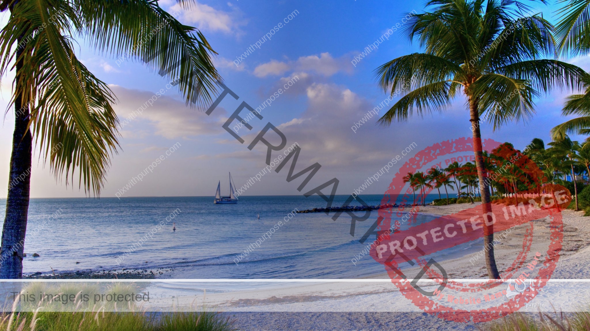
Cayo Hueso
Key West (Spanish: Cayo Hueso) is an island in the Straits of Florida. Together with all or parts of the separate islands of Dredgers Key, Fleming Key, Sunset Key, and the northern part of Stock Island, it constitutes the City of Key West. Wikipedia
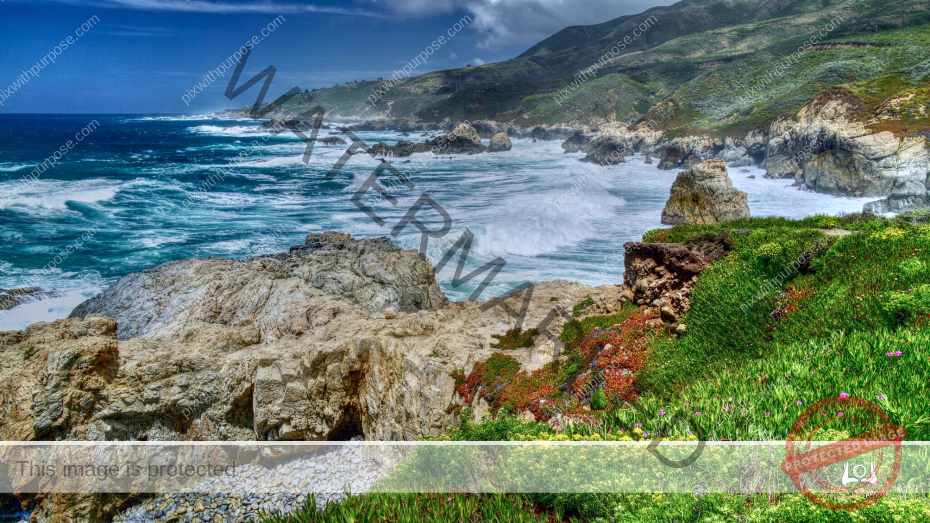
California Coastal Color
Along US1 near Monterrey
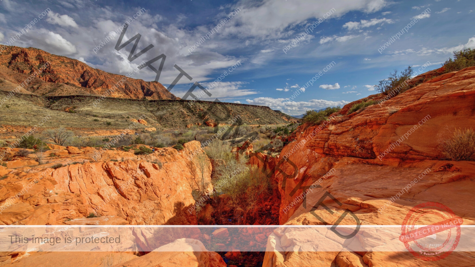
Ivins Utah
Ivins is a city in southwestern Washington County, Utah. It is a part of the St. George Metropolitan Area as a suburb. The population was 8,978 at the 2020 census. The elevation is 3100 feet. On the other side of these very red Navajo sandstone mountains lies Snow Canyon State Park.
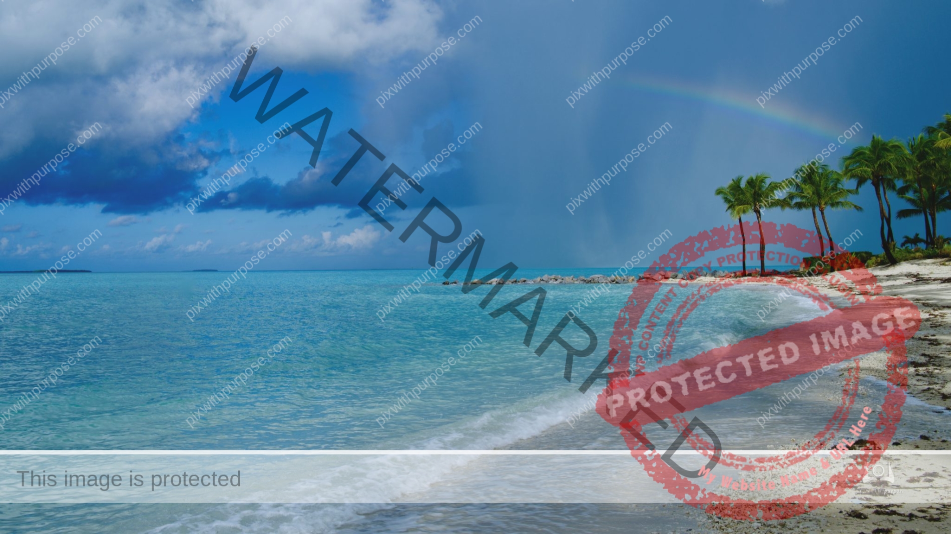
Rainy tropical sunrise
Walking the beach in Key West during a light rain and the sky lit up from imbedded lightning while the sun rose.
Old World Wisconsin
Old World Wisconsin is an open-air museum located near Eagle, Wisconsin. It depicts housing and the daily life of settlers in 19th-century Wisconsin, with separate areas representing the traditions of different ethnic groups who settled in the state. Costumed interpreters portray the occupations and chores of typical settlers of the time.Wikipedia
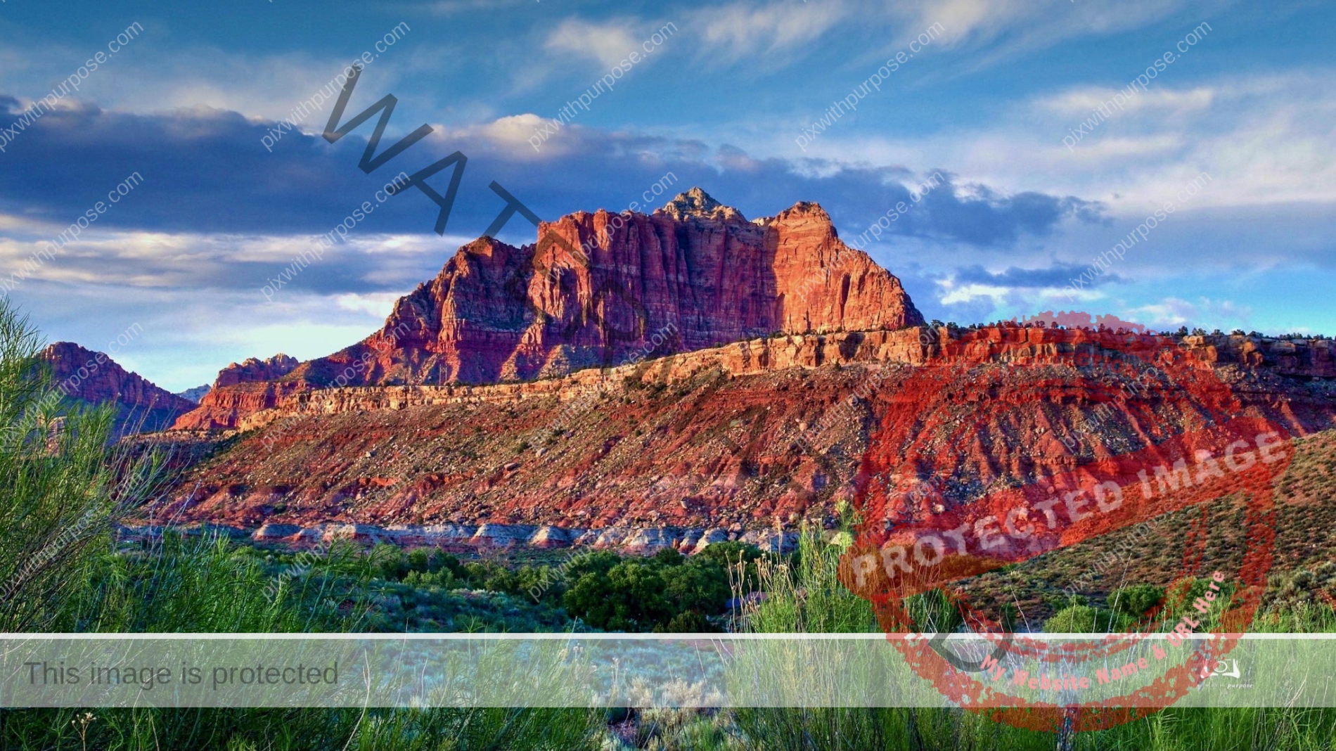
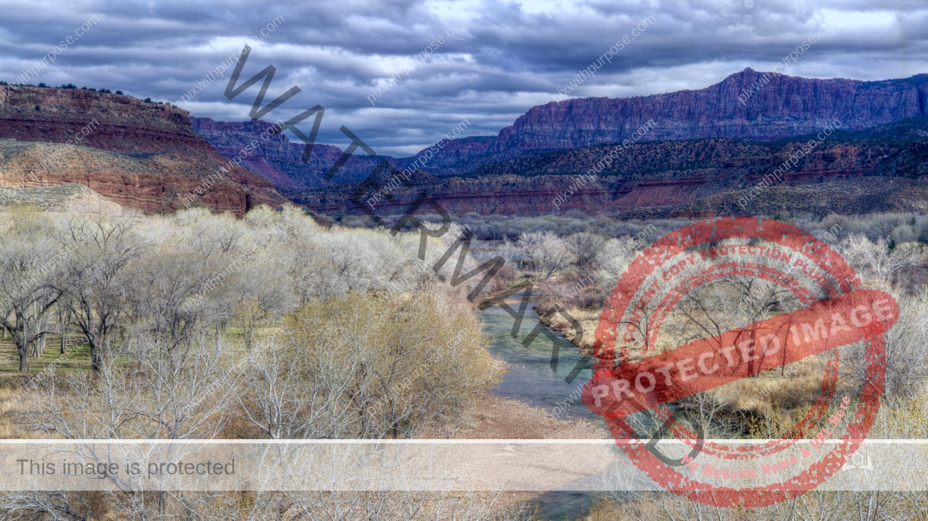
Near Zion
Outside of Zion National Park this serves as a background for the abandoned town of Grafton. At the base, and reason for the towns settlement is the Virgin river which carved the landscape here and created Zion Park a few miles away.
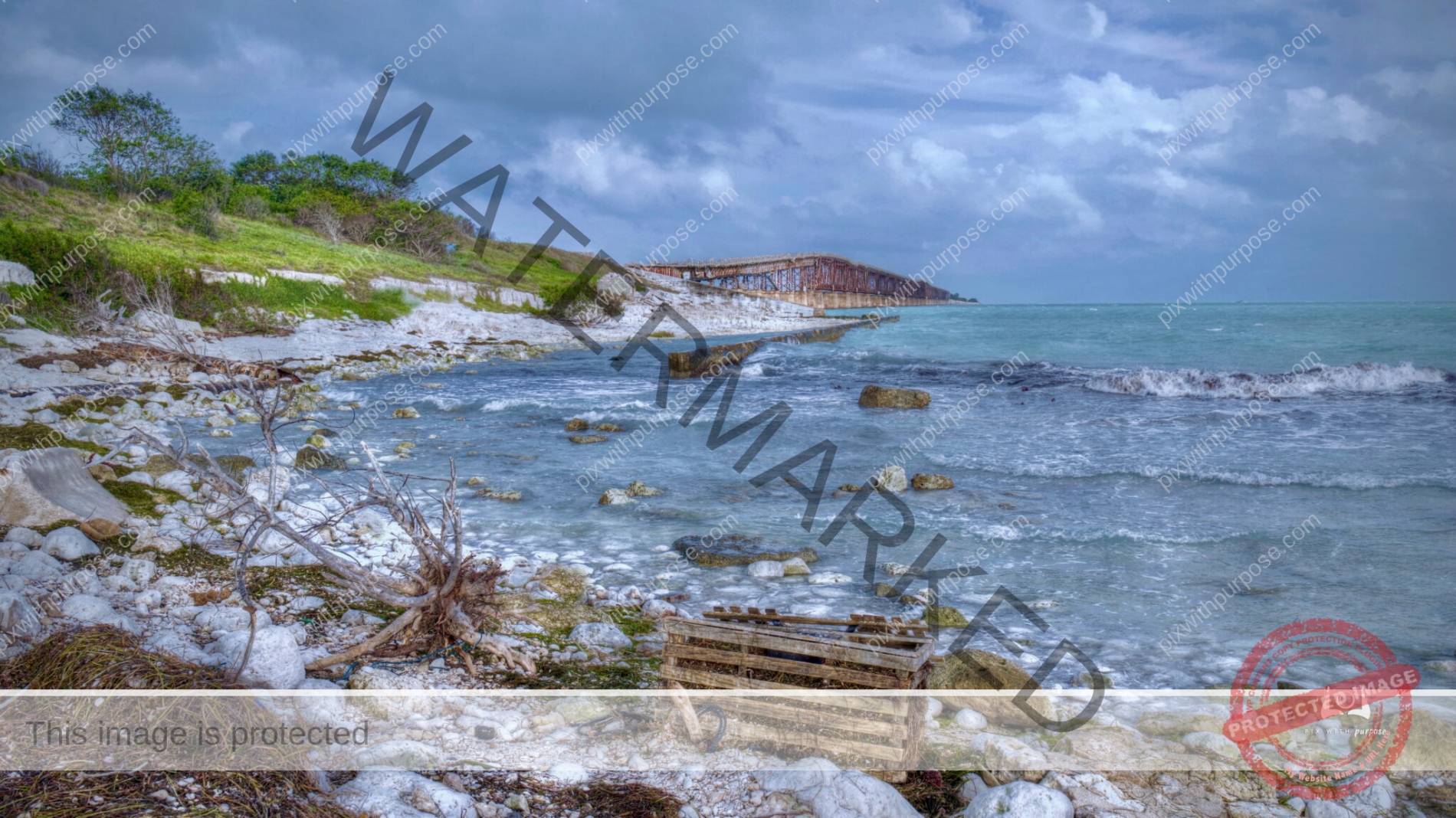
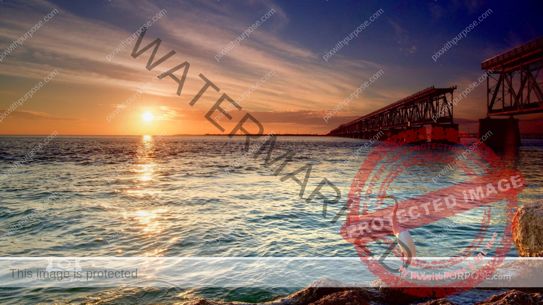
Florida Keys Bahia Honda Bridge
The Bahia Honda railroad bridge was originally built by Henry Flagler as part of the FEC's Overseas Railroad. Opened in 1912, The Labor Day Hurricane of 1935 destroyed much of the line and it was purchased by the state of Florida and converted for highway use in 1938. A new four-lane bridge was built and opened in 1972, a few hundred yards north of the old bridge, replacing the former route of U.S. 1. Wikipedia
Two Pots of Gold
Pine Mountain Utah
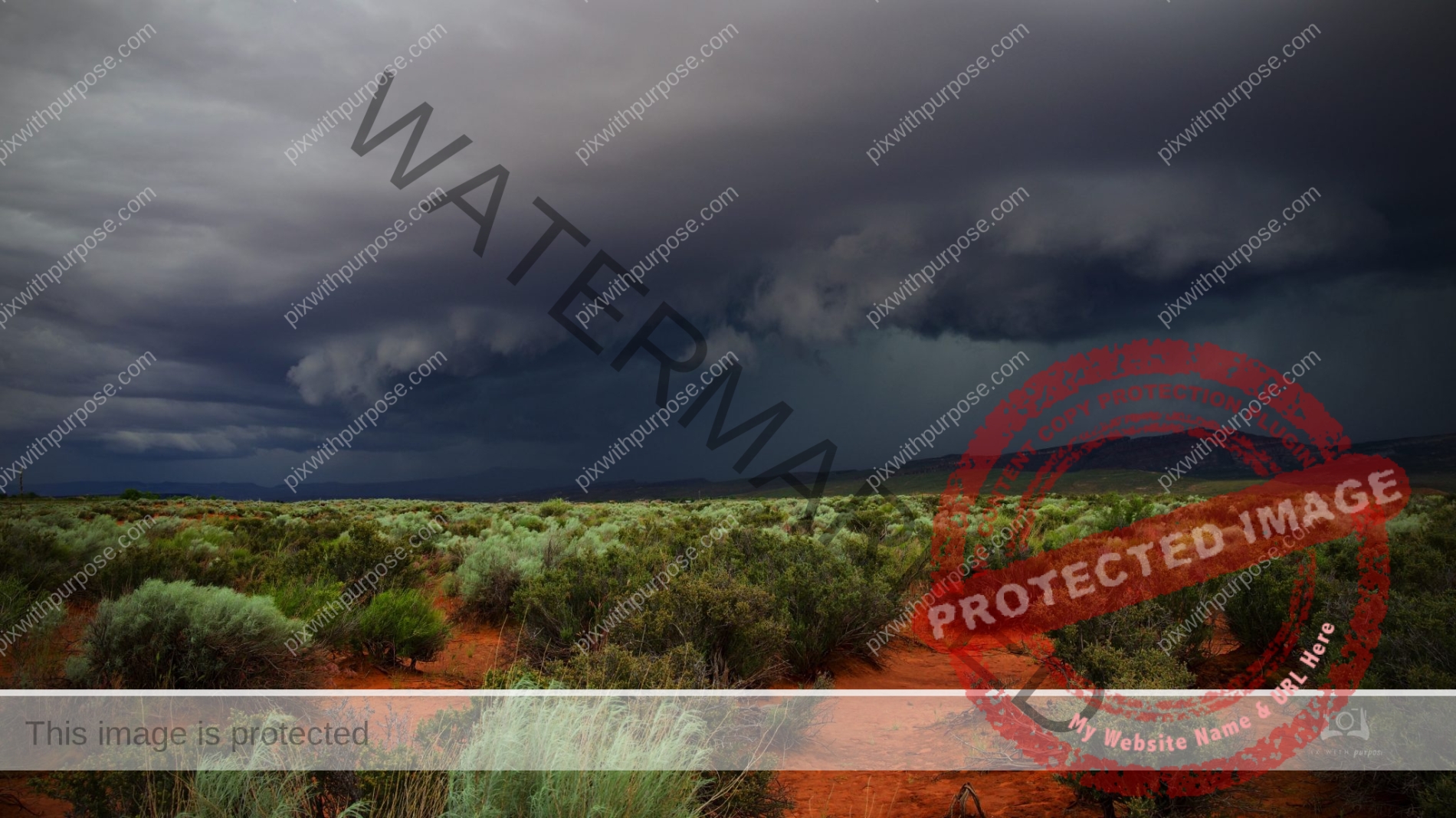
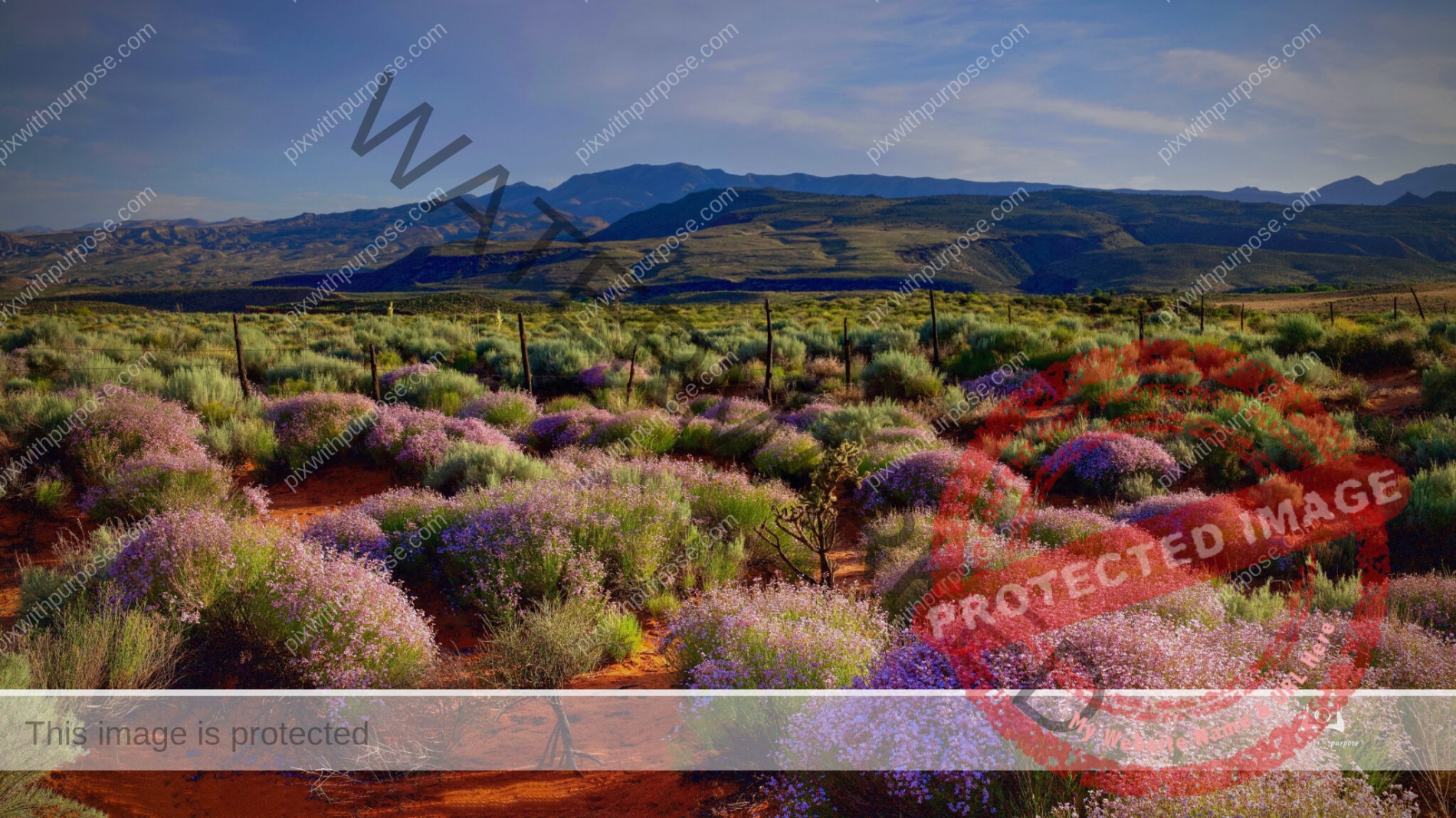
Monsoon Season Begins
The desert just woke up … The air smelt of creosote, and the distinctive olive-green bush with oily leaves was filled with bright yellow flowers. Wildflowers and a barrel cactus, withered and dry a few days ago, were blooming… dragonflies and birds filled the air, lizards, quail and roadrunners scuttled on the ground, a jackrabbit hopping across the trail, and a cardinal, with its bright red plumage flying by. Sunset brings bats, the sounds of frogs and the howl of coyotes. The desert awakes…
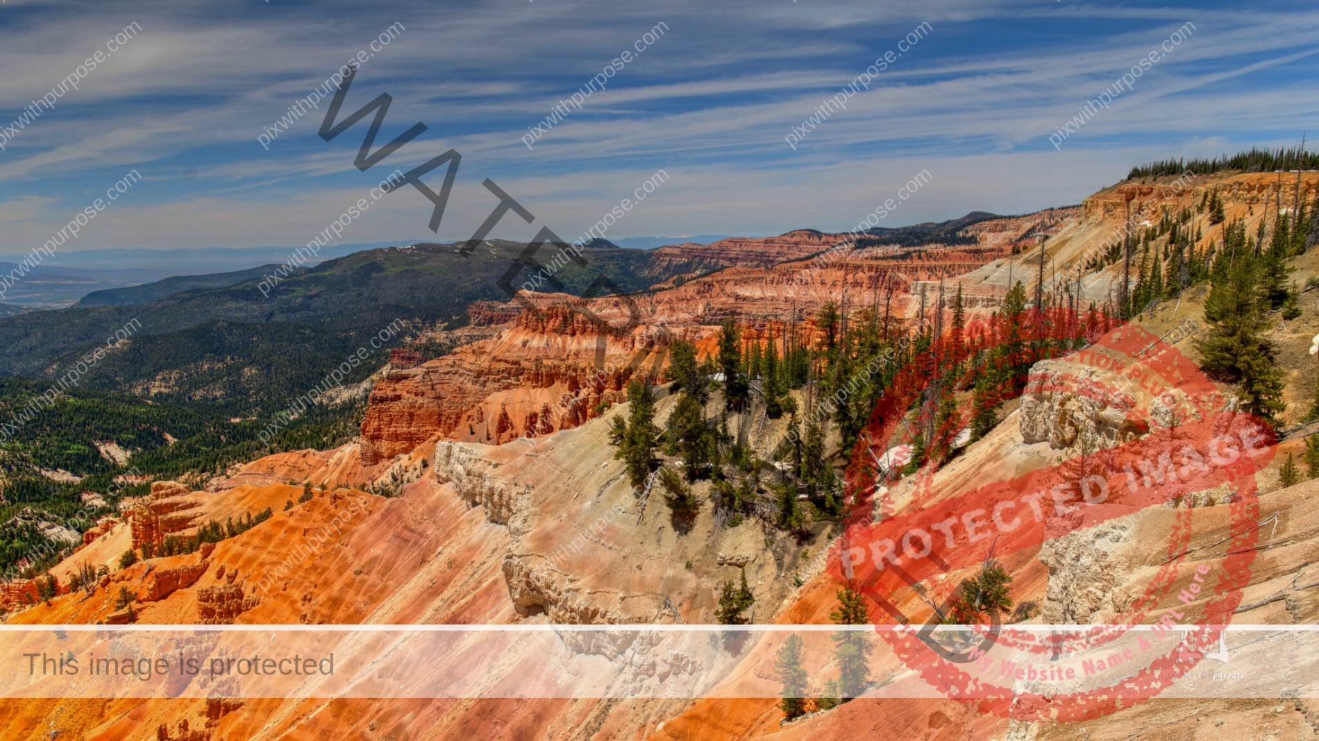
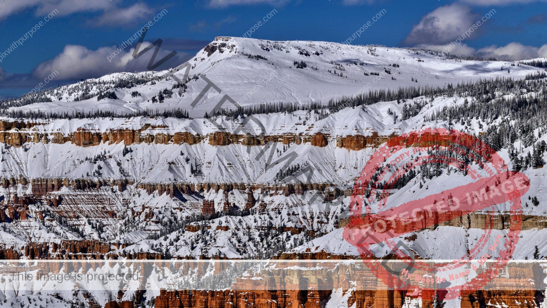
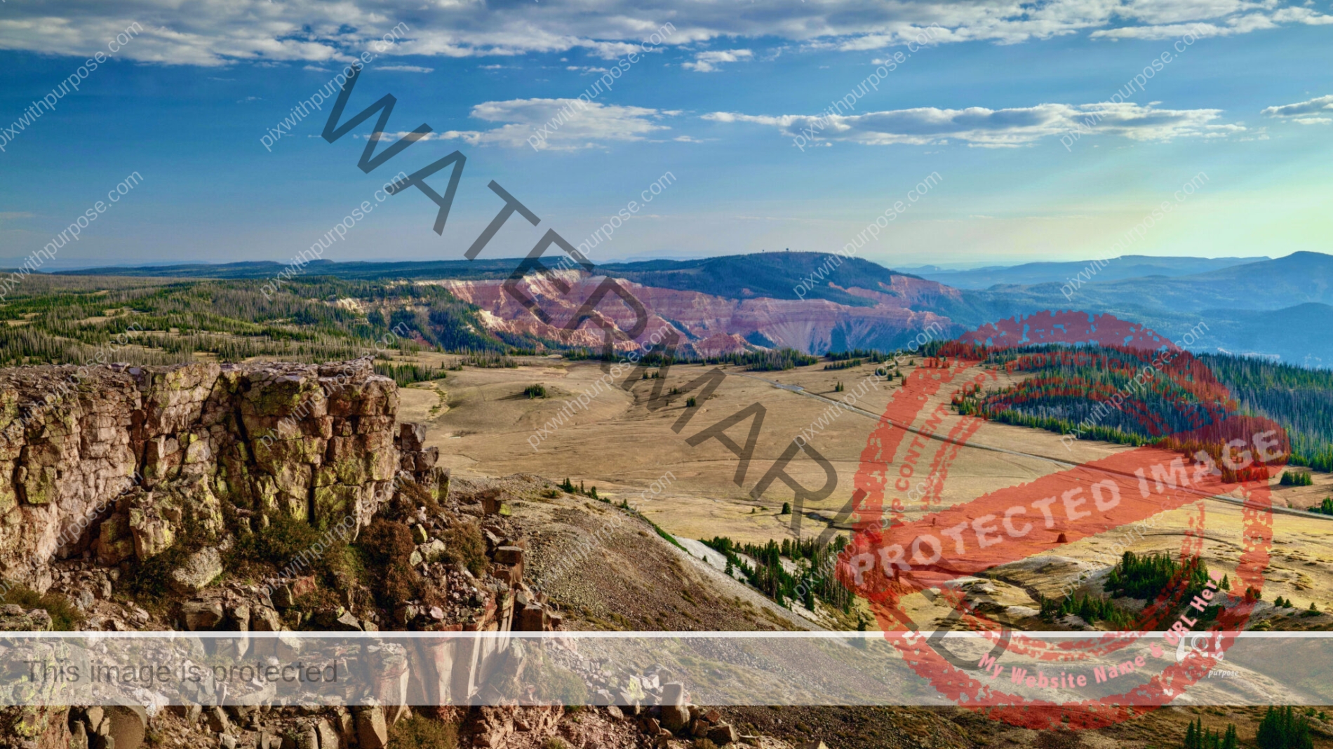
Cedar Breaks National Monument
Cedar Breaks National Monument is a U.S. National Monument located in the U.S. state of Utah near Cedar City. Cedar Breaks is a natural amphitheater, stretching across 3 miles, with a depth of over 2,000 feet. The elevation of the rim of the amphitheater is over 10,000 feet above sea level. Wikipedia
Pine Mountain Utah
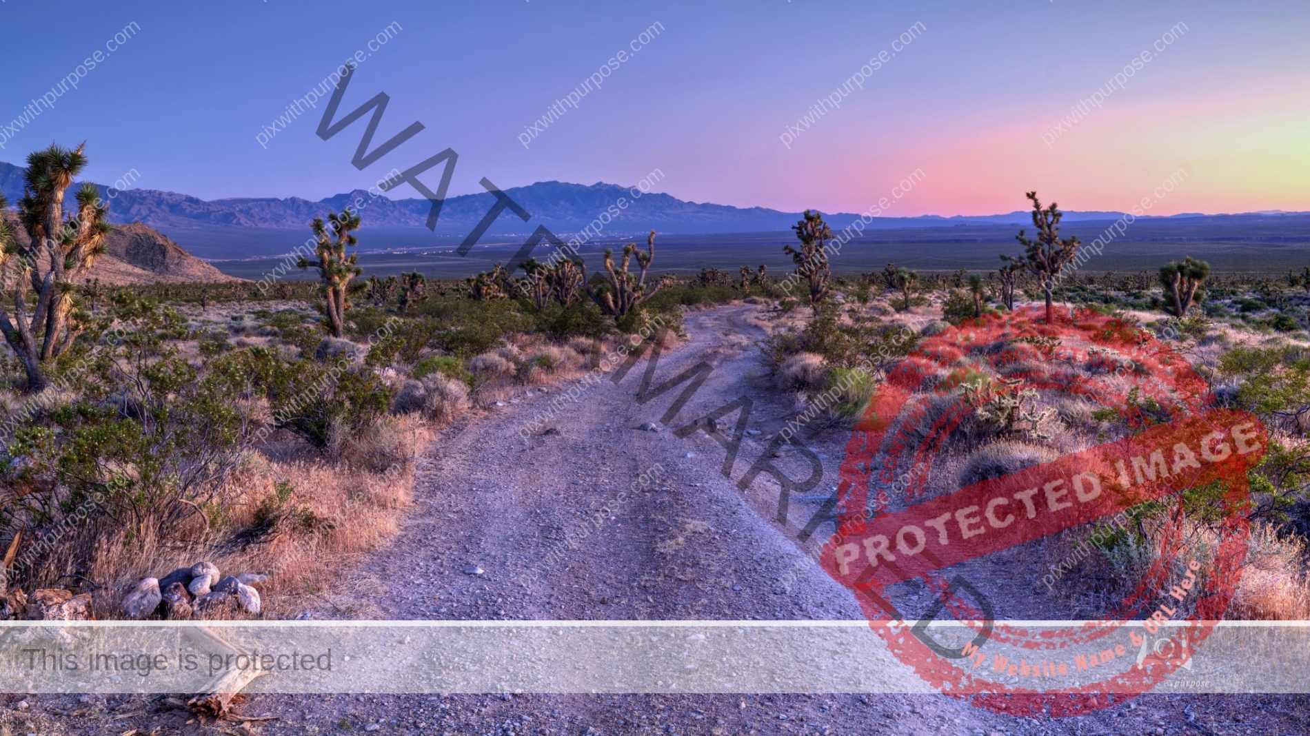
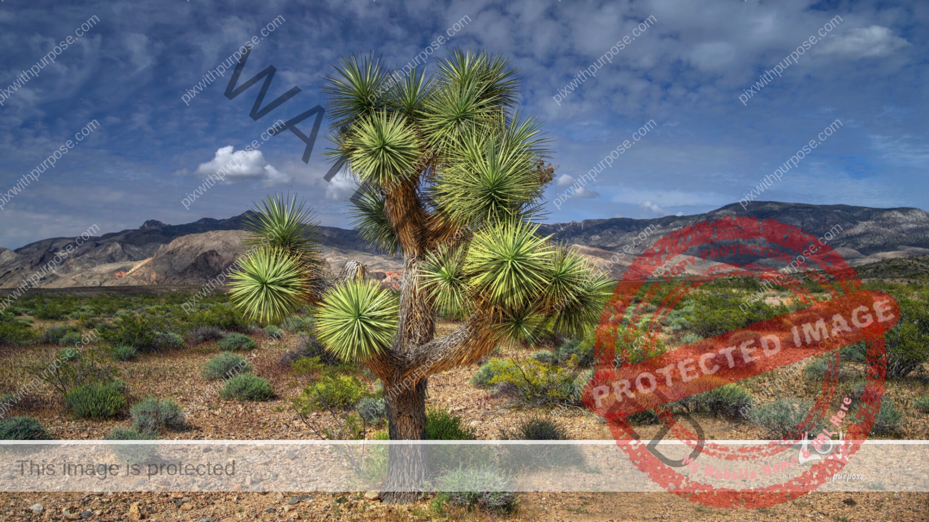
Joshua Trees in Gold Butte
Gold Butte National Monument is located northeast of Las Vegas and south of Mesquite. The monument protects nearly 300,000 acres of desert landscapes featuring a wide array of natural and cultural resources, including rock art, sandstone towers, and important wildlife habitat for species including the Mojave Desert tortoise, bighorn sheep, and mountain lion. The area also protects historic ranching and mining sites such as the ghost town of Gold Butte. Wikipedia
Mesquite
Rugged road through some Joshua trees with Mesquite Nevada way off in the distance. Not quite sure if I'm standing in Arizona or Utah because all three states are at this location, pretty close together. Beautiful spot to be for sunset due to the light and silence.
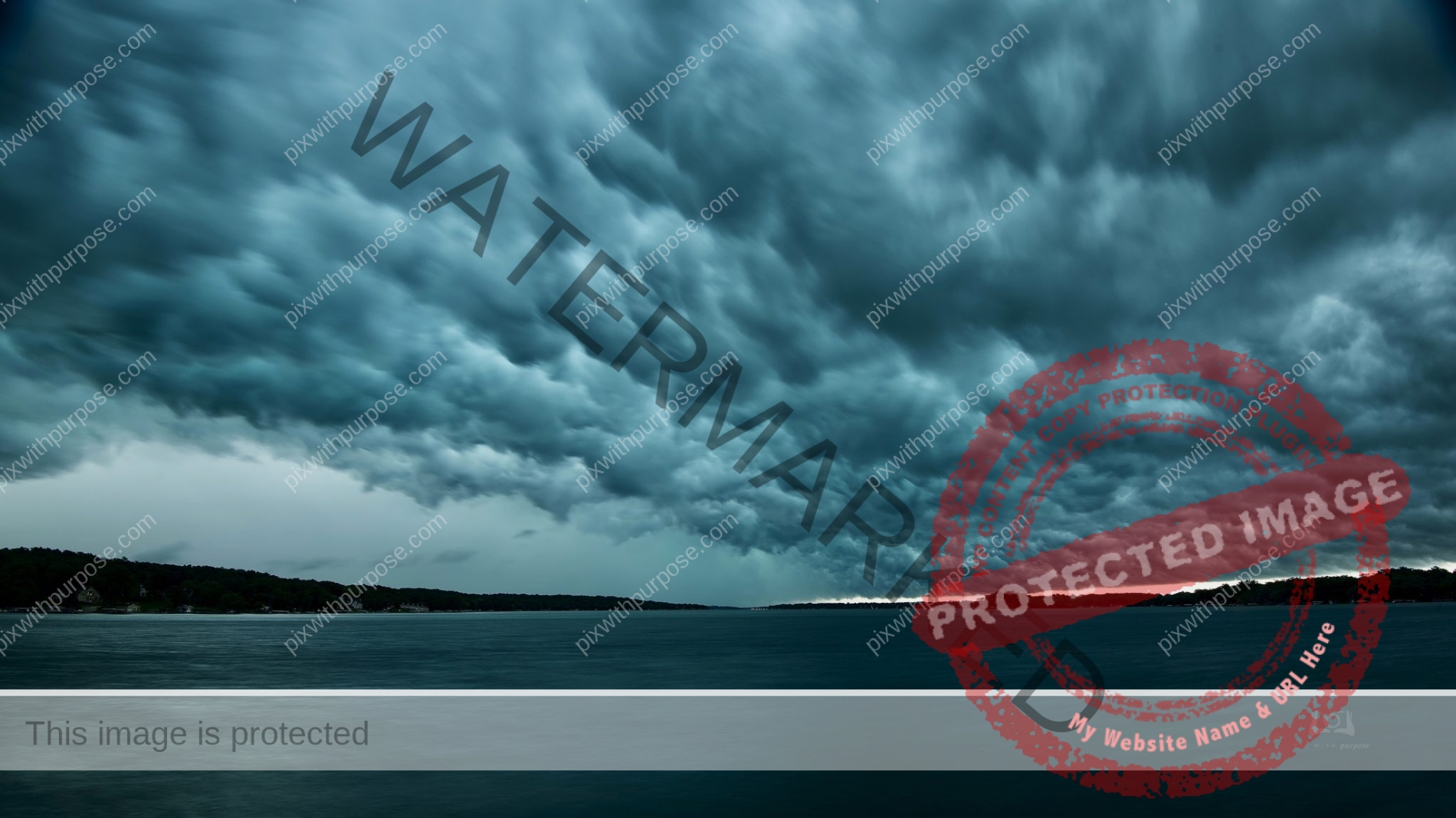
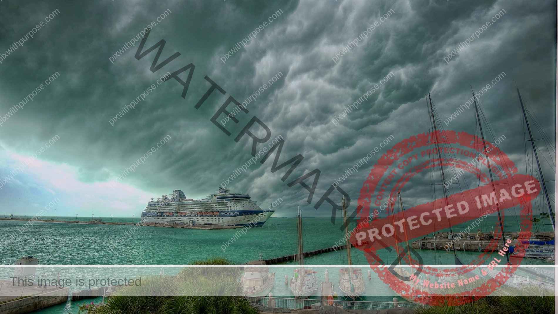
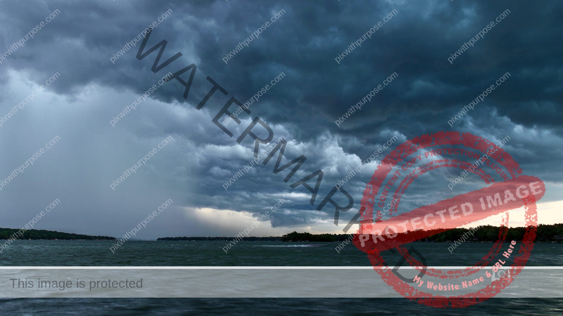
Squall
This one sent a strong message to the boaters that day.
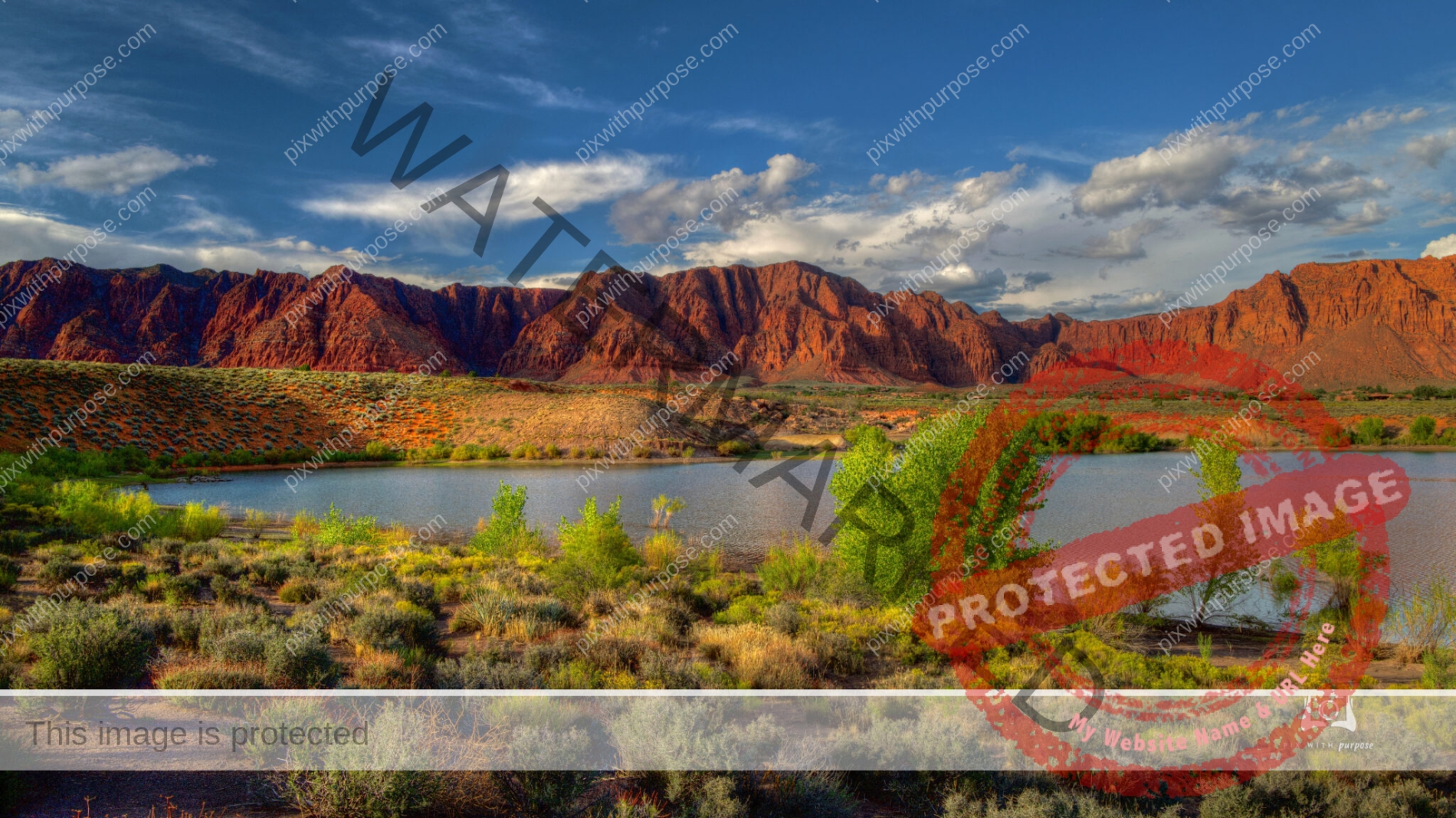
Gunlock State Park
For much of the year, Gunlock experiences relatively low traffic. Gunlock Reservoir is a small, quiet body of water where you can fish for bass and catfish. Others enjoy participating in water sports like wakeboarding and waterskiing.
During certain times of the year, the reservoir gets full enough that the Gunlock waterfalls begin to flow into the Santa Clara River. This typically happens in early spring, as snow starts to melt. When the falls are active, the area gets much busier than usual but It’s worth it, however, to get a glimpse of the water jetting over Southern Utah’s signature red rocks. Utah Travel Site

Winter In Gunlock Utah
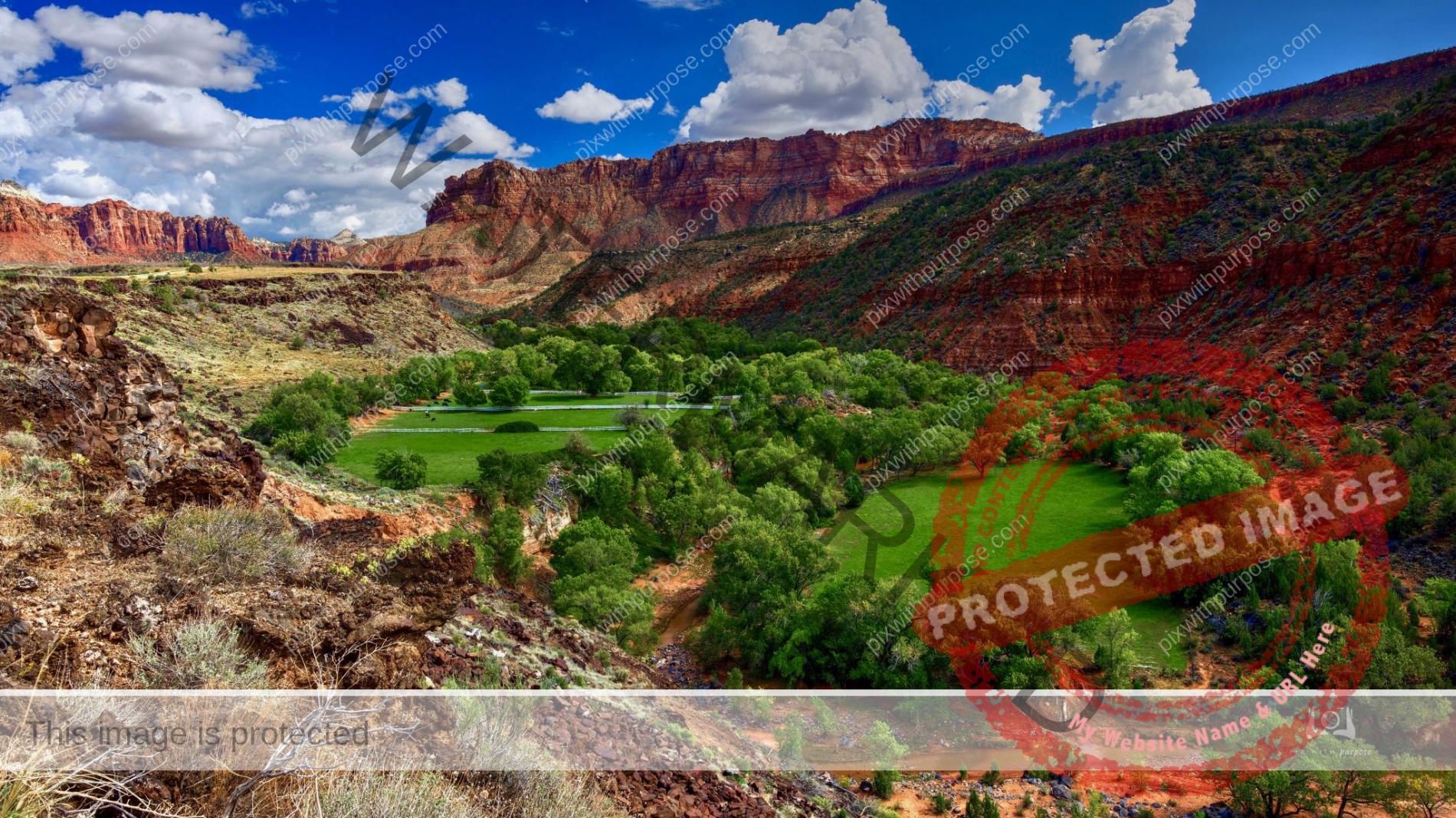
Horse Ranch
Located in a very deep valley alongside a river with Zion National Park as background.
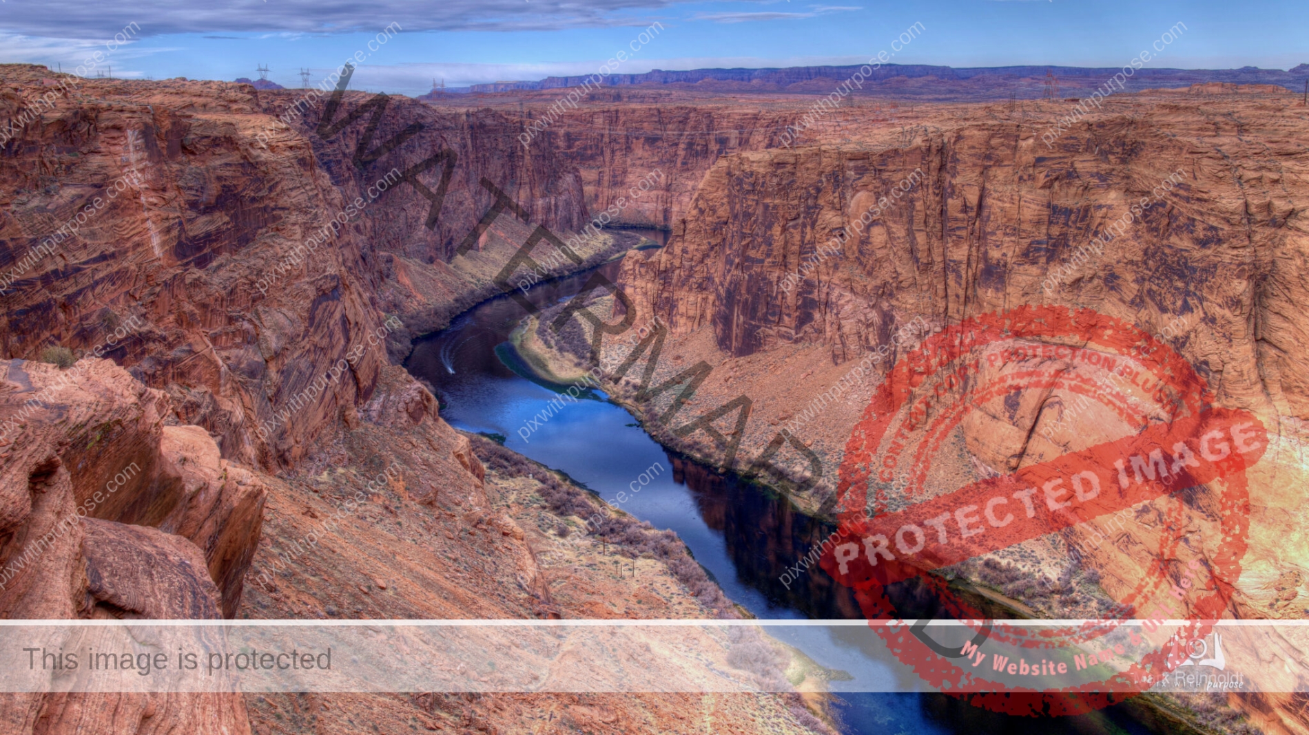
Colorado River
Over my right shoulder around a bend is the Glen Canyon dam holding back Lake Powell. This is downstream from the dam with the river about 750 feet below me. You may be able to make out a boat about 1/2 way into the photo to give you an idea of scale.
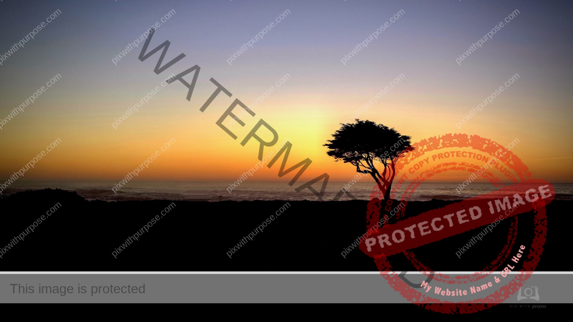
As seen on tv
I'm not a golfer but I've heard this is one of the iconic cypress trees seen along the ocean on a particular hole at Pebble Beach CA.
PCH
The Pacific Coast Highway is about 1600 miles of photo opportunities. It follows the coast from Seattle to San Diego. This photo was taken along the 600 mile section in California near Big Sur.
Gunlock Reservoir Overflow
Fed by a record snowpack in the surrounding mountains, the waterfalls at the Gunlock Reservoir near St. George UT is flowing again and unleashing a torrent of water and visitors.
It’s the third time in the past five years the water from the reservoir has cascaded over the dam and spilled onto the cliffside rocks, creating the rare waterfalls that lure visitors from all over Utah and southern Nevada. Text credit: The Salt Lake Tribune
Almost
A full double over the Red Mountains in Ivins Utah
Desert Color
Ivins Utah is on the outskirts of St George bordered by red sandstone mountains, a Paiute reservation and large tracts of BLM land. The elevation is is about 3500', almost anything can be grown with supplementary water, snow come 2x/year but rarely lasts past 10am. Air is dry, rarely gets below freezing, it gets hot in July and August without the extremes of nearby Arizona and Nevada. The soil is orange due to the sandstone mountains behind me. Spring color begins in February as the temperatures climb with the falling rain.

Sunset Key West
Through a "fisheye" lens.
PG
Pacific Grove CA is called PG for those lucky enough to live there. This mornings color was nicely muted by a little fog.
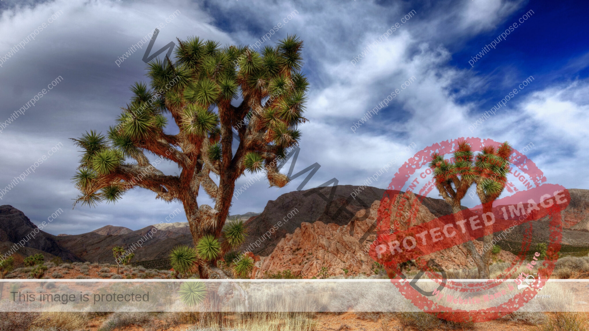
Joshua Tree
Taken in Nevada at Gold Butte National Monument. This tree is about 10' tall and gets large white flowers when in bloom.
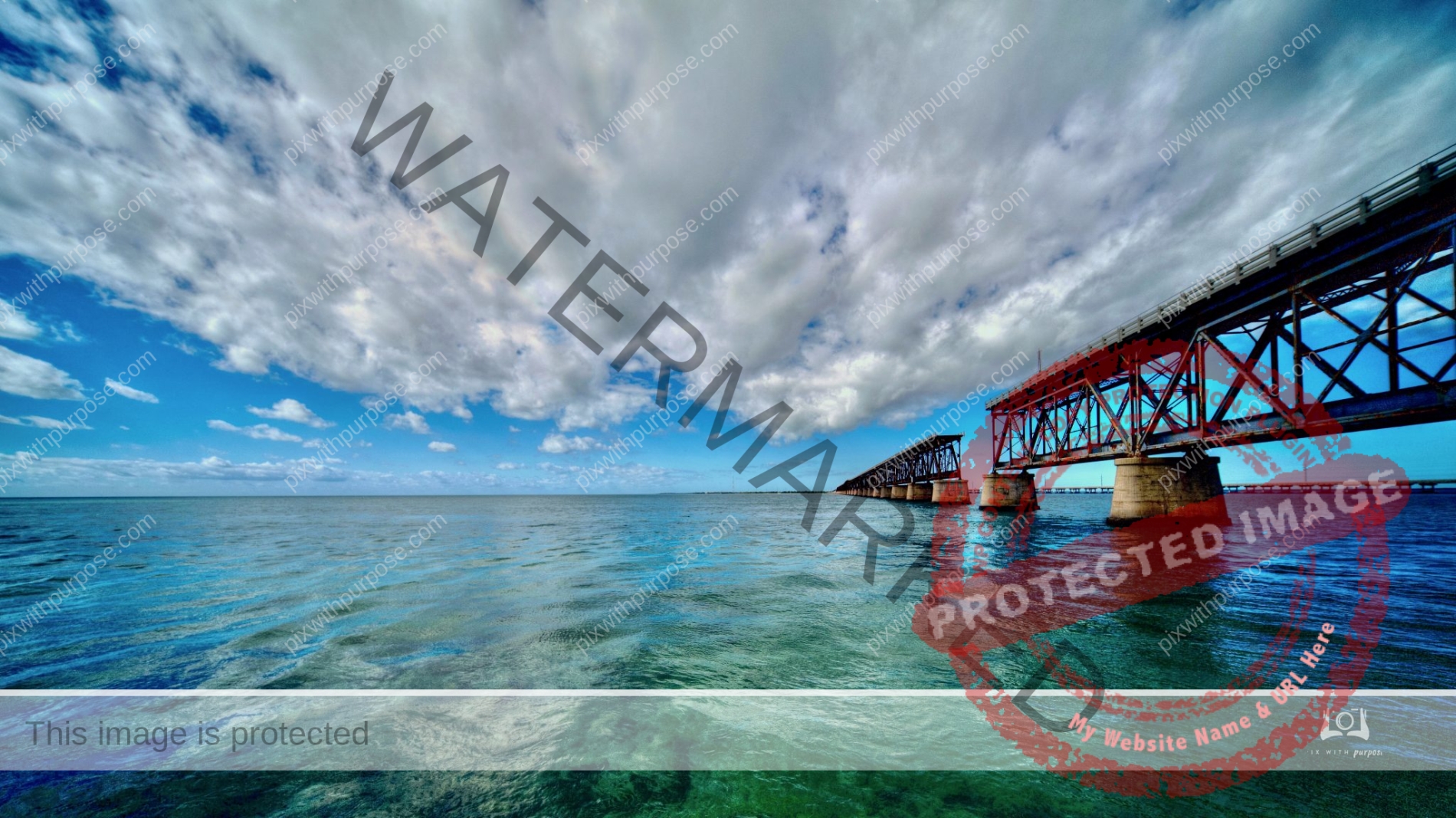
Labor Day 1935
The death of Flagler’s railroad happened on Labor Day in 1935. It began when the barometer started dropping. Nobody knew that the most powerful hurricane to ever hit the United States was on its way.
In the 200-mph winds the railroad cars were blown off the track. Only the locomotive, which weighed 320,000 pounds, stood up to the storm. More than 400 bodies were recovered. Most had drowned though others were killed by flying debris.The Flagler railroad was lost too.
When I drive across the New Seven Mile Bridge now I crane my neck to look at the Old Seven Mile Bridge and I see ghosts.
Jeff Klinkenberg - Historian
Hear it?
Some photos just naturally come with a soundtrack.
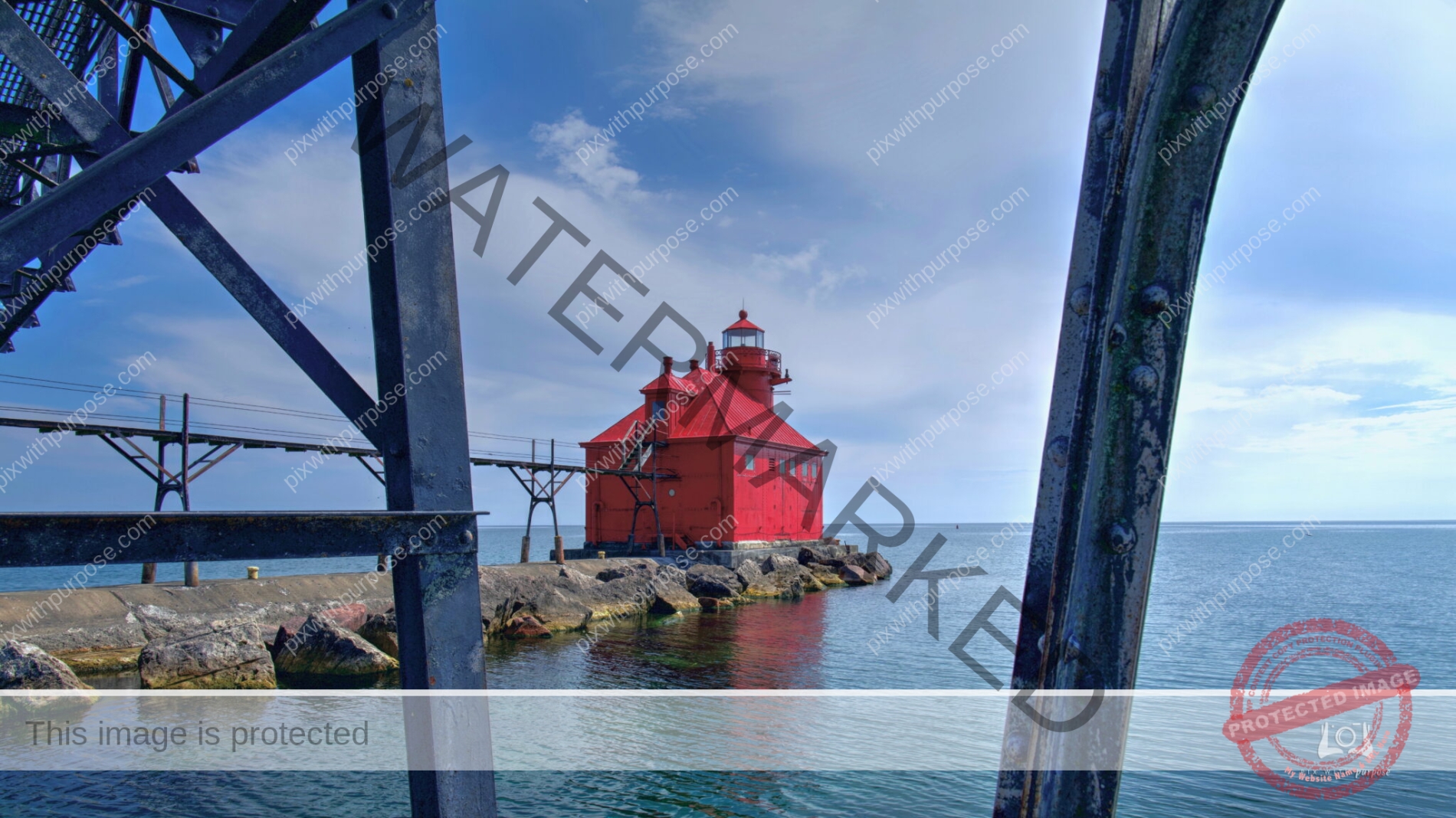
Sturgeon Bay Ship Canal North Pierhead Light
This impressive structure is located at the fully operational U.S. Coast Guard station on the Lake Michigan end of the Sturgeon Bay ship canal. The Pierhead navigation light was built in 1882, and the station was built with a tower light in 1899, renovated in 1903, and automated in 1972. The lower level breakwall is the only section of the grounds that are open to the public.
Cedar Breaks
The far peak is 11,300 feet. It's accessible by preferably 4WD vehicle a few months a year.
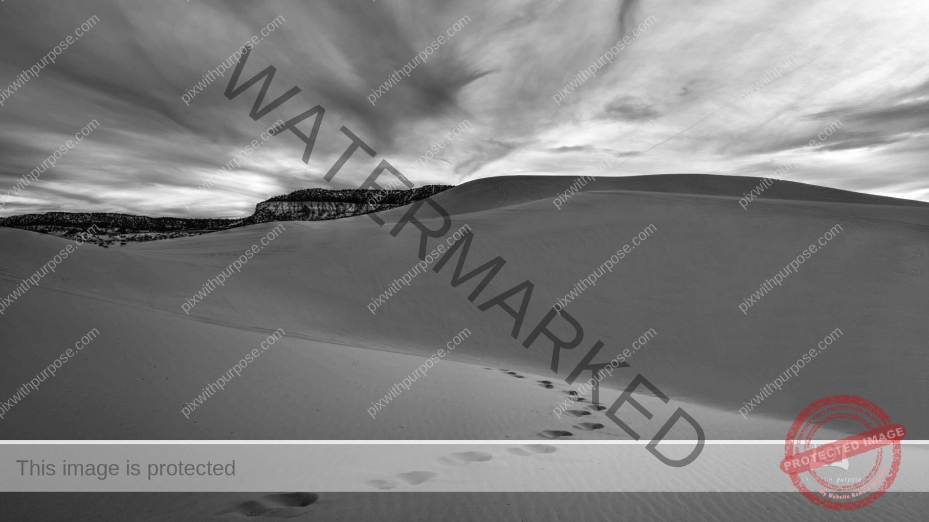
Sandy Sunrise
Arrived at Coral Pink Sand Dunes (Utah State Park) before sunrise. Hiked out into the dunes hoping for a bright sky to light up the pink sand but overcast skies made me try black & white instead.
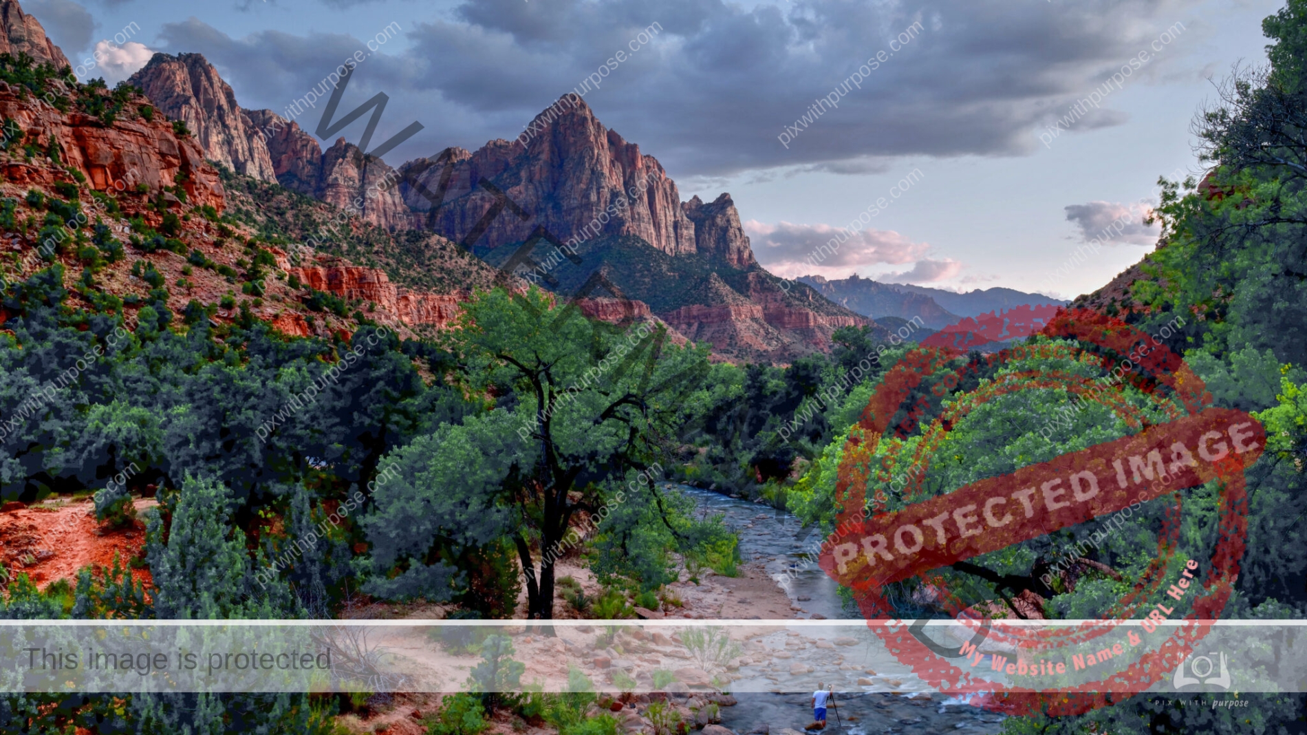
Zion National Park
Big Sky Country
The clouds were so nice I had to pull over between Lees Ferry AZ and the Grand Canyon North Rim.
South Dakota
Colorful Composition
Gunlock State Park Utah
1880s
South Dakota

Hard to beat
Wind, surf, sunrise, beautiful clouds and a partial double rainbow all in one Key West morning.
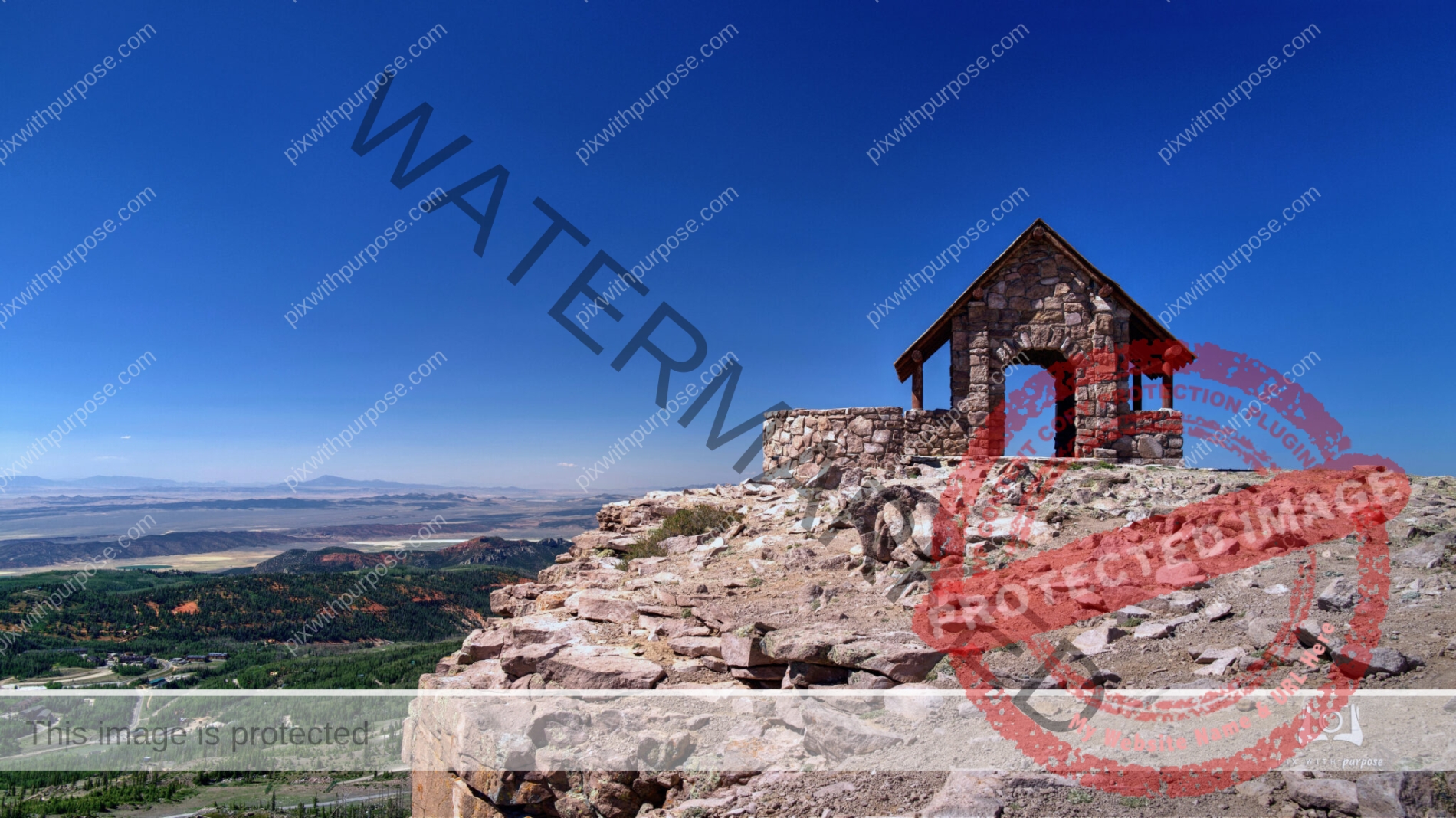
Top of the world
Brian Head peak Utah at almost 12,000 feet. On the dark side I've seen snow drifts in July. There was a small old stone shelter up here until last month when severe winds destroyed it.
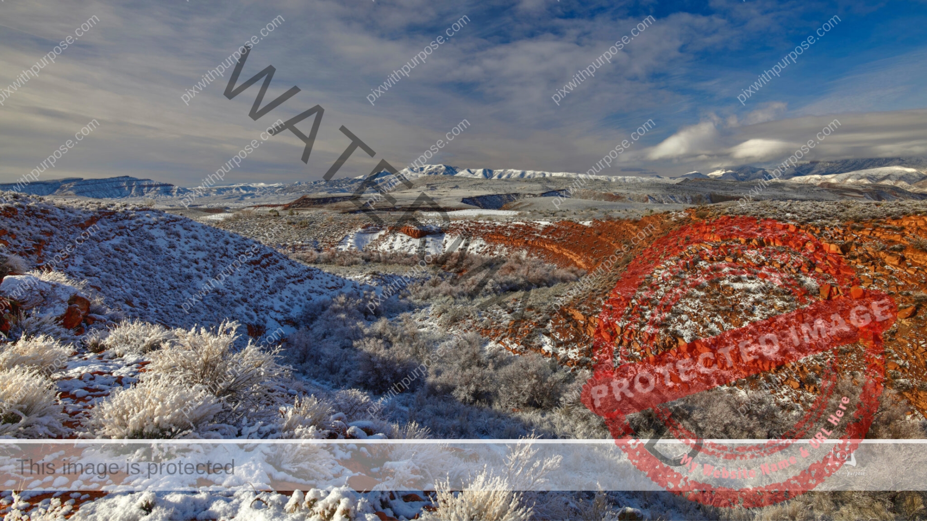
Standing in one place, shoot right then left
On this rare snow covered morning I quickly set up my camera on the edge of a wash. I turned right and shot up the wash towards the Red Mountain that borders Snow Canyon State Park then turned the camera left and took another down the wash towards the Beaver Dam mountains. I spent the previous 2-3 hours in the park taking other photos of snow covered red sandstone, sand dunes and black lava. I had to move fast because in Ivins Utah snow like this only falls every couple of years and is gone in as many hours.
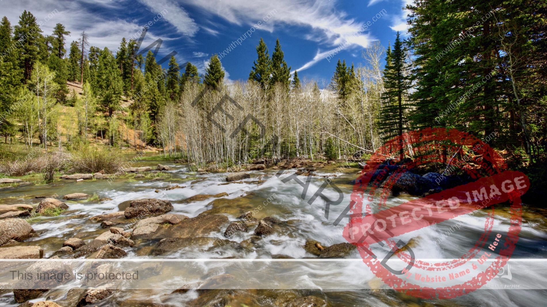
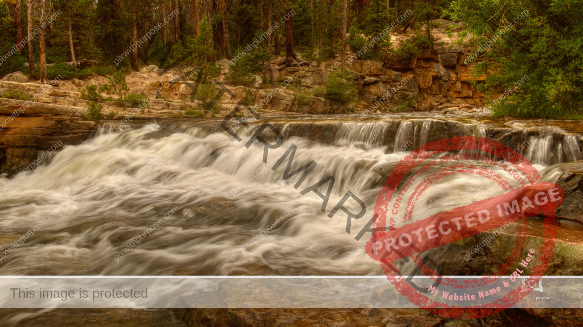
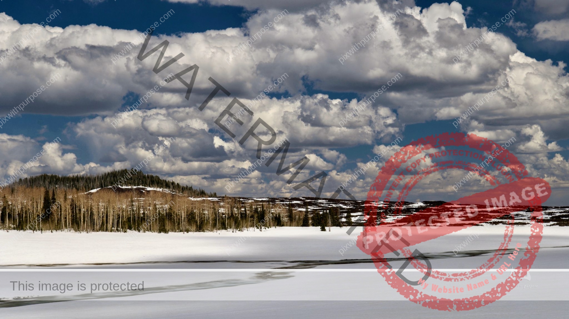
Snow Melt
This stream is at about 9,000-10,000 feet near Duck Creek UT which is between Bryce Canyon National Park and Cedar Breaks National Monument.
Pine Valley State Park
Located is SW Utah at an altitude that allows for snow all winter but only 30 minutes away is St George Utah that rarely ever gets snow.
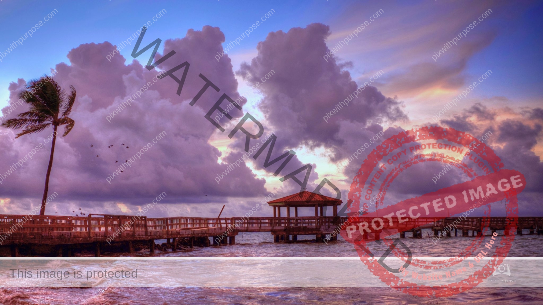
A Key West Sunset
Including Fred (really) trying to get his picture taken.
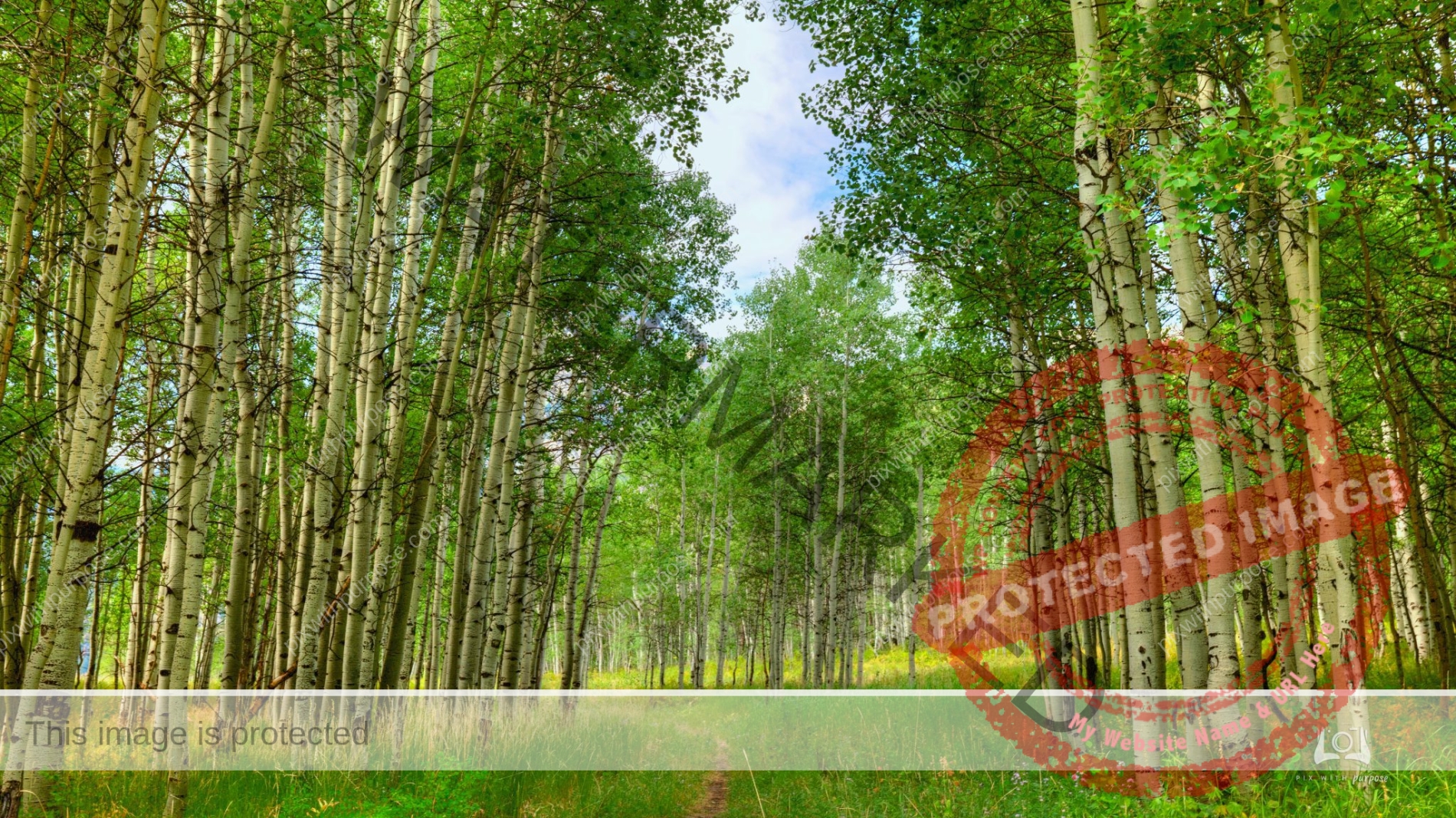
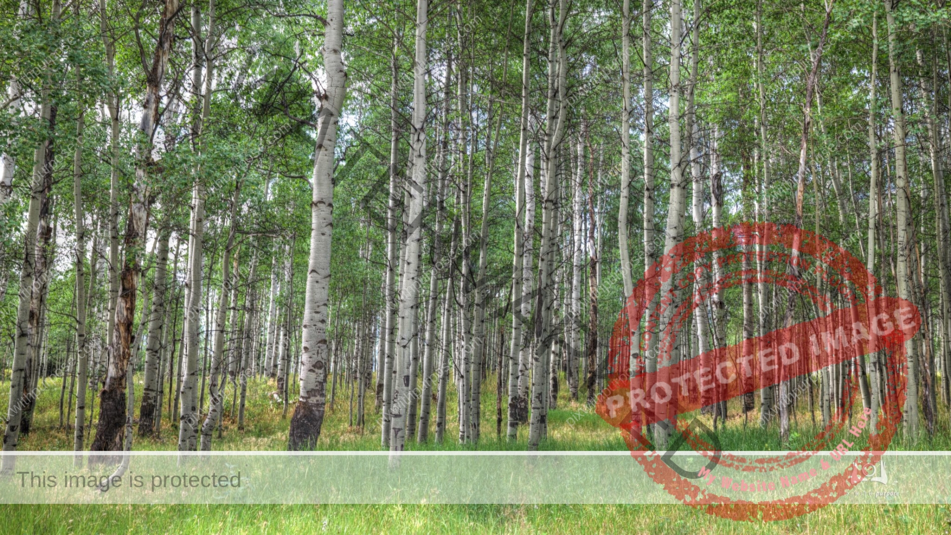
Aspen Forest
Northern Utah in the Park City area.
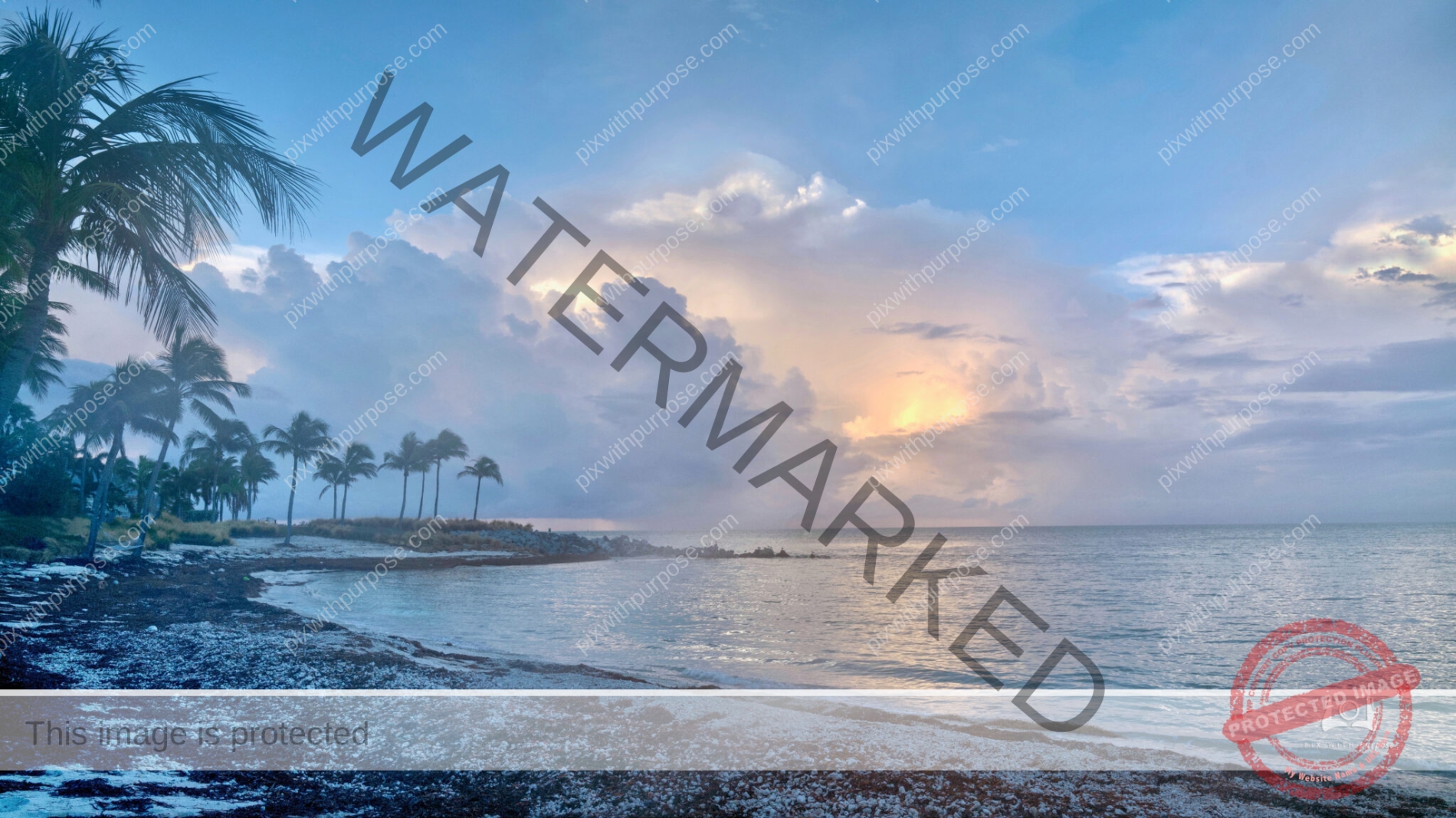
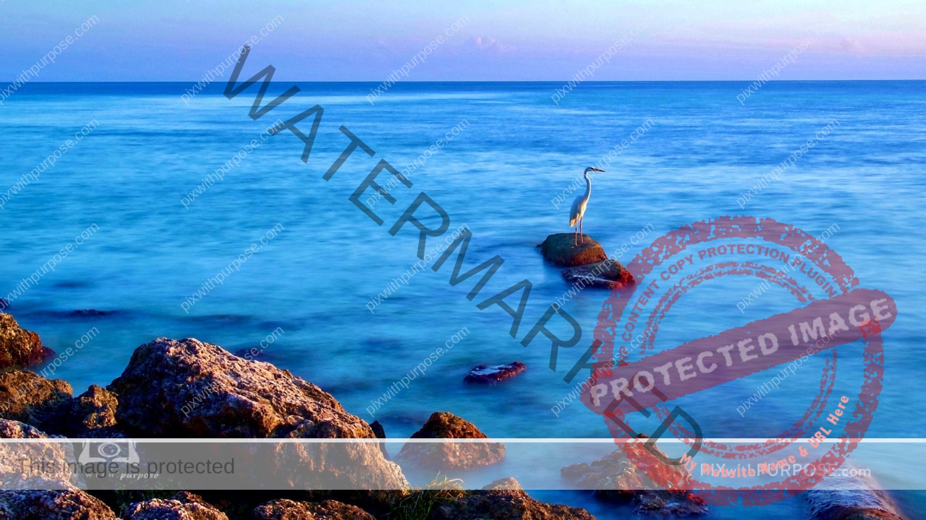
Tropical golden hour
An hour after sunrise and sunset are called the golden hours during which time the light really nice for taking certain types of photos. I took this while walking a beach in Key West.
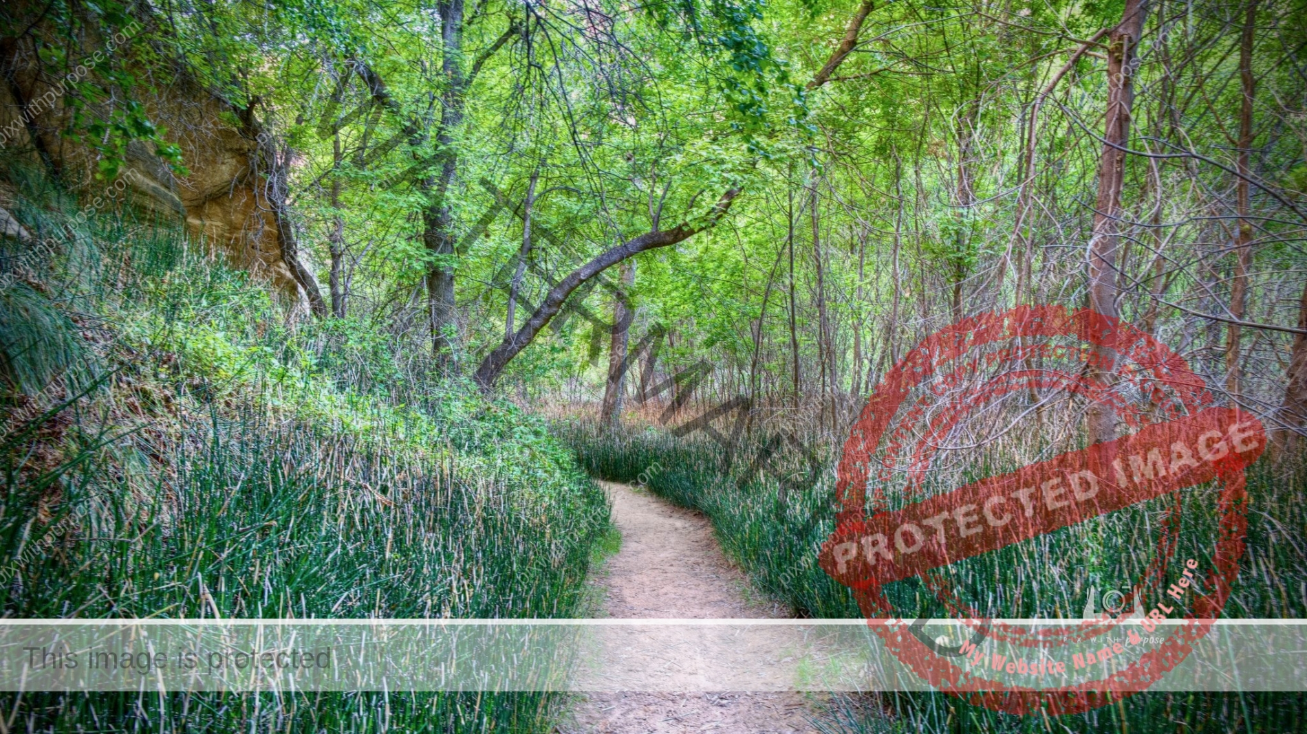
Calf Creek Canyon
Beautiful waterfall up ahead but I loved this part of the trail
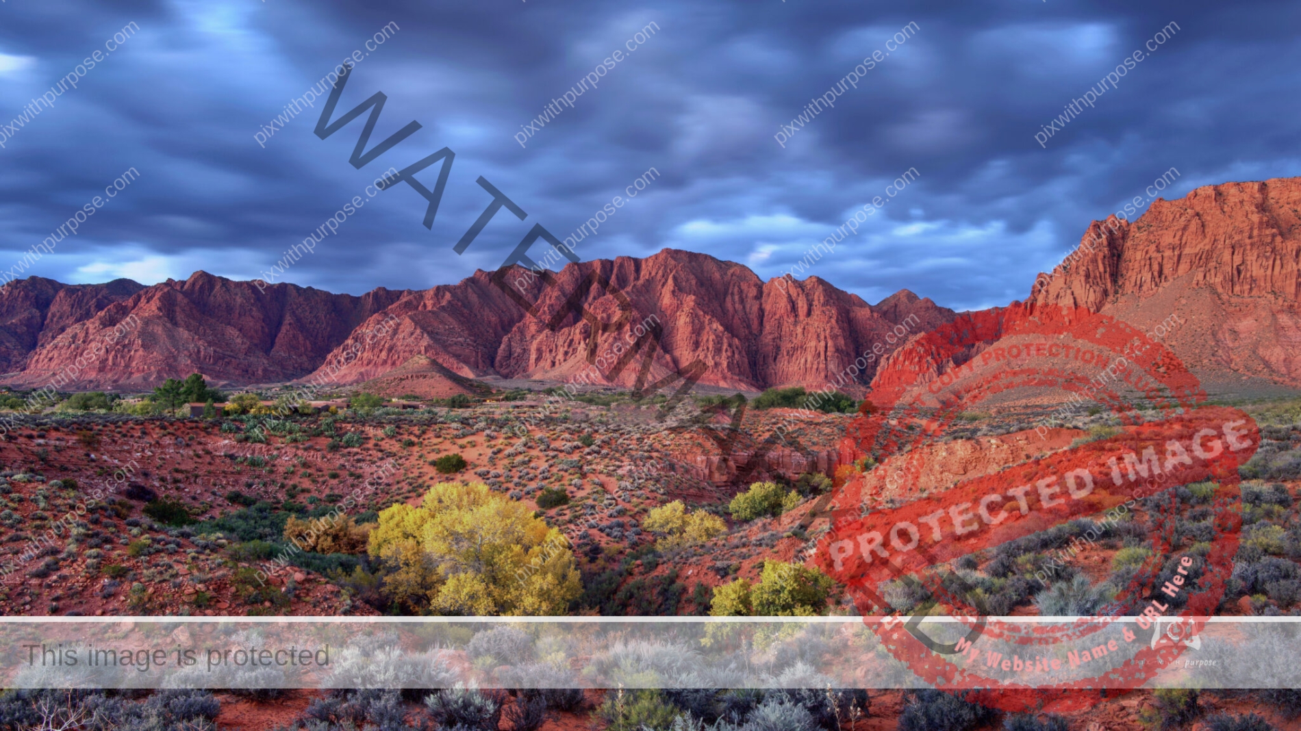
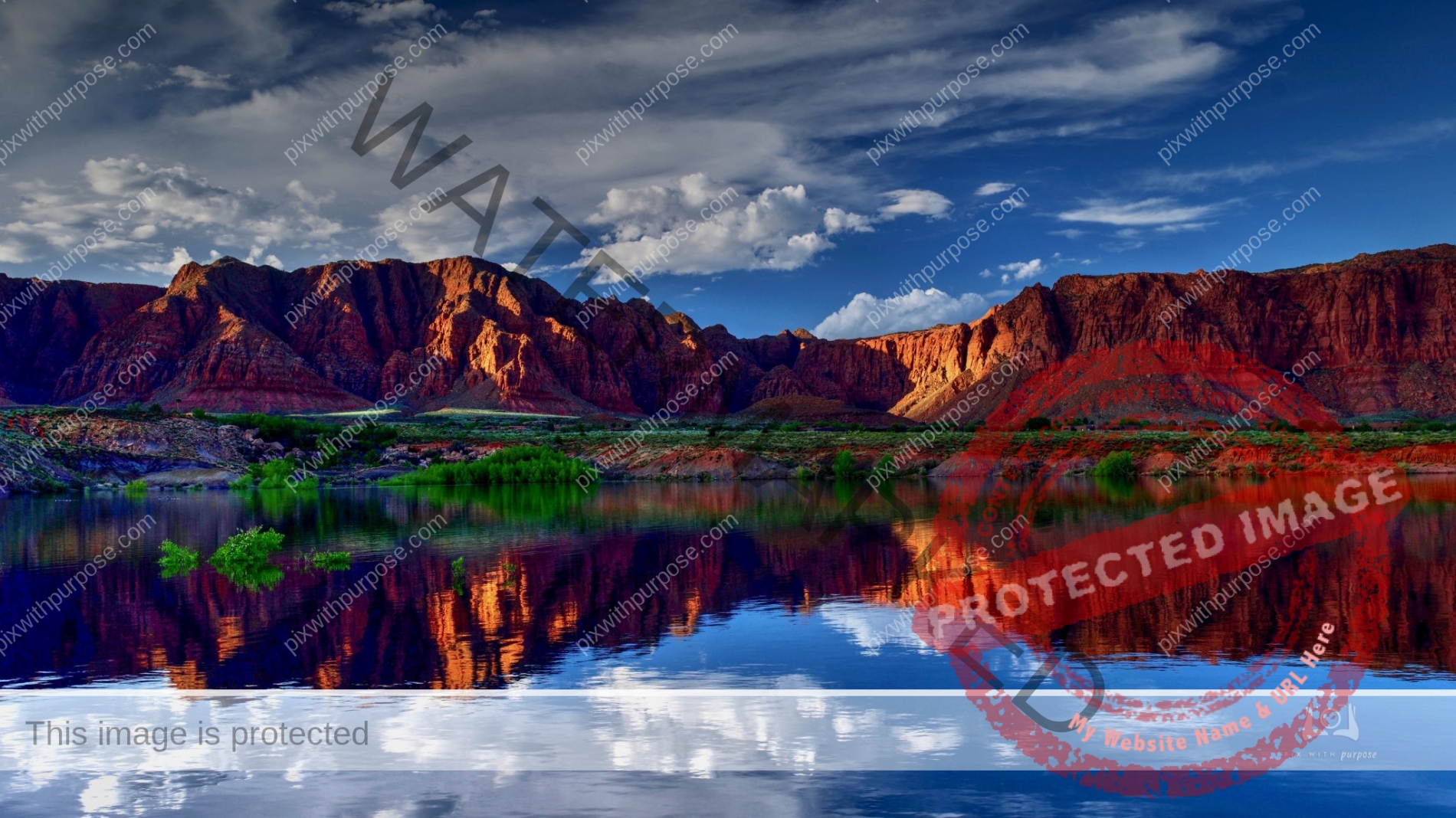
Red Mountain
This is in Ivins Utah which is about 100 miles from Las Vegas. The Navajo sandstone give it the red colors. There is a housing development at the base of the mountain and a beautiful outdoor amphitheater on the other side.
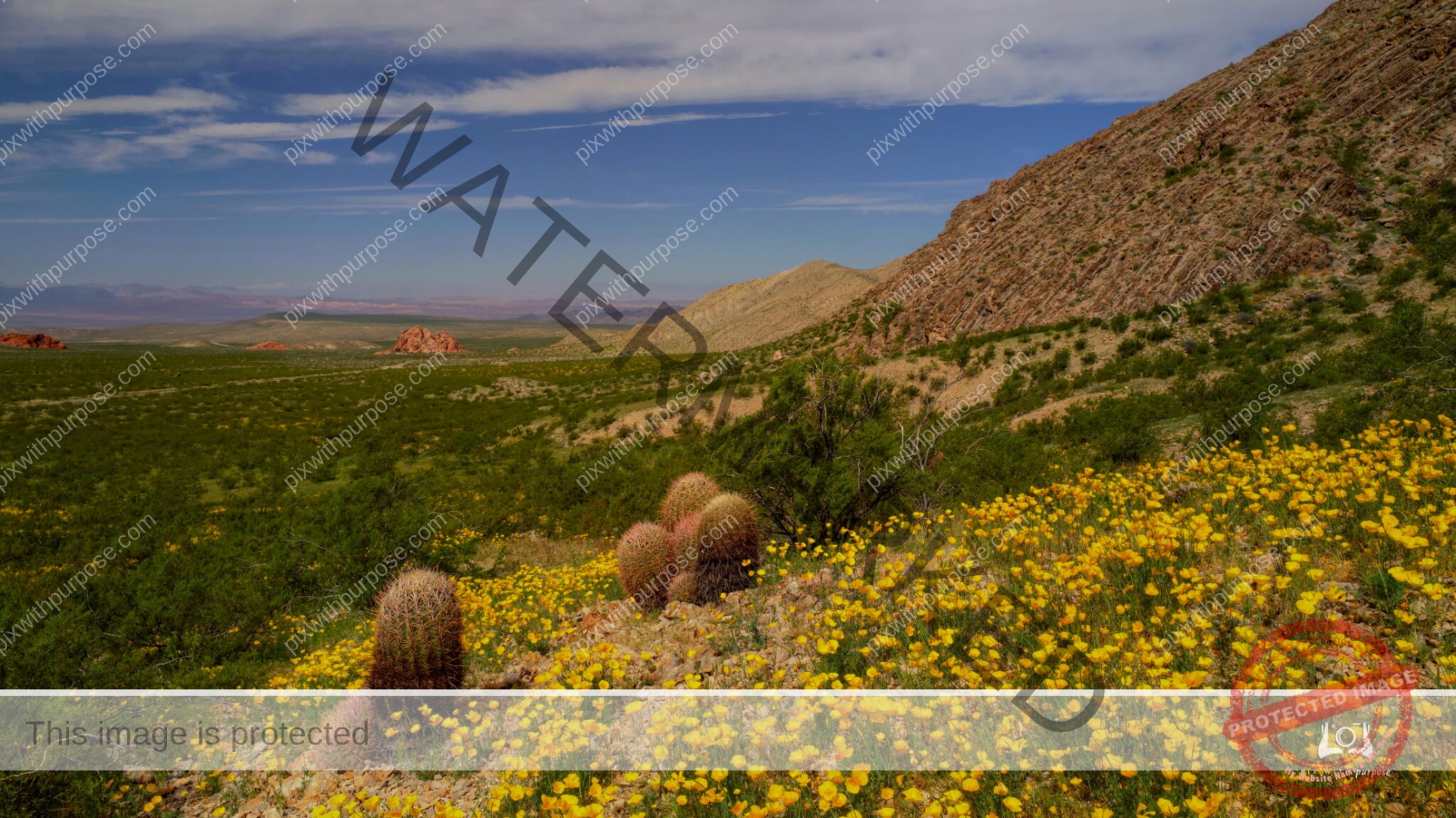
Mexican Gold Poppies Desert Bloom
Hundreds of acres of Mexican Golden Poppies bloom in abundance at Gold Butte National Monument in Nevada.
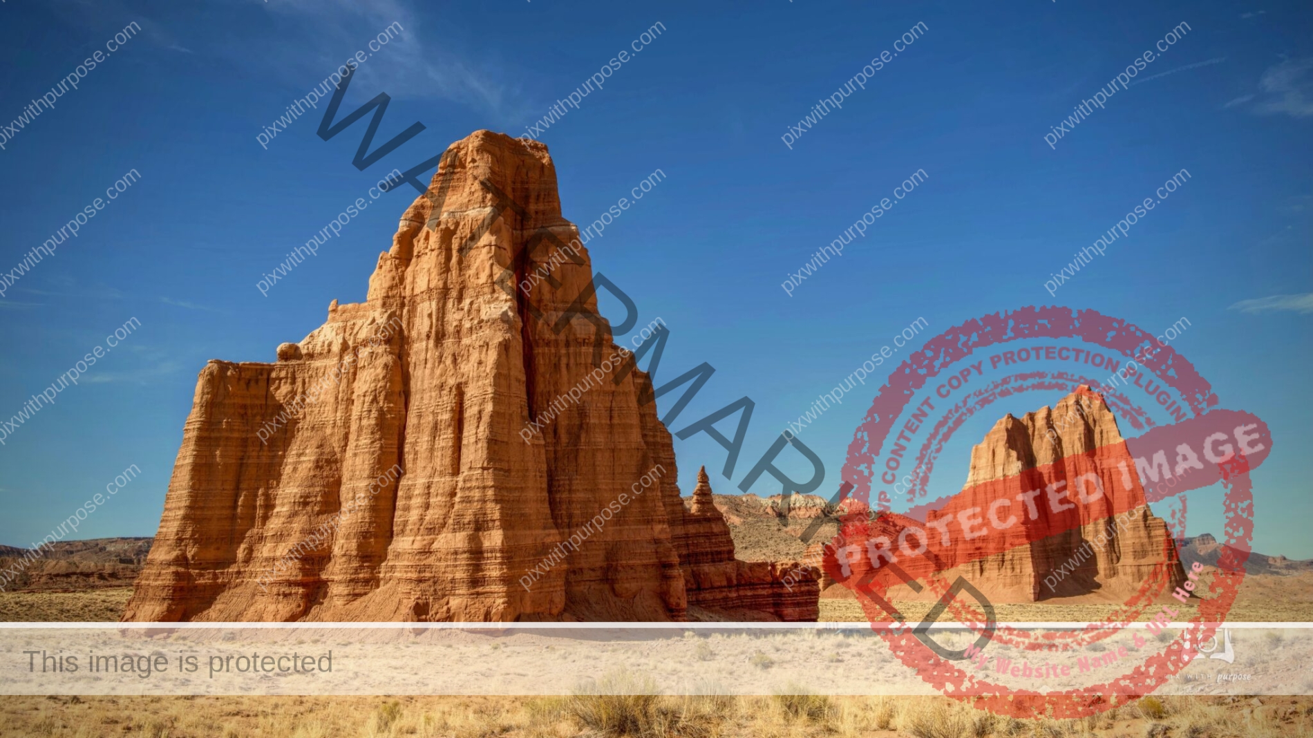
Temple of Sun and Moon
This is one of the many sites along the 73 mile Cathedral Valley loop which is located partially in Capital Reef National Park. You may be able to make out the people in the shadowy right corner for some scale. The nearest town is Hanksville Utah.
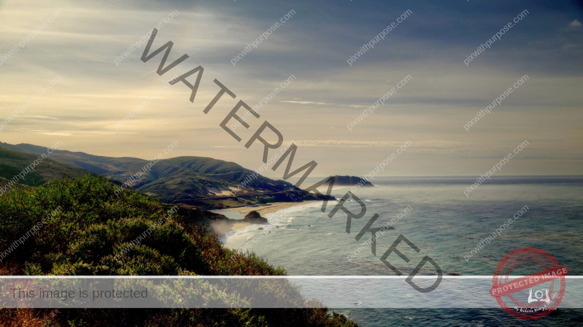
California Coast
On the distant island is the Point Sur Lighthouse i24.6 miles south of Monterey, California.
Brian Head
Utah’s Brian Head Peak stands at a whopping 11,306 feet. From this observation point at the end of Break Head Peak Road, it is possible to gaze out into three different states at once: Utah, Nevada, and Arizona. The view is truly unbeatable, but the drive up can be tricky for inexperienced drivers. It’s important to have tires with good traction as the road winds around the mountain and becomes very steep in certain sections.
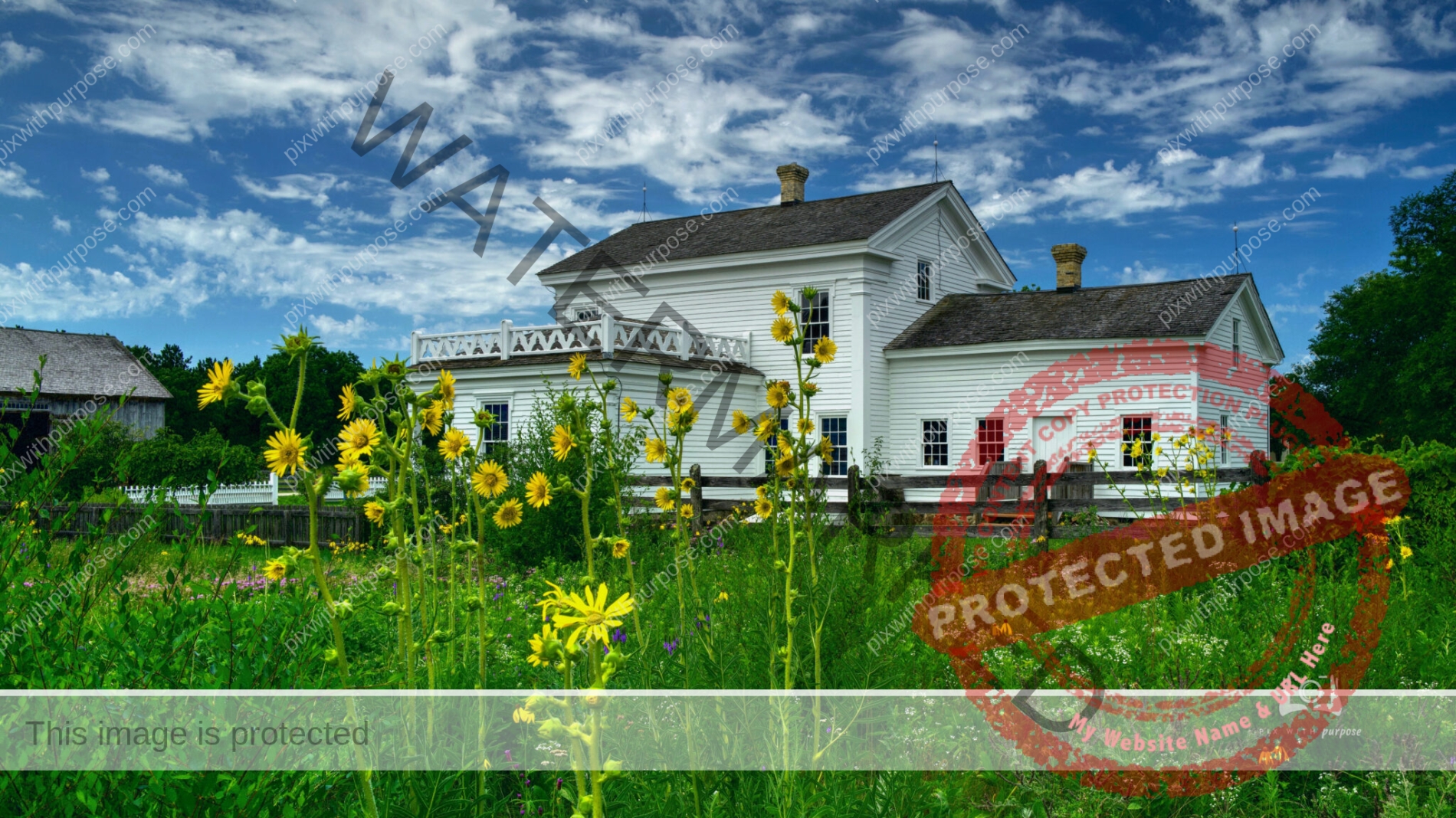
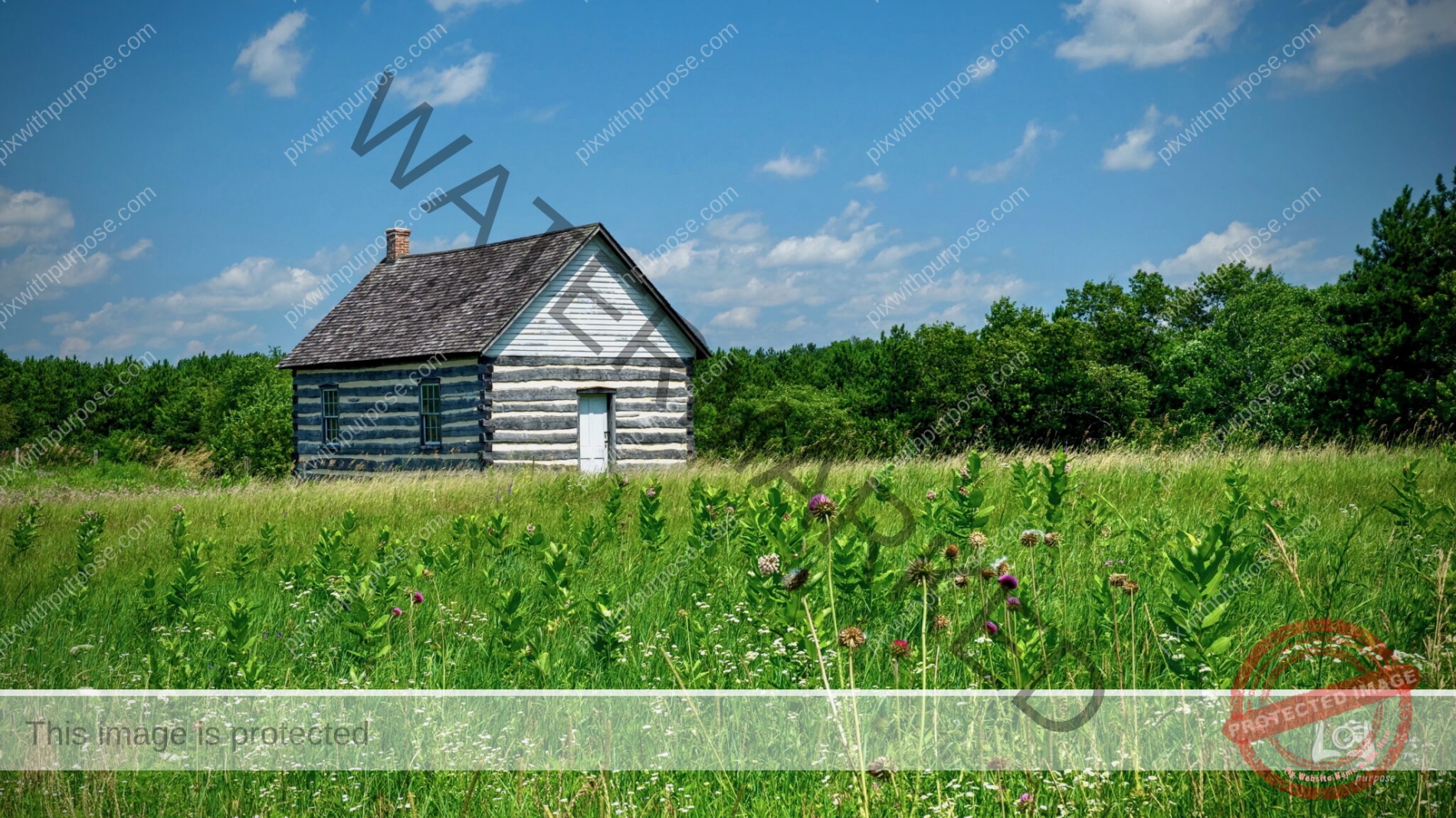
Mid 1800s Farm
This Utah farm was established in 1859-1863.
Reddish Dawn
Key West, Casa Marina pier.
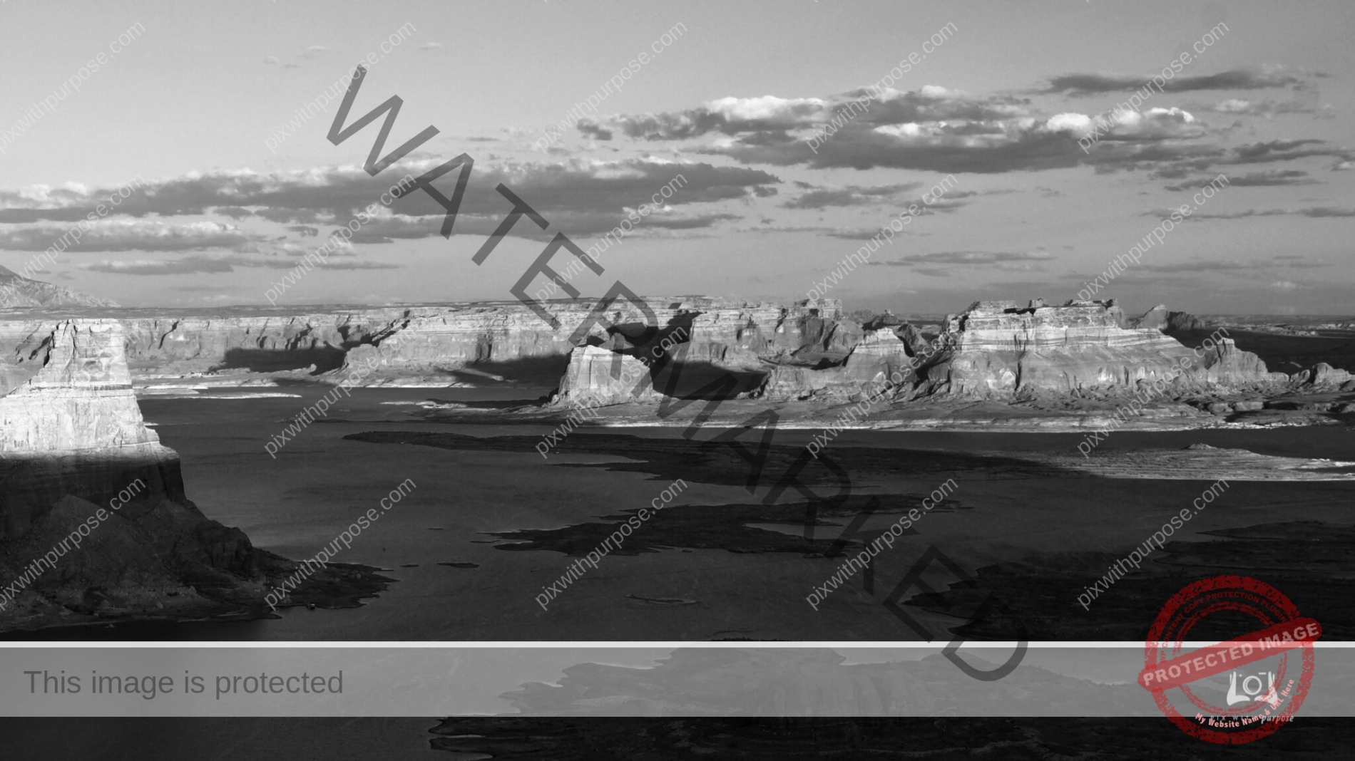
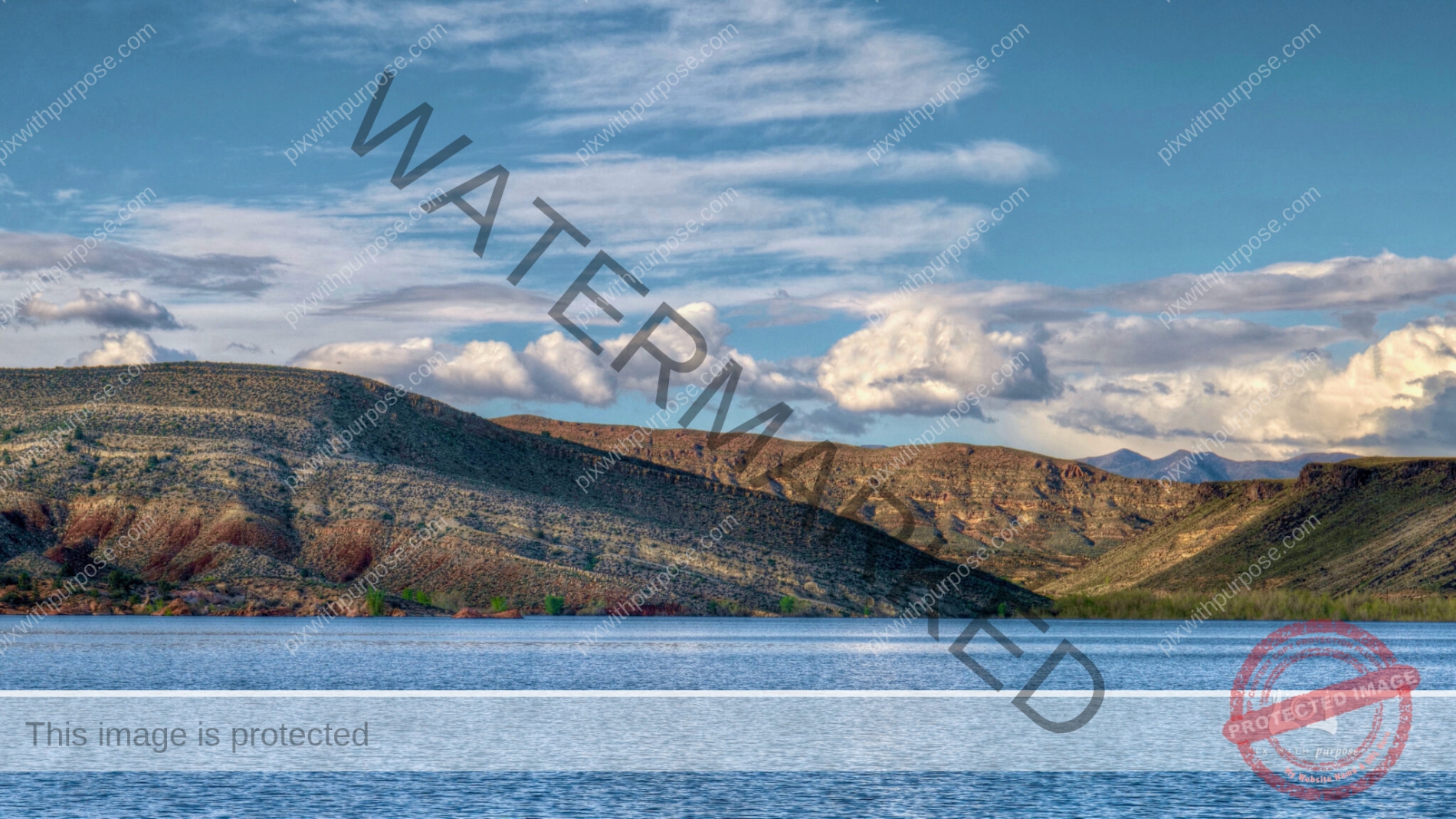
Lake Powell AZ
Lake Powell, Page Arizona with sun setting behind me.
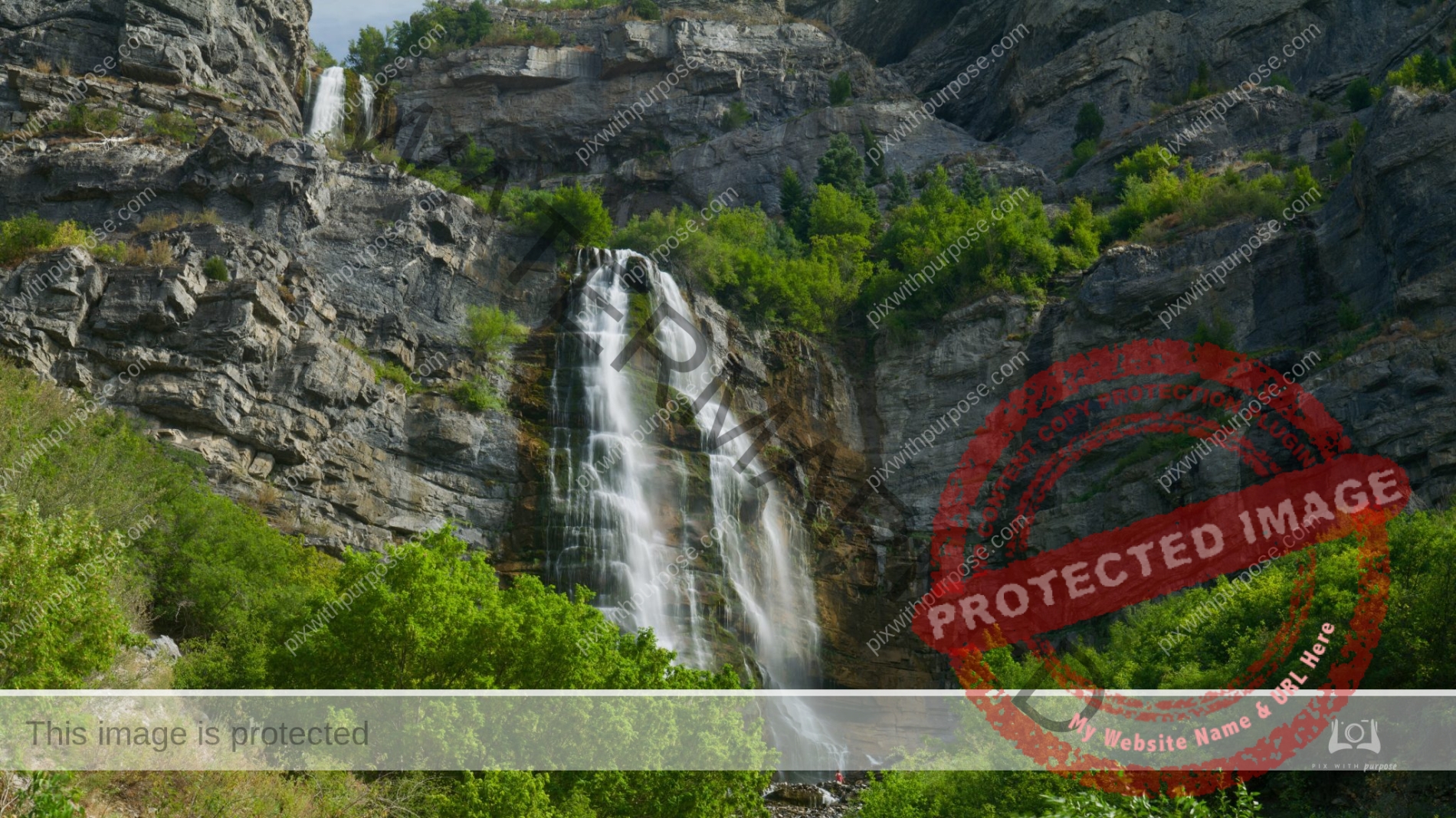
Bridal Veil Falls
Bridal Veil Falls is a 607-foot-tall double cataract waterfall in the south end of Provo Canyon in Utah. Maybe you can see the lady in red near the bottom to give you better size perspective.
Gold Butte National Monument
This national monument located northeast of Las Vegas. The monument protects nearly 300,000 acres of desert landscapes featuring a wide array of natural and cultural resources, including rock art, sandstone towers, and important wildlife habitat for species including the Mojave Desert tortoise, bighorn sheep, and mountain lion. The area also protects historic ranching and mining sites such as the ghost town of Gold Butte. Wikipedia
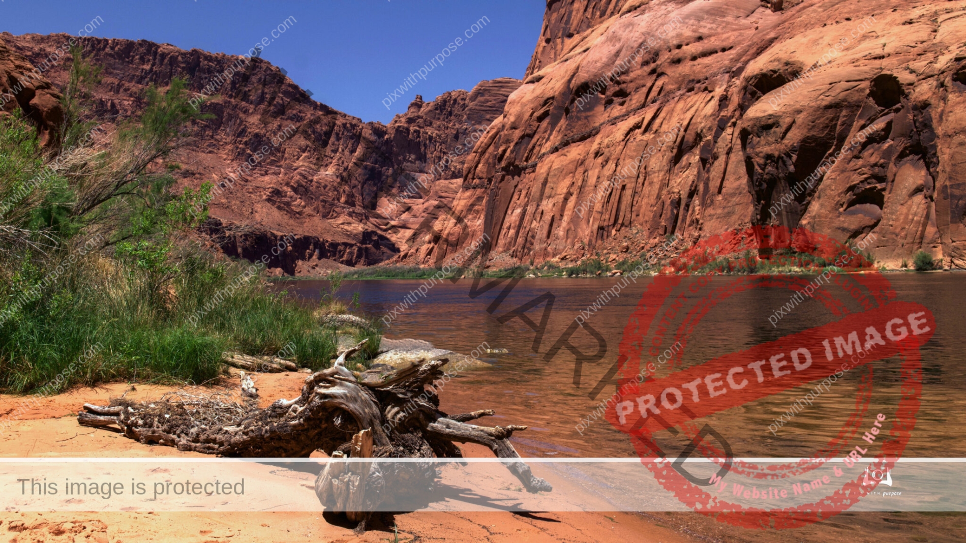
Colorado river
Taken on a nice 1/2 day raft trip south of the Glen Canyon dam in Page Arizona.
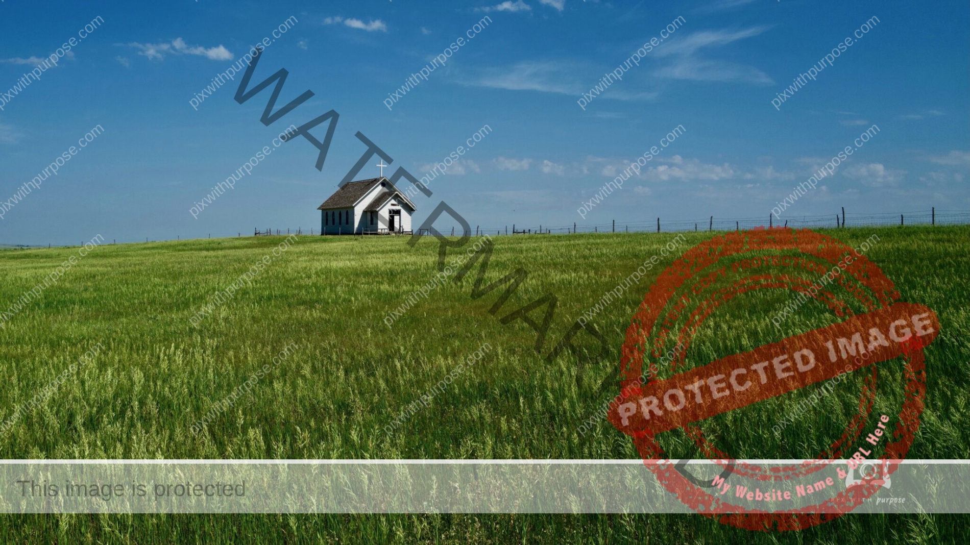
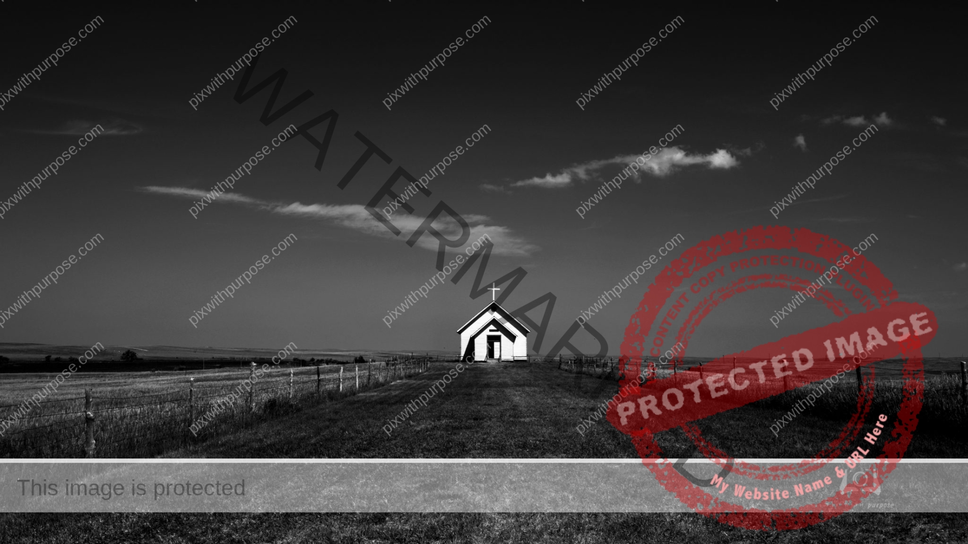
1910s Church & Community Cemetery
Located in Old World Wisconsin historical site.
Outside Zion
This is the Virgin River after it has left Zion National Park. Behind me is the deserted town of Grafton UT which has been partially restored by the Park Service due to its unique history.
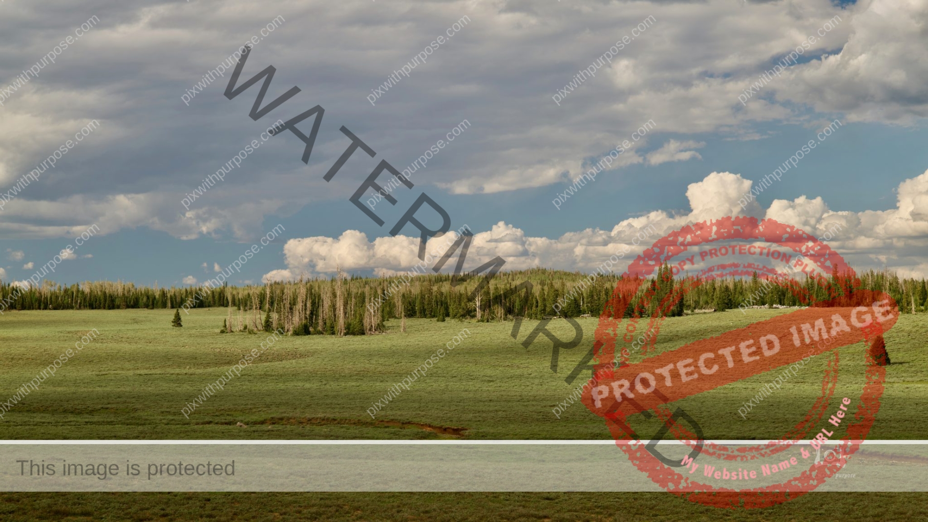
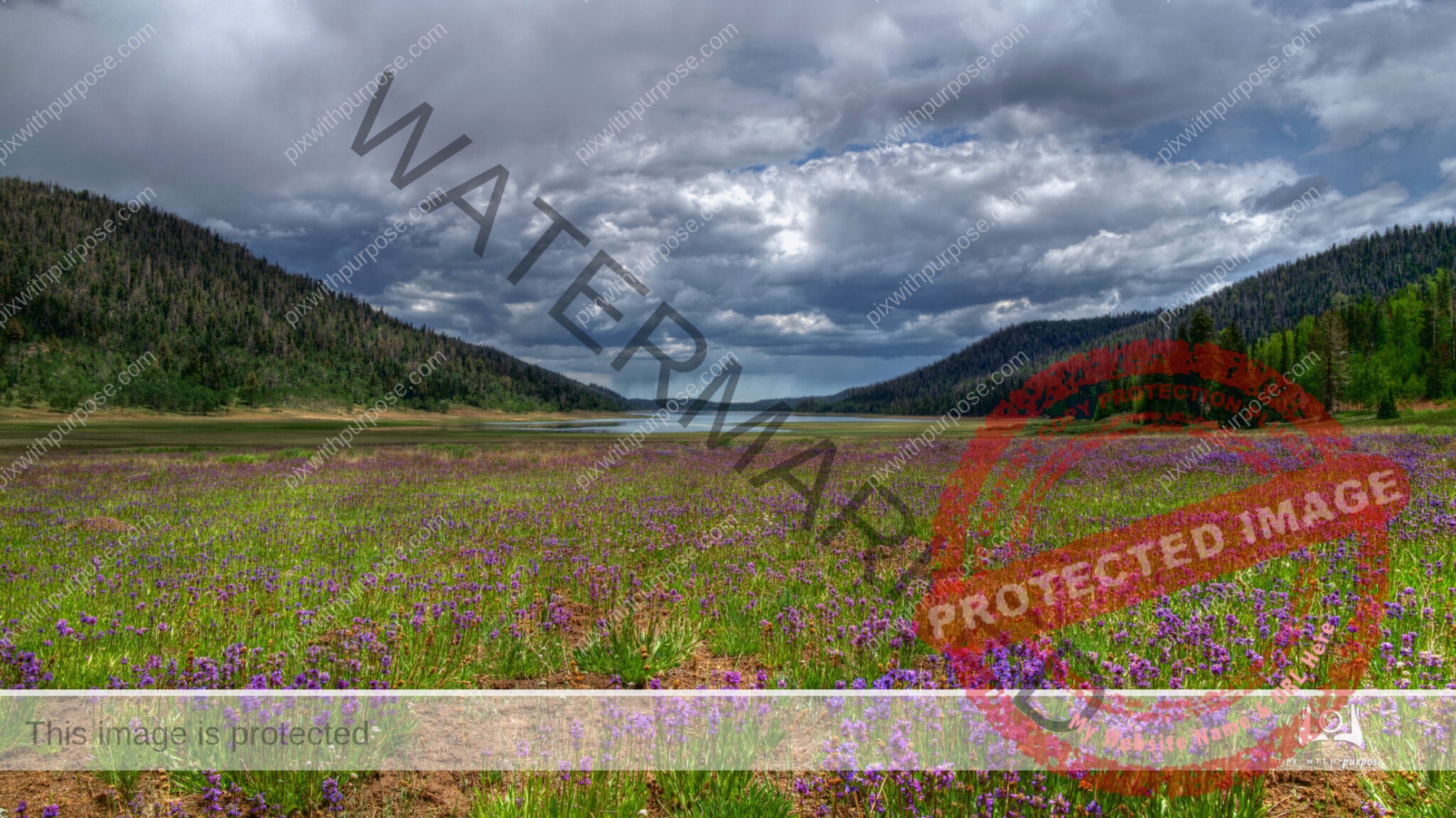
High Altitude Prairie
Located near Cedar Breaks UT the prairie at the 10,000 foot level is covered in wildflowers if the previous season received adequate rainfall.
Red Mountain Ivins Utah
Scenic Drive
Somewhere along Hwy 89 between Cedar Breaks National Monument and Bryce Canyon National Park.
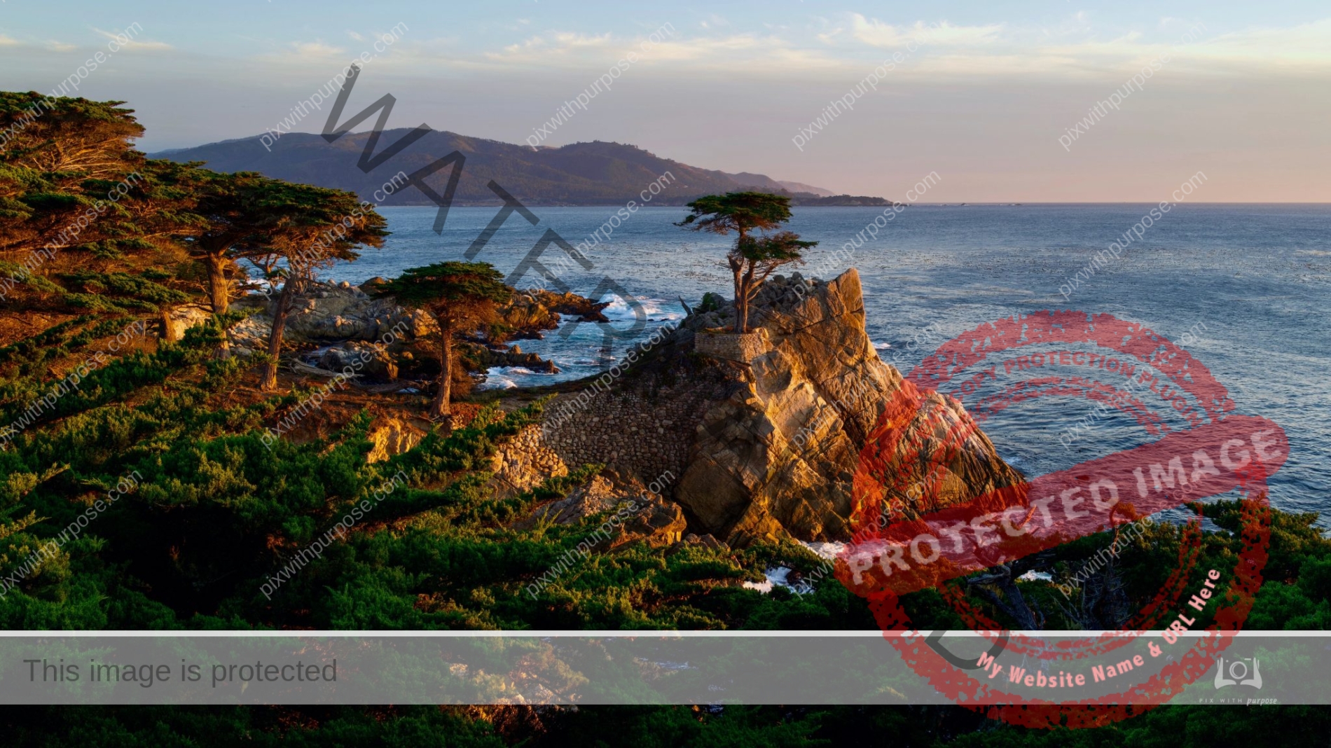
The Lone Cypress
The Lone Cypress is a Monterey cypress tree located in Pebble Beach, California. Standing atop a granite headland overlooking Carmel Bay, the tree has become a Western icon and has been called one of the most photographed trees in North America. Wikipedia
Gunlock State Park
Located near Ivins Utah.
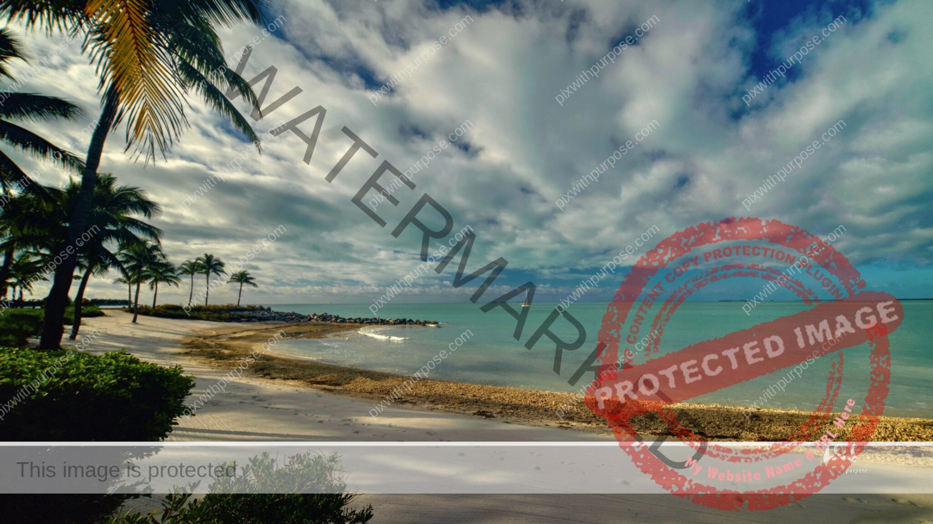
Key West Florida
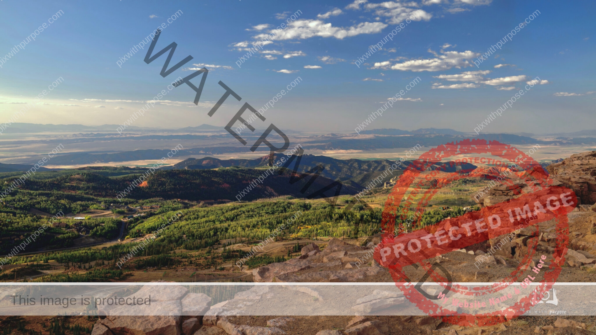
11,318 Feet
From here on Brian Head Peak UT you look over Arizona and Nevada. At the base is Cedar Break National Monument and in the lower left corner is Brian Head ski slopes. It takes a fairly sturdy vehicle to venture up here and at this altitude, combined with the awesome views they will literally take your breath away.
Key West Squall Line
Coming in from the West produced big wind and rain.
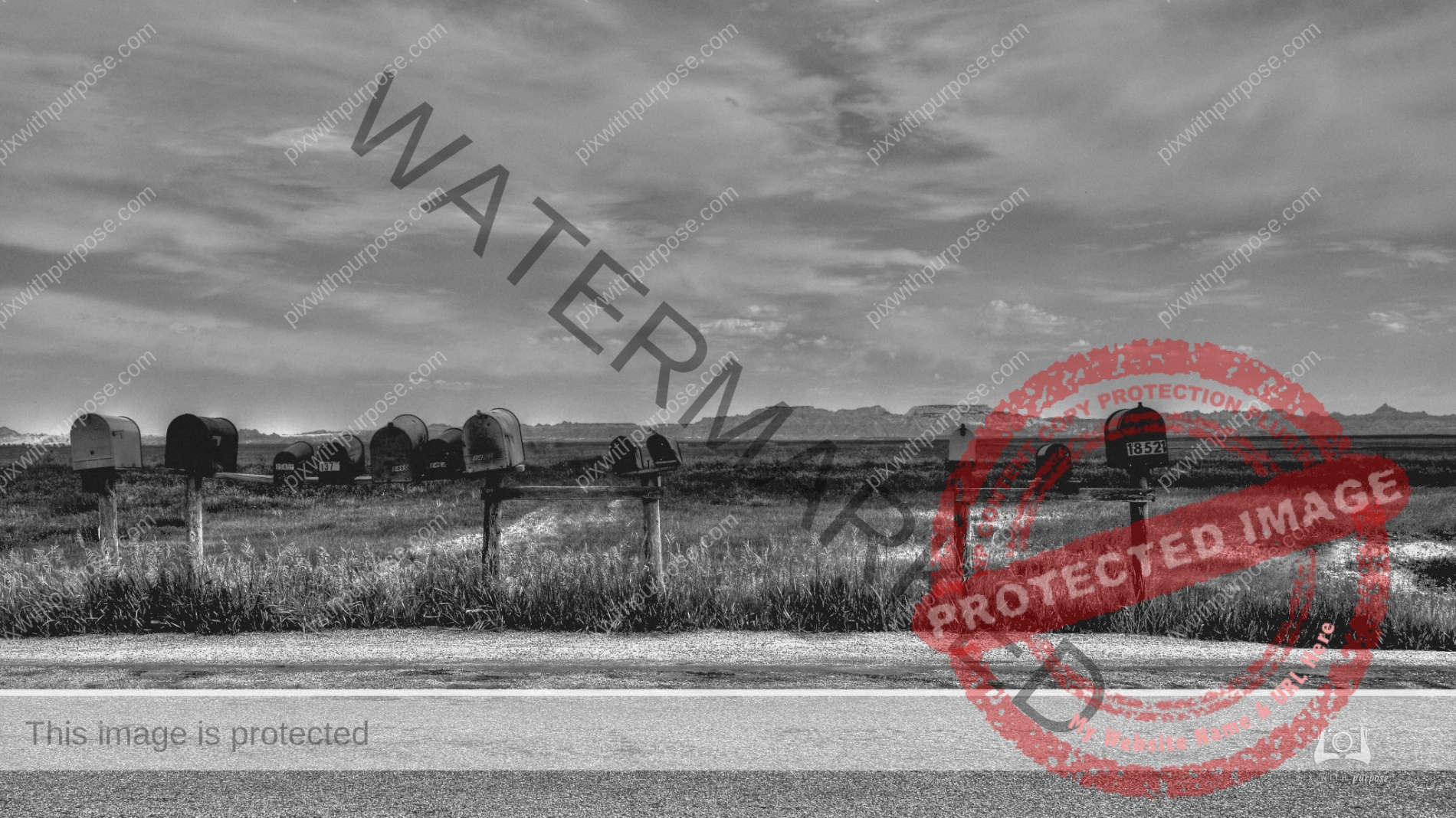
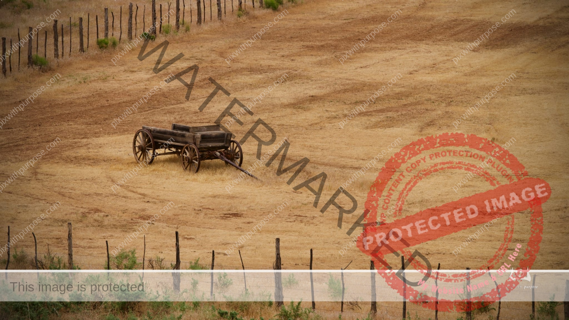
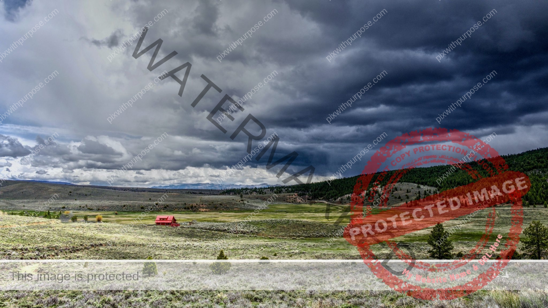
Dakota
This area of South Dakota was so desolate there were no homes or farms to be seen yet there was mail.
California State Route 1
State Route 1 is a major north–south state highway that runs along most of the Pacific coastline of the U.S. state of California. At 656 miles, it is the longest state route in California, and the second-longest in the US after Montana Highway 200. Wikipedia
Sunset Key
Sunset Key is a small 27 acre island with a hotel and individual homes. It is reachable by a short ferry ride from Key West. It was originally developed by the US Navy to hold fuel tanks but later sold to a developer.
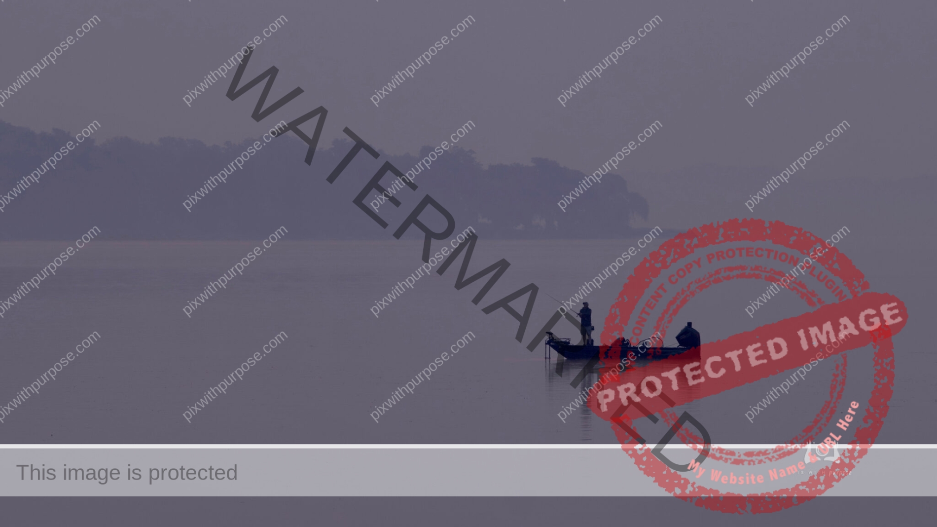
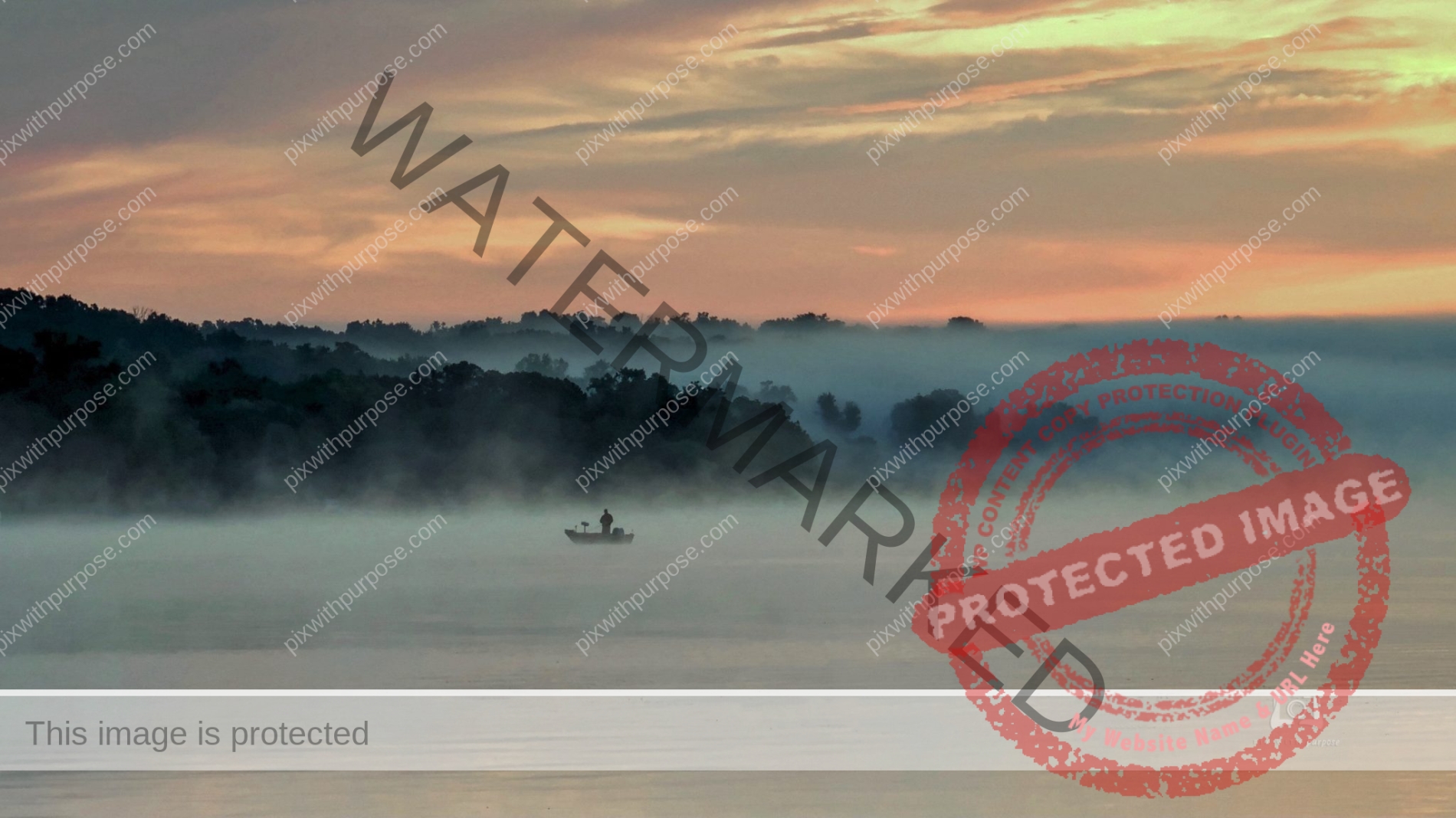
Foggy fishing
Not being a fishing guy, I do admire their dedication to the hobby. Pretty much an early morning all weather sport that requires a large investment in equipment. It is similar to photography in that some days you catch a good one but most are just average.
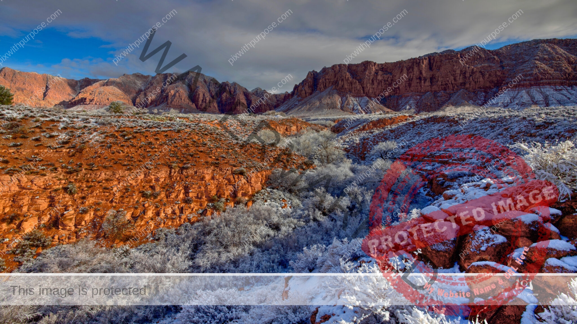
Standing in one place, shoot right then left
On this rare snow covered morning I quickly set up my camera on the edge of a wash. I turned right and shot up the wash towards the Red Mountain that borders Snow Canyon State Park then turned the camera left and took another down the wash towards the Beaver Dam mountains. I spent the previous 2-3 hours in the park taking other photos of snow covered red sandstone, sand dunes and black lava. I had to move fast because in Ivins Utah snow like this only falls every couple of years and is gone in as many hours.
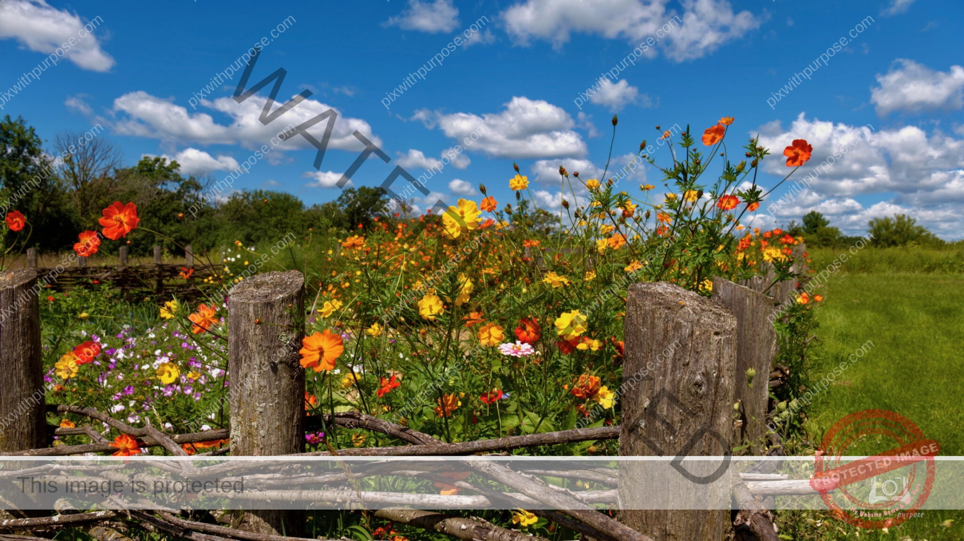
Wisconsin farm garden
Note the fence made of woven buckthorn branches.
Desert morning color
Gold Butte National Monument in Nevada about an hour after sunrise.
Navajo Lake Utah
Navajo Lake is a small lake in southern Utah at an elevation of about 10,000 feet. It is shallow, reaching depths of only 25 feet. The lake was formed by a lava flow across the eastern end of the valley. The lake drains into both the Great Basin and the Colorado River drainage systems through sinkholes in the lake floor.
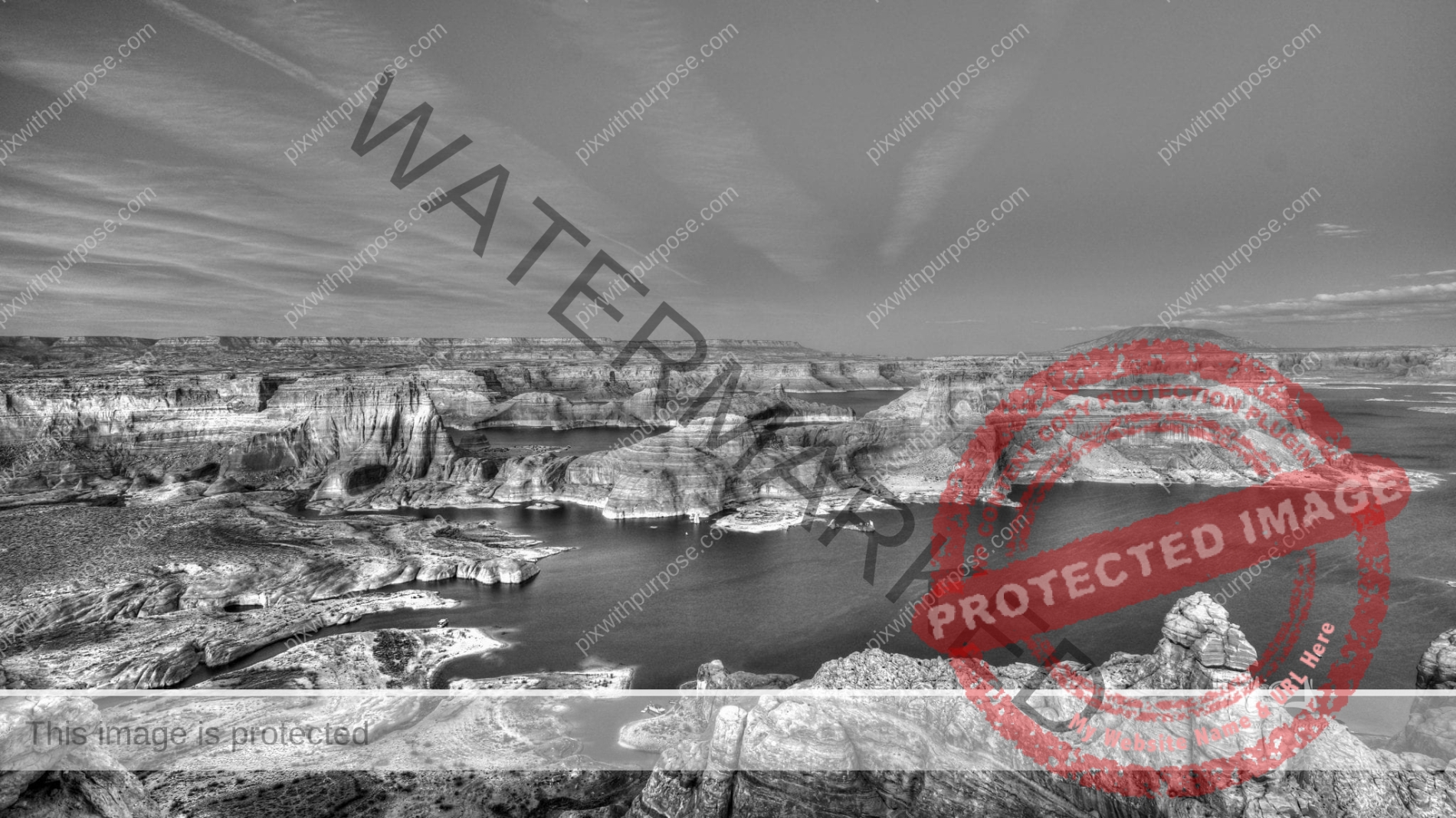
Lake Powell AZ
Lake Powell was created by the flooding of Glen Canyon by the Glen Canyon Dam, which also led to the 1972 creation of Glen Canyon National Recreation Area,
a popular summer destination of public land managed by the National Park Service. This photo was taken from Observation Point. A couple feet in front or to my
right is a sheer 800 foot drop.
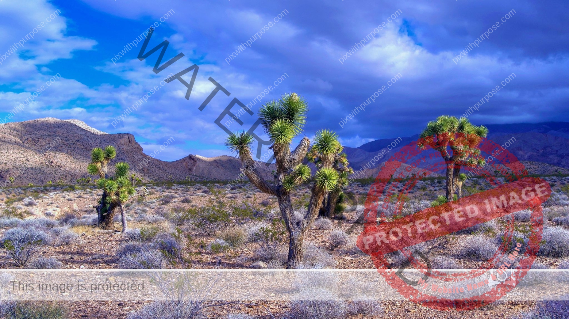
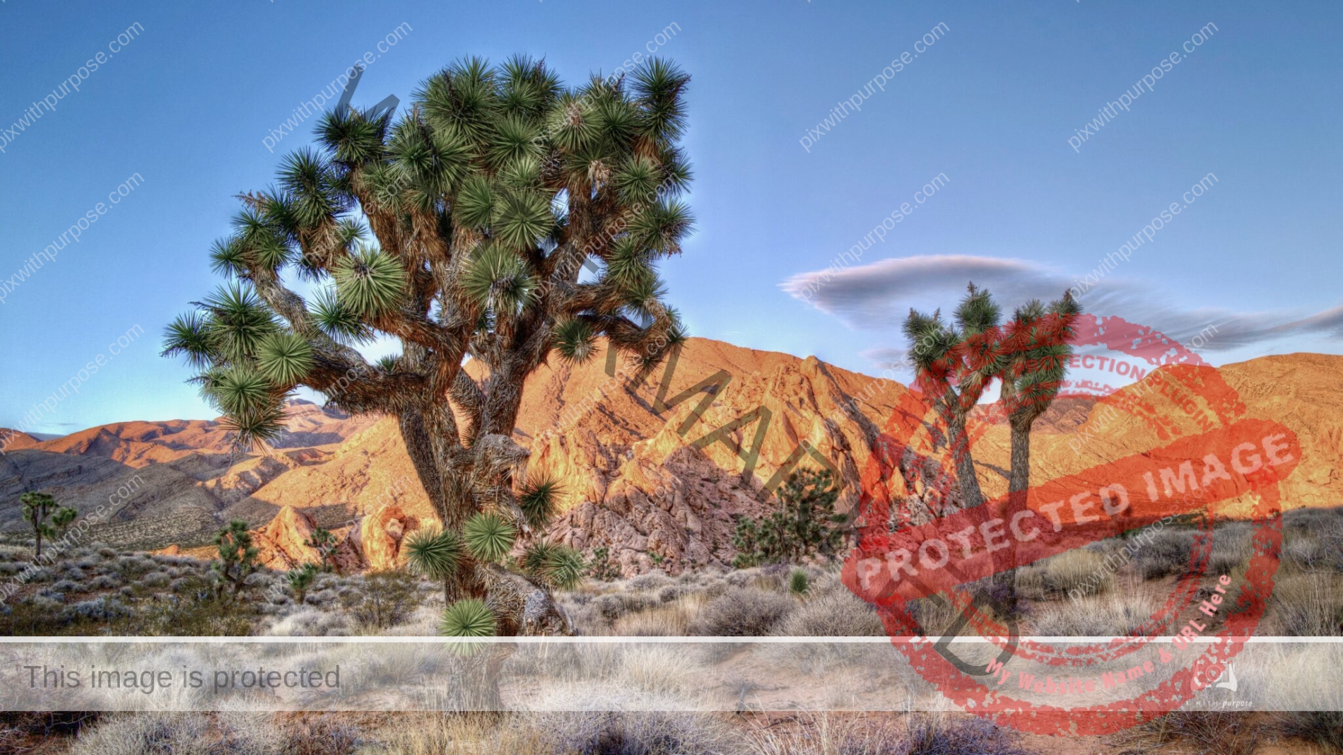
Mojave Desert
Gold Butte National Monument covers nearly 300,000 acres of remote and rugged desert landscape in southeastern Nevada, where dramatically chiseled red sandstone, twisting canyons, and tree-clad mountains punctuate desolate stretches of the Mojave Desert. The brightly hued sandstone provides a stunning canvas for the area’s famously beautiful rock art. BLM
This remote area is a favorite of due to the colors and feeling of remoteness. By Park Service design there are no services and access requires a capable vehicle. There are these beautiful Joshua trees, numerous abandoned mines, ancient rock art and endless new discoveries.
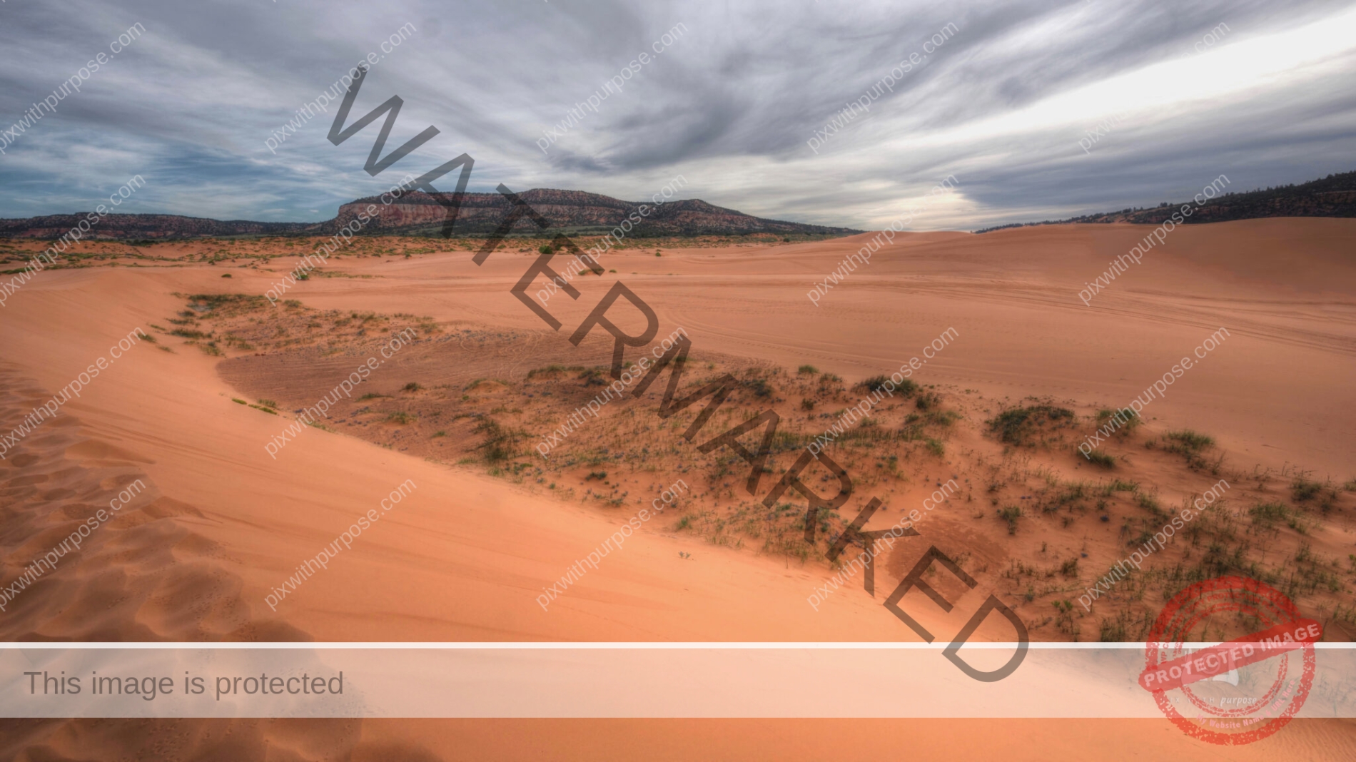
Coral Pink Sand Dunes State Park Utah
An off-the-radar expanse of photographic bliss, Coral Pink Sand Dunes State Park is where weekend warriors can leave footprints in soft sand or adventure on the vast off-road playground. You can also walk among old juniper, and pinion and ponderosa pines. The dunes were formed by the continual erosion of the nearby Navajo sandstone cliffs and estimated to be 10,000 to 15,000 years old. The state park which stretches 3,730 acres was first opened to the public in 1963. The park has an elevation of 6,000 feet. Park Website
Angry Skies
My usual serene sunrise setting is upset about something.
Rolling Lake Fog
Wisconsin
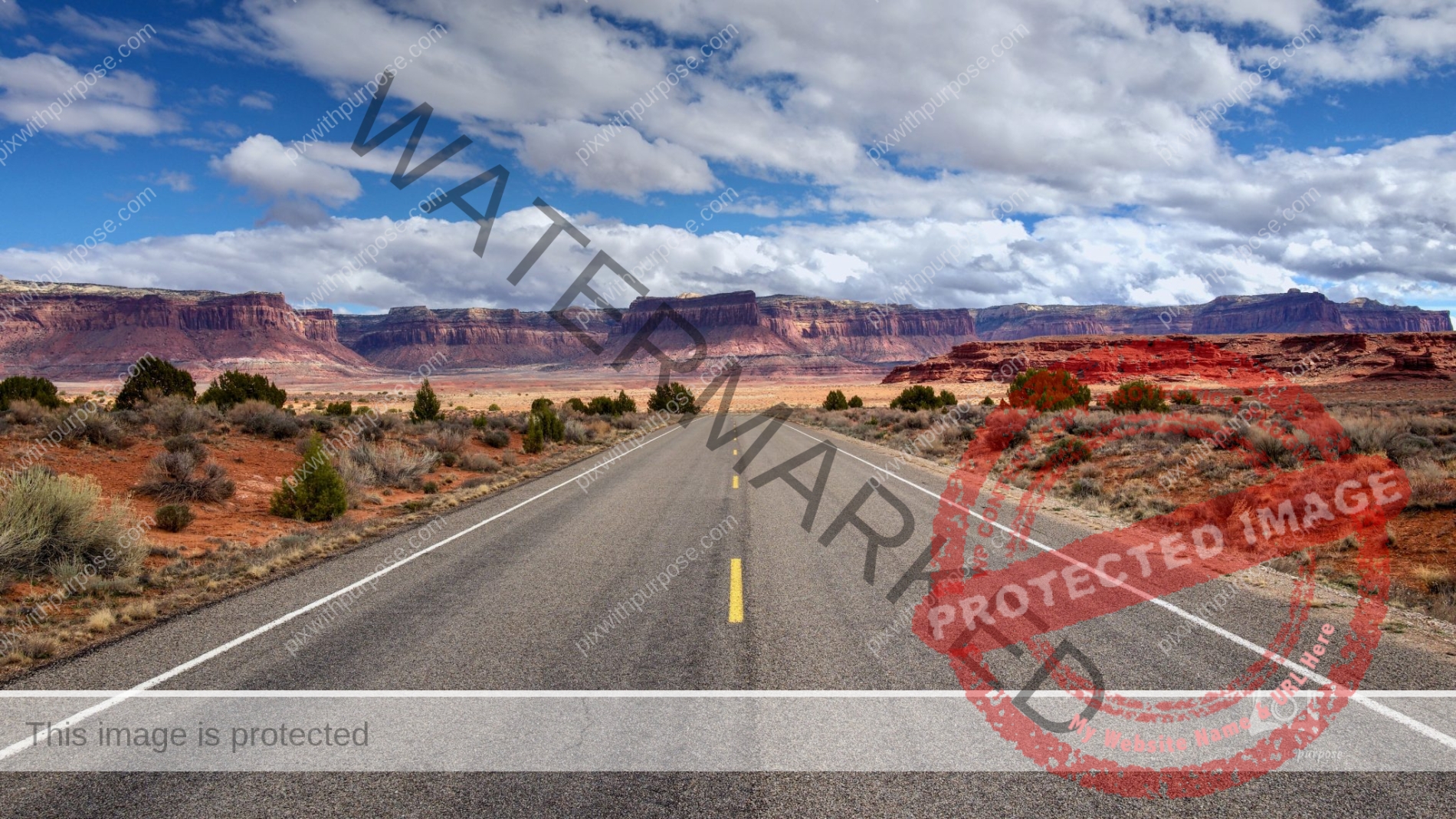
Road to Canyonlands
Outside of Moab UT is Canyonlands National Park. This 340,000 acre park preserves a colorful landscape eroded into numerous canyons, mesas, and buttes by the Colorado River, the Green River, and their respective tributaries. (Wikipedia) While driving through wide vistas I will sometimes shoot with a camera close to the pavement which can make for an interesting photo.

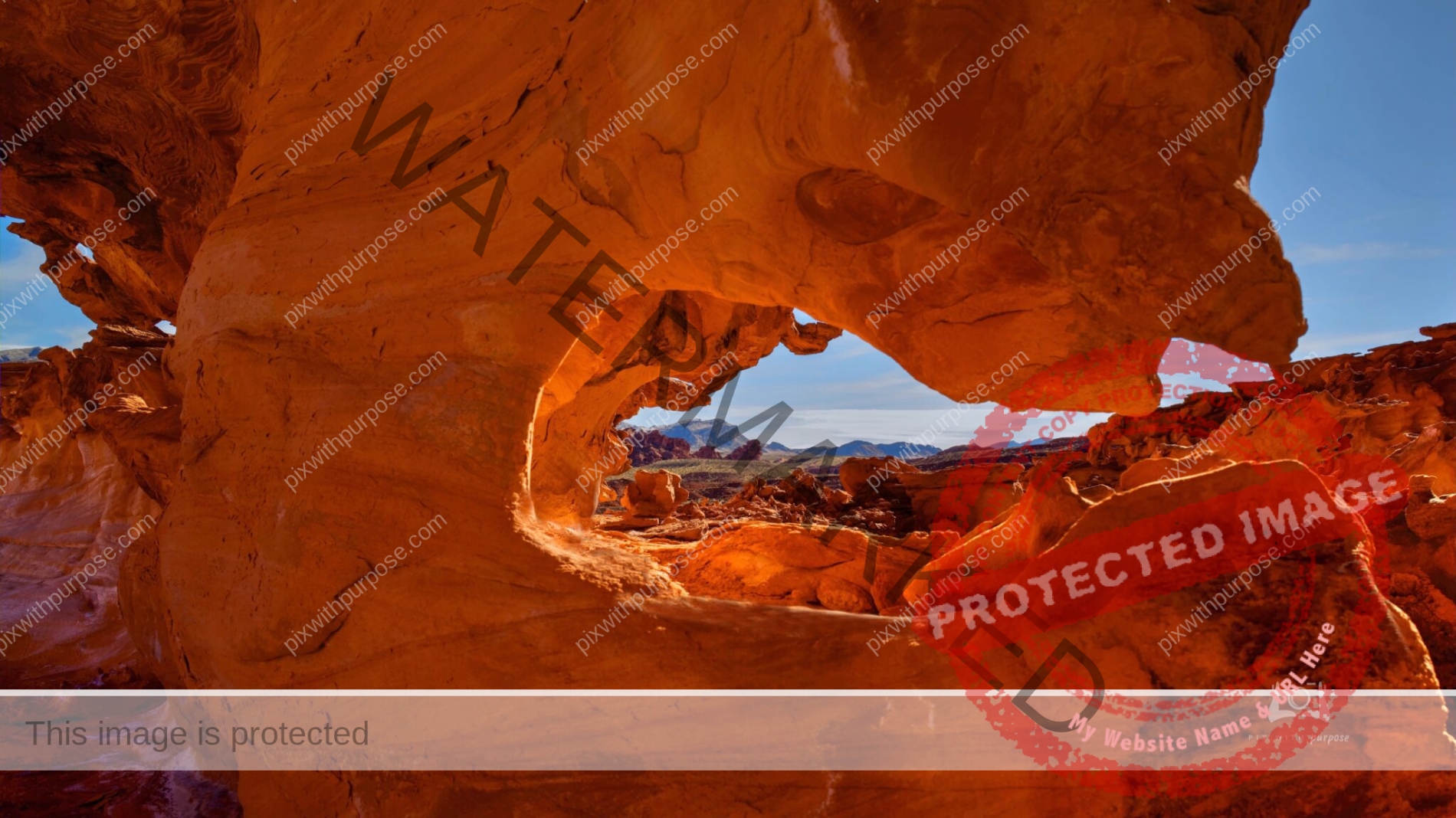
White Pocket National Monument
Very remote Utah location
Quaking Aspen Forest
Photo was taken near Park City Utah. The leaves quake or tremble in light breezes and turn a brilliant yellow in fall.
Red Mountain
The city of Ivins in Southwest Utah is located about 100 miles from Las Vegas. The centerpiece is Red Mountain which is the ever-present backdrop for Tuacahn Center for the Arts, Snow Canyon State Park and the art community of Kayenta.
Low Ceiling
Near Duck Creek Utah at roughly 10,000 feet. Aspens, perfect clouds, river and lava field make for a nice landscape. Leica SL ISO 50 72mm f/11 1/125
Brian Head Peak
11,300 feet overlooking the town of Brian Head (out of sight) which is the highest year round occupied city in the USA. From here one can see Utah, Nevada and Arizona. Straight ahead the red scar is Cedar Breaks National monument. I drove up here in July and there were still snow drifts along the "road".

Sunset Light
Florida Keys nearing sunset. Everything just kind of lined up for me at the right time. And, I had my camera.

Death Valley NP
These are the sand dunes with mountain range in the background. I took this on a bright sunny day with a black and white camera. The deep blue sky becomes grey black but lightens where the white sand reflects the sunlight upward.
It’s a rare one
Pewaukee Lake WI
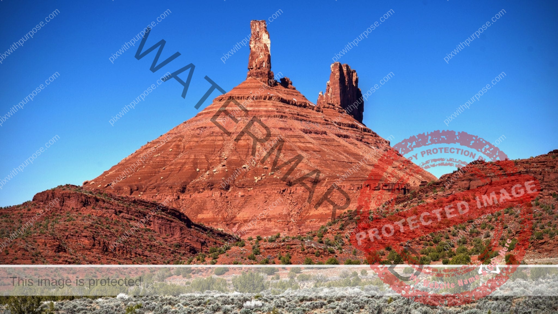
Castle Rock in Moab Utah
This formation has been used in many tv commercials over the years. Among the most popular rock climbing destinations in the world, Castle Rock has been summitted by thousands. Climbing historian Stewart Green reports that the number of successful ascents is over 40,000 and there have been so many that "no one really knows how many folks have reached the summit. From ground level to peak it's about 4,000 feet.
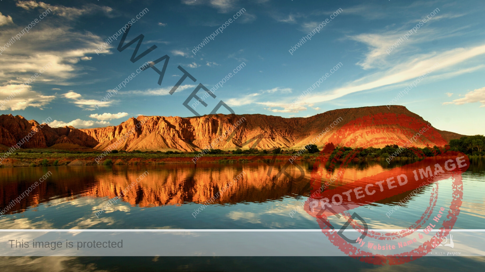
Beaver Dam Mountains bathed in sunset color
Sunset over the 17,600 acre Beaver Dam wilderness area. The mountains are 23 miles long and reach a height of 7,680 feet. This photo with sage and a small oak tree was taken from a residential area in Ivins Utah
Sundown
And the Henry Flagler Railroad Bridge
Dusk in the Keys
Watching the sunset

Dramatic Sunset
Key West